|
|
Area/Range |
|---|---|
|
|
42.82505°N / 13.03384°E |
|
|
Hiking, Mountaineering, Mixed, Scrambling |
|
|
8038 ft / 2450 m |
|
|
Overview
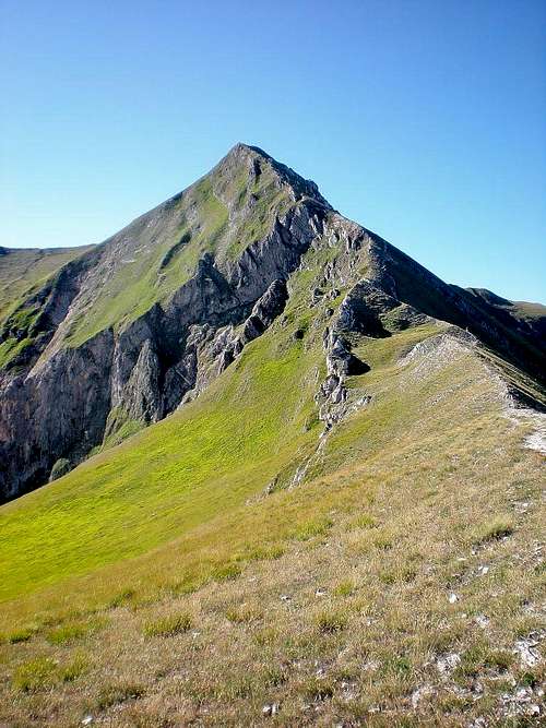
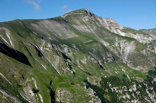
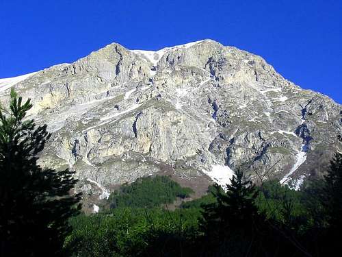
The Sibillini Mountains, the "Monti Azzurri (Blue Mountains)", situated in Central Appennines (Italy), are a mountain group mostly composed of limestone rocks. Includes many peaks over 2000 mt. Higher is Monte Vettore that reach 2,476 m (8,123 ft).
Formed in a ancient sea, emerged around 20 million years ago, range's morphology is due to glacier erosion during Quaternary, as shown by characteristic "U-shaped" valleys and by wide glaciar circles still visible. Also karst phenomena contributed to define area's morphology.
- Northern Area;
- Southern Area;
- South-occidental Area.
Most interesting peak of the northern sector is Monte Bove with its limestone vertical walls and the second group's height, Monte Priora ( or Pizzo della Regina )
South-occidental Area is the less interesting form mountaineering point of views but it is absolutely important for environmental characteristics.
The name “Sibillini” comes from the Sybyls ‘ legend (the prophetesses of classical mythology). Legend claim one of these to live in a cave on Monte Sibilla, still visible climbing the normal Monte Sibilla route but not accessible due to damages by an earthquake in past century, known as the Grotta delle Fate (Cave of the Furies).
Built by glaciers erosion, these mountains shows some outstanding natural sights, including Lago di Pilato (Pilato’s Lake), where tradition claim that Pontius Pilate is buried.
The National Park area is home to 1,800 plant species and a wild bouquet of mountain flowers including edelweiss, pasqueflowers, martagon lilies, bearberries, and various orchids. Animal life includes wolves and wild mountain cats as well as prickly porcupines.. Roe deer have recently been reintroduced. Goldeneagle is also present in few individuals, but also peregrine falcons, eagles,owls, goshawks, snow finches, and sparrow hawks can be observed.
Getting There
- AMANDOLA
Route from Refuge Città di Amandola to Pizzo Tre Vescovi, Monte Castel Manardo, Monte Acuto
- ARQUATA DEL TRONTO
Route to Monte Vettore via Forca di presta
- BOLOGNOLA
Route from Rifugio del Fargno to Monte Priora, Pizzo BerroRoute from Refuge Città di Amandola to Pizzo Tre Vescovi, Monte Castel Manardo, Monte Acuto
- CASTELSANTANGELO SUL NERA
Route to Monte Bove South via Macchie/Passo CattivoRoute to Monte Palazzo Borghese from Monte Prata
- MONTEFORTINO
Route to Monte Priora from Infernaccio CanyonRoute to Monte Priora via Capotenna/Fosso le VeneRoute to Monte Sibilla from Infernaccio CanyonRoute to Monte Priora from da Vetice
- MONTEMONACO
Route to Monte Vettore via FoceRoute to Monte Sibilla via Foce/Fosso ZappacenereRoute to Monte Palazzo Borghese via Foce/Fosso ZappacenereRoute to Monte Palazzo Borghese via Foce/CanaleRoute to Monte Vettore via AltinoRoute to Monte Sibilla from Refuge Sibilla
- NORCIA/CASTELLUCCIO DI NORCIA
Route to Monte Vettore via Forca di prestaRoute to Monte Palazzo Borghese via Forca di presta
- USSITA
Route to Monte Bove South from Frontignano via NW ridge/Monte BiccoRoute to Monte Bove South from Casali/Val di PanicoRoute to Monte Palazzo borghese from frontignanoRoute to Monte Bove North from frontignano
- VISSO (suitable for USSITA, SATELSANTANGELO SUL NERA)
Headquarter of Parco dei SibilliniStart point for GAS - Grande anello dei Sibillini ( Great Sibillini Ring )
Motorway A1 up to Orte gate, then E45 up to Spoleto (all sectors).
From North ( Ancona/Bologna airports):Best suitable to reach VISSO, USSITA, NORCIA
Motorway A14 dir. south up to Macerata/Civitanova,then SS77 up to Sforzacosta gate (Northern sector)
Best suitable to reach AMANDOLA, MONTEMONACO, MONTEFORTINOMotorway A14 dir. south up to Macerata/Civitanova,then SS77 up to La Maddalena (Western sector).Best suitable to reach USSITA, VISSO , CASTELSANTANGELO SUL NERA, BOLOGNOLAMotorway A14 dir. south up to San Benedetto del Tronto gate, then SS4 up to Ascoli Piceno (Occidental sector).Best suitable to reach ARQUATA DEL TRONTO, AMANDOLA, MONTEMONACO, MONTEFORTINO
Motorway A14 dir. north up to Macerata/Civitanova,then SS77 up to Sforzacosta gate (Northern sector).Best suitable to reach AMANDOLA, MONTEMONACO, MONTEFORTINOMotorway A14 dir. north up to Macerata/Civitanova,then SS77 up to La Maddalena (Occidental sector).Best suitable to reach USSITA, VISSO , CASTELSANTANGELO SUL NERA, BOLOGNOLAMotorway A14 dir. north up to San Benedetto del Tronto gate, then SS4 up to Ascoli Piceno (Occidental sector).Best suitable to reach ARQUATA DEL TRONTO, AMANDOLA, MONTEMONACO, MONTEFORTINO
ACQUACANINACESSAPALOMBOFIASTRAFIORDIMONTEMONTEGALLOPIEVE TORINAPIEVEBOVIGLIANAPRECISAN GINESIOCALDAROLASARNANO
Red Tape
Sibillini are a protected area since 1993, included in Parco Nazionale dei Monti Sibillini ( Sibillini Mounts national Park). In the protected area no fees are due, no access permits are required, but free camping is not allowed. Park rules must be respected.External Links
http://www.sibillini.net/ official site Parco dei SibilliniPeaks
- Monte Vettore m 2476
- Cima del Redentore (Scoglio del Lago) m 2449
- Cima del Lago m 2422
- Pizzo del Diavolo m 2410
- Punta di Prato Pulito m 2373
- Cima dell'Osservatorio (Palazzaccio) m 2350
- Quarto San Lorenzo m 2247
- Monte Torrone m 2117
- Cima di Pretare (Il PIzzo) m 2281
- Monte Banditello m 1873
- Monte Prata 1850
- Monte Argentella m 2200
- Palazzo Borghese m 2145
- Monte Porche 2233
- Cima Vallelunga m 2221
- Monte Sibilla m 2173
- Cima di Vallinfante m 2113
- Monte Bove Sud m 2169
- Monte Bicco m 2052
- Monte Bove Nord m 2112
- Croce di Monte Bove m 1905
- Pizzo Berro m 2260
- Monte Priora (Regina) m 2332
- Pizzo Tre Vescovi m 2090
- Monte Castel Manardo m 1917
- Monte Rotondo m 2102
- Croce di Monte Rotondo m 1926
- Monte Pietralata m 1888
- Many peaks from 1600 to 1900 m. Highest is Monte Lieto, 1944 m.
The Great Sibylline Ring is a trekking route driving trough the whole mountain chain. It's divided in 9 stages and it's more than 100 km long
It is fully signed and maintained, lead trekkers trough Sibillini's various landscape and let to know area's story and culture.
Refuges (sometime not guarded ) are available in Cupi, Fiastra, Colle, Colle Le Cese and Campi. Others will be available in short time and in any case several lodging possibilities available at any stage terminal or in the immediate vicinity.
STAGE I: VISSO - CUPI (approx. 4 hrs 30 mins)
STAGE II: CUPI-FIASTRA ( approx. 4 hrs)
STAGE III: FIASTRA – MONASTERO (approx. 3 hrs)
STAGE IV: MONASTERO – GARULLA (approx. 5 hrs 30 mins)
STAGE V: GARULLA – RUBBIANO (approx. 3 hrs 50 mins)
STAGE VI: RUBBIANO –COLLE DI MONTEGALLO ( 5 hrs)
STAGE VII: COLLE DI MONTEGALLO – COLLE LE CESE ( 5 hrs 30 mins)
STAGE VIII : COLLE LE CESE – CAMPI VECCHIO ( 6 hrs 30 mins)
STAGE IX : CAMPI VECCHIO -VISSO ( 3 hrs 30 mins)
Here more detail about GAS


