|
|
Route |
|---|---|
|
|
40.40984°N / 111.71345°W |
|
|
Hiking |
|
|
Spring, Summer, Fall |
|
|
Half a day |
|
|
The first half
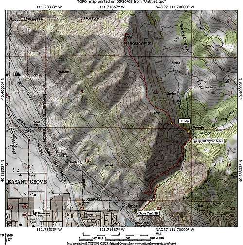
Half of the route is via the Grove Creek Trail and the other half is pure cross country. For a feel of the route, see the map of the route at the bottom of this page.
From the Mahogany Mountain page, comes this information:
After you find the trailhead via the getting there directions, you will find a paved parking area with a FS vault toilet facility and some picnic tables present. At the east end of the parking lot you will see a gate and a trail sign (with a warning about being hazardous for horses). The trail is a jeep road that goes up the canyon about a third of a mile and where the jeep road dips down to the creek, you will see a trail that continues up to the left. A bit steep at the beginning but after it passes an old fence line, the trail has a very nice grade and and an easy tread. A couple switchbacks will get you to a trail junction, take the one that heads into the canyon.
The trail is well made and the kind that is enjoyable. There are a few areas where you will pay close attention to your footwork but overall it is an easy hike up to the bridge that crosses the creek, at about the two mile mark. You will pass a bench sitting next to an outcropping and the bench is a great place to sit and look back at the valley and the canyon below. The bench is a memorial for a person who is being honored and a small plaque and tiny mailbox register is found nearby. It is a bit over two miles to the bench and the elevation is roughly 6800 feet, a gain from the parking lot of 1600 feet.
The cross country half

After you pass the Les Case Memorial Bench (placed there in honor of a mountain biker)it is about twenty feet to where you want to start going up.
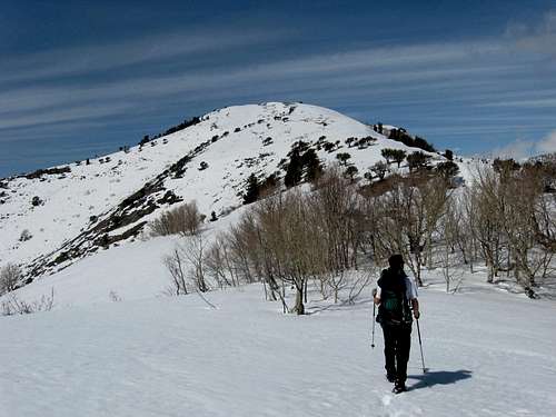
See the pic. The way up is steep and loose but nothing you can't handle with a bit of care. The second pic in this section will show you what the
overall route up to the ridgeline looks like. Click the pic to high resolution and you'll see my attempt at marking the route. If you should get to the bridge crossing the creek, you have gone too far. Backtrack towards the bench and check the hillside for the way up. From here to the first yellow dot, you will gain several hundred feet to the ridgeline and as mentioned before, the up to this point is fairly loose yet not difficult slope. When you reach the point mentioned before you will be at 7050 feet.
From here you can pretty much scope the route as it ascends along the SE ridge, deciding where you might want to traverse from. The map shows the route Eric and I chose but it was totally covered in snow. With the snow gone, it might be easiest to just continue up the SE ridge to the broad ridge area. Near the top of the ridge we angled across the slope (snow covered in March) and gained access to the upper ridge that leads to the summit. From this point on the angle relented and it was just a relatively easy walk from there to the summit. From the bench area on the trail to the summit was an elevation gain of 2200 feet and about 1.8 miles.
We did have a spot where we lost elevation on the way to the summit and back but that didn't add much more than 200 feet total. Your mileage and elevation may vary but this information will put you in the ball park.
Update: June 9, 2008 All the snow is gone and so now it'll be interesting to repeat this hike without the snow. I will add new information regarding this route once I get back up there. A recent hike to the top of G mountain gave me some views of the SE Ridge route that I have added in the form of pics to this page.


Gear

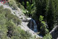
Good hiking shoes, trekking poles, ice axe during times of snow, perhaps even crampons and snowshoes might be needed. Water can be found at nearby Grove Creek early in the season and should be filtered (lots of elk in the area). We saw two elk as we were descending the ridge and elk droppings all over the place. Take along your common sense and you will have an enjoyable hike.

Map