
-
 25716 Hits
-
 79.04% Score
-
 10 Votes
|
|
Route |
|---|---|
|
|
48.39320°N / 121.057°W |
|
|
Mountaineering |
|
|
Summer |
|
|
Most of a day |
|
|
Class 2 or 3, plus glaciers |
|
|
Overview
If you've been paying attention to the map, you're aware of how closely the Ptarmigan Traverse cleaves to the crest of the Cascade Range. In the first two stages you crossed the crest three times, not including any side trips made to climb peaks. On Stage 3, you'll stroll along the crest for awhile, then drop off to the East side, only to cross it twice more. You'll spend most of the day on glaciers, from the little patchwork ones that are so common in the High Cascades, to the South Cascade Glacier, a classic valley glacier that drains to both sides of the Crest.

[Thanks to Klenke, rfbolton and ragu for their photos. This page would be pretty dull without their contributions. Click any of them for the originals, with captions.]
As always, opportunity abounds for the climber and SummitPost contributor: of the four named peaks and several other unnamed ones you'll pass, not one is in SP yet.
Approach
The “Routes” of the Ptarmigan Traverse are the stages of this multi-day trek. Therefore, the approach to Stage 3 is Stage 2.
Route Description
From Yang Yang Lakes ascend SSW to a low part of the crest, a little steep to attain, but once on top, you'll find it broad and easy at 6500 feet.
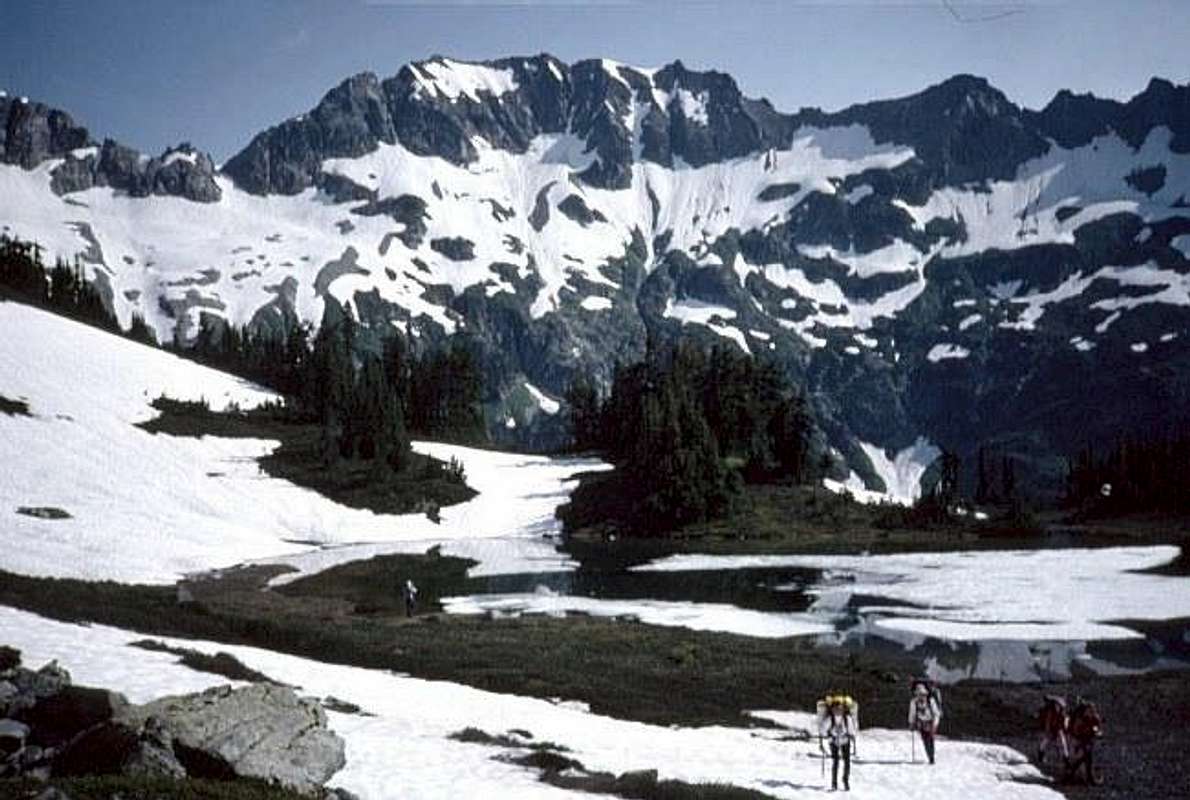

In this view from at or near Spider-Formidable Col, the Yang Yang Lakes bench is the shaded patch just below the center. Le Conte Mountain breaks the skyline right of center, and the crest between them is mostly an easy, rounded hump.
Walk the crest a short distance, then drop east onto the long, intermittent Le Conte Glacier. (To climb the standard route of Le Conte Mountain, ascend from here to its NE slope. Beckey's guidebook describes Points 7456 and 7612 as Le Conte's Middle and South peaks.) Traverse SE on the Le Conte Glacier toward Sentinel and Old Guard Peaks.
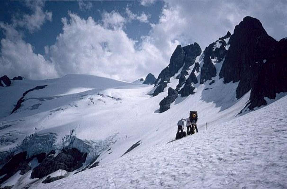
You'll descend almost to 6,400' to pass below the E face of Point 7456. The glacier begins as a narrow band of ice clinging to the NE slope of the ridge, broadens and deepens into a major ice field covering the entire N slope of the Sentinel/Old Guard massif and cutting through three ridges to hang over the E, S, and W sides. The route ascends the main part of the glacier, passing though some of the most active and heavily-crevassed ice of the PT.

At 7300' you'll reach the end of Le Conte Mtn. (If you wish to climb Sentinel and/or Old Guard, continue up to their summit pyramids.)
Otherwise, pass through the break and descend the W slope 100 - 200 feet before turning S. Contour the W slope of Sentinel southward, staying at 7100' all the way to the South Cascade Glacier.
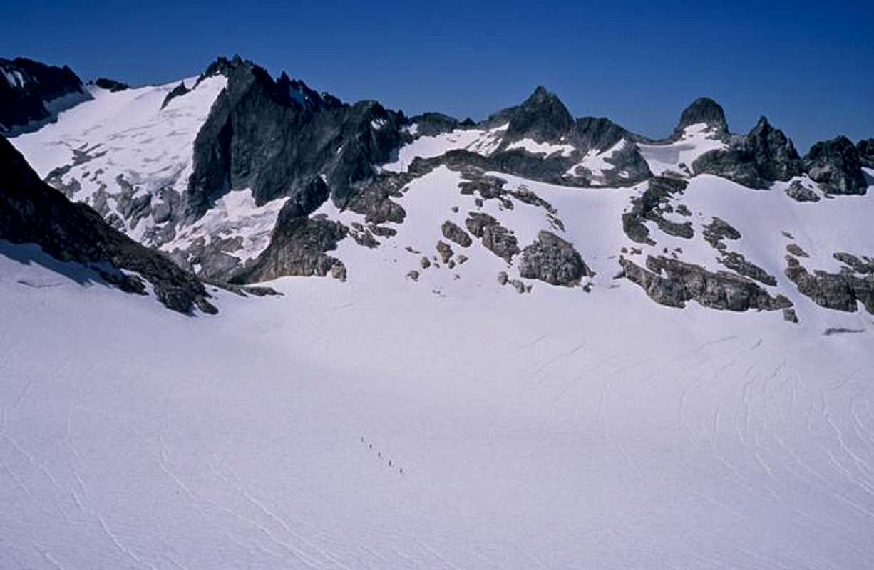
Cut across the top of the glacier, heading SW to a pass (6800+') in the S ridge, 2000' feet (3/8 mile) W of Lizard Mountain's summit. (Lizard is an easy ascent from here.) Descend glacier ice, rock, talus, and more ice to White Rock Lakes, elev. 6194 feet.

The best camping is probably near the largest lake; we were desperately soaked after a few hours of dramatic weather and settled for the 6280' hump just E of the outlet from the E lake.
 |
Essential Gear
See the Ptarmigan Traverse main page.Peaks to Tempt You
Le Conte Mountain (north)
Peak 7456 (Le Conte middle)
Peak 7200 (“The Donjon”, S of 7456)
Peak 7612 (Le Conte south)
Sentinel Peak
Lizard Mountain
Alternate Exits
The South Cascade Glacier and River offer a viable route almost back to your starting point: descend the glacier to South Cascade Lake. [Note this may be easier said than done. I've wandered around the upper portion of the glacier, and I've hiked the trail from the road up to the lake at the glacier's terminus, but I haven't been around the lake or on the lower glacier. Others have done it, but I don't have the route details. Study the maps and keep your eyes and options open.] There are two gaging stations W of the lake: one at its outlet and one 1000' WNW of there, on Satix Creek at the 5200' contour line. From that second station cross to the N side of Satix Creek. Bushwack the logs and brush of avalanche debris about 100 feet N of the creek, going straight downhill, then head WNW across almost flat (but log & brush-infested) ground to the wall of trees that runs NE from the 90-degree bend in Satix Creek. Hit those trees at about 200 feet from the creek (just above the 4800' countour line), and you'll find a trail just inside the trees.
The trail's not marked on any map, but it's used by glaciologists and National Outdoor Leadership School (NOLS) groups several times a year. The route stays E of the river, usually 200+ feet above it, though there are side creeks to fill watter bottles. It crosses Drop Creek at about 3240' elev., then climbs to 3640 feet, 800 feet above the river, to avoid a box canyon. It finally reaches the river itself about a mile after the high point of that detour. There are a few campsites along the lower valley.
There may be times when you can't see your boots under the brush, but the trail is continuous all the way to a junction with the Middle Fork Cascade River Trail and out to a spur road off the Cascade River Road. Distance from the lake to the road is 8.5 miles by my reckoning, and the trail was good enough in about '95 for a friend and I to hike from road to lake and back in a day. (Yeah, it hurt.)
You could conceivably descend the West Fork of Agnes Creek from just SE of White Rock Lakes to reach a trail that the Agnes Mtn. map shows terminating S of the creek at 2520+ feet elev. You'll have to beat a lot of brush to reach it, but once there, you'd follow gentle valley bottom (crossing to the N side in ½ mile). About 3 miles past the creek crossing, reach the Pacific Crest Trail. Turn left (NE), and about 4 miles of the most famous trrail in Washington will take you to High Bridge Campground on the Stehekin River. From there you can catch a shuttle bus to Stehekin on Lake Chelan and ride the boat down to Chelan and the rest of the known world. You'd want the Agnes Mtn. USGS map and the Wenatchee National Forest map.
August 2010 edit: Don't exit into Agnes Creek! My description was based on map & satellite images. Jim Vallance has tried it, and knows better:
At stage 3, I suggest you very strongly warn people away from exiting via the West Fork of Agnes Creek. I did this about 30 years ago. It was a big mistake! And I doubt if 30 years have made it any less a mistake than it was then. From where our party entered the alder thicket to where we got onto viable trail took 16 hours, working very hard to traverse a distance of a little less than 4 miles. To make forward progress, we had to ascend the alder branches and jump from branch to branch about 6 feet off the ground, periodically falling out into the devil's club below. The trail remnant shown on the south side of the creek on the Agnes Mtn. quad did not exist, so one may as well save two dangerous creek crossings and head for whatever of the trail remains on the north side of the creek. Toward the end of this traverse the going relents ever so slightly. We found walking straight down icy tributaries and through a waist-deep swamp to be considerably easier going than the brush, which is the worst I have ever dealt with. If as I suspect the Forest Service has not maintained the spur trail up the West Fork, the bushwack may be longer than I indicate above. There are no useful camp sites along the way.
AlpinWeiss - Aug 31, 2016 1:15 pm - Hasn't voted
Additional Beta to Gaining the Ridge from Yang Yang LakesWe attempted the Ptarmigan Traverse on 8/19 - 8/23 2016. We made it to the LeConte Glacier where we encountered more ice than planned for and incoming weather. Overall the Summitpost beta was excellent, but one area could use improvement: Gaining the ridge out of Yang Yang lakes was not straightforward. The posted Beta indicates: "From Yang Yang Lakes ascend SSW to a low part of the crest, a little steep to attain, but once on top, you'll find it broad and easy at 6500 feet." This lead us to climb a loose and sketchy gully. On our return trip we found a much better route: From Yang Yang lakes ascend SSW along a large talus field looking for cairns, when you see the first cairn look left and find a rising traverse across the talus to a forested section of the ridge with a indistinct trail that looks impossibly steep. Ascend this trail (cairned along the way) to the low part of the crest. Once on top you'll find it broad and easy at 6500 feet. Unless you have significant snow cover avoid the obvious gully which is steep and loose. For more details see the image attached to this page or linked below: Route to Gain Ridge Above Yang Yang Lakes