
-
 5076 Hits
-
 70.83% Score
-
 1 Votes
|
|
Mountain/Rock |
|---|---|
|
|
38.83402°N / 112.26967°W |
|
|
Millard |
|
|
Hiking |
|
|
Spring, Summer, Fall, Winter |
|
|
10088 ft / 3075 m |
|
|
Overview
Sunset Peak is the southernmost 10,000-foot peak in the Pahvant Mountains. As with most of the peaks in the mountain range, it is easily accessed by the dirt roads and ATV trails. Covered with a mix of spruce and aspen near the summit, it stands in stark contrast to the high desert environment 5,000 feet below.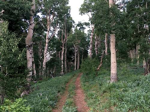
Classic Utah Aspen
Getting There
From Richfield, Utah, take 300 N west out of town. It turns into Forest Road 096 just past I-70. Drive straight for about 8 miles then turn right onto the continuation of Forest Road 096 (Richfield West Mountain Road). There are good signs that direct you to White Pine Peak. Drive another 6.2 miles to the spine of the mountain range where you will turn South (left) onto Forest Road 500. Take this road for 1.9 miles where you have the option of making a U-turn onto a less-maintained road toward the peak.Route
You can basically drive to the summit in a high-clearance 4WD vehicle or start your hike from the U-turn off of Forest Road 500.Round-trip Distance: 2 miles
Elevation Gain: 435 feet![South Hiking Route]()
South Hiking Route
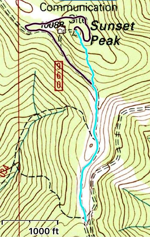
South Hiking Route