Introduction & Purpose
With the following trip report I wish to outline with words and pictures what the experience of the Kays Creek trail was for me on an early autumn day. September 29, 2012 to be exact. The summer grasses were withered, brown, long past their prime, worn down and leaning as though a slow death were pushing, forcing them to kneel. Maple leaves were various shades of red, some so outrageous they seemed to be screaming, "Look at me!" Chlorophyll was shutting down its live-giving powers with the ever-shortening days. Aspens preened with their brilliant yellows in stark contrast to their chalky white pencil-thin trunks. Kays Creek still showed signs of life but was an obvious shadow of its former springtime glory. The trail was dry and dusty, a brown ribbon hungry for rain and worn with the prints of men's and women's boots and trail runners' Nikes and Adidas and the jarring arc-shaped hooves of horses. The Farmington Ridge and its western accordion-fold flank were in the throws of the endless cycle brought so elegantly and precisely by a thoughtful Mother Nature. A stark contrast to the Salt Lake valley with its predictable sprawl, endless streams of cars and trucks on I-15, people shuffling in and out of big box stores, families cheering their kids on at soccer games, couch potatoes watching college football and listening to the drivel of announcers nuancing every replay. Therefore we hike.
Where in the heck is that trailhead?
"Getting there" is a mixed bag of information on SummitPost pages. Have you ever followed instructions exactly as posted and found yourself doubling back, re-reading the text and at last uttering a few words which would not be allowed to be spoken on network television? Those directions can be precise or they can be the opposite. Confusing. Even horribly wrong. Or a terrible mix of all of the above. I will describe and show how best to reach the Kays Creek trailhead. I don't wish anyone to read this, follow my suggestions and end up stopping their car in frustration, frazzled by innacuracies or foggy descriptions.
I live south of Salt Lake City, so this description begins with the drive on I-15 northbound from the city. The picture I took of the exit to Highway 89 is a bit blurry, but then so were my eyes at the time. Nonetheless, the number 324 is legible even if just barely. Not to worry, the quality of photos gets better.
![Kays Creek trail]() Leave I-15 and proceed north on Highway 89.
Leave I-15 and proceed north on Highway 89.
After commencing the journey on Highway 89 - might be good to reset one of your trip mileage counters - glance east at the Lagoon Amusement Park. Continue north as speed limits gradually drop back to 55 mph and an occasional light brings traffic to a possible stop. Watch for Cherry Lane intersection where a Tesoro gas station occupies the southwest corner and is therefore kitty-corner to the competing Sinclair station north and east of the light. My Trip A odometer displayed a mileage of 6.7 from the #324 exit. Yours may differ slightly, but this figure should be in the proverbial ball park.
![Kays Creek trail - getting there]() The Tesoro station at Cherry Lane intersection.
The Tesoro station at Cherry Lane intersection.![Kays Creek trail - getting there]() Left on Valley View Drive, a quick maneuver after leaving Highway 89.
Left on Valley View Drive, a quick maneuver after leaving Highway 89.![Kays Creek trail - getting there]() Right on Fernwood Drive (2000 North) and begin climbing
Right on Fernwood Drive (2000 North) and begin climbing
Turn east (right) here and then north (left) onto Valley View Drive. You might spend all of 15 seconds on Cherry Lane before making this turn. Passing behind the Sinclair station you begin a gentle climb and proceed less than 1/2 mile before spotting the sign for and turning east (right) on Fernwood Drive. The road climbs ever more steeply, makes a gentle right bend and then a much sharper left switchback as you gain elevation. Fernwood leads east once again and then offers you a T (no, not a "tea"). Fernwood Drive continues right (south) while Snoqualmie Drive takes up its northerly direction.
![Kays Creek trail - getting there]() Turn right at the T intersection to stay on Fernwood Drive.
Turn right at the T intersection to stay on Fernwood Drive.![Kays Creek trail - getting there]() Pass the picnic area - you're nearly at the TH.
Pass the picnic area - you're nearly at the TH.
You are now just about one minute from the Kays Creek trailhead. Pass by the picnic area and then enter the small parking lot; there are about 20 parking spaces. If you are hauling a horse trailer, not to worry - there are spaces for those rigs also. This is a first class trailhead because there is not only a restroom but drinking water from 2 different delivery methods. Note: there is a steel gate which can block entrance to the trailhead parking area. I do not know how strictly the hours for closing and/or opening the gate are adhered to.
![Kays Creek trail - getting there]() Creature comforts at the civilized TH.
Creature comforts at the civilized TH.The Kays Creek Trail - Switchbacks & Contours
![Kays Creek trail to Thurston Peak]() First few yards of the trail complete with inlaid cinder blocks.
First few yards of the trail complete with inlaid cinder blocks.
The trail officially begins at the northeast corner of the parking area. There is another trail leading southbound from the southeast parking lot corner. That one is NOT the trail you want. I noted the elevation as 5,200' (N 41 degrees 05.264' W 111 degrees 54.105'). Someone laid patterned cinder blocks along the first few yards of the trail. Inexpensive cobblestones to give it that "European" look? Maybe. I don't know. But thank goodness these blocks don't last long.
For a while you look down on the roof tops of gigantic homes. Conspicuous consumption. Soon the trail bends eastward into the narrower part of the gully through which Kays Creek tumbles. The refreshing cascade of Kays Creek waters rush below you off your left side. Taller trees provide a comforting canopy; trail runners pass both from ahead and behind. But not too many. If you start early you can plan on being in the shadow of the mountain for at least the first hour and a half.
![Kays Creek trail to Thurston Peak]() Quality bridge, built to last.
Quality bridge, built to last.
The bridge (5,484')pictured is sturdy enough to support a small army brigade carrying heavy battle packs. I was warned to not not take any of the spur trails heading left from the main trail.
![Kays Creek trail to Thurston Peak]() Three minutes after the bridge a look back at autumn hues.
Three minutes after the bridge a look back at autumn hues. This was good advice although the main trail was always obvious. After 30 minutes the Great Western Trail sign stood prominently on the west edge of the trail, the elevation here about 5,650' (N 41 degrees 05.939' W 111 degrees 54.026').
![Kays Creek trail to Thurston Peak]() Tall pole, legible text - for now.
Tall pole, legible text - for now.
That meant a gain of only 450' in half an hour. Not a splendid show of strength or speed, good reason for trail runners to mock me. But it was in part due to the undulating trail and gradual grade. This would soon change as the switchbacks came into play with a vengeance. As a result, the one-hour point found me standing at an elevation of 6,733' with 2.7 miles behind me. I was beginning to ask myself silly questions like, "Are these danged switchbacks ever going to stop?" On the other hand, most of the trail was in tall scrub oak, thick brush or under the potential shade of maples and aspens, so tolerance of the conditions was made easier than it might have been. There was virtually no wind. The temperature had remained about where it was when I had begun, 55 degrees F. Perhaps ideal for hiking.
I count switchbacks and know there are at least 35 serious ones. I stop counting as swerves and meandering become common place and interupt the rhythm of my calculations. I enjoy the tones and colors of fall as the second hour quickly passes . For fifteen minutes the trail becomes perturbingly rocky but soon gives way to sandy dirt. I am in and out of foliage and notice that deadfall is a problem only once. I take a hydration break at two hours (8,507', N 41 degrees 06.355' W 111 degrees 51.884') and take two pictures, one looking down on Clearfield and Hill AFB. No F-16s burning Jet-A fuel today. No afterburner climbouts. No pitchouts from 4-ship echelon formation. Dead still on the base. Our tax dollars at rest. The other snapshot offers a view to the south where the trail will soon begin to contour and offer prolonged exposure to the morning sun. Only thin mid-level clouds, transparent like old waxed paper. Wind continues to be a non-factor.
![Kays Creek trail to Thurston Peak]() Clearfield & Hill AFB
Clearfield & Hill AFB![Kays Creek trail to Thurston Peak]() A view to the south which promises lots of contouring.
A view to the south which promises lots of contouring.
Soon after taking the 2-hour break I continue on, wondering if at some point I will attain the ridge directly east and above me and follow it south to Thurston Peak. As the trail turns southward my answer plays out over the following 45+ minutes; I will contour until I am sick of it. Gaining then losing elevation becomes mildly aggravating. But I love to hike, so I attempt to brush away any feelings of anger by admitting that it was my decision to take this hike and I need to be more grateful for the pleasant day Mother Nature is offering me. It works. And I am pleasantly surprised when the trail crosses a delightful spring which offers me cool refreshing water. A wonderful exclamation point along the way.
![Kays Creek trail to Thurston Peak]() Cool, clear water
Cool, clear water![Kays Creek trail to Thurston Peak]() This square plastic trough collects water 20 feet downstream from the PVC pipe.
This square plastic trough collects water 20 feet downstream from the PVC pipe.
The contouring terrain is a series of giant irregular accordion folds perched at angles varying from 10 to 15 degrees. Like desert dry washes except for the angular displacement. For the most part brush is growing on both sides of the trail, but the trail seems used enough that the brush does not encroach on the hiking path. Trees are sparse; autumn-drab grass and bushes coat the surrounding slopes. A rough carpet of auburns, hazels, cinnamons, russets, ochres, umbers and gingers. And just when I think I have gone over and around the final shoulder yet one more lazy dip leads down to a broad shallow drainage and then up to one more "soft" shoulder. This is the nature of the upper east bench of Layton. Or Clearfield. Or Kaysville. All the way to Ogden.
![Kays Creek trail to Thurston Peak]() A typical terrain fold; the trail passes below the evergreens.
A typical terrain fold; the trail passes below the evergreens.
The bland tawny colors of the hillsides will soon yield to a mini-forest growing at the base of what I will label a cirque. Not as grand as many I have encountered, but certainly in stark contrast to the myriad easy curtain folds over which I have been roller-coasting for the last half mile. I am startled, not to find a camping site at a level spot at the north edge of the trees, but to find a cast-iron stove plunked on the ground next to a large fire pit. It begs the question: How did it get here? Horseback? Pack mule? Forest Service chopper? I look for other evidence of serious long-term camping, maybe even a ramshackle cabin skeleton but find nothing. So I name this spot "the stove site."
![Kays Creek trail to Thurston Peak]() The stove site near trees at the cirque base.
The stove site near trees at the cirque base.
Shade from the mini-forest is welcome. It does not last long. The trail begins to climb and after crossing a river of small boulders and passing two well-designed cairns I see that I will be on a narrow section of trail which leads to the ridge above me to my right.
![Kays Creek trail to Thurston Peak]() Nice work, my friend.
Nice work, my friend. I pass beneath a mammoth rock outcropping, angular and sunburned. A long stretch of dirt trail, a sharp switchback to the right, lasting perhaps 30 feet, another sharp angle to the left and soon another sharp righthand jig and I am looking at a rocky scree-littered path to the ridge top.
![Kays Creek trail to Thurston Peak]() The final "push" to the west ridge of the cirque.
The final "push" to the west ridge of the cirque.
Cairns. Evidence of boredom. Or of the need for a rest. Or both. The trail turns left, parallels the cirque's west ridge past a small rock outcropping and opens up to - are you ready for this - yet more contouring. I can see the rounded summit area in the distance, slightly left of what I envision to be due south. Suddenly I meet a mountain biker and wonder to myself how on earth he has reached this spot. He is pushing his bike, the bike tilted up at a 90 degree angle. He is important because he has information about where this trail leads.
I am hoping he says straight ahead to the summit. No, the trail first wraps around yet another shoulder, out there where "those trees are," and soon it crests out on a ridge. After which the trail is quite flat leading to a saddle south of Thurston Peak. After which one makes his or her own way north, up the ridge, to the top. Information less detailed and factual than an encyclopedia's offering but good enough for ordinary hikers.
I continue and lose another 35' over 300 yards but soon see how his description of the wrap-around was fact, not fiction.
![Kays Creek trail to Thurston Peak]() The sloping trail, trees and the next to last wrap-around before attaining the west ridge of Thurston Peak.
The sloping trail, trees and the next to last wrap-around before attaining the west ridge of Thurston Peak.The summit ridge and general area
The shoulder mentioned above is quite sharp compared to those baby-shoulders I have encountered since beginning the contouring. One more slight fold, then a brief patch of wet ground. Perhaps seepage, perhaps a distant spring. Then the long-awaited topping out and to my left I see a gently rounded ridge which looks like it could lead directly to the summit. Some vegatation, some boulders. In fact, the rocky trail leads directly east and I think that it will take me right up to the top. I am wrong.
It soon breaks right and heads southeast. I begin to slowly lose elevation. I have seen this scenario many times during the past hour. And it continues to lose elevation. A mind-numbing thought at this stage of my journey. Yet I am determined to follow the Kays Creek trail, not create a cut-off. If I do not follow the trail, how can I ever write a fully truthful trip report? I decide to hang with the dusty track distinctly cut ahead of me and once I am at the top I can then make a deviation.
Ten minutes and I break left from the trail and find the slight saddle south of the obvious summit ridge, a ridge festooned with occasional pine trees, brave evergreens who have survived ferocious east winds as low pressure systems pinwheel across Utah and place their backsides against the Wasatch.
![Kays Creek trail to Thurston Peak]() The final contouring section of the trail; here the summit is always above and on my left.
The final contouring section of the trail; here the summit is always above and on my left.
A short break, hydration and then an unceremonious launch toward the summit, the trail a faint hit-and-miss affair which looks like it was made by many undecided hikers over years and years, each group questioning and wondering if "this is the way." Each time the same dull conclusion: it has to be, it's the only way. Just keep going up. I do this. About 450' vertical feet to go. Still no wind. Still cool temperatures. But now I have a view of the still-green Morgan valley, and it creates a feeling of change and hope and vigor. A shot in the arm for the final short push.
Thurston Peak summit
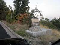
Three hours and forty-five minutes. 7.99 miles on my GPS total distance. The summit. A breeze. Cool but not cold. I don a light top to serve as a windbreaker. Perfect. I was here several years ago but had come from the south, from the radar domed Francis Peak. The granite block with the memorial plaque to Thomas J. Thurston, sitting resolutely and stately. A roughed-up benchmark. A huge boulder level enough to make sitting a pleasure rather than a chore. Views in all directions which reach out to reel in the miles.
![Kays Creek trail to Thurston Peak]() Looking east southeast from the summit.
Looking east southeast from the summit.![Kays Creek trail to Thurston Peak]() The top half of the plaque inscription.
The top half of the plaque inscription.![Kays Creek trail to Thurston Peak]() The bottom half of the plaque inscription.
The bottom half of the plaque inscription.![Thurston Peak via Kays Creek]() Benchmark, gouged and scuffed but hanging on.
Benchmark, gouged and scuffed but hanging on.
Skies are not crystal clear. Some smoke has blown down from forest fires in southern Idaho; normal valley haze builds up giving climate-control enthusiasts more fuel for the fire of their arguments about global warning. Whatever. I look northward and see Mt. Ogen and further Mt. Ben Lomond and maybe even Willard Peak, the highpoint for Weber County. I've seen much better views, but this vista is all I'm going to get today. You take what Mother Nature gives you.
![Kays Creek trail to Thurston Peak]() The view to the north with Mt. Ben Lomond and Willard Peak in the haze-draped distance.
The view to the north with Mt. Ben Lomond and Willard Peak in the haze-draped distance.
Summit menu: one medium banana with browned and bruised skin, but I don't normally eat the skin; one Naked Mango Veggie cocktail; water; M&M peanut candies, as many as I want. Cell phone calls with near-perfect reception. Lots of bars. Soon it's time to call the summit party to a halt and think about the 8-mile return. Contours. More contours. The spring. Contours, Part Three. Switchbacks down. Autumn leaves. The bridge. The cinder-block cobblestone knock-offs. The trailhead luxuriating in warm afternoon temps. But I have a plan.
The return trip with one slight deviation
Intrigued by the thought of being able to descend in a more direct route to the trail on which I had come I walk a few yards west and peer down the silent ridge. It leads in a more-or-less straight line toward the point where I at last crested the final ridge and could look east up at the summit area.
So I head down, looking in vain for any sign of a trail. This ridge is gently rounded and is covered with scrub brush, dying clumps of grass and uneven patches of smaller boulders and rocks. A few times the brush is dense and forces me to drop slightly down to one side or the other to avoid wading through the tangles and possible brambles. I am quickly at the point I name "the merge," for there is a faint trail leading west down the obvious ridge straight ahead. I surmise that this is the ridge which one follows from the Adams Canyon TH to take by far the most direct route from the lower bench to the Thurston summit.
![Kays Creek to Thurston Peak]() This picture of my GPS track shows the difference in distance between the Kays Creek trail proper and the route from the merge point directly east and up to the summit.
This picture of my GPS track shows the difference in distance between the Kays Creek trail proper and the route from the merge point directly east and up to the summit.
From the track it is obvious that the quicker and smarter way to the summit on the Kays Creek trail is to leave the more well-worn trail and simply continue straight up the ridge. This variation cuts off almost .7 miles and probably 10 to 15 minutes of time. My GPS said that the shorter distance was about 1/3 of a mile while the other way, the way I had taken, was about one mile on the button. You can decide for yourself which way to go. I know what I will do the next time.
I pick up the actual trail at the merge point because my car is waiting at the Kays Creek TH and I have no desire to pick my way down the Adams Canyon trail/ridge and then hike or hitchhike two miles plus to my car from the Adams Canyon TH.
From the merge point I repeat what I had done only in reverse, so I am surprised by nothing. At least for the first part. I descend the steep section leading down the west slope of the cirque hugging the left (north) side where the protruding rocks are far more stable and solid than the areas to the south. Piece of cake. But no room for throwing caution to the wind. The switchbacks and the trail seems much milder on the way down. The rock river, the two interesting cairns and the small forest leading to the stove site.
Then I receive both a shock and a surprise which in a startling way lifts my spirits even higher than they already were. As I crest the little berm forming the southern boundary of the gully in which the spring flows I hear a noise I cannot identify but which suggests strength and power and purpose. A fraction of a second later I see and am mesmerized by the 5-foot wingspan and soaring figure of a full-grown golden eagle. Like a bronzed camoflaged stealth bomber on takeoff. Right there! Holding altitude, westbound with ever increasing acceleration, the terrain separation increasing with each passing second. No time to take out the compact camera waiting deep in my right front pocket. Only time to marvel and admire. The majesty of this creature was palpable. It's wings and body were soon only a diminishing silhouette against the muted blue western sky. I wish it would come back; I mean it no harm. It's gone. I will never forget the experience and only regret that hiking companions were not there to share the moment.
The remainder of the return was uneventful except for the afternoon colors I found at several junctures during my descent through the forested areas. I am not feeling tired, but my legs have lost some of their spring. I will let a couple of pictures show the beauty I experienced on the way back.
![Kays Creek trail to Thurston Peak]() Beauty on the return trip. A lovely meadow near a hidden flow of water.
Beauty on the return trip. A lovely meadow near a hidden flow of water.![Kays Creek trail to Thurston Peak]() 100 yards below the meadow this scene opens up.
100 yards below the meadow this scene opens up.![Kays Creek trail to Thurston Peak]() Ah, maple leaves in the slanting afternoon sun.
Ah, maple leaves in the slanting afternoon sun.
I reach the TH with an elapsed time from the summit of 2+35. I note that the mileage on my GPS is not double the one-way distance but only just over fifteen miles. Yes, the more direct way was the right decision. The final picture illustrates the entire track. If someone asks me what the Kays Creek trail does I'll simply say, "Track north, take switchbacks east, contour south, bag the west summit ridge and slog east and up." End of story.
I recommend the Kays Creek trail for those who enjoy longer hikes, enjoyable views of the Great Salt Lake, and topping out at two-county highpoint and who have a day to enjoy it.
![Kays Creek trail to Thurston Peak]() The entire track of the Kays Creek trail.
The entire track of the Kays Creek trail.


Comments
Post a Comment