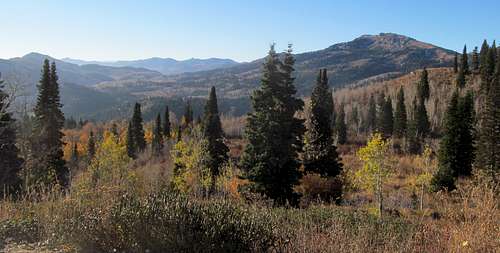
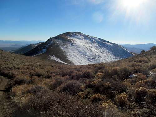
Swasey Peak - October 5th, 2013
It had been an excruciatingly long drought, similar to the void of 2004-2007, or 2008-2011. And since that glorious June of 2011 there were kids as old as two and a few months’ change who had yet to experience a Boston Sports World Championship. The brethren approached this Red Sox postseason with bated hopes in the Fall of 2013, having watched our boys of summer slug their way to the best record of the majors, but still wary of a team that was only a year removed from an era of gutless glut and cognizant of the many heartaches we had suffered in recent memory…in fact, still smarting from a heartbreaking loss to the Chicago Blackhawks only three months prior.
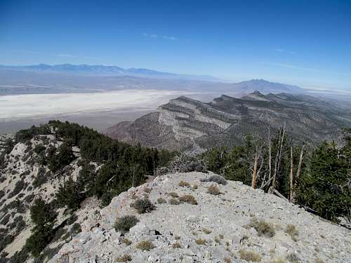
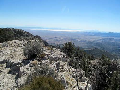
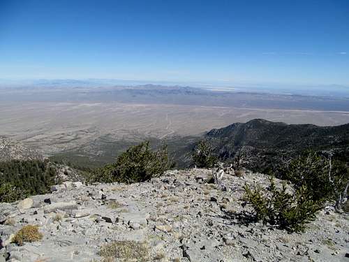
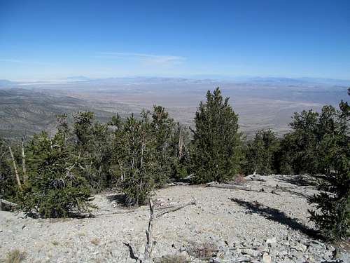
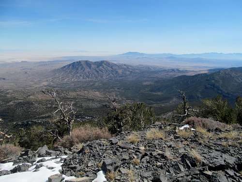
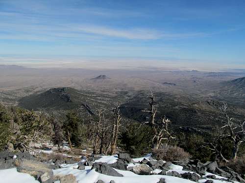
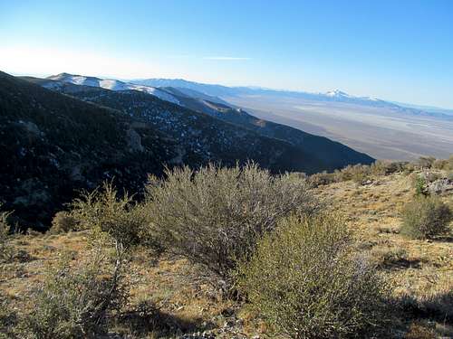
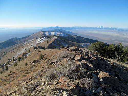
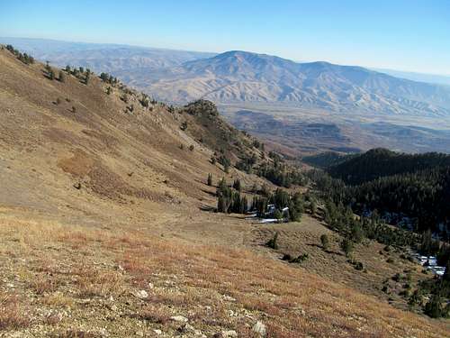
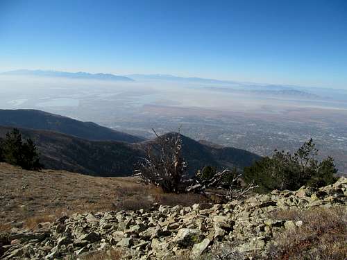
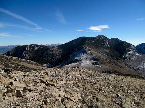
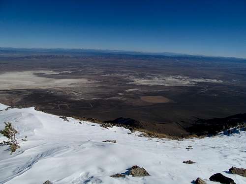
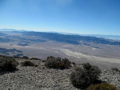
It was in the shadow of this newest Masshole sports renaissance that I began my last fall push for peaks. Saturday was Game 2 of the ALDS against Tampa, with first pitch around 3:30 Mountain time. I figured this would give me enough time to head down for a day trip to Delta, get Swasey Peak, and still be able to catch most of the game, all the while with the understanding that the monarch of Utah’s House Range is deceptively hard relative to its modest ascent route stats.
I was delayed past Delta trying to avoid some extra driving. The map showed the Old 6 and 50 road as a good, major gravel road that would take me directly west off the highway not far from town, but I had trouble finding it. After several false starts I gave up and continued down US-50 to take the main approach via the Long Ridge Reservoir road, a startlingly smooth gravel highway that took me to the starting point at the high pass south of the peak.
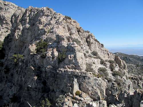
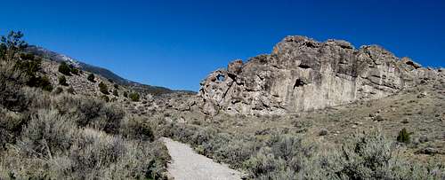
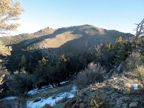
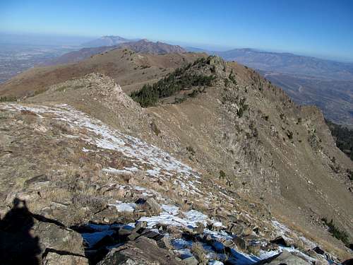
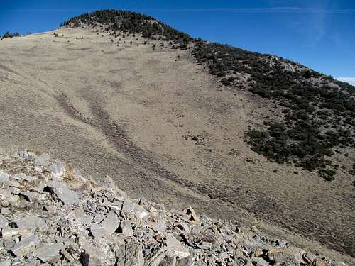
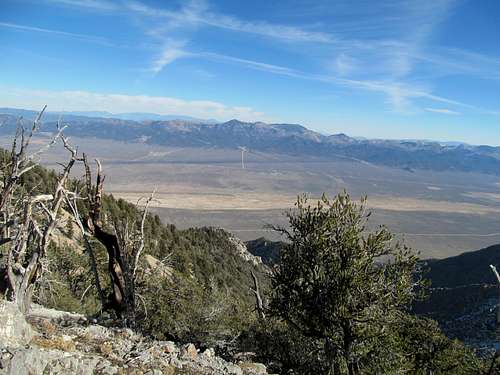
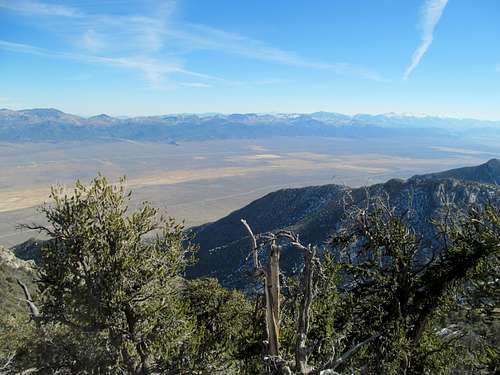
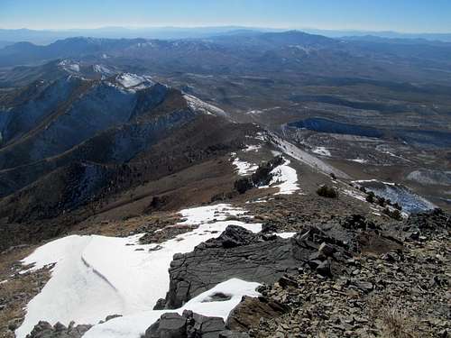
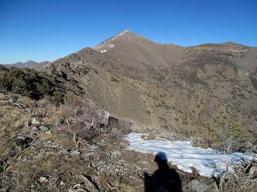
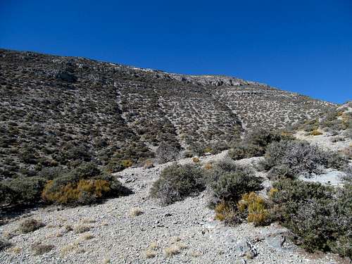
Swasey is infamous for its brush, and spying it from my car I thought a direct southerly scramble up the south ridge of its false summit looked better than the thicker alternative to its right, and the rocks offered a possibly exciting escape route from the brush.
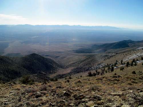
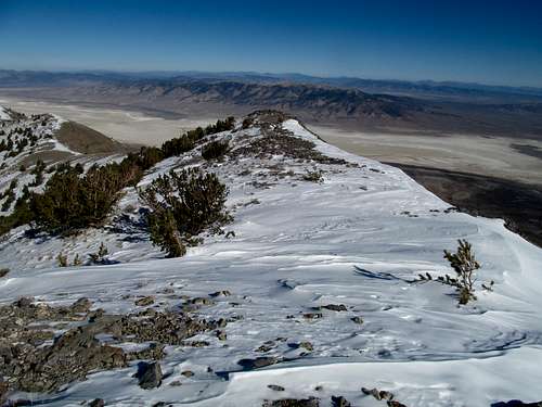
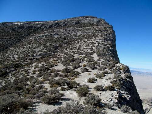
I tried my best to straight shot it to the ridge as the bushwhacking scene steadily deteriorated. Finding myself to the right of the ridge crest, I still had to clamber through 500 feet of the stuff amidst steep dirt until reaching the yellowish rocks, where some basic scrambling moves were required to gain the false summit.
There was some exposure to the left; nothing crazy, but for someone like me hellbent to take the path of least resistance it proved motivation enough to seek an alternative route for the way down.
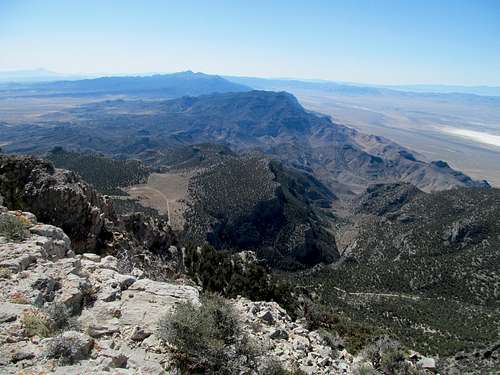
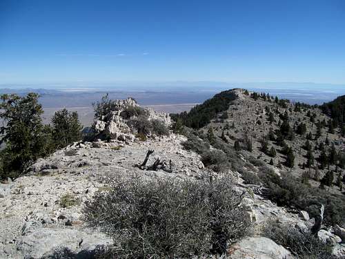
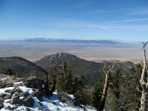
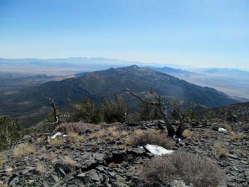
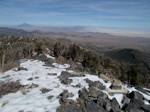
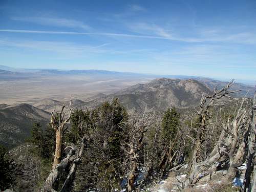
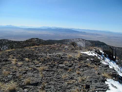
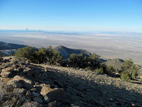
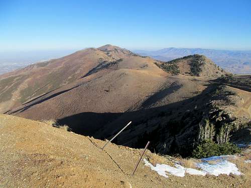
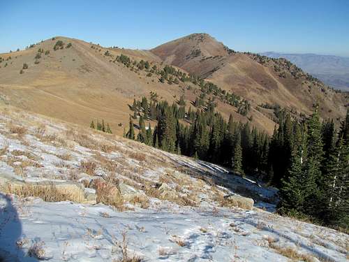
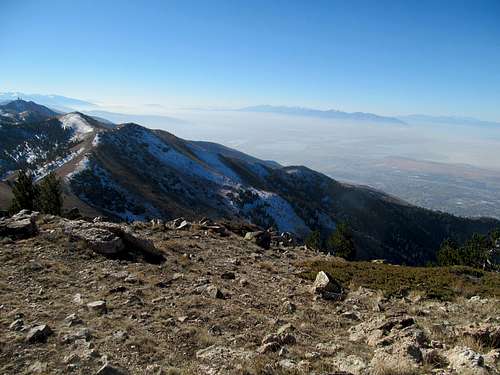
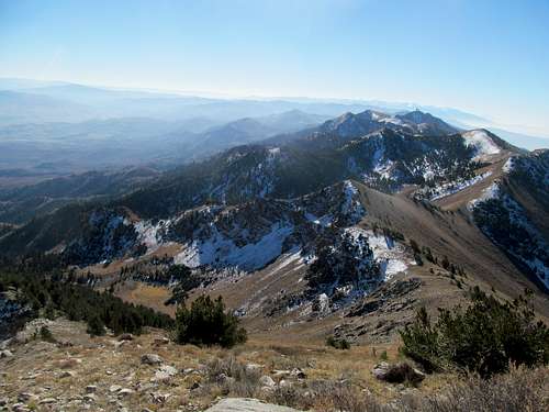
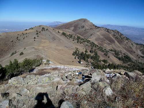
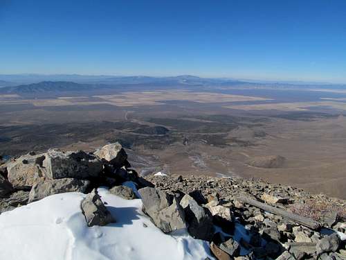
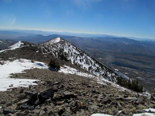
The traverse to the summit was pretty basic, taking you over some cool rock slabs. Interestingly enough the summit register had been signed by Gerry Roach of 14ers guidebook fame a day prior, and I bemoaned the fact that I had missed out on meeting a peakbagging legend by only one day, and wondered what peak in the area he was likely doing.
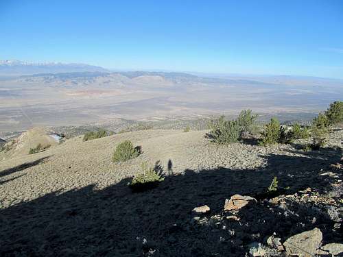
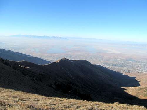
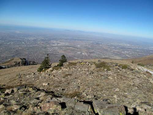
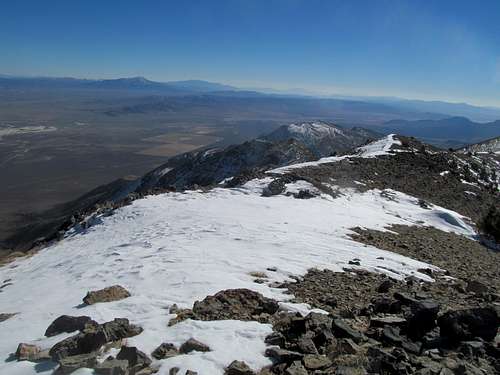
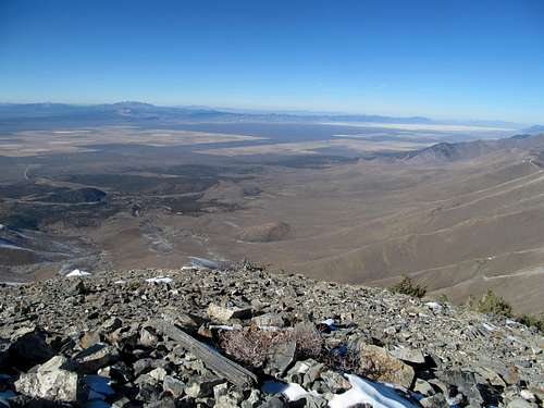
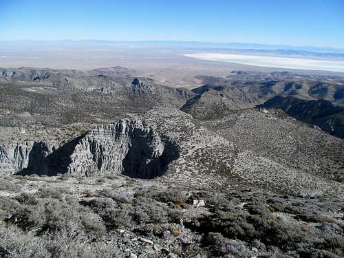
I enjoyed the views and wondered when I would finally make an attempt on Notch Peak to the south, but more pressingly, I had to get down in time for first pitch.
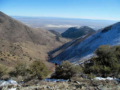
I angled further left (SE) on the descent, generally trying to follow the sparser brush cover. It took me through a completely separate drainage and away from my car, but I knew that I would run into the road sooner or later. Once off the upper slopes the brush situation improved, and I coasted down various dry washes where the footing was good, occasionally hitting the sides if the wash got choked. Eventually I emerged at a spot on the road about a mile back from the 4Runner, and trudged back up to the pass.
I had factored in the brush, but not navigational difficulties near Delta, into my baseball ETA. I thought about maybe finding a bar with a TV in Delta where I could catch the game, but thought better and figured my chances of finding a good spot were (very very marginally) improved nearer Provo. Once there, I saw that we had taken a commanding lead early, so instead of stopping I continued home to watch the tail end of the game.
Gone Goshuting - October 19th, 2013
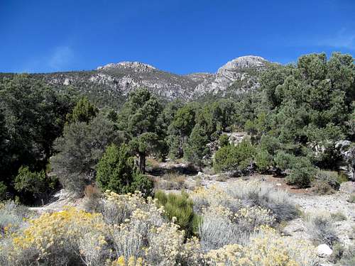
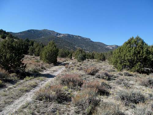
We took the series, and amidst cruddy weather I decided to take the following weekend off, focusing on watching the Sox drop the ALCS opener Saturday, followed by an edge of your seat Patriots comeback win Sunday afternoon, followed by an edge of your seat Red Sox comeback win Sunday night. It was a good day for Boston sports (we decided in a group text that it was the best doubleheader day since a Sunday in 2003, when we beat the Titans in a thriller, followed by a thriller against the A's in the ALDS), and our good fortunes continued through the week, with the Sox on the precipice of clinching the series against Detroit Saturday night. The Pats had a Sunday 1 EST against the Jets as well, so I figured my best bet was to head to Wendover and get some Nevada peaks. Saturday would be Goshute, which despite its prominent visage over I-80 and US-93A, casting its spell over me each time I drove by, remained a complete cipher in my mind. Until Dean posted his page on SP a few months before my climb the only information I had on it was from Greg, who obviously did it the hard way (20 miles XC from the highway), and described it as excessively brushy. Dean’s accounts of the peak seemed a little more optimistic, so I tried my best to follow his and Ken Jones' beta but invariably myself confused by the rough dirt tracks, often having trouble discerning which was a road, and which was a wash, and where the former often left the latter.
Much of the driving was in washes, and taking it slowly I eventually trial and errored my way to what I was pretty sure of was the right road to Felt Canyon. The problem was that a major washout stopped my progress at a little over 6000’, still several miles from the described trailhead, so I had to back up and park and continue the rest on foot.
The route described proceeds NW from the road through a drainage before hitting the peak’s SE slopes, but my problem was that, this still being in my pre GPS hiking phase, I had no clue where the hell the correct drainage was.
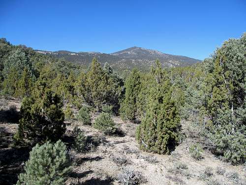
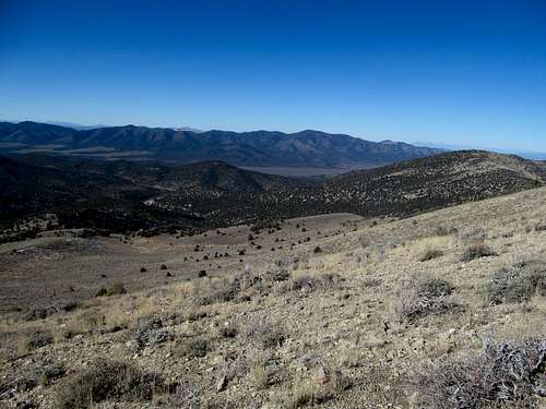
After a bit down the road I spotted a cairn and decided to give it a go. I actually had to crest a small hill and then look down at a drainage before me…not sure whether it was the right one, I decided I had no choice but to follow it. In hindsight it was definitely east of the one in Dean’s route description. Nevertheless, the going was easy, not too brushy, and upon reaching the ridge crest at some meadows around 7,700’ I was able to traverse west without much elevation loss, past the crest of the described drainage, and finally up to the main peak itself.
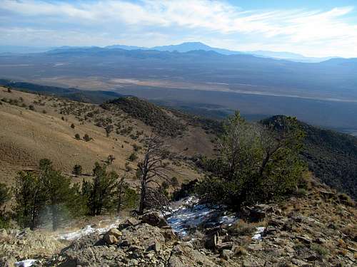
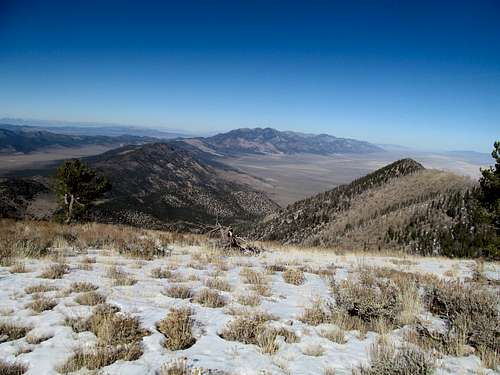
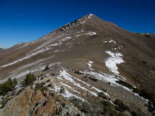
It was steep, steeper, and steepest near the top, where a final wooded ascent yielded a surprisingly pleasant and open summit surrounded by snowbound high peaks such as Pilot, Ibapah, Deseret and Wheeler/Moriah.
The ascent route was pleasant enough that I was able to follow it approximately on the descent, aiming for those high saddle meadows visible from upwards on the peak and following the same drainage in a general direction back down. I enjoyed Shane Victorino clinch the American League for the Sox at a casino bar that night, then passed out for an early wakeup the next day.
Pequop Peak Hop - October 20th, 2013
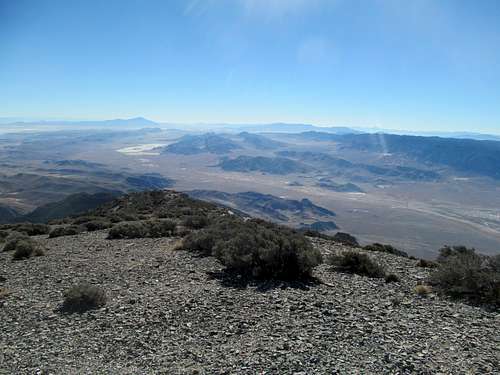
My goal was South Pequop Benchmark, a P2K in the northern part of the Spruce Range. It had modest ascent stats and a proximity to Wendover that would allow me to catch at least some of the Pats’ 1 EST game. I coasted down I-80 and watched a beautiful sunrise over the Independence Valley, following Dean’s excellent directions to the steep and rocky access road ending a tad below 8,000’.
I parked, then found that the road actually extended up another switchback, which I followed, then eventually cut steeply NE through the stunted forest, following a side ridge east to the range crest.
Here a small and narrow but obviously manmade trail cut towards the summit, which I followed until it seemed to traverse too low to gain the summit. I XC'd it up the remain few hundred feet to glimpse enjoy the views for a fleeting few minutes.
Then the rush down, cutting back into the drainage through steep and open (thus warmer) dirt slopes, reaching the original drainage northeast of my car and following the easy terrain back.
I should have taken my time, as the Pats lost to the Jets in an overtime referee screwjob.
Thirstin' for Thurston - October 26th, 2013
But the Pats would have to take a rare back seat as the Sox geared up against the Cardinals in the World Series. Sunday was a lost cause, but Saturday I hoped to get a peak in the morning before settling down to watch some college football games in the afternoon and whet my appetite for the night game. With some Halloween drinking planned in Park City, Thurston Peak in nearby Davis County fit the bill. I made the drive up Farmington Canyon with the utmost impatience, swerving around other vehicles slowly chugging their way up the good gravel road.
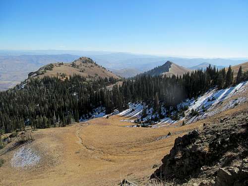
Up high the road yield good views of foliage and terrain south towards Bountiful Peak, then approached the moonscape of Francis Peak with its summit structures.
I parked below Francis, walked to the summit, then headed down a short and steep trail to rejoin the crest trail/dirt road, following it north.
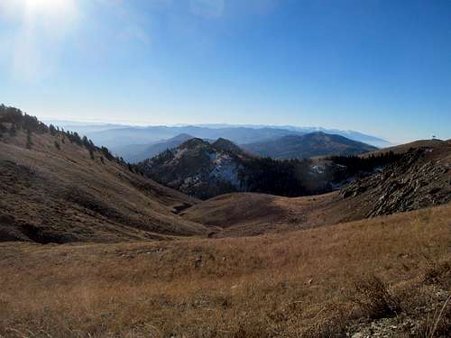
The route is quite scenic traversing the ridge of the Wasatch, with expansive views in all directions except towards the higher peaks up ahead.
I skipped the sub-summit on the way up and huffed up a few hundred feet of steep cross country to gain the summit.
It was evident during this trip that bridge season had come. The southern slopes still looked like summer, but it was evident that any of the high north facing slopes had already seen their fair share of winter.
I left the trail a few hundred feet on the way back to peak 9,491, a ranked summit, then headed back to Francis.
Along the way it was refreshing to see hikers, trail runners, and the like, a contrast from a summer and fall spent mostly doing more obscure peaks. It became more and more crowded as I approached my parking spot, and the hordes of high school kids now wandering the road aimlessly made me regret my sentiments slightly towards urban hiking.
I made it down and despite the hiccup of a brutal Sox loss that night, enjoyed the spectacle of another championship days later.
Telegraph Hill - November 9th, 2013
I was damned homesick. But not for long, as I would be able to spend a month plus working remotely from Boston for the holidays. As such I wanted one last push for peaks knowing that it would be mylast chance of the year, and to fit it in the weekend before a trip to Tampa/Tallahassee for some fun and an FSU game I got a three day weekend in Ely; with the Pats on a bye, this was a rare weekend with a fully open Sunday.
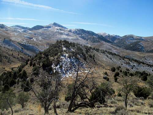
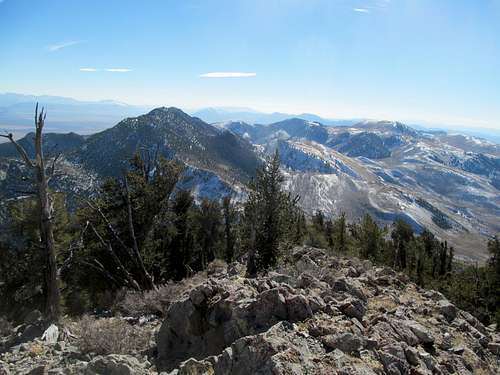
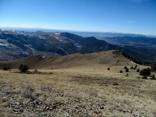
Day one was the familiar drive down, smiling contently at Goshute for the first time knowing that I could now file it into the “climbed” category. My goal for the day was Telegraph Hill, a P2K over 10,000 near the junction of the Cherry Creek and Egan ranges, an easy peak that once more hopefully facilitated some college football watching later in the day. As usual, a trip into Nevada meant following Dean’s directions into the backcountry. First was a drive into the semi-ghost town of Cherry Creek which I had visited before en-route to Cherry Creek Highpoint. This time, I followed a good road past it and through a narrow, scenic canyon into the remote backside of the range, then past the corral to the pass described in Dean’s beta. From here I started directly northeast up the bare yellow slopes (damn them), a steady upward progress until around 9,000 feet, where views of cool looking cleft drainage leading up to the summit area opened up.
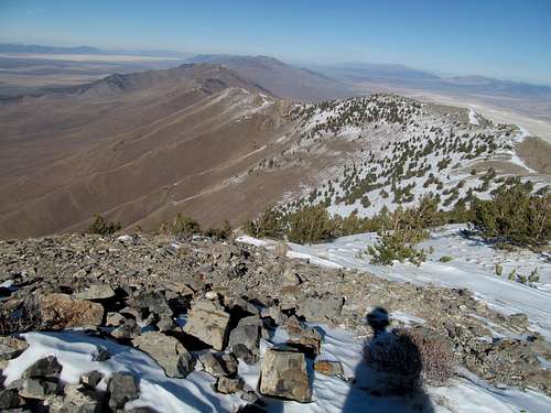
It was a fun ridge walk up to the saddle around 9,700 ft at the head of the drainage, where I glimpsed the first views north at the Cherry Creek Range while the sun kissed the snow glazed golden hills to the south, then it was a trudge east up the deceivingly steep summit block.
The summit area was actually a narrow and wooded north south running ridge with a few rocky outcrops and plenty of deep snow off the high ridge, so I made sure to hit each high area to ensure that I reached the true highpoint.
An easy descent took me back to the car and into the familiar town of Ely, where as usual I watched a little football and got a little drunk.
Diamond and Dust - November 10th, 2013
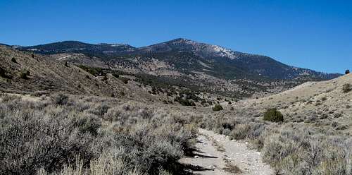
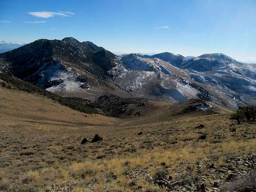
Diamond Peak was my plan for the Pats’ bye on Sunday. It’s a strikingly grand peak when viewed from the east, rising steeply up from the Newark Valley to its summit at over 10,000 feet. The range itself is classic as well, a thin steep break in the basin and range topography running north from Eureka. As a hike though, I found the peak and the range to be surprisingly dull, though the summit was still worthwhile.
Maybe my late start and slight hangover dulled my own perceptions of the peak. Add in a day where the winter sun barely seemed to grasp on to the edge of an oddly dull clear sky, and the barren loneliness of the general area, I can only describe this day as bleakly scenic.
At least the road leading to Newark Summit was spectacular, fit for my old Camry (rest in peace babe). I drove the 4Runner north on the 4WD road maybe another half a mile before the track got too rough, then packed up and started the road walk.
The first few miles offered up a variety of ways to proceed. I was impatient to gain the ridge, so I left the road and started up cross country. In retrospect, I recommend following the road, since you have to drop back to it anyway, losing the elevation you gained.
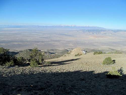
At the end of the road you hit the ridge crest once more and see Diamond looming before you, a strange and foreign monolith dominating a barren landscape. The rest of the route was a traverse, over or around some bumps, with some rocky areas, a few brushy ones…your basic desert shit. There was some snow of varying depth along the north facing slopes, but the slightly balmy November weather made up for it.
The homestretch featured a slightly discouraging descent before a long and steep trudge of over a thousand feet, only to hit a false summit. The wind picked up and brushed away what little I had left of summer as I walked a few football field lengths over to the true summit.
There was not much to consider for the downclimb, but I had to assess my options for Monday. I had originally considered Currant or Troy, a rather grandiose fantasy for this time of year. Seeing what looked to be heavy snow cover further south, I decided that the time had finally come for Notch Peak, which I could hit on my way back to Salt Lake.
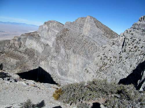
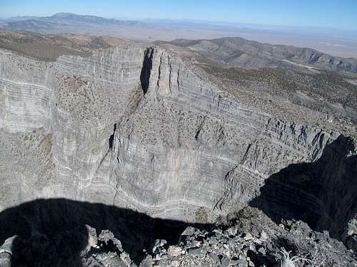
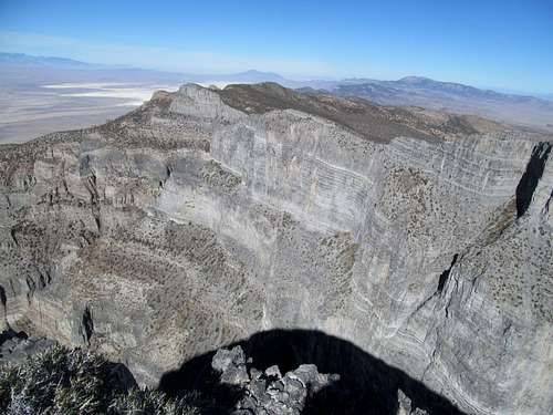
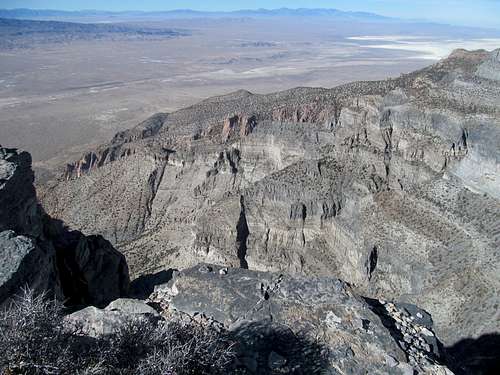
Notch in the Belt - November 11th, 2013
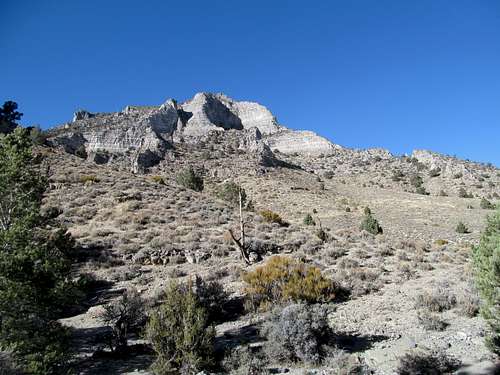
Simply put, Notch is everything they say it is and more. I caught up on sleep Sunday night and didn’t arrive at the trailhead until maybe 10-ish. Along the way I stopped at the gas station on the state line between near Baker and enjoyed what could be the best rice krispy treat I’ve ever had (seriously, ask for one if you’re ever there), and reminisced about staying at this very motel way back in 2008, where in between climbs of North Schell and Wheeler I watched the first presidential debate between McCain and Obama. Not much had changed since then; the gas station still offered VCR movies for rent if you stayed in the motel rooms attached to the property.
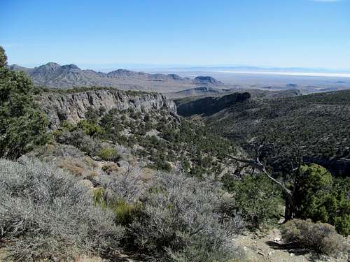
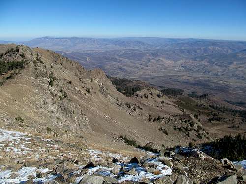
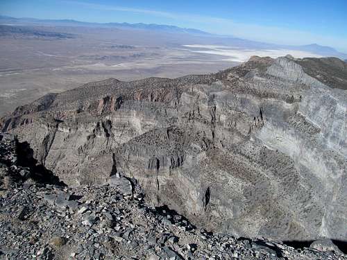
I had always been intimidated somewhat by the idea of Notch Peak. Knowing that theoretically the route was a very easy scramble at most, I wondered about routefinding through the complex patchwork of canyons and drainages in what appeared to be, especially viewed from the highway coming from Nevada, a very complex part of the House Range.
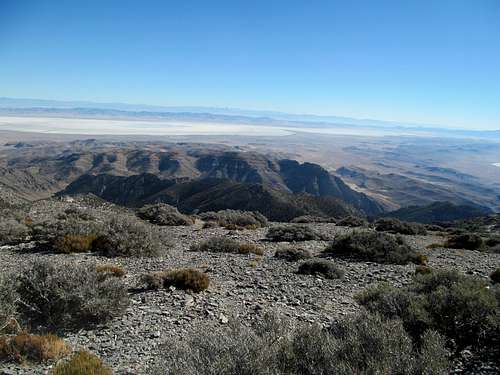
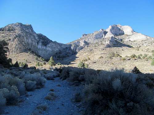
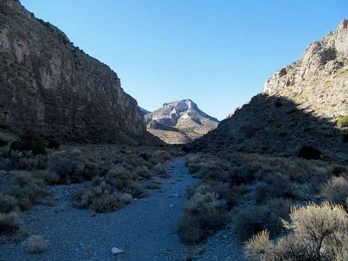
In actuality the route was delightful and easy in every shape and manner. On what would be a warmer November day Sawtooth canyon was nice and shaded for most of the parts that mattered. The gain was gradual, and the only routefinding challenges involved the occasional light brush and the need to decide which half of the narrow drainage offered quicker progress.
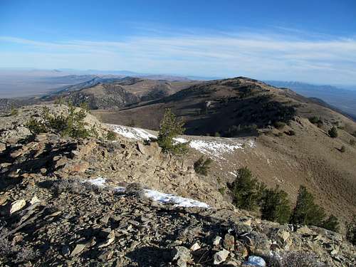
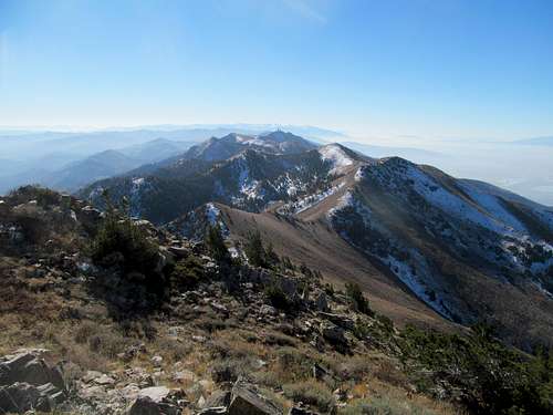
The scenery was spectacular at the get-go, from Zion like walls visible from the trailhead to golden cliffs and warped rock slabs and every angle of pine and deadfall through the shadier parts of the canyon. There were a couple of scrambling sections that were easy and fun, and the way the route opens up as you leave the canyon and emerge into the broad inverted slopes of Notch and its neighbors are hard to describe in words.
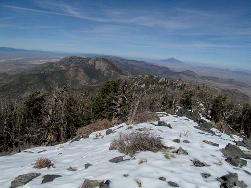
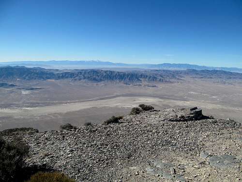
All along the way there were traces of a decent climber’s trail, which especially was obvious between the canyon and the saddle, where for the first time you saw firsthand the awe and fear inducing cliffs coming down the other side of the range. The last climb to the summit was a quick class 2 jaunt with light scree and dirt; nevertheless I chose to stay a little more to the left to avoid the vertigo along the ridge crest.
Everything about this peak was perfect, from the route, to the views, to the summit. As I sat (carefully) on top enjoying the expansive vistas I wondered if I would ever climb another peak. I had a trip back east the next weekend, and soon afterwards I would be home for a month, but part of me yearned to be back east for more than just the holidays. I stood atop the summit basking in satisfaction and wondering if memories of this and everything I did in the past year would be enough to keep me satisfied for a longer duration.
I caught up on podcasts on the way down listening to Barstool’s guys savage the Jonathan Martin bullying fiasco and talking about Halloween weekend, and reminded me of all the fun back home I used to have when that holiday arose.
I descended through the canyon amid cliffs radiating in the approaching evening, enjoying the present but focused on memories of the past and future.
Still satisfied with the weekend of climbed, I wrecked the front of my car as well as an unfortunate deer while driving down the last hill leading towards the town of Nephi. It was a temporary setback to an otherwise golden weekend and autumn.
Comments
No comments posted yet.