
|
|
Route |
|---|---|
|
|
34.65301°N / 114.4384°W |
|
|
Download GPX » View Route on Map |
|
|
Hiking |
|
|
Winter |
|
|
Most of a day |
|
|
Hike |
|
|
Overview
Topock Gorge is a rugged canyon on Colorado River at the north end of Lake Havasu. USGS Maps show an area of sand dunes on the eastern side of the gorge rising 200 ft above the river sitting among jagged peaks. A Google search, had not revealed any hiking information. I had only seen a mention of the sand dunes by boaters and kayakers who had gone through the gorge. By looking at satellite photos/Google Earth, I was able to come up with a path that took me from Route 95 to the sand dunes. When I finally reached the dunes, the scenery turned out to be even more dramatic than I had imagined.I had originally planned to start my hike at a dirt road a short distance to the north of what the map below shows. That road turned out to be gated with private property signs on it forcing me to start further south. The first 3.1 miles on the new path was in common with the last 3.1 miles of
Dead Burro Canyon loop hike. I was able to merge the two hikes into a single 17 mile hike.
Getting There
From Lake Havasu City, drive north on Route 95 past the airport and go just to the north of a hill that has communication towers on top of it on the west side of the road. At mile marker 192, you will see a dirt road on the west side of the road. Turn onto the road and park at the parking area at the beginning of the road. Four wheel drive can go a mile or so more.Route Description
Roundtrip Hiking Distance: 15.4 milesTotal Climb: 1150 ft.
Important Note: This is a description of the path that I took. It is a hike but requires route finding skills in a wilderness. If you chose to do this hike, you must be able to find your own way.
The first 3.1 miles of this hike is in the same as the last 3.1 miles of Dead Burro Canyon loop hike. For pictures of this section see the link above.
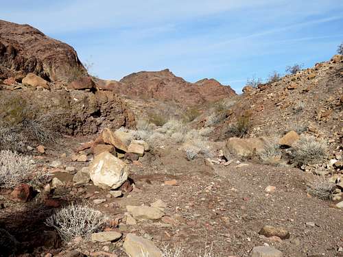
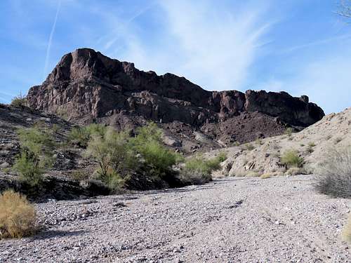
From the parking area, head west and follow the dirt road past the hill with communications towers on top of it until the road drops into a dry wash. After 0.8 miles, you must leave this dirt road and turn north onto another dirt road that takes you on top of an embankment on the east side of another dry wash. Continue until the road drops steeply into the dry wash. Pay attention and note that the wash splits into two branches at that spot. Take the one on the left and continue up at the bottom of the small canyon past a cable marking your entrance into Lake Havasu Wilderness. The wash seems to branch at least two more times. Pay attention to your map and take the left branch both times.
 In the wash south of the 1180 ft saddle
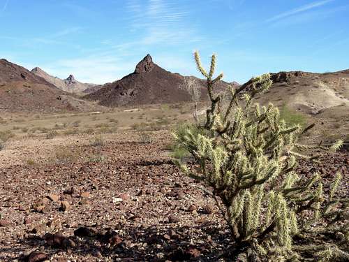
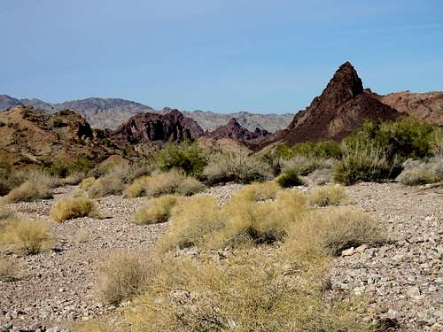
As you go north, the wash opens up and reaches a broad 1180 ft high saddle where there are patches of beige colored dirt. The jagged Tumarion Peak comes to view.
 Tumarion Peak Tumarion Peak |
 looking east looking east |
 Looking north Looking north |
 Crossman Peak, looking south Crossman Peak, looking south |
Wild burros roam around this area. Here is a zoomed photo of one that I saw at the saddle.
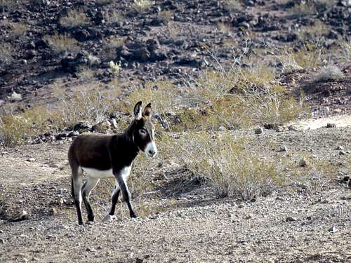 Wild Burro, zoomed view
Head northwest and go down into another dry wash as it forms, going toward Tumarion Peak.
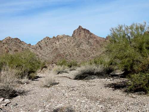 Tumarion Peak Tumarion Peak |
 Palo Verde Trees in the wash Palo Verde Trees in the wash |
More wild burros. Zoomed view.
 Wild Burros
The wash makes a 180 degree turn heading south and then anther turn to head back northwest.

An arch on the left side of the canyon.
 Arch
ArchBrown colored jagged peaks appear in the distance.
Another view of Tumarion and other surrounding mountains.
 |
 Tumarion Peak Tumarion Peak |
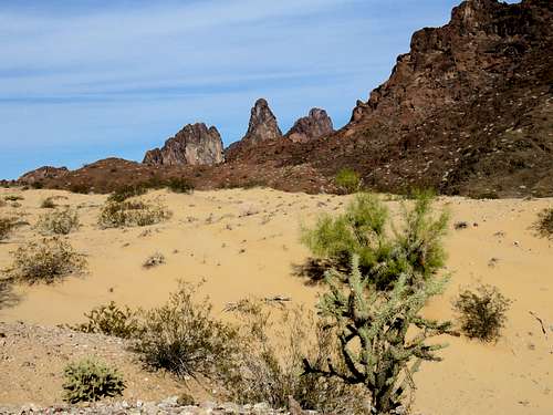
Peak 1144 ft. Lake Havasu sits behind this peak.
 Peak 1144 ft
As you reach the base of Peak 1144 ft, sand dunes appear on the right. Leave the wash and hike up to the top of the sand dunes.
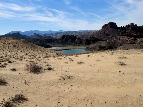
 The Needles and from the sand dunes
Views from the sand dunes.
 Looking NW Looking NW |
 Looking west Looking west |
 Looking east, peak 1224 ft Looking east, peak 1224 ft |
 The Needles, looking north The Needles, looking north |
Lake Havasu from the sand dunes.
 |
 |

Separation between the sand dunes and Peak 1144 ft.
