The Morning Weather
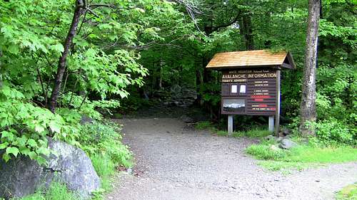
![Tuckerman Trail Start]() Tuckerman Ravine Trailhead - avalanche danger low
Tuckerman Ravine Trailhead - avalanche danger lowIn June of 2012 my wife (Nikki), in-laws (Joe and Diane), and I took a 10 day trip to New England. After touring sites in New Hampshire, Rhode Island (including Jerimoth Hill!), and spending a few days in Boston, it was time to head north for the White Mountains. We drove up I-93 in what had become customary for our trip - beautiful weather.
We had been touring pretty hard to this point, so we took the afternoon off and lounged around North Conway. It was bike week in the White Mountains so motorcycles were everywhere. We took advantage of a delicious BBQ joint along Route 16...just as the rain began.
It rained off and on all night, and showed no sign of letting up in the morning. I had intended on getting an early start on the trail, but hiking in rain was something I hoped to avoid. The hourly forecast showed it should quit around 11 o'clock, but that put our hike much later in the day than I had hoped.
We decided to trust the weatherman and go for a compromise - we'd hike starting at 11:30, and Joe and Di would drive the auto road and meet us at the top. Diane had just had a knee replacement a month before and wasn't going to be able to hike the trail anyway. With only a four mile, one-way hike ahead of us, leaving at mid-day was much more doable. For the morning, despite the rain and fog, we decided to drive the loop around the mountain and see what sights there were to see.
We headed up US-302 through Crawford Notch, and while what we could see was beautiful, much of the landscape was obscured by fog and, occasionally, rain. We got gas in Carroll, then headed east on Route 115 and US-2. In Gorham we met up with Route 16 again and headed south towards Pinkham Notch.
By the time we got to the Notch it was nearly 12 and I was anxious to get going. The skies still threatened, so we took our nylon (i.e. rain-shedding) jackets and garbage bags to keep things dry. It was also quite cold, so we put on much of our cold-weather gear. After a brief chat with the folks at the visitor center and a look at the topo map, we headed to the trailhead.
Hike Up...and Down?
![Tuckerman Brook 1]() Ellis River
Ellis River![Crystal Cascade]() Crystal Cascade
Crystal CascadeNikki was very apprehensive about the hike. I had done
Mount Marcy the previous September, but she had never done a hike with such significant elevation gain. However, she was in good shape and wanted to at least give it her best shot. Throughout the hike we took several breaks and moved at a relatively slow pace (about 1 mile per hour), which would end up coming into play unexpectedly later in the day.
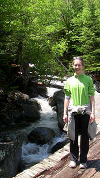
Almost immediately we began following the Ellis River, which made for some interesting scenery and background noise. Also almost immediately we realised we wouldn't be needing our cold-weather gear for a little while, as the exertion of the "slow but relentless climb" was beginning to warm us. After crossing the Ellis, the trail goes through several switchbacks, and at one point brings you to a wonderful view of Crystal Cascade. Shortly after Crystal Cascade the sky suddenly cleared, the sun shone, and the temperature rose. We were pleasantly surprised with this turn of events.
Continuing skyward, the trail parallels the Cutler River, a tributary of the Ellis, and which itself begins in the Huntington and Tuckerman Ravines. This section is fairly straight, which means you can look up-trail above the trees and get some views of Huntington Ravine and Lion's Head (I mistook the latter for Washington's Summit...the actual summit is over 1200' higher!). The exciting thing to me when seeing these views was to consider that "we're going to be hiking at least that high today." The same realisation hit Nikki, but didn't bring the same level of excitement. But she was a trooper and pressed on. The trail crosses the Cutler on a stoutly built bridge, where we stepped down to water level to check the temperature. The finger thermometer read about 37 degrees - it was cold!
![Cutler River]() Nikki recrossing the Ellis
Nikki recrossing the Ellis![Tuckerman Trail Steepens]() Entering the Alpine Zone
Entering the Alpine Zone
It was near the split for the Lion's Head Trail that Nikki got enough reception to check her phone for updates from her parents. We figured they'd have called to leave a message once they drove up to the summit. The message we had, however, was nothing like what we expected. Her mom had left a message saying that the morning rain had dampened the auto road such that no personal vehicles were permitted beyond the 4 mile (half-way) mark. Above that point, part of the road is unpaved, and those in charge of the road didn't want drivers tearing up the gravel. Only the official vans were traveling all the way to summit. We would have to hike down the road to meet them once we got to the summit.
This was not great news, as it added 4 miles to our hike, and meant Nikki's parents wouldn't be able to make the summit. Furthermore, although we had just enough reception to listen to the message, we could not make a connection to call her parents back and let them know we had gotten their message and would be hiking down the road as they had said. We decided the best thing was to continue on as quickly as we were able so that we would have plenty of time to deal with the change of plans.
After several stops for water and nourishment, we finally made it to the Ranger station at 3800'. Here you could see Hermit Lake and a great view of the Ravine itself. At this point we'd traveled 2.4 miles and gained 1600'. However, this was only 40% of our total elevation gain for the hike, but 60% of our total hiking distance. Basically this meant that from here on out, the trail would get much steeper. Much much steeper.
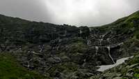
![Tuckerman Ravine]() Tuckerman Ravine
Tuckerman Ravine![Ravine Waterfalls Distant]() Waterfalls at the end of the ravine
Waterfalls at the end of the ravine
We headed into the ravine and were immediately greeted by a distant view of some cataracts pouring down the steep cliffs at the far end of the ravine. At this point the trees began to thin, and we passed a sign informing us that we were passing into the Alpine Zone. Although even the summit elevation of 6,288 is not high enough to cause altitude sickness, entering the alpine zone did signify the end of most of the shade cover for us as hikers. The sun was beating down pretty hot at this point, and Nikki wanted to put more sun-block. The tube, however, was already pressurised from the altitude, and when she took the cap off much more tried to come out than she wanted. She quickly wiped it clean and replaced the cap.
The trail also began to get significantly steeper at this point, and although most of the trail had been rocky, the rocks making up our footing were growing in size. Still, here, before the waterfalls, the trail was still walkable without too much thought to foot placement or exposure. Just above the tree line, I turned around and snapped a photo of the Wildcats to the east. You can see the ski trails on the right.
![Tuckerman Trail East view]() Wildcat Range
Wildcat Range![Clouds over ravine]() Clouds pour into the ravine
Clouds pour into the ravine![Ravine snow]() The trail steepens
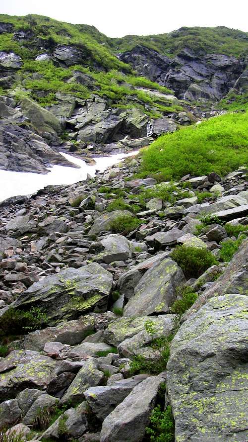
The trail steepensContinuing toward the bottom of the waterfalls, we began to speculate about how we were going to get out of the ravine. Since there were no longer trees to paint with trail markers, marks were now painted directly on the boulders we were climbing. You could always see the next marker or two from your current position, but I couldn't hazard a guess on where they might lead. It was fun thinking about how we had no idea how we were going to get out of the very large and steep "bowl" that made the ravine, but that we would, somehow be led out by these little yellow stripes.
Eventually we came right up to the waterfalls we had been pursuing since entering the ravine. In the shadowy areas near the bottom, there was still a snowpack sufficient to allow the water to pass under it. You can see the line of water heading under the snowbank in the picture. Also, at the time of the photo, very menacing looking clouds suddenly poured into the ravine from the west. You could actually see the condensation rolling and dropping as it came over the pass at the top of the ravine. We were concerned for a moment until the clouds passed over and exposed the bright sun again. This was to become the pattern for the rest of our hike - mostly clear, bright sun interspersed with short periods of clouds rolling overhead.
Just shy of the waterfalls the trail went to the right and began to become steep in earnest. I tried to capture the steepness in the photos, but it doesn't really show how steep the trail was. My marathon training began to show at this point, and I was continually hiking up the boulders for a minute or two before stopping to allow Nikki to catch up. The bugs at this point were merciless, and we continued as quickly as we could up the ravine. The trail headed to the right of the waterfalls before coming back on top of them. There were plenty of seemingly minor water crossings, but a slip on a wet rock could really send you tumbling, so we were very cautious and planned each foot movement before taking it.
Finally we achieved the top of the ravine, and since the westerly breeze was keeping the bugs off, we stopped to rest at the junction with the AT. There were an amazing amount of cairns heading towards Lake of the Clouds, and Nikki and I wondered at how many hands had carried rocks up so far to create them. I doubt I'll ever get a chance to do a long-term hike of the AT, even in sections, but I will never cease to be amazed at the work that goes into its upkeep.
Very near the junction was the spring that fed the western branch of the Cutler River. I'd never followed a creek all the way to its source before, and it was fascinating to see the water just bubbling out of the ground, at 5500 feet. This was real mountain spring water, and it was even colder (if that was possible) than the rushing water further down the mountainside.
From the spring we had only the summit cone to climb, but this turned out to be the most difficult part of the entire hike. Nikki was really tiring at this point, and although I don't think altitude was a factor at only 6000 feet, the "trail" up the cone was merely a class 2-3 walk/scramble/heft up boulder after boulder, cairn to cairn, seemingly unending. The shape of the cone from this perspective keeps the actual summit and structures out of sight for much of the upward hike, and as you hike from one cairn to the next you get the feeling that you aren't any closer to the top now than you were five minutes ago. Even here we could hear the trickle of water underneath the boulders, hinting that the Cutler's source may begin at even higher elevations than the Tuckerman/AT junction. The continual climb and demoralizing conditions kept me from remembering to take any pictures from this part of the climb. We were focused only on attaining the summit.
![Mount Washington Summit]() Summit
Summit![Mount Washington Summit Marker]() Proof ;)
Proof ;)![Mount Washington Summit Nik & I]() Self-photo
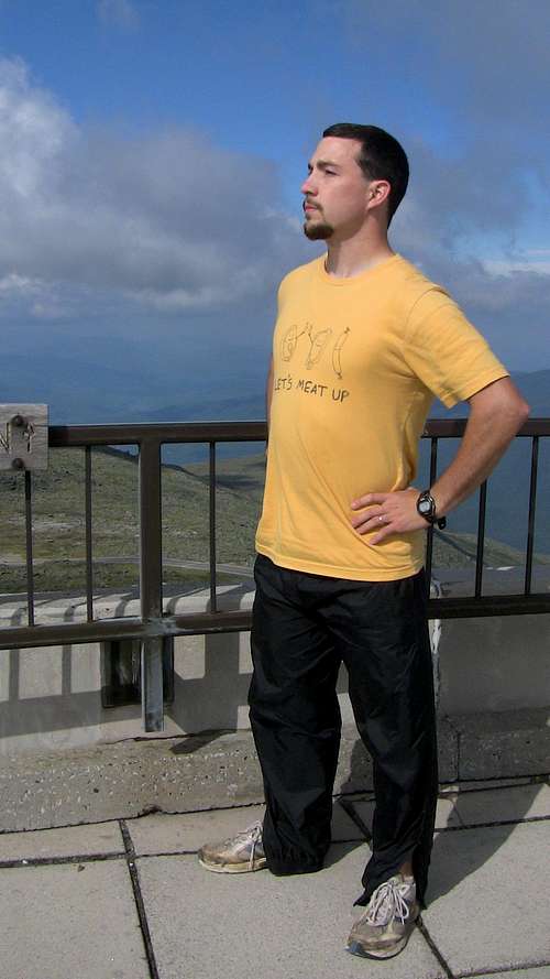
Self-photo![Mount Washington summit pose]() Me and my awesome summit pose
Me and my awesome summit pose
Finally, we could see a tall something, orange, above the boulders overhead. We continued climbing and more of the structure came into view. Keep climbing. Now we could see the roof of a hut. Keep climbing. More structures. Keep climbing. Keep climbing. Suddenly - there was the road. The boulders finally ended and we were crossing a road at over 6000 feet. On the far side was a stairway of about 60 steps. Nikki was very tired by this point. We took the steps a landing at a time, pausing when necessary. Finally, we emerged at the top of the steps...and we were at the top.
Not the true top, mind you. The little pile of rocks that makes up the true summit was still on the other side of the cog railway tracks. But most of the summit area is flat to accommodate cars, and we were very definitely at the top. Searching for a tissue, we went inside the gift shop.
We had barely gotten inside when the man at the counter asked us if we had been planning on meeting a vehicle here on the summit. We said yes, but that we had received a call and were now planning on hiking down the auto road to meet them. He reminded us that the auto road closed at 6:45, and that we'd have to be down by then or ride the last shuttle (for something like $90 a head!). I said that we saw no issue in meeting that deadline, since it was currently only 4:15. As we poked around the shop, he made a phone call. I wasn't listening at first until I heard his say "Yeah, the two hikers just got up here. I told them they have to be down by 6:45, but they think they can make it..." I was a little perturbed. We'd just hiked 4.1 miles and 4,100 vertical feet in about 4 hours. Surely we could hike 4 miles downhill (and on a road) in under 2 hours. We left the gift shop shortly after to take our pictures and start heading down since everyone at the summit seemed interested in us getting off the mountain.
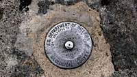
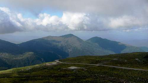
We quickly found the true summit pile and headed up to the sign. Without photographers or a tripod we had to settle for a super close-up hand-held self-shot. I took a photo of the summit marker as well, confirming that we really were at 6288.76 feet. After getting our shots at the summit we walked over to the observation deck and took some pictures of the Presidentials. The beauty was phenomenal. We were at eye level with many of the clouds, and the views of the peaks below them were awesome. For me, mountain climbing is an adrenaline rush - you pursue you summit, you give it your best effort, and if everything cooperates, you are rewarded with picturesque beauty and a sense of accomplishment. This was only my second "real" mountain climb after Marcy, but I was already hooked.
![Summit view North]() Looking north
Looking north![Summit view West clouds]() Looking west
Looking west
The activity around us, however, had us feeling rushed. The few official-looking people were packing up vans and locking doors. We felt like we ought to start heading down, even though it was only 4:30 and we'd barely been on the summit. I packed up my camera and we started hiking down the road.
The road, although easy to hike, was not very easy on the knees. It was so steep that you felt compelled to go faster than you really wanted to. We quickly adopted a "semi-squat" technique that saved our knees and helped us to apply the brakes in our descent. The views from the road were good, especially as all of this part was above the tree-line. We also saw some things you don't see on hiking trails - signs requiring cars to pull off and stop to cool their brakes, and kegs of water listed "for radiators only." We were about 2 miles down the road when the gift-shop attendant passed us in the van. Seeing our progress over about 40 minutes, he expressed his new-found optimism that we would easily make it down the mountain in the allotted time. I nodded agreement, feeling like we had finally gained some respect.
It took a little over an hour to hike the 4 downhill miles to Joe and Diane. They were waiting at a small parking lot with another ranger who was "guarding" the road to keep people from driving the upper 4 miles. He, too, expressed surprise at our pace down the mountain; it turns out it was this man that gift-shop-guy called when we first reached the summit.
Continuing down the mountain in our rented Suburban, we discussed the days events with Nikki's parents. Apparently, when they discovered they couldn't drive to the summit, they tried calling us and left the message we got at the Lion's Head split. However, never knowing if we got the message, they tried to contact park officials to get us the information once we reached the summit. What followed was a small fiasco between the AT officials, the state park officials, and Nikki's parents. As the officials saw it, we were two out-of-towners trying a fairly difficult trail for the first time. We had left much later in the day than most people do, and would probably be so tired once we got to the summit (if, indeed, we ever got to the summit), that there would be no chance of us hiking down the auto-road to meet Nikki's parents. They reminded Joe several times that the cost for riding the van down after 4pm was $90 per person, and that the cost of sending rescuers down the Tuckerman Ravine trail was far higher.
I can see some sense in their assumptions of our ability and perceived poor planning, but I wish they had been a little more accommodating of doing simply what Joe and Di were asking: when a male and female hiker come up the Tuckerman Ravine trail around 4pm, please tell them to hike down the road to meet us. That was all that was asked. It didn't need to become a huge issue. But, it all worked out in the end.
Mount Washington was my first Ultra-Prominent Peak and sixth state highpoint. I would like to return someday to try the Lion's Head trail or Huntington Ravine trail. But next time, we will leave earlier in the day, and hopefully will not need to contact the park service!
Comments
No comments posted yet.