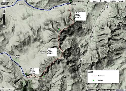
Trip Details
South-to-North Presidential Traverse
Route: Crawford Notch to Appalachia
Total Distance: ~24 Miles
Elevation Gain: ~10,000 ft
Time to Complete: 2.5 days, 2 nights
Saturday Night Camp: Mizpah Hut
Sunday Night Camp: The Perch
![Presidential Traverse Route]() Presidential Traverse Planned Route
Presidential Traverse Planned RouteSaturday, 8/30/08: "Sure, I'll go"
Never having been to the White Mountains but hearing great things about them, I didn't hesitate to say 'sure' when my friend asked me Friday afternoon to go on some presidential traverse somewhere up there. Of course, in my mind I was picturing myself maybe hiking up a couple mountains, camping, enjoying the view, relaxing, etc.. It turned out to be absolutely nothing like what I'd imagined, which made it even more amazing. Here's what we had planned:
On Friday night, we made the trip to ems to pick up dehydrated food and other supplies. Our packs, fully loaded, ended up being ~40 lbs (and in retrospect, I should have left out
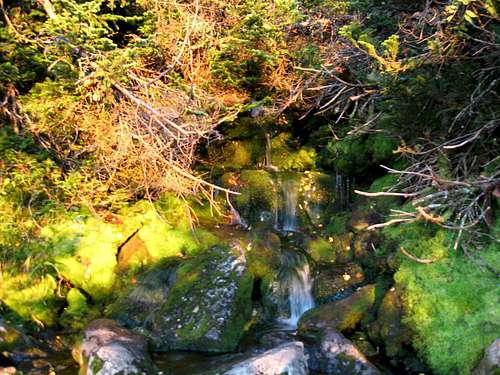
everything except the bare essentials). We left from northern CT at around 930 am on Saturday, and it took about 4 hours or so to make the drive. We took two cars- one we left up north at the Appalacia parking lot, and we drove a half hour south to park at the Crawford Notch lot, right at that hotel. The plan was to hike up to the Mizpah camp site to crash for the night. The trail up the Crawford notch was a great warm-up for the tough days to come. The forest was beautiful- rich, green moss carpeted the forest floor, while flowers and streams finished painting us an incredible backdrop. It took us about 3.5 hours to make it to Mizpah.
![Ascending Crawford Notch]() Waterfall up in Crawford Notch
Waterfall up in Crawford Notch
We got to Mizpah just in time to get the last spots on a tent platform. It was around 6 pm and it was about 50 F with a slight breeze, and the fog seemed to congeal around us as the night went on. We set up camp, ate dinner and then couldn't resist making the .7 mile hike to the summit of Mount Pierce around 9 pm. We descended and then went to bed soon after to rest up for the long day ahead.
![Mizpah Hut]() Mizpah Hut
Mizpah Hut![Dense Fog on Mount Pierce]() Dense fog looking up at Mount Pierce
Dense fog looking up at Mount PierceSunday, 8/31/08:"Are you F*&$%#@ kidding me?"
We woke up at 4 am Sunday morning to try and make it to Eisenhower for sunrise. However, it was as foggy as ever when we started to break down our camp, so we took our time making breakfast. We made it to Mount Pierce for sunrise, but all we saw was the sky turn from a dark gray to a light gray. The walk to Eisenhower was sweet- there were sustained winds (I'd say at least 40 mph, if not 50), dense fog, and beautiful tundra flora everywhere. To get a sense of the conditions encountered, check out this
video clip we took.
![Dense Fog ascending Mount Eisenhower]() Ominous day ascending Mount Eisenhower
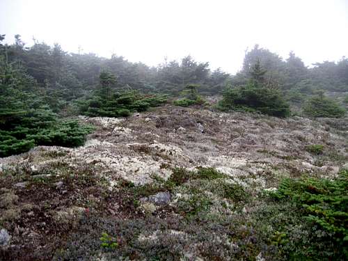
Ominous day ascending Mount Eisenhower![Nice Flora near Mount Eisenhower]() Typical flora seen just below treeline
Typical flora seen just below treeline
Once we got to the summit of Eisenhower, winds were very strong, and visibility only 20 feet or so. We then made our way to Monroe, and finally to the Lake in the Clouds hut for a break. The weather was the same the whole way: cold, damp, foggy, and windy.
![Lake In the Clouds, Mt Monroe in background]() Lake in the Clouds, Mount Monroe in background
Lake in the Clouds, Mount Monroe in background
After hearing that the weather was supposed to break by noon, we decided to head out to Mount Washington from the hut. The hike up Washington was one to remember- wind gusts well above 60 mph, wind chill of 20F, and not being able to see anything. Each step from rock to rock seemed like a leap of faith, and our packs acted as parachutes for the wind so we were constantly fighting it. We made the summit around noon, and it was still as foggy as ever. The real cool thing about this weather was seeing clouds forming and then being swept right up Washington's side. We went inside to make lunch (it was really weird seeing cars and people again), and by the time we came out the clouds broke and we could see all the progress we made. It was one of the high moments of my life: seeing mountains for as far as the eye could see from the top of the northeast.
![Tower at Summit of Mount Washington]() Tower enveloped in fog on Mount Washington
Tower enveloped in fog on Mount Washington![View of Southern Presidentials from Washington s Summit]() Our progress thus far
Our progress thus far
After Washington, we headed up Mount Clay, which didn't seem very significant until we descended from the summit and we saw how far down the saddle-point between Jefferson was. Pictures of the Great Gulf don't come close to capturing the sheer beauty and magnitude of this amazing cirque.
At this point, fatigue really started to set in, especially in the knees. This is why we decided to split up and go into two groups- those that have been up mountains before and want to tackle Jefferson, and my buddy Frank and I.
![Ascending Mount Clay]() Ascending Mount Clay
Ascending Mount Clay
So, as the others marched ahead towards Jefferson, we decided to go around the summit via the Gulf-side trail, but we didn't have a map and someone-who-should-not-be-named-but-will-probably-read-this mistook a sign and sent us down the Sphinx trail into the Great Gulf! After pretty much a half mile of fatigue-induced controlled falling down the trail, we found out from another hiker that we were going the complete wrong way! You should have seen the look exchanged between Frank and I- after hiking hard for 9 hours, exhausted, hungry, and now lost! I think we literally crawled back up the Sphinx to head back to the Gulf Side trail.
![View of Great Gulf from Sphinx Trail]() Great Gulf from the Sphinx Trail
Great Gulf from the Sphinx Trail
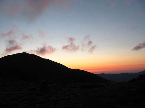
Once back on track, we started the much-longer-than-expected journey to the Perch, which is the highest tentsite and lean-to at 4300'. It took about 3 hours for us to make it there from Jefferson, and we probably looked like zombies as we stumbled into a lean-to and couldn't even move for a half hour. I don't think I've ever pushed myself harder to just get up and hike 300 yards or so for a view of sunset, but as you can see below, it was well worth it. Looking out to golden, sun-drenched valleys and mountains while drinking fresh spring water was a well-deserved reward for this long day.
![Spring at the Perch (4300 )]() Fresh spring at the Perch- perhaps the best water I've ever had
Fresh spring at the Perch- perhaps the best water I've ever had![Sunset at the Perch (4300 )]() Sunset from the Perch
Sunset from the Perch
It was a clear night, and it seemed as though we could see millions of stars in the sky. I don't think I've ever slept more soundly in my life.
Monday, 9/1/08: Doggin' It
Somehow we managed to wake up at 4 am once again, and we were going to try and summit Mount Adams by daybreak. We took much longer than expected to get ready, so we missed sunrise (we were behind Mount Adams when it rose).
![Silhouette of Mount Adams at Sunrise]() Sunrise behind Mount Adams
Sunrise behind Mount Adams
We were the first on the summit of Mount Adams (just before 7 am), and the weather was amazing- crisp, sunny, and breezy. I couldn't believe how far away Mount Washington was, and the views of Jefferson, Madison, and the Great Gulf were impossible to describe with words.
![Frank Doggin It]() Frank Doggin' It
Frank Doggin' It![Jefferson from the Summit of Mount Adams]() Looking out at Jefferson and the Great Gulf from Mount Adams' summit
Looking out at Jefferson and the Great Gulf from Mount Adams' summit
We didn't end up having time for Madison because we had to be back in CT for 5, so we hiked down to the Madison hut and took the Airline trail back down to the Appalachia parking lot. We arrived at Appalachia around 11:30 am, so we made pretty decent time.
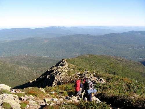
![Trekking Near Mount Madison]() Rob and Paul trekking past Star Lake with Mount Madison beyond
Rob and Paul trekking past Star Lake with Mount Madison beyond![Descending the Airline Trail]() Descending the Airline trail
Descending the Airline trail
As I said before, this trip was probably the most challenging thing, both mentally and physically, that I've ever done. Before this hike, I'd never hiked up a mountain, let alone gone overnight backpacking. I can't say I'd recommend this to another beginner like myself, but it got me hooked- I'm already trying to plan my next trip up there. There were many times where I'd look to see how far we had left to walk and having my knees tell me that unless there is a divine intervention, I'm going to collapse before I ever get there. But the thing was, somehow I'd always have one more step in me.


Comments
Post a Comment