
-
 12301 Hits
-
 76.66% Score
-
 7 Votes
|
|
Route |
|---|---|
|
|
32.21270°N / 111.0064°W |
|
|
Hiking |
|
|
Spring, Fall, Winter |
|
|
Less than two hours |
|
|
Easy Sunday stroll or jog |
|
|
Overview
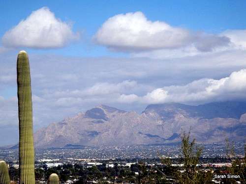 Santa Catalinas from north side of Tumamoc
This route is a fun and easy-going stroll to the top of a Tucson landmark. The route is asphalt to the summit plateau, and plenty steep in spots, making it a popular option for Tucson area runners and fitness walkers. The gonzo views of the Tucson metro area, including downtown, and the Sonoran Desert ambiance attract plenty of families and couples, too.
This route is not only the most popular way up the mountain, but the only legitimate way up the mountain, as well. So, embrace the fact that so many other folks are out getting some exercise, wear a smile, wish people good morning / good afternoon and appreciate that the University of Arizona has opted to continue sharing access to Tumamoc Hill with the residents of and visitors to Tucson.
Distance: 3 miles
Elevation Gain: 730 feet
Getting There
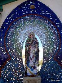 Shrine at base of route
The trailhead is on West Anklam Road, just east of Silverbell Road. For those unfamiliar with the area, this may be the simplest set of directions:
• From I-10, take Exit #285 toward Congress Street.
• Turn west on Congress Street.
• Slight right on North Silverbell Road.
• Slight left onto W Anklam Road.
Keep a sharp eye out for the rather inconspicuous “Tumamoc Hill Road,” across from a St. Mary’s Hospital parking garage. Look for a gated asphalt road. There likely will be other walkers’ vehicles parked on the road, tipping you off to the location of trailhead.
Special Notes & Restrictions
 Tucson Mountains from Tumamoc Hill
The University of Arizona has numerous signs posted reminding visitors this area is not a public park and certain restrictions apply. Dogs are strictly forbidden, as is any travel off of the main road. The area is closed to the public between the hours of 7:30 AM and 5:30 PM during the week weekdays to enable research to be conducted.
 Tumamoc Red Tape
Route Description
 Pusch Peak from Tumamoc Hill
 Tucson urban views
Depart the Aklam Road parking and weave around a traffic gate. Soon, you will pass this little shrine on the left. The first ½ mile of the route is almost need-strait, heading due-south, and gains little elevation. Soon the route begins to traverse across the northeastern spur of the hill, switchbacking sharply.
At about 1 mile, the hikers reaches a collection of stone buildings and an abandoned flagpole. It does not appear much is going on here. Curving around these buildings, you’ll encounter a gate (there is a portable toilet nearby).
From here, the steep-going picks up again until the summit plateau is reached. Here you will notice a couple of observatories as well as numerous communications towers. The pavement ends near the first summit plateau hump and it is here that visitors are encouraged to stop walking. The true summit lies on the southern-most hump of ground near the observatory at the end of the dirt road.
Essential Gear
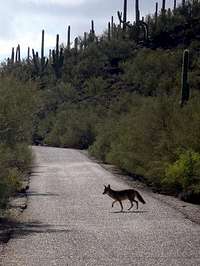 Injured Coyote
 Saguaro Covered Hillside
• Comfortable shoes (tennis, running shoes or sports sandals are fine)
• Plenty of sunscreen
• Ample water
• Camera