|
|
Route |
|---|---|
|
|
32.21270°N / 111.0063°W |
|
|
Hike |
|
|
Less than two hours |
|
|
Class 1 |
|
|
Approach

VIA SENTINAL RIDGE TRAILHEAD: From exit 258 on I-10 head west on Broadway away from downtown. Stay on road until the road until just before the road veers a sharp right. Make a left on South Cuesta Ave. The road then turns into South Sentinel Peak Road. Halfway up the ridge the parking will be on your right.
Route Description
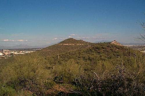
From the trailhead the Sentinal Ridge begins as a very gradual climb up Tumamoc Hill. At about 0.2 miles the trail go over a wash and then switchbacks to the right. Notice the beautiful desert vegetation on the way up the trail. The trail then switchbacks again and rise gradually to top of a col between Tumamoc Hill and A Mountain about 0.7 miles from the base. From there you will see small cairn marking a trail to Tumamoc Hill on the right.
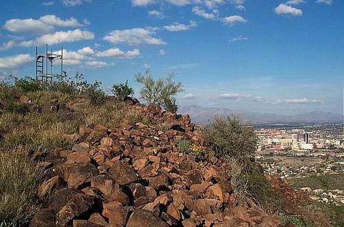
This unnamed trail is not marked and for the hundred feet resemble for of a footpath. The trail character changes quickly though and widens into an actual trail. It begins climbing steeper with a number of steep switchbacks. The trail continues it's pace for roughly the last 0.4 miles until reaching near the cupola at the summit area. The trail then become gradual and runs into the dirt road. From there the true summit is marked by the observatory on the left.