
|
|
Mountain/Rock |
|---|---|
|
|
47.05292°N / 10.53928°E |
|
|
Samnaun-Gruppe |
|
|
Hiking |
|
|
Summer |
|
|
9199 ft / 2804 m |
|
|
Overview
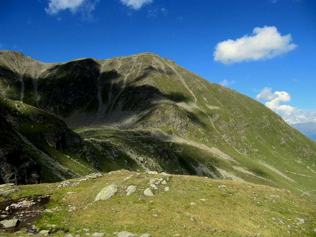
Planskopf (2804m) SW Face
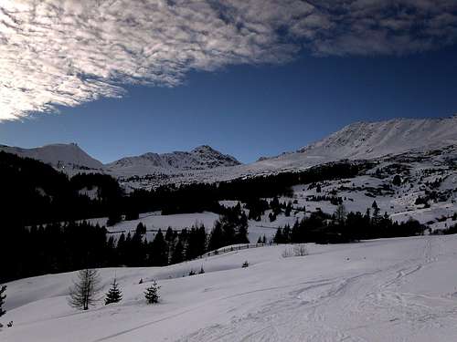
Planskopf is a very nice dome-shaped mountain above the village of Serfaus. Planskopf is part of the Samnaun-group and the inhabitants of Serfaus call it (together with it's higher neighbour Furgler ) their 'home mountain'. Planskopf consists of a long ridge which starts high above the village of fiss with Zwolferkopf and Oberer Sattelkopf. The ridge continues with Oberer- & Hinterer Sattelkopf (2670m) and Vorderer Brunnenkopf (2682m) and ends with the highest of them all: Planskopf.
The full ridge of mountains can be seen very well, especially from Serfaus (1427m). A famous hiking route in this part of the Samnaun group leads over the entire ridge of these mountains starting at Oberer Sattelkopf and ending at the highest peak of the ridge: Planskopf. This hiking trail is not too difficult and very popular: T3+. Planskopf can be climbed best during the summer months plus in spring and fall, when there is no snow present on the mountain. Planskopf is also occasionally climbed by ski in winter.
 Planskopf from Serfaus | 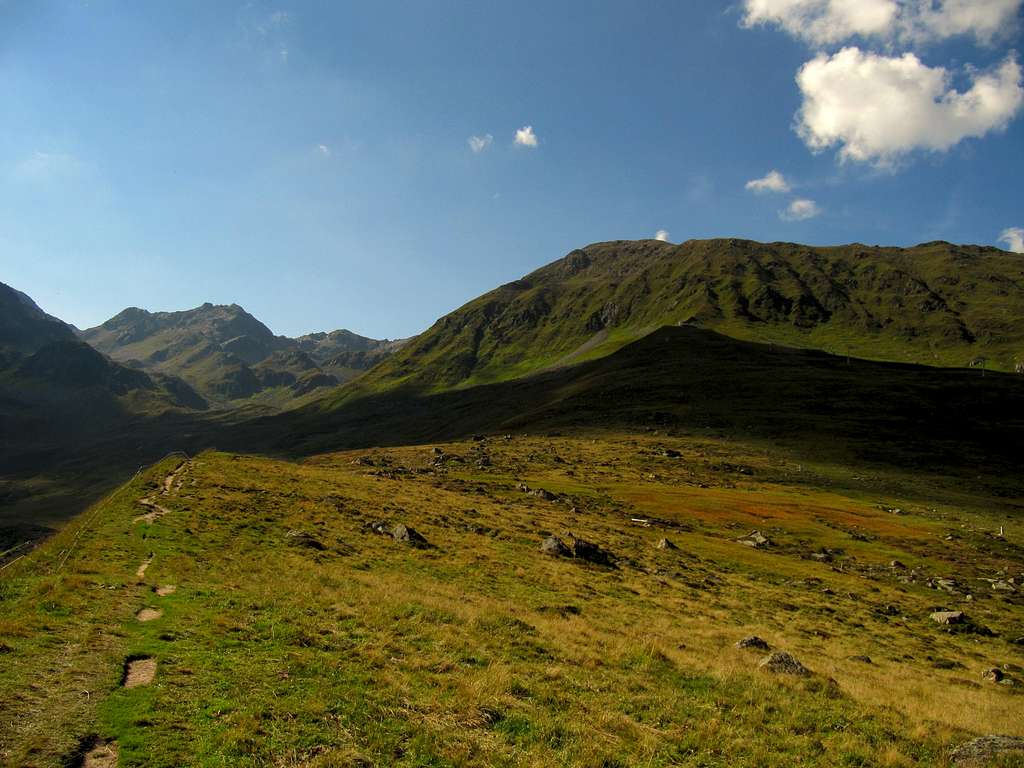 Kleiner Furgler & Planskopf from Komperdell |
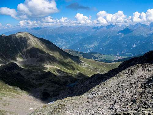
Planskopf is a mountain with spectacular views on the surrounding alps. Standing on the summit you can see in a Northwestern direction: Hoher Riffler and Valluga. To the south and south-east you can see the Otztaler Alps with beautiful views on Watze-Spitze, Wildspitze and a whole lot more beautiful 3000-meter peaks of the Glockturmkamm and Kaunergrat. Climbing Planskopf is therefore a nice hike and makes up for a beatutiful day-trip. Planskopf is mostly climbed from the side of Fiss and Serfaus, but ascents can be done from the Paznauntal as well. From See a trail goes up to the Kubelgrubescharte and continues further up to Planskopf. This route is substantially longer compared to the ascent routes from Fiss and Serfaus, mainly because of the presence of the cableway system.
Route description

Planskopf Route MAP
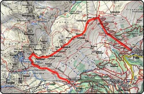
Planskopf-route
The nicest way to climb Planskopf is from Fiss:
In Fiss you'll take the cableway to Fisser Joch at an altitude of above 2400 meters. From there you hike up to Zwölferkopf, 2.596 m or pass underneath it along trail 23. There starts te beatutiful walk along the whole ridge of Planskopf with on your left the villages of Serfaus and Fiss.
On your right you can see the villages of See and Kappl. You pass in following order Oberer Sattelkopf, 2.596 m, Hinterer Sattelkopf, 2.670 m, Vorderer Brunnenkopf, 2.682 m and Hinterer Brunnenkopf, 2.642 m before starting your last climb to the Planskopf summit (2804 m) See the Route map at right. This route is marked by the red line.
From the summit you start your descent to Urgjoch 2.759 m and further down. At some point you cross 'Zentralalpenweg 02 '(Weitwanderweg 702) which you follow down to the Komperdell-cablewaystation at 2000m.
An option is to walk down to the village of Serfaus (1427m) or take the cableway down.
Using the cableways ( up from fiss and in the end down to Serfaus) the trip will take about 4,5 hours and is ideal for the average or good hiker.
TIP: It's of course also possible to take the route the other way, for example when you are staying in Fiss you can start in Serfaus just to end again in Fiss.
Camping + Hotel
Hotel
Staying in a hotel is the easiest option in Serfaus. Serfaus is a well know Wintersport resort and therefore has a lot of hotels where you can stay during the summer. For hotels in Serfaus: check: Hotels
Camping
A campground in the Serfaus-area is camping Prutz. This campsite is situated in the village of Prutz, about 20 minutes (by car) away from Serfaus. The campsite lays along the beautiful river Inn and from this campsite you have a good starting position for hikings in Serfaus and many other places (like the Kaunertal) check: Camping Prutz
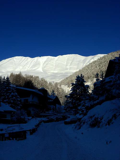
 Furgler & Planskopf | 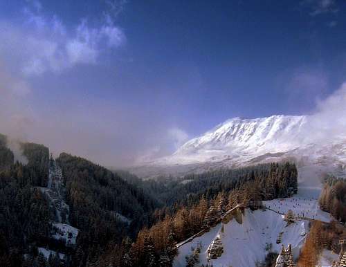 Planskopf from Serfaus | 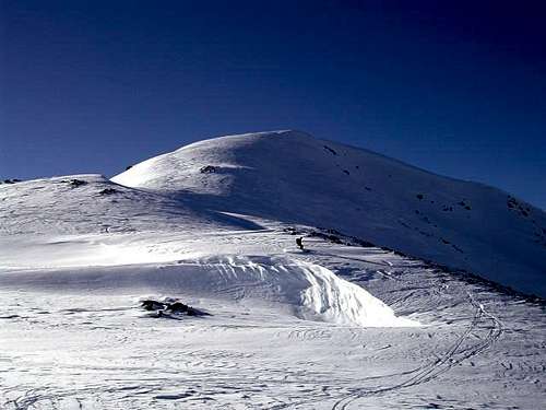 Planskopf N-Face |
How to get there

How to get There Map
When to climb
Planskopf summit with Serfaus
If you plan on climbing Planskopf, take good hiking shoes and if the wetter is not to good, also take a (rain)coat. On the ridge to the summit it can be windy and therefore a bit cold, even in summer.
Maps & Books
Kummerleyand Frey – Ischgl & Serfaus - 1:35.000 - ISBN 9783259007136
Kompass 42- Landeck Nauders Samnaun Group – 1:50.000 - ISBN 9783850265423
 |  |
External Links
Planskopf West Face & Serfaus
Bergfex Weather Fiss and Serfaus
Accomodation in Fiss and Serfaus
Koningsleithe Webcam with Planskopf
Weather
For the weather forecast for the Serfaus-area click HERE
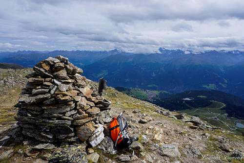
Summit Panorama
  Planskopf summit Panorama with Serfaus (1427m) and the Glockturmkamm and Kaunergrat |