Overview
The Southwest Ridge is a classic route up Mount Sneffels, although considered more technical compared to route going via Lavender Col, it is definitively worth it. Most people descend down via Lavender Col. So, you get to experience more of the mountain.
SP describes this route as "South Ridge", but Colorado scrambles book published by the Colorado Mountain Club calls it
The Southwest Ridge, and the route is facing south west.
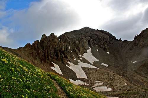
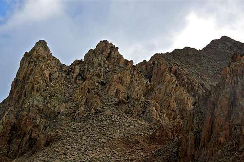
The spectacular pinnacles dominate the lower part of the ridge, but you bypass most of those. The difficulty of this ridge is Class 3, but large sections are Class 2 and exposed.
I created this page when some one else owned the route, later the route got deleted, and I created a new page for the route - therefore I have both route and album on this topic. Anyway, this is one of my favorite routes up Mt. Sneffels. Hike to Blue Lakes Pass
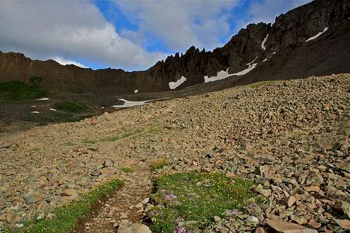
The initial section is very easy class 2 hike towards the Blue Lake Pass. The views from here are amazing, and the trail is easy to follow.
![Trail towards Blue Lake Pass]() Trail towards Blue Lake Pass Trail towards Blue Lake Pass | ![Near the Blue Lake Pass]() Nice trail towards the pass Nice trail towards the pass |
![Gilpin Peak]() Gilpin Peak as seen from the trail Gilpin Peak as seen from the trail | ![The Southwest Ridge overview]() The Southwest Ridge close up The Southwest Ridge close up |
![Gilpin Peak]() Gilpin Peak from near the pass Gilpin Peak from near the pass | ![Wildflowers between rocks]() Wildflowers between rocks Wildflowers between rocks |
Blue Lakes Pass
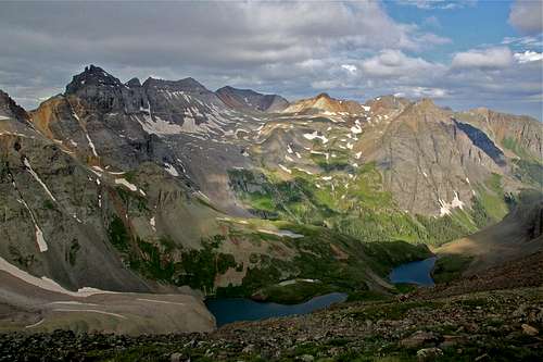
Most people reach the top of Blue Lakes Pass from Yankee Boy Basin. There is also a longer approach from Dallas Creek Road on a very scenic trail, which goes by three Blue Lakes. The top of the pass is at 13,000 feet.
![Top of Blue Lake Pass]() Blue Lake Pass 13,000 ft Blue Lake Pass 13,000 ft | ![Upper and Middle Blue Lake]() Upper and Middle Blue Lake as seen from the pass Upper and Middle Blue Lake as seen from the pass |
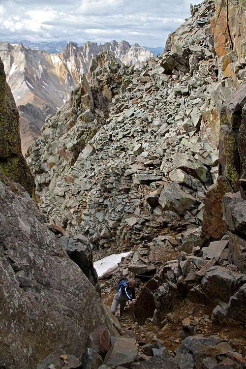
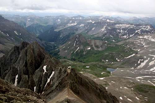
The Lower Ridge
The climber's trail bypasses the difficulties of the lower ridge on its left (west) side. Head up the climber's trail as it hugs the left side of the ridge, climbing on talus. Continue up to the 13,500 foot level, and move right, through a notch. There are cairns marking the way.
![The Southwest Ridge overview]() The Southwest ridge as seen from the pass The Southwest ridge as seen from the pass | ![The initial section]() Close up of the talus on the initial section of the ridge Close up of the talus on the initial section of the ridge |
![Initial section of the ridge]() Looking down towards the Blue Lake Pass Looking down towards the Blue Lake Pass | ![Cairn and Blue Lake]() View of Middle Blue Lake from the first section of the ridge View of Middle Blue Lake from the first section of the ridge |
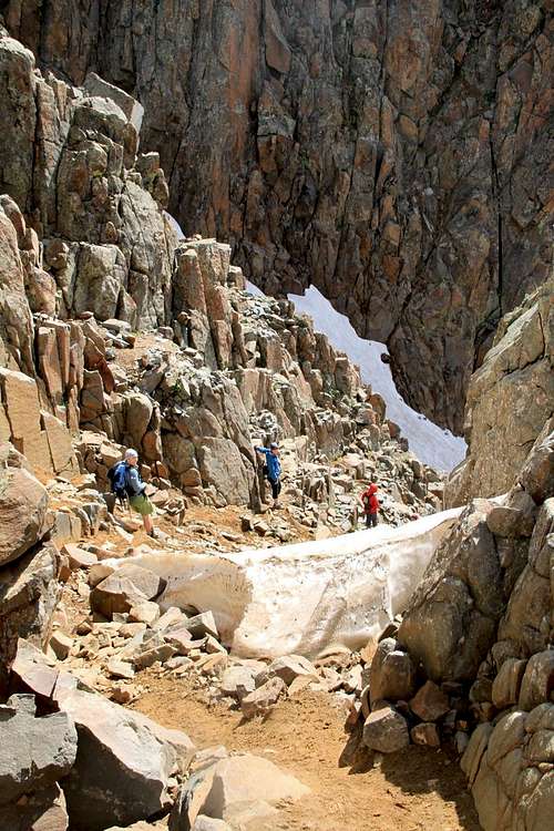
Inside the gully
at 13,500 feet you drop down about 25 feet and traverse on ledges into the large, south-facing gully. Follow this gully to its end before exiting a narrow slot on the right edge. Just follow the climber's trail.
![Drop inside the gully]() Drop inside the gully Drop inside the gully | ![Deep snow at some sections]() Deep snow inside the gully Deep snow inside the gully |
![Fun scramble]() You could also by-pass the snow You could also by-pass the snow | ![Class 3 section]() A short class 3 section A short class 3 section |
![Peek-boo]() Peek-Boo - so many interesting rock formations Peek-Boo - so many interesting rock formations | ![The path was pretty obvious]() A lot of scree around, but trail was good A lot of scree around, but trail was good |
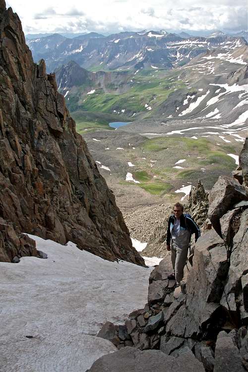
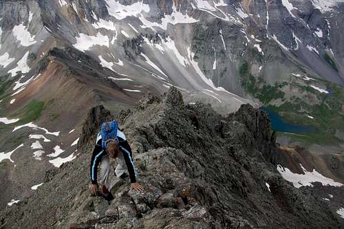
The Final Ridge
The scrambling on the upper section of the ridge is on a solid rock. Stay either right on the ridge (better for taking photos) or on its right (east) side.
![The Southwest Ridge]() Getting onto a final ridge Getting onto a final ridge | ![Blue Lakes]() Another view towards Blue Lakes Another view towards Blue Lakes |
![It feels safe]() The rock felt truly solid The rock felt truly solid | ![Don t fall down here]() Althought the rock is solid, you don't want to fall Althought the rock is solid, you don't want to fall |
![almost there...]() Looking up towards the summit Looking up towards the summit | ![The final section]() The final section The final section |
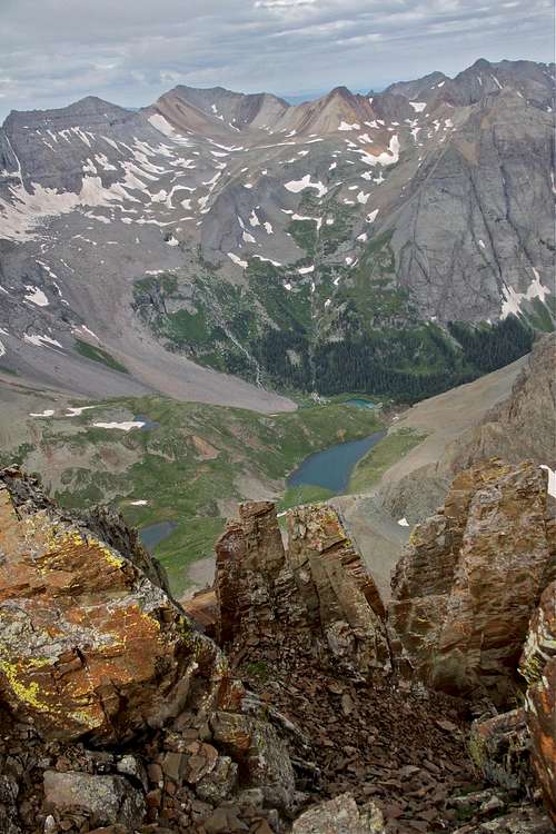
The Summit
The ridge went by fast, I wished, I wished it to be at least 2,000 feet higher.
Summit of Mt. Sneffels: 14,156 feet (=4,315 m).
![Summit view]() Summit photo Summit photo | ![View from Mt. Sneffels]() View towards Yankee Boy Basin View towards Yankee Boy Basin |
![Blue Lakes as seen from the summit]() Blue Lakes as seen from the summit Blue Lakes as seen from the summit | ![Famous Yankee Boy Trio]() The famous Yankee Boy Trio The famous Yankee Boy Trio |


Comments
Post a Comment