
-
 23805 Hits
-
 89.01% Score
-
 28 Votes
|
|
Route |
|---|---|
|
|
38.00360°N / 107.7923°W |
|
|
Hiking, Mountaineering, Scrambling |
|
|
Summer, Fall |
|
|
Most of a day |
|
|
Class 3 |
|
|
Overview
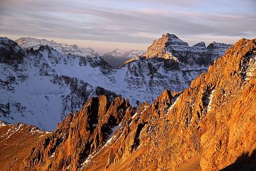
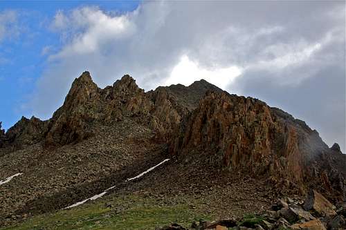
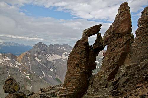
Southwest Ridge on Mount Sneffels with morning light, Dallas Peak in the background
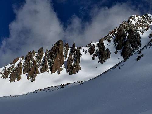
SW ridge - winter view from Yankee Boy Basin
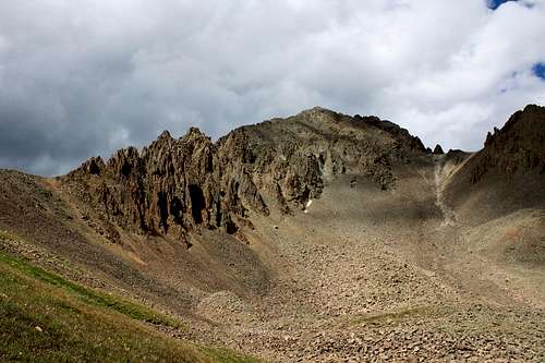
Mt. Sneffels and its southwest ridge as seen from Yankee Boy Basin
Truly a classic and my favorite route up Mount Sneffels. This ridge provides an impressive backdrop to Yankee Boy Basin. The spectacular pinnacles that dominate the lower part of the ridge might scare off the aspiring scrambler, but in fact the route bypasses these features quite easily.
The difficulty of this ridge is rated class 3, but some sections may feel like class 4, especially if you run into some wet or ice sections. Mountain guides usually rope up their clients up this route. I found it comfortable without a rope, make your own decision, a slip could be fatal here.
Tour de Sneffels - ascend via southwest ridge and descend the standard route South Slopes gives you a nice overview of the area.
Sneffels name has been a source of contention for years. Some believe that the name is from Jules Verne's book Journey to the Centre of the Earth. In this book, Verne refers to a volcanic mountain in Iceland, known as "Snaefellsjokull", as the gateway to the center of our planet. Most of us had not idea how to pronounce it, and it became "Sneffels". Other rumors persist that a "Mr. Sneffels" existed. A third explanation is that miners who worked on the mountain called it "Mount Sniffels", due to the cold-induced conditions of the chilly tunnels.
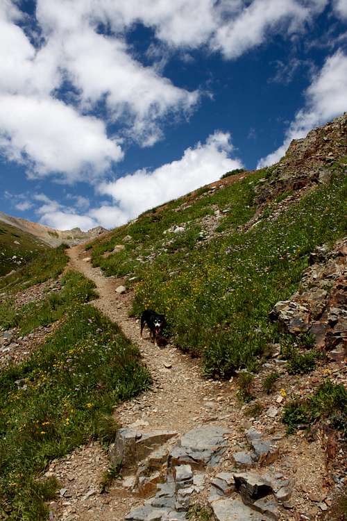
I would not recommend to take a dog on this route. You will see some images of my dog Duchess. I have
Parent Lineage: Uncomphahgre Peak
Wilderness: Mount Sneffels
Difficulty: the easiest route is 2+, Southwest Ridge class 3
![Camp Bird Road]()
Camp Bird Road![Camp Bird Road]()
Camp Bird Road![Toilet Trailhead]()
Toilet Trailhead
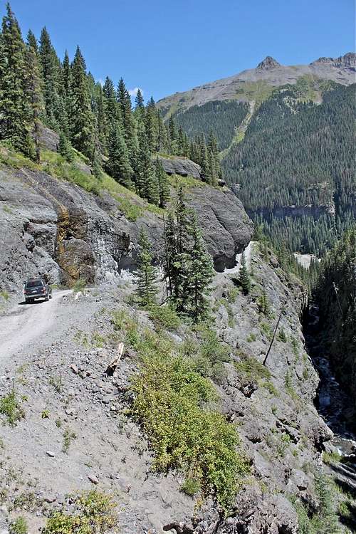
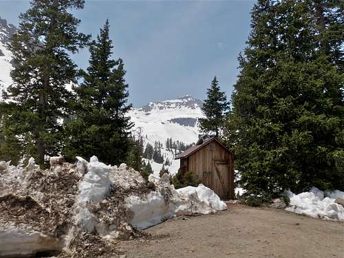
From the town of Ouray, head south on U.S. 550 (=Million Dollar Highway) for 0.3 mile from the south end of Main Street, and turn right onto the Camp Bird Mine Road. Cross the upper bridge over the Uncompahgre Gorge (= location of Ouray Ice Park during the winter) at 0.4 mile and continue on the dirt road up Canyon Creek to a junction at 4.9 miles (9,620 feet). The road stays open in the winter up to Senator Gulch (about 4.5 miles). Continue up the road past some active mines. Take the right fork and head up Sneffels Creek (road is marked Yankee Boy Basin) to a parking area at 8.3 miles = "Toilet Trailhead" parking lot.
Note that the road becomes progressively rougher as you proceed, and the drive to the parking area requires a 4WD vehicle. It is possible to drive considerably further up this road, but are we climbers or jeepers? The road is popular with four-wheelers and jeeps in the summer, and there can be a lot of traffic especially on weekends. If you choose to drive to the end of the road you can make it up to a high parking area (the end of the road, right below Kismet and Mount Sneffels) at 12,314 feet, and above Wright's lake.
Of note, I have seen low clearance cars making it to the "Toilet Trailhead", but you are risking getting stuck. The road has been recently nicely repaired by mining companies and you can encounter even some industrial traffic at lower sections.
Toilet Trailhead also provides access to other mountains in the area: Teakettle, Coffeepot, Potosi, Cirque Mountain, Gilpin Peak etc.
You can also approach the Southwest Ridge from Dallas Creek Trailhead, which would require 5.7 mile hike to get you to the Blue Lake Pass. This trail is much longer, steeper, but incredibly scenic when hiking around Blue Lakes (lower, middle and upper). You can camp out and do this as an overnight trip. For more information see Blue Lakes SP site.
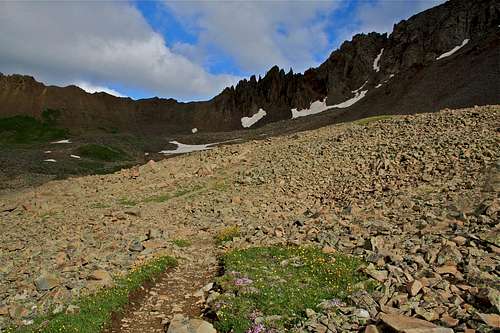
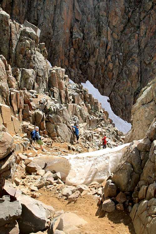
Head up the climber's trail as it hugs the left side of the ridge, climbing on talus. Continue up to the 13,500 foot level, and move right, through a notch. There are small cairns marking the trail. Drop down about 20 feet and then traverse on ledges into the large, south-facing gully. You can also stay to its let edge, but you will be forced back into the gully eventually. Again, there are cairns along this section, just follow it. Follow the gully to its end before exiting a narrow slot on the right edge. Just follow the climber's trail in this section.
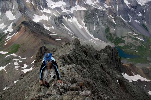
The slot deposits you on the upper ridge. The scrambling from here to the summit is on ledges with very solid rock. Stay either on the ridge (great for photos) or on its right (east) side.
From the summit, most people descend the well-used "normal route" trail. This uses a narrow gully that parallels the east ridge and takes you down to Lavender Col. There is tons of loose rock on this section, but it is not as steep as your way up. From the Lavender Col, descend the broad, shallow couloir to the defined trail taking you to the Blue Lakes parking lot. Follow the road back to your car.
Round Trip Distance: 5.3 miles (if you start from Toilet Trailhead)
Round Trip Time: 6 hrs (varies based on your fitness level, I have done it in the past in 4 hrs, and did not rush)
Starting Elevation: 11,316 feet
Highest Elevation: 14,150 feet
Route in images as you go up it - enjoy the scenery
Jacket, hat, gloves, snacks.
Remember weather can change rapidly high up, a beautiful morning can turn into a snowstorm :)
Sneffels name has been a source of contention for years. Some believe that the name is from Jules Verne's book Journey to the Centre of the Earth. In this book, Verne refers to a volcanic mountain in Iceland, known as "Snaefellsjokull", as the gateway to the center of our planet. Most of us had not idea how to pronounce it, and it became "Sneffels". Other rumors persist that a "Mr. Sneffels" existed. A third explanation is that miners who worked on the mountain called it "Mount Sniffels", due to the cold-induced conditions of the chilly tunnels.
I would not recommend to take a dog on this route. You will see some images of my dog Duchess. I have
fond memories of my beloved companion. She passed in May 2015, and has summited Sneffels many times via the standard route. Duchess has summited over 300 peaks in Colorado.
Some stats Mount Sneffels:
Colorado Rank: 27
Parent Lineage: Uncomphahgre Peak
Wilderness: Mount Sneffels
Difficulty: the easiest route is 2+, Southwest Ridge class 3
For more information on Mount Sneffels see Mt. Sneffels main SP page.
For more information on Mount Sneffels area see SP page Sneffels range.
Getting There
Camp Bird Road
Camp Bird Road
Toilet Trailhead
From the town of Ouray, head south on U.S. 550 (=Million Dollar Highway) for 0.3 mile from the south end of Main Street, and turn right onto the Camp Bird Mine Road. Cross the upper bridge over the Uncompahgre Gorge (= location of Ouray Ice Park during the winter) at 0.4 mile and continue on the dirt road up Canyon Creek to a junction at 4.9 miles (9,620 feet). The road stays open in the winter up to Senator Gulch (about 4.5 miles). Continue up the road past some active mines. Take the right fork and head up Sneffels Creek (road is marked Yankee Boy Basin) to a parking area at 8.3 miles = "Toilet Trailhead" parking lot.
Note that the road becomes progressively rougher as you proceed, and the drive to the parking area requires a 4WD vehicle. It is possible to drive considerably further up this road, but are we climbers or jeepers? The road is popular with four-wheelers and jeeps in the summer, and there can be a lot of traffic especially on weekends. If you choose to drive to the end of the road you can make it up to a high parking area (the end of the road, right below Kismet and Mount Sneffels) at 12,314 feet, and above Wright's lake.
Of note, I have seen low clearance cars making it to the "Toilet Trailhead", but you are risking getting stuck. The road has been recently nicely repaired by mining companies and you can encounter even some industrial traffic at lower sections.
Toilet Trailhead also provides access to other mountains in the area: Teakettle, Coffeepot, Potosi, Cirque Mountain, Gilpin Peak etc.
You can also approach the Southwest Ridge from Dallas Creek Trailhead, which would require 5.7 mile hike to get you to the Blue Lake Pass. This trail is much longer, steeper, but incredibly scenic when hiking around Blue Lakes (lower, middle and upper). You can camp out and do this as an overnight trip. For more information see Blue Lakes SP site.
Route Description
From the parking area (=Toilet Trailhead), walk up the road for 0.8 miles to a point where the Wrights Lake Cutoff Trail leaves the road. Take this narrow trail for 0.4 miles to a small lake, where the trail rejoins the road briefly. Continue above the lake towards Blue Lake Pass. You will pass a parking lot where the road ends. At Blue Lake Pass (13,000), take a moment to look at the ridge. You can see that a climber's trail bypasses the difficulties of the lower ridge on its left (west) side.Head up the climber's trail as it hugs the left side of the ridge, climbing on talus. Continue up to the 13,500 foot level, and move right, through a notch. There are small cairns marking the trail. Drop down about 20 feet and then traverse on ledges into the large, south-facing gully. You can also stay to its let edge, but you will be forced back into the gully eventually. Again, there are cairns along this section, just follow it. Follow the gully to its end before exiting a narrow slot on the right edge. Just follow the climber's trail in this section.
The slot deposits you on the upper ridge. The scrambling from here to the summit is on ledges with very solid rock. Stay either on the ridge (great for photos) or on its right (east) side.
From the summit, most people descend the well-used "normal route" trail. This uses a narrow gully that parallels the east ridge and takes you down to Lavender Col. There is tons of loose rock on this section, but it is not as steep as your way up. From the Lavender Col, descend the broad, shallow couloir to the defined trail taking you to the Blue Lakes parking lot. Follow the road back to your car.
Round Trip Distance: 5.3 miles (if you start from Toilet Trailhead)
Round Trip Time: 6 hrs (varies based on your fitness level, I have done it in the past in 4 hrs, and did not rush)
Starting Elevation: 11,316 feet
Highest Elevation: 14,150 feet
 Trail to Wright's Lake Trail to Wright's Lake | 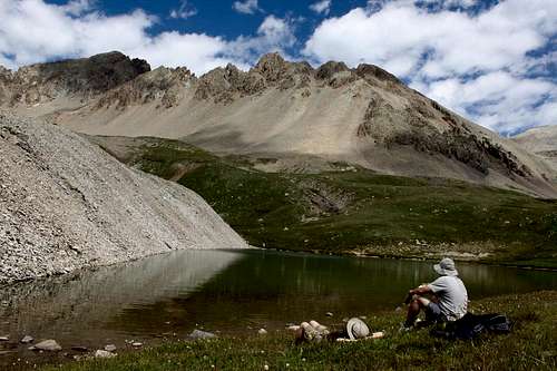 Resting by Wright's Lake with Mount Sneffels in the back Resting by Wright's Lake with Mount Sneffels in the back |
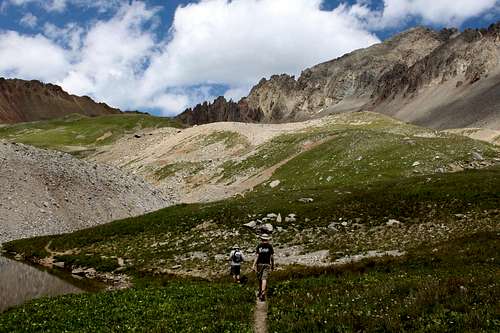 Walking towards Blue Lake Pass Walking towards Blue Lake Pass | 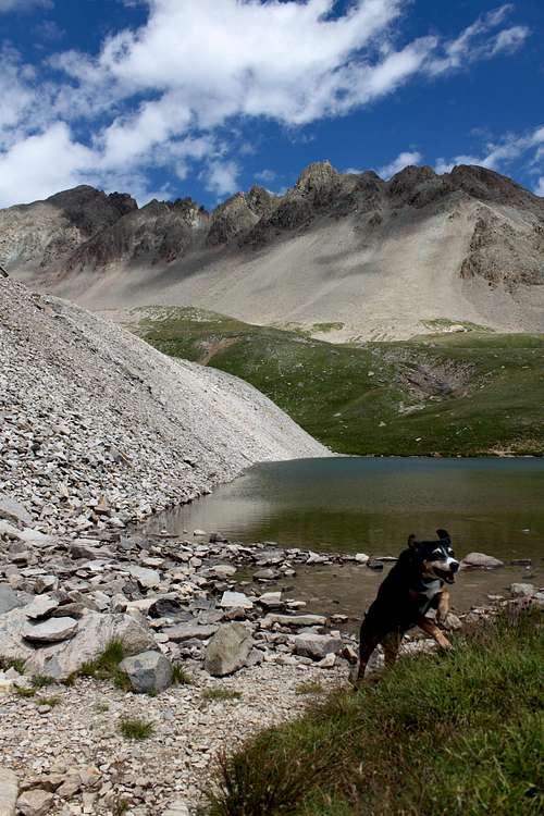 Duchess by Wright's Lake Duchess by Wright's Lake |
 Trail towards Blue Lake Pass Trail towards Blue Lake Pass | 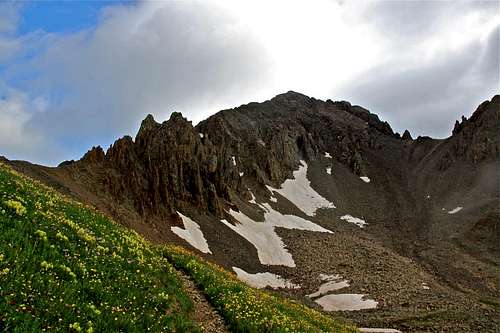 Near the Blue Lake Pass Near the Blue Lake Pass |
 Trail to Blue Lake Pass - looking down, nice view of Gilpin Peak Trail to Blue Lake Pass - looking down, nice view of Gilpin Peak | 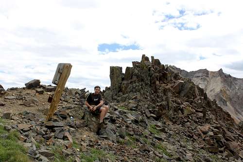 Resting at Blue Lake Pass Resting at Blue Lake Pass |
 Top of Blue Lake Pass and Gilpin Peak in the back Top of Blue Lake Pass and Gilpin Peak in the back | 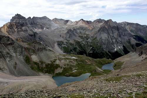 Blue Lakes (upper and middle ones) as seen from the Blue Lake Pass Blue Lakes (upper and middle ones) as seen from the Blue Lake Pass |
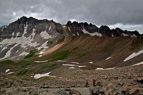
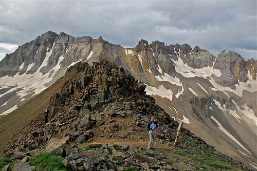
 The Southwest Ridge overview as seen from the pass The Southwest Ridge overview as seen from the pass | 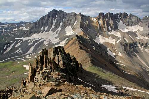 Looking back from the ridge towards Blue Lake Pass and Gilpin Peak Looking back from the ridge towards Blue Lake Pass and Gilpin Peak |
 Drop inside the gully Drop inside the gully | 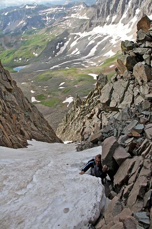 Deep snow inside the gully was easy to negotiate Deep snow inside the gully was easy to negotiate |
 Many interesting rock formations along the route Many interesting rock formations along the route | 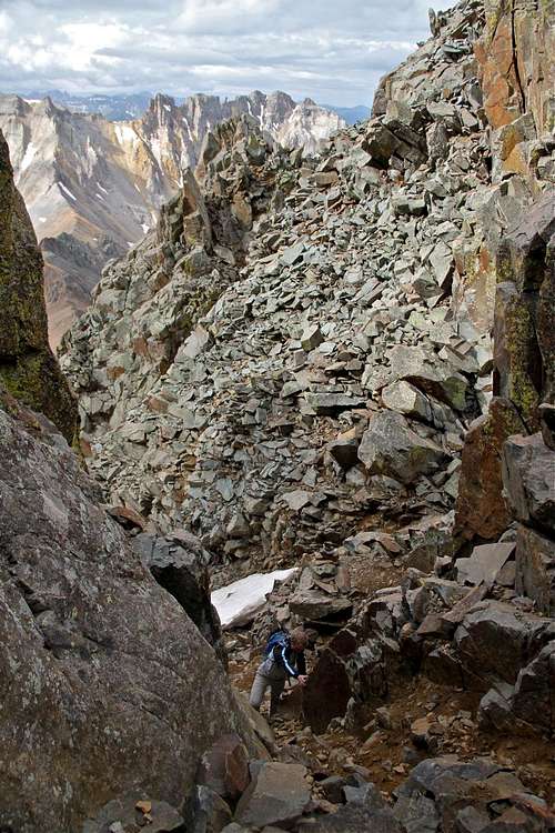 The path was pretty obvious with many small cairns The path was pretty obvious with many small cairns |
 Final Ridge Final Ridge | 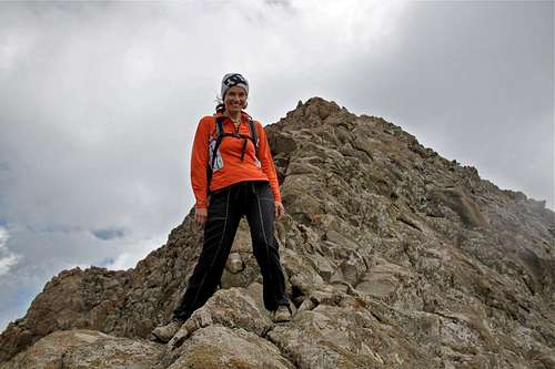 Summit is just a little bit above :) Summit is just a little bit above :) |
Essential Gear
Good hiking boots. Trekking poles ok for the lower section, but higher up you will have to use your hands, so trekking poles may be more of an obstacle higher up. Some parties feel more comfortable roping up, professional mountain guides usually short rope their clients up this route.Jacket, hat, gloves, snacks.
Remember weather can change rapidly high up, a beautiful morning can turn into a snowstorm :)