Gem Lake Peak Bagging July 19-21 2013
I spent last weekend backpacking with some friends above Snow Lake. The plan was to visit 4 peaks and at least 5 alpine lakes in a single weekend. Along the way we would encounter mountain goats, ice shelf collapse and even an explosion. We had stellar weather with temperatures up to the high 70's and sunny skies the entire trip.
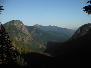
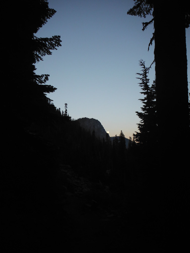
On Friday night I hiked in after work with Colin and set up camp on the north end of Gem Lake just as the Sun set, then we made the short trip up Wright Mountain by headlamp. A nearly full moon made for less than brilliant starry skies, but the surrounding peaks were so brightly lit that they could be distinguished from miles away. After a quick dinner we hit the hay to prepare for an early start on a long day.
Saturday - Wildcat Lakes, Lake Caroline, Caroline Peak, and Wild Dare Peak
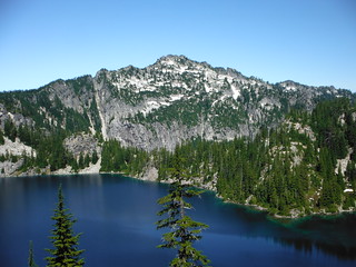
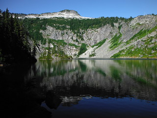
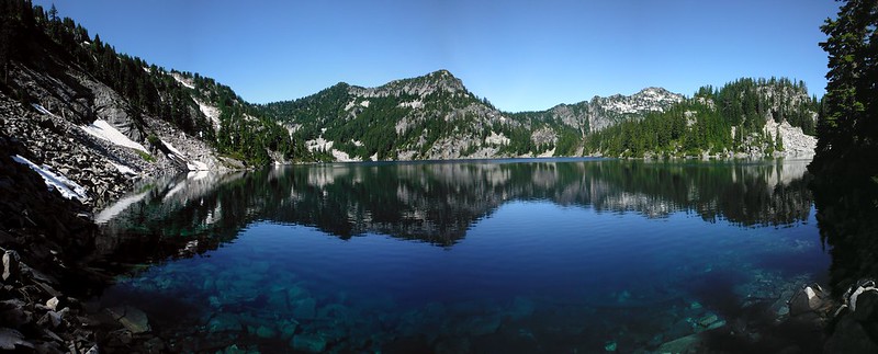
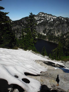
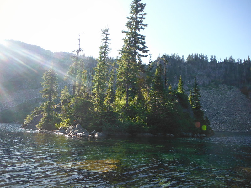
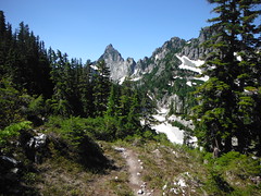
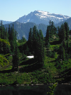
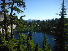
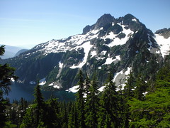
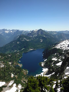
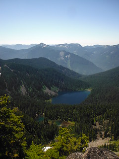
Just before 8 o'clock we continued West on the High Lakes Trail, losing around 1000 feet over 2 miles to reach Lower Wildcat Lake where the official trail ends. A short overgrown bootpath took us to Upper Wildcat Lake, where we had a beautiful view of or planned destinations for the day - Caroline Peak and Wild Dare Peak. We watched some fish jump and discussed the possibility of moving camp after Ben and Eric were to arrive that evening, then proceeded up to the saddle between the 2 peaks. From there we dropped a few hundred feet to Lake Caroline which looked at least 2/3 the size of Snow Lake. The small overgrown campsite we found seemed to have seen very little traffic in recent years.
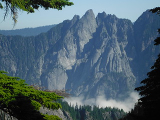

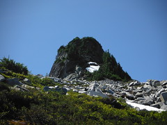
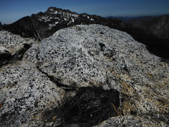
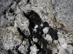
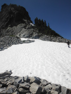
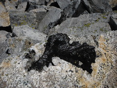
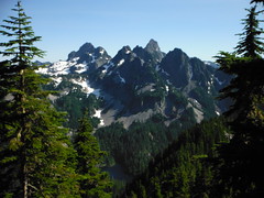
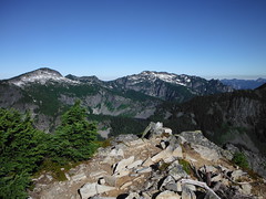
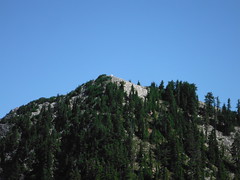
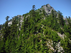
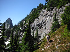
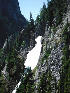
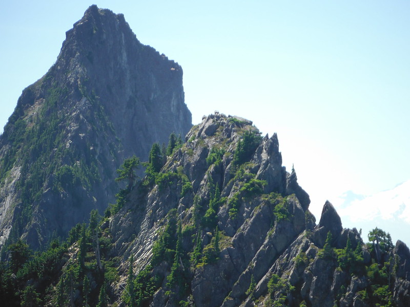
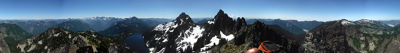
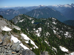
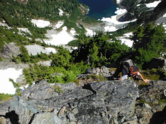
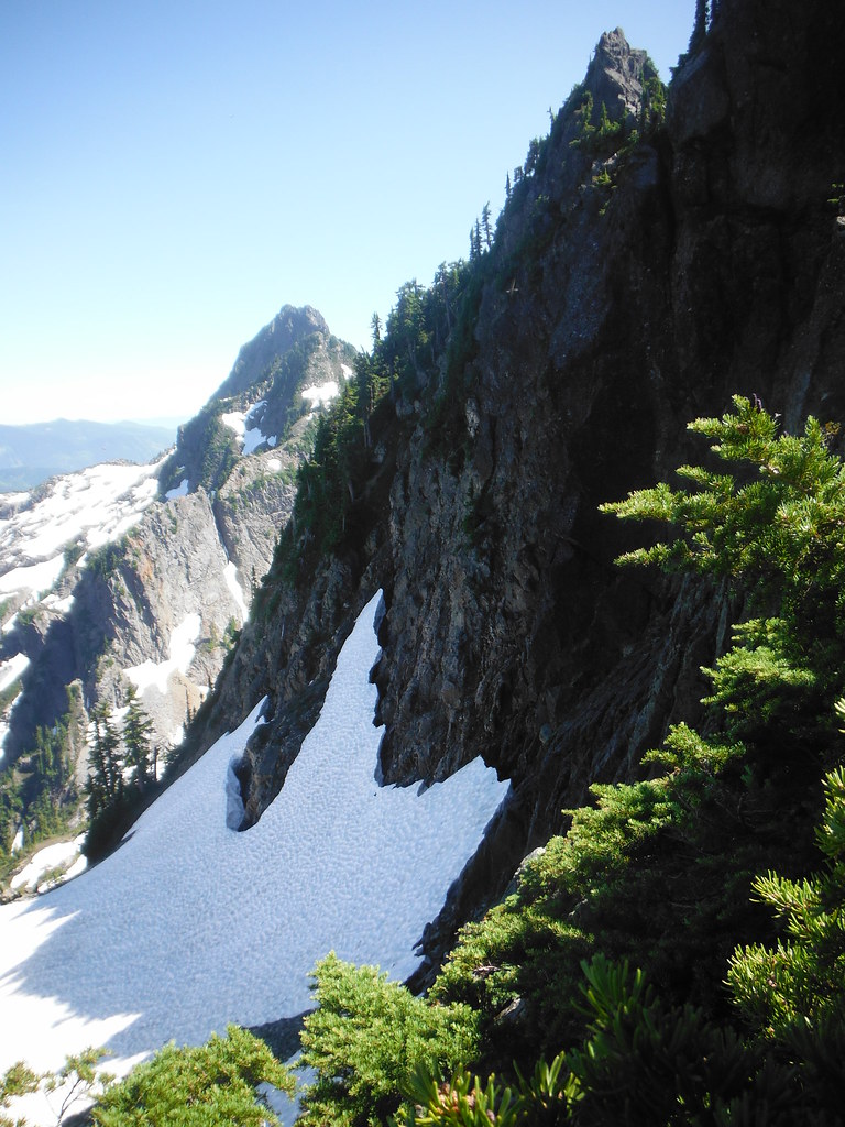
Climbing talus and scree toward the southwest quickly brought us to the base of Mount Caroline's broad summit block. On the ridge to the East we found what we believed to be quartz and carbon embedded in the chunks of talus. As we moved toward our planned accent route on the SW ridge Colin suggested we climb straight up the short NW face, which turned out to be one of the most enjoyable parts of the days journey. Views from the top were great. The haze from the day before had burned off and was replaced West of the Cascades by a sea of clouds below 4000 feet. From about 300 feet West of the summit we descended talus and crossed a small snow field on the way to the North ridge where we found a bootpath down to the saddle.
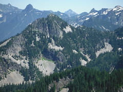
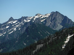
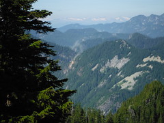
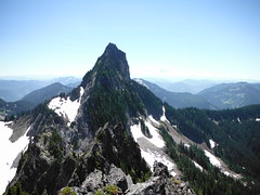
The ridge to Wild Dare Peak is heavily forested. We alternated between thick bush-whacking on the ridgetop and steep side-hilling below. Mount Garfield and Treen Peak dominated the surprisingly wide northern view from the summit. At 4:30pm, while we bathed in a snow patch we heard a huge boom far to loud to be a gunshot. After exchanging bewildered looks I noticed a large cloud of dust rising from the ridge by Green Ridge Lake. Maybe a new trail being built?
Back at Upper Wildcat Lake a few people had set up camp. We crossed the creek and bushwhacked to the island (the toughest bushwhack of the entire weekend) and took a quick swim before the Sun set behind Caroline Peak. The 1000 foot climb back to Gem Lake was tough but we pushed through the pain and hurried to meet Ben and Eric at camp. They mentioned some difficulty getting through the crowds up to Snow Lake. After dinner I couldn't convince anyone to join me climbing Wright, and I had already missed the sunset. I would have liked to catch the sunrise in the morning but not enough to set an alarm.
Sunday - Mount Roosevelt
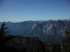
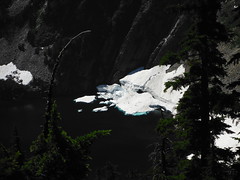
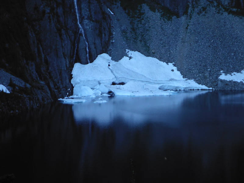
I awoke just after sunrise, cooked some Pad Thai and ate it on Wright Mountain summit. Colin was up when I returned to camp. As we prepped our gear and discussed the plan for Mount Roosevelt we heard what sounded like an avalanche coming from near Chair Peak. The folks camped between Gem Lake and Snow Lake rushed toward the latter and seemed to have seen something in the lower basin out of our view.
Ben was suffering from inflamed knees and choose to start back to Alpental early to allow for a slow hike out. He and Eric watched our progress from camp through binoculars for the first hour or two before heading out.
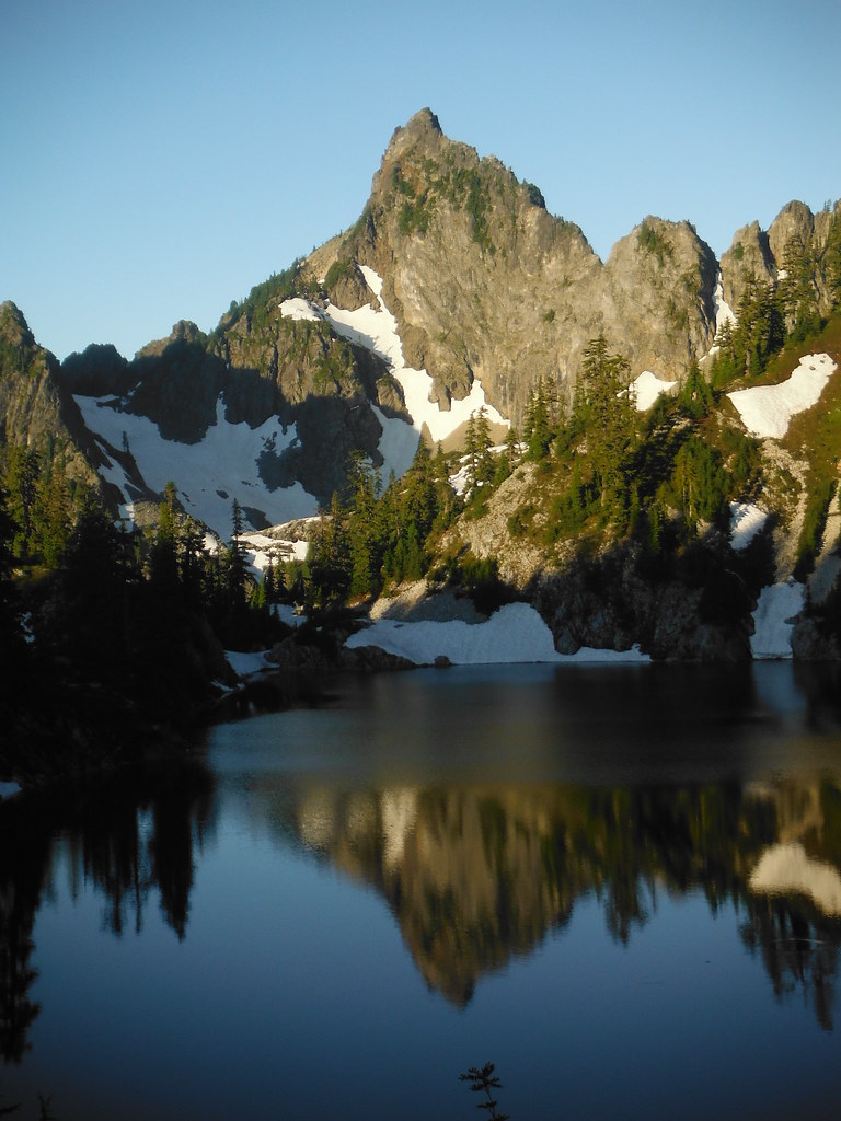
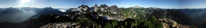
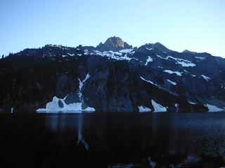
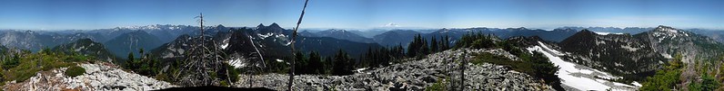
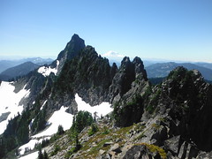
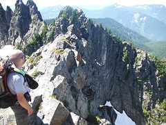
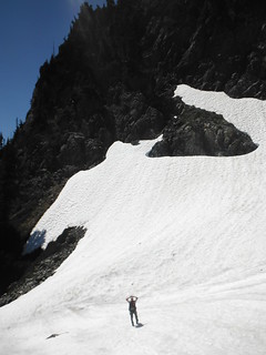
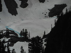
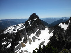
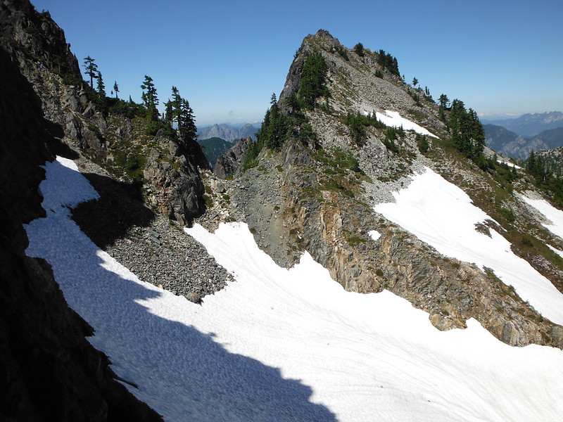
A clear bootpath follows the ridge top to just below the North False Summit. Looking into Snow Lake we could see where a huge ice shelf had collapsed into the water (likely the "avalanche" we had heard that morning). We paused at the edge of the highest snow field on the North Face before making a simple scramble up to the peak. The false summit has significant exposure to the north and West and unobstructed views all around. We watched our friends as they started down the trail toward Snow Lake, then examined our route to the true summit.
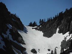
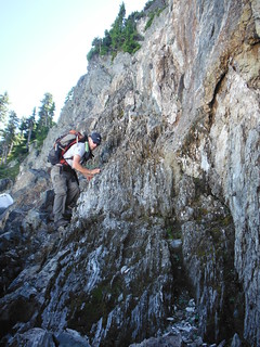
We would lose several hundred feet to the saddle and cross a small snow field to the base of a small shelf/gully on climbers left with a few trees for exposure relief. From the snow field we spotted a lone mountain goat watching us from his den right in the middle of our route. Roosevelt the Goat kept an eye on us while climbing out of sight as we scrambled up.
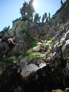
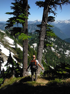
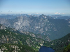
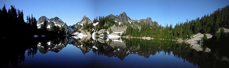
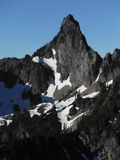
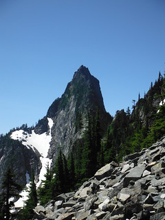
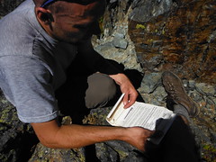
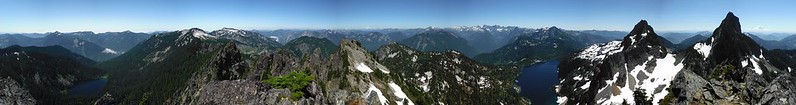
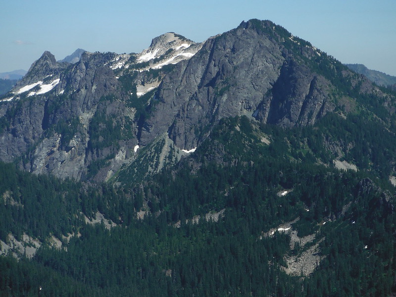
We both had fun with a couple of exposed moves and we were standing on the summit before we knew it. We both signed the Mountaineers register (a first for Colin) and snacked while playing "name that peak". Kaleetan to the south looked particularly steep and impressive. From our position the talus-filled crater in Wright Mountain that forms Gem Lake appeared very prominent.

Below the goat gully we traversed above the snow field and jumped over the bergschrund for a small glissade. Before returning to camp we attempted to climb a small peak between the true and false summits. The last 100 feet or so turned out to be more exposed than anything else we had seen that day, so we turned back there.
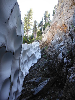
Back at camp we packed up quickly and then enjoyed a good meal on the lake while tossing around ideas for future trips. Little did we know that 6 days later we would be returning from a successful summit bid on Mount Stuart. We had a leisurely hike out with plenty of rest stops. Just below Gem Lake we got a closer view of the ice shelf collapse that had occurred that morning. The sun setting on Chair Peak and Snow Lake was stunning, and we managed to make it back to the truck without headlamps.
Trip Stats:
23.7 miles
~11000' gained and lost
4 peaks with 400'+
5 alpine lakes
plenty of sun
tons of fun
My Blog
Comments
No comments posted yet.
