Bettys Jugs (Bettys Peak)

Bettys Jugs (Bettys Peak)

Page Type Page Type: Mountain/Rock
Location Lat/Lon: 48.38566°N / 121.40228°W
Additional Information County: Skagit
Additional Information Elevation: 6103 ft / 1860 m
Sign the Climber's Log

Overview


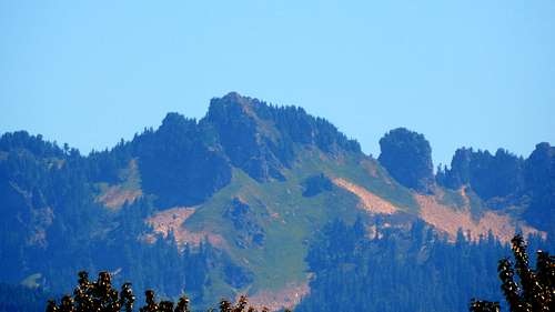
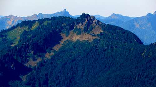
Bettys Peak from SR530 north of Darrington


Bettys Peak is a 6103' (1123' prom.) high point located 13 miles northeast of Darrington, WA. It is the high point of a north/south trending ridge located about midway between Illabot Peaks and Mount Chaval. It is also positioned about midway between Betty's Pass and Jug Lake, hence the other, more popular name.
 
Because of the easy nature of this scramble (nothing exceeding class 2), and the beauty of the alpine areas on the upper parts of this mountain, I have decided to bestow upon Bettys Peak the 2015 'Underrated Peak of the Year Award'. In addition to great scenery and easy scrambling, Bettys Peak offers almost guaranteed solitude, and a route that stays completely shaded in the early morning hours (even in early July).

A note about the name: Most online references for this high point (peakbagger, listsofjohn, etc.) will refer to it as Bettys Jugs. My proofreader/wife prefers that I keep my Summitpost materials kid-friendly and rated-G, so any materials I post in regards to this peak will be labeled 'Bettys Peak'. Truthfully, I think the original name is something of a misnomer anyway - nothing I saw in this area in any way resembles 'jugs', or any other anatomical feature. But, to each their own, call it whatever you like.

Getting There


From Darrington, follow SR530 north for 7.4 miles to the Suiattle River Road. This will be a right turn off the highway immediately after crossing the Sauk River Bridge. Follow the Suiattle River Road for 6.4 miles to FR2640. Turn left, and follow FR2640 for 3.7 miles, where the road will split. If you have a low-clearance vehicle, park here (2160'). If you have a high clearance vehicle (preferably four wheel drive), continue another 1.0 miles to an intersection marked as 2643' on the USGS map, and park here. At this point, the spur you will follow turns off to the right. If you are equipped with a no-kidding 4x4 (i.e. Jeep CJ-5), it is possible to continue up the road another 0.9 miles to a switchback at 3100'. At this point, the road is completely undriveable, and you will find yourself at the 'trailhead' for Bluff Lake. 

Route


Bettys Peak route map
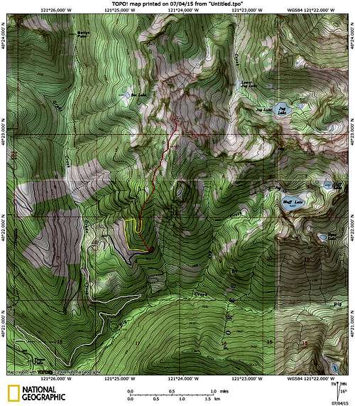
Bettys Peak route map. White line shows the road driveable by 'normal' high clearance vehicles, blue line shows road that could potentially be driven by four wheel drive. Red line shows the recommended route, yellow line shows an optional hiking route.


Once at the Bluff Lake 'trailhead', you have one of two options (you will not be using the Bluff Lake trail). The first option (shown in red) is to simply plunge into the woods, and begin heading straight uphill to the N/NW. On this route, you will encounter the old road bed again at about 3850'. Despite the fact that this area is second growth, it is really not too bad by Cascade bushwhacking standards. The second option (shown in yellow) involves walking up the road another 0.7 miles, then scrambling up a steep slide area to regain the old road bed at 3750'. Having tried both routes, my friend and I are of the opinion that the first (red route) option is probably slightly less offensive. There is a third possible option of staying on the road, but this will add considerable distance - additionally, the road bed seemed to degrade quickly after the slide area.
 
Alternate road approach on Bettys Peak
Alternate road approach on Bettys Peak - This is option 2. Leave the road at N48 22.066 W121 24.913. Get back on the road at N48 22.098 W121 24.762. BTW, this is much steeper than it appears in the photo. 

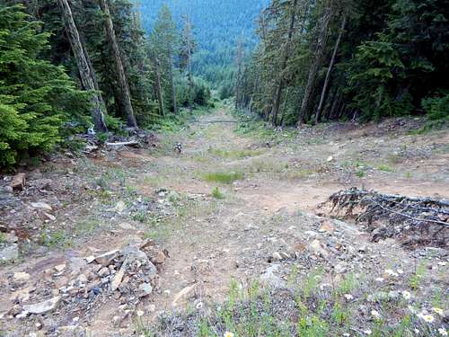
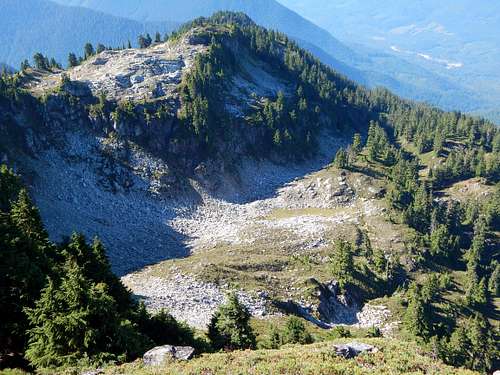
From the old road bed at 3850', we found it easier to follow the ridge crest just to the west of the road, as the road bed was choked in alder at this point. After one more crossing of the old road at 4000', continue north on the ridge crest, which will be well-defined at this point. The scrambling was surprisingly easy here for second growth, alternating between ferns, grass, and small trees. At approximately 4500', you will enter the old growth. Continue N/NE to 4600' where you will encounter the first of several talus slopes. Make an oblique traverse to the N/NE along two large talus slopes. Shortly after the second talus slope, you will arrive at a creek gully that drains just to the southeast of a cliffy, 5040' high point. Scramble up this gully (or in the woods adjacent to it), until reaching a nice alpine meadow at 5100'.
 
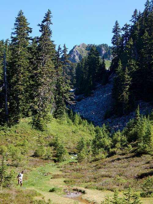
Meadow at 5100' on Bettys Peak

From the meadow, continue in a N/NE direction, following a talus filled gully that lies just to the west of Point 5835. For most of the route, you will have the choice of talus, or heather slopes (obviously, in early season, this area would be snow covered). At 5500', you will arrive at an open basin just south of the summit. There are a couple of different options for approaching the summit here, but we found that the direct approach worked just fine. The final scramble consisted of steep grass slopes, and no real rockfall danger of any kind was encountered. The final scramble is steep enough to require an ice axe for early season ascents.

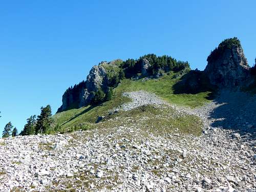
The final scramble on Bettys Peak

Here is a view looking back on the route from the summit.

Looking down on the Bettys Peak scramble route
Looking down on the Bettys Peak scramble route - Point 5835 at top of photo

Use caution as you approach the summit area, as there are substantial cliffs on the northeast side of the summit block.

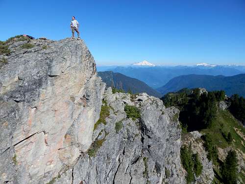
Bettys Peak summit cliffs

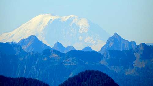
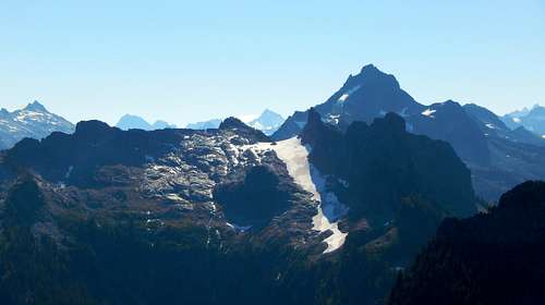
My apologies for the glut of photos, I got a little carried away on the summit.

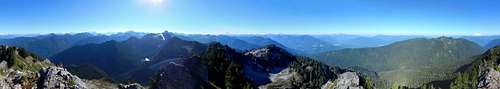
Bettys Peak summit pano

Darrington, Three Fingers, and Whitehorse from Bettys Peak

White Chuck Mountain from Bettys Peak

Pugh Mountain from Bettys Peak

Sloan Peak from Bettys Peak

Glacier Peak from Bettys Peak
Glacier Peak from Bettys Peak. Boulder Peak at center left.

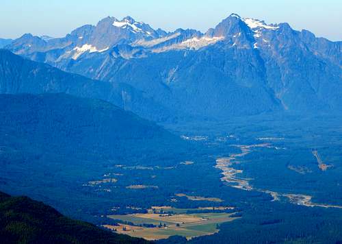
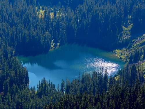
Jug Lake from Bettys Peak

Snowking Mountain from Bettys Peak

Eldorado Peak from Bettys Peak

Mount Baker from Bettys Peak

Mount Shuksan and Mount Blum from Bettys Peak

Prairie Mountain from Bettys Peak
Prairie Mountain from Bettys Peak - Devils Peak in background just left of center

Mount Rainier from Bettys Peak
Mount Rainier from Bettys Peak. Morning Star Peak and Sperry Peak below. 

Mount Chaval from Bettys Peak


Red Tape


A parking pass is not required anywhere on FR2640.

When to Climb


Any time one can drive a reasonable distance up FR2640 - probably May to November most years.

Camping


There are several places one could camp on this route - the first good meadow is found at 5100' (N48 22.653 W121 24.339).