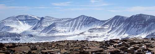
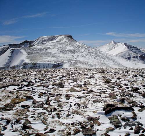
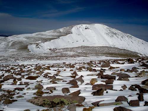
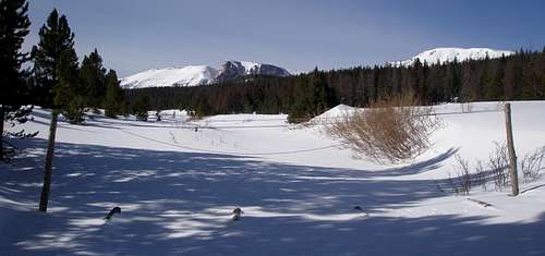
![Emmons to Painter]() Five out of Utah's 17 13000 footers
Five out of Utah's 17 13000 footers
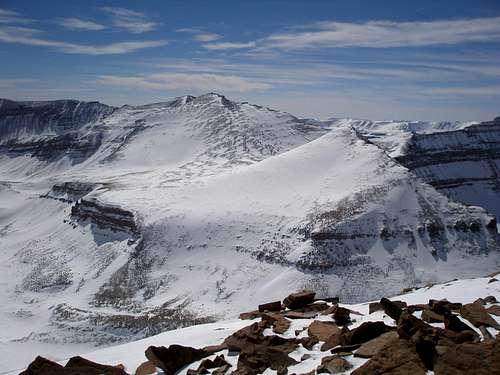
Tokewanna Fail
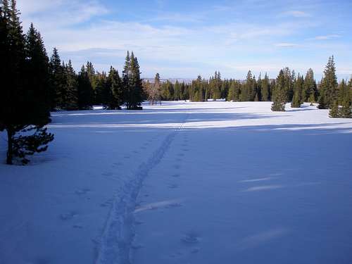
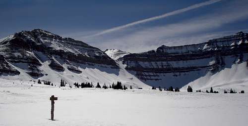
I've had a goal of climbing Utah's 13000 footers in the winter for several years. This winter I had a first hand dose of how unrealistic that goal is. Depending upon how you count, there are 17 of them. The minimum round trip distance to any of them is over 20 miles. At a maximum, the round trip mileage is at least 42. Two winters ago I did a one day trip to Gilbert Peak and last year I did a one day trip to Mount Powell. Wow, 2 out of 17, I was moving at a snails pace. I was hoping to step it up this year and get a few more in day trips and then try an overnighter. I ended up trying the overnighter first as a friend proposed a three day trip to Tokewanna, February 16-18. I was dreading it. Sleeping out when it is cold isn't so bad, it's the part where you have to get up and do stuff that I didn't like. On day one we would ski 6.4 miles on a snowmobiled road and set up a base camp. On day two we would ski 21.5 miles round trip to the summit, and on day three we would ski out. I had actually skied to Tokewanna in one day before, but it had been in June, when the road had melted out.
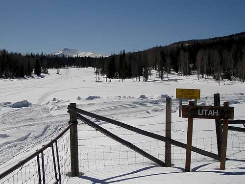
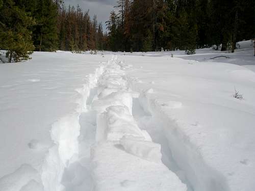
![Entering Utah]() Entering Utah on the snowmobiled road
Entering Utah on the snowmobiled road
I wasn't used to carrying a heavy pack but my friends assured me that it would be easy on a flat, snowmobiled road. Well, maybe it is if you are not a wuss like me, but I had a hard time with it and the pack only weighed 40 lbs, lighter than both of theirs. Since someone cancelled at the last minute leaving the tent situation less than ideal, I slept in an ultralight 3 season tent in which there was barely enough room for my ultra puffy -40 degree sleeping bag in which when filled with everything I didn't want to freeze, was barely room enough for me.
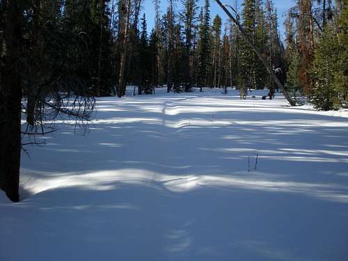
![Middle Fork Blacks Fork]() Deep snow
Deep snow
The first night we were lucky and the temperature was in the teens (F) in the evening, but rose to the upper 20's by daybreak. On "summit" day, we trudged through dense powder, sinking in calf deep with every step, but at least there wasn't a crust to break. After my turns at trailbreaking, I'd eat a snack and then spend seemingly forever fiddling with stuff and worry that it would be hard to catch up, but oh my God, there they'd be, just right around the corner. Things were not going well. It took us 7 hours and 12 minutes to go a measly 5.5 miles one way, with over 5 miles remaining. Mike, who ascribed to the ski until you drop theory, had asked "Do you want to turn around at 2 or 3?" Glen and I both immediately said 2, thankful for each other's support. The weather was unsettled and the temperature dropped throughout the day. Whatever, at least we tried.
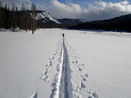
![Middle Fork Blacks Fork River]() Heading back to camp
Heading back to camp
The next morning it was -8F, more typical than the balmy temps the night before. However, the sun was bright and the ski back to the car would have been quite pleasant had not my back and legs been killing me. Next time I'm going to try a sled and if that doesn't work for me, multiday winter trips are going to be out of the question and bye bye winter 13000 footers.
Gunsight Success
Now it was back to the plan of getting some 13000 footers in day trips. This I could do. Gunsight Peak seemed the easiest. If you are heading to Kings Peak via Henrys Fork and Gunsight Pass, Gunsight Peak will be on your left. The route I would take parallels the Henrys Fork route but is about 1 mile to the east along the banks of Joulious Creek. It's about 24 miles RT and I had skied it in one day in early April 2011 so I knew I could do it with the right conditions. The skiing is more difficult than in Henrys Fork so I needed to be at the summit by 3PM to be able to ski down the difficult portion while it was still light.
![Gunsight Peak]() Gunsight Peak on the left.
Gunsight Peak on the left.
I gave it a week and a half, hoping the snow would consolidate. The forecast for March 2 looked perfect, sunny, high of 28F, and most importantly, minimal winds as I'd be above treeline for 9 miles. Given the failed Tokewanna trip, I thought I'd head up 2 days before and do some trailbreaking. I drove up on Feb 27th, slept in my car and set out the next morning at 6:45. The first 2.7 miles are on a flat unplowed road that leads to the Henrys Fork TH, the main access for Kings Peak. I was relieved to find this stretch broken, but as soon as I turned off the main road onto the Hole-in-Rock Road, oh, oh, oh, was the snow deep. I thought it was even worse that the Tokewanna trip. Each step was painfully slow, often sinking in to my knees or even farther. It wasn't light fluff either, it took work to lift my ski back up out of the heavy snow. I broke trail for a whopping 1.15 miles and then turned around. The first 2.7 miles had taken me 1 hour and 4 minutes. The last 1.15 miles had taken 4 hours and 15 minutes. Big ouch! Well, unless the snow conditions miraculously changed in the next 2 days there was no way I was going to reach Gunsight on March 2.
On the way out, on the flat road part, I met a group of 3 heading in with big packs on a 3 day trip to Kings. I wished them well and wondered if I'd see them again on the 2nd.
I drove home and the next evening drove right back, a 150 mile one way drive, the last 20 of which are on a plowed dirt road. Getting ready for trip 2 was a lot easier than for trip 1 since I didn't bother unpacking the car. Snow conditions hadn't changed and I extended my track another mile. It was exhausting. Skiing over my old track was no picnic either as it was very choppy.
When I got back to my car the group of 3 Kings Peak hopefuls were sprawled out with their stuff scattered everywhere. I asked if they had made it and they said no. They had camped near Alligator Lake and then followed some tracks to the Dollar Lake area, where the tracks veered off-course from Gunsight Pass. They tried skiing off of the track but said they were sinking in to their hips at times and that was with wide AT skis.
![Rain crust]() Rain crust
Rain crust
I took a break and waited until the evening of March 7 to drive back. The third time is supposed to be a charm but I had no such luck. I didn't think it was possible, but snow conditions were even worse. It had rained since my last trip and now there was a 1" thick, unsupportable rain crust on top of the sugary snow. Each step would almost support me, but then I'd break through the crust and then have to break the crust even more to get my ski back out. I took to cracking it with my ski pole before lifting my leg up. I didn't think I'd even make it a mile farther, but barely did. I reached a big meadow at 10400' with the hope that with the terrain opening up the remaining snow wouldn't be so bad as it had been more exposed to wind and sun. The forecast for the day had been for snow but it had been quite pleasant and didn't start flurrying until I was back on the main road. By the time I got to my car it was snowing lightly.
The forecast called for 1-3" that night and another 1-3" the next day. Typically the accumulation is on the low end of the range. A few new inches over my now icy track would be perfect, smoothing out all the rough edges, but did it snow 2"? Did it snow 6"? No, it snowed 14! I didn't believe it when I looked at the first snotel, but 2 others in the general area confirmed it. Big, big, groan. There had only been a minor amount of precip locally. Usually it's the other way around, a lot of snow on the Wasatch front where I live, but substantially less in the Uintas. I spent the day thinking things over, wondering if I was on a fool's errand. In prior years I had had 6 successful solo ski trips to 13000 footers, 2 in winter and 4 in spring. Each was a stand alone trip in just one go without the benefit of any prior trail breaking. Maybe I had just gotten lucky with snow conditions on the other winter trips.
I had spent so much time breaking trail that I was not going to give up. New Uinta snow, even deep, is easier to break than the sugary/crusty stuff because it covers up all the crappy stuff. Maybe it wouldn't be so bad. I set off again on the evening of March 11. I had waited an extra day, giving the snow a chance to settle and the roads a chance to be well plowed. The 20 mile drive on the dirt road was always interesting. The best conditions were nice smooth frozen dirt for the first five miles and packed powder for the rest. The worst conditions were mud, slush, muddy slush, and frozen mud/slush ruts.
Off I go for the fourth time. This time Mountain View, the last little town, is white, not brown. By the time I got to the dirt road it was dark. Initially it looked great with the first part being bare as usual with a few small drifts across it. The drifts got deeper, but my trusty Subaru with studded snow tires had no problem whatsoever. The drifts got deeper still and the snow got denser. I reached a super deep drift with truck ruts going through it that I knew would come up way past the bottom of my car. I went left to avoid it through some smooth snow and pretty quickly got stuck. Sad face. It took two attempts, but I was able to shovel my way out of there. There were several more drifts along the initial open stretch that made me nervous. Since it was dark I had no idea how long it would be until the road was tree lined and safe from drifts. Is that a tree? No it's just a utility pole. Maybe that's one now, no, it's just another utility pole, at least I think, it's kind of hard to tell in the dark. Finally, the trees were real not phantoms, the road transitioned to well snowpacked, and I was going to make it to the trailhead.
I was lucky and again the first stretch on the main road was broken. I turned off and this time it was just trail breaking hard vs trail breaking hell. I rebroke all that I had broken before plus another 100' or so for good measure in less time. It didn't do more because I didn't want to wear myself out as I was coming right back.
![My old track]() My old track
My old track
On the way home, all the drifts had been replowed but the road was super muddy. The next day back in Salt Lake when stopped for a traffic light, the guy behind me felt compelled to get out of his car, pound on my window, and tell me three times how dirty my brake lights were. That evening I drove the 150 miles back one more time.
This time I had some confidence that I would make it. All the other times I told my husband that I'd probably be home for dinner, but if conditions were good I'd go for it, but it was unlikely. This day I thought I could actually do it. I had 2 worries, warmth and wind. It was predicted to be 40 degrees at the summit and 52 at the trailhead with a strong wind above treeline. The warm temperatures meant that I'd probably be sinking in on the way back even with a broken trail. The wind was a concern as I'd be above treeline for over 9 miles round trip with nothing to hide behind.
The low was only supposed to be 26 but the sky cleared and it got down to 14, allowing for a good solid refreeze. That would help the snow to hold up longer. I was off at 5:07AM and skied for about 1.5 hours in the dark. Navigating was easy as I was following a broken trail. Crunch, crunch, I skied over my broken track through crusty snow. I was hoping to make it to the meadow where my track ended by 9 and made it by 8:35. Now was the moment of truth, how far would I sink in? It was just a few inches through the long meadow, easy-peasy. Then I hit the trees and boom, I sunk in past my knees. Aaarg. If this kept up I'd never make it. I had carefully plotted my route using google earth to use as many open areas as possible and as long as I was in the open I was ok. Whenever I'd get near trees I'd sink in, but it wasn't every single step like on my trail breaking trips. It was slow going but I made steady progress.
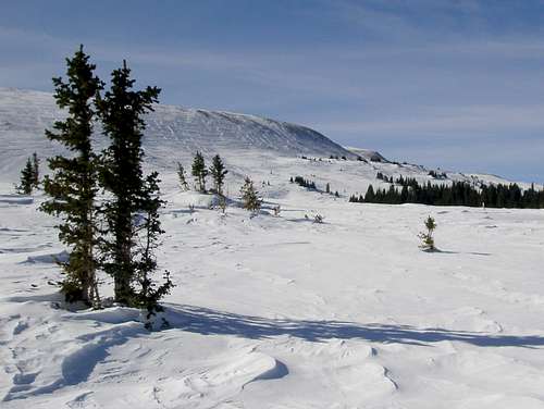
![Treeline]() Treeline
Treeline
I got to treeline and now it was a mental test as opposed to a physical challenge. It's hard knowing that you'll be out in the wind for over 9 miles with no respite. The snow was a mix of windblown powder and boilerplate crust, so little trail breaking was needed. The first time I did this route was in May 2010 on the way to Gilbert Peak, which is off to the side as you approach Gunsight Peak. On that trip I was able to ski all the way to the summit. Today, that was hard to imagine as exposed rocks were everywhere. I have learned to skirt the direct line to where the snow is better.
![Skirting the rocks]() Skirting the rocks
Skirting the rocks
Better, doesn't mean good and there are still lots of rocks. It is so windy that only in spring when the snow is wet and heavy is there any chance of them being covered. You don't go to the high Uintas to have a fun day of skiing, you go to get to the top.
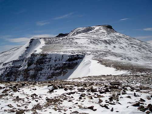
![North ridge of Gilbert and Gunsight]() Gunsight's north ridge
Gunsight's north ridge
Gunsight has a very wide, gentle, and exposed north ridge and this is what I was skiing on. There are no distinct landmarks until you reach a steep 80' vertical step at 12400'. The step has lots of huge rocks making it an ideal place to stash skis. The ridge gets rockier and rockier as you approach the step, but it's worth it to gingerly step over the small ones to make it to the big ones. Even with a GPS it's hard to find your skis if you lay them down in the middle of a featureless plain, especially when they may be covered by wind blown snow by the time you return.
![Gilbert Peak]() Below the step, looking up at Gilbert
Below the step, looking up at Gilbert
Below the step, you can't see the rest of the route to Gunsight, so I was just guessing that ditching the skis was the right thing to do based on how rocky it was below. I wouldn't have been happy if I got up there and found a smooth white surface. It turned out that I could have skied about .25 miles out of the 1.7 I had left. At first I was regretting my decision as I traversed high to stay on rocks, but when I realized how small the snow field was I was glad.
![Gunsight Peak]() Looking ahead to Gunsight
Looking ahead to Gunsight
![Gilbert Peak]() Looking back at Gilbert
Looking back at Gilbert
I crossed the saddle between Gilbert and Gunsight which I think must be the windiest spot in the whole Uintas. I was going super slow as I started the 640' climb to the top. I hadn't been very high this winter and I was really feeling the elevation. I had plenty of time to make it there by 3 and just took my time and rested a lot. I got to the top at 2:44. It was a nice clear day and I had great views in all directions. In my April 2011 trip it had been cloudy and the surrounding summits were all socked in. It was a thrill to see Kings Peak, Mount Emmons, and the ridge running between.
![Kings Peak and West Gunsight Peak]() Kings Peak and West Gunsight Peak
Kings Peak and West Gunsight Peak
It was a long slog to get back to my skis. I couldn't bear to do anymore uphill so I stayed low and plodded through the snowfield. It's always a relief to find the skis. I scraped off the accumulated ice and kept the kicker skins on for about a half mile to help me get through the worst of the rocks. Now it was time for some fun. Back and forth I went, zooming across the gentle slope on the hard, icy snow. I was going wicked fast even though it was mostly horizontal. My tracks had been totally obliterated by the wind in stretches and in others could barely be seen. Getting back to treeline was another mental milestone.
Now it was time to see how badly the sun had damaged the snow and how far I'd be sinking in. Before I got to my prebroken track, it was a fair amount in the trees. Areas that had held on the way up, now were like quicksand. The meadows however were great, they had an icy crunch to them and I got good glide even though they looked flat. It was getting close to 6PM and the snow was starting to cool off.
![Icy meadow]() Icy meadow
Icy meadow
Once I was back on the prebroken track along Joulious Creek the skiing was a delight. Just the right amount of glide without being too icy. However, the last mile back to the road is steep and wooded. Here is where I had some problems. If I deviated from my old track by so much as an inch, I was in up to my knee or more. My foot got really stuck once and it took 10 minutes to dig myself out. It was hard to do without knocking even more snow in the hole.
The last little stretch down to the Hole-in-Rock road is a steep open slope. I would have been going way too fast on my track. The snow was of such a cement like consistency that I pointed my skis straight down the unbroken snow and didn't move unless I double poled and even then would get stuck. Once back on the Hole-in-Rock road, I was sinking in even when I was exactly on my track. Fortunately, that stretch is only a quarter mile and soon I was on the main well tracked road a mere 2.7 miles from my car. It took 40 minutes and was a mix of icy double pole glide delight and a too soft snow slogfest. I was back at the car just after dark at 8:08PM, a 15 hour day.
West Gunsight Fail
After the effort expended on Gunsight I had neither the time nor the energy for any more trail breaking trips. I had one shot left to try for another 13000 footer, on the last day of winter, March 19th. The easiest peak was West Gunsight which is on your right as you head to Kings Peak from Gunsight Pass. Given the tracks I had seen on the main road, I was hopeful that there would be a broken trail to Elkhorn Crossing and from there the snow would be windblown and easier to break.
![Henrys Fork Basin]() Henrys Fork Basin, West Gunsight Peak on left
Henrys Fork Basin, West Gunsight Peak on left
I drove up the evening of the 18th, scoped out the trailhead, and was elated to see a parked car and fresh tracks. I set out the next morning and discerned that there were two people ahead of me, one of whom was pulling a sled. I fantasized that surely these people had the right stuff. Surely they were leaving camp right now on their way to Kings. All I had to do was ski in their tracks to make it to West Gunsight. Who knew, if their tracks didn't blow away maybe I could even make Kings myself.
I skied the 3.5 miles to the summer trailhead and then instead of following the summer trail, skied along the creekbed as had my predecessors. I noticed a lot of big snow collapses under their tracks, now well frozen. After 2.8 miles from the summer TH, the tracks sidestepped steeply out of the creek bed. Hmm, what to do, the creek bed was the optimal route, but surely these people knew what they were doing. They must be following the summer trail instead of the creek. Up the steep slope I went and found them still in camp at 8:25am, looking like they were in no hurry to go anywhere. They said they had planned to make it to Elkhorn the day before and Kings the current day, but the going was so tough they gave it up.
![Elkhorn Crossing]() Elkhorn Crossing
Elkhorn Crossing
I skied back to the creekbed and continued on. Now it was my turn to break trail and collapse, but it wasn't so bad, only one per half hour or so. I made a few navigation errors as it was so cold in the creek bed that I skimped on my GPS use. I made it to within a mile of Gunsight Pass dragging all the way. I was still tired from my 15 hour Gunsight trip 5 days ago and the 9 hour trail breaking trip 2 days before that. It was all OK because I had given it my best shot. By the time I got back to my car I had skied 24.5 miles, another long day. It would have been another 4 miles round trip to the summit and an additional 1800' of elevation gain, not possible this winter, but next year I'll do it for sure. Maybe.
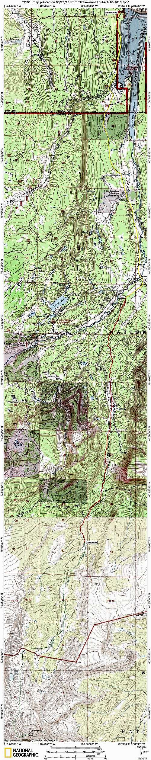
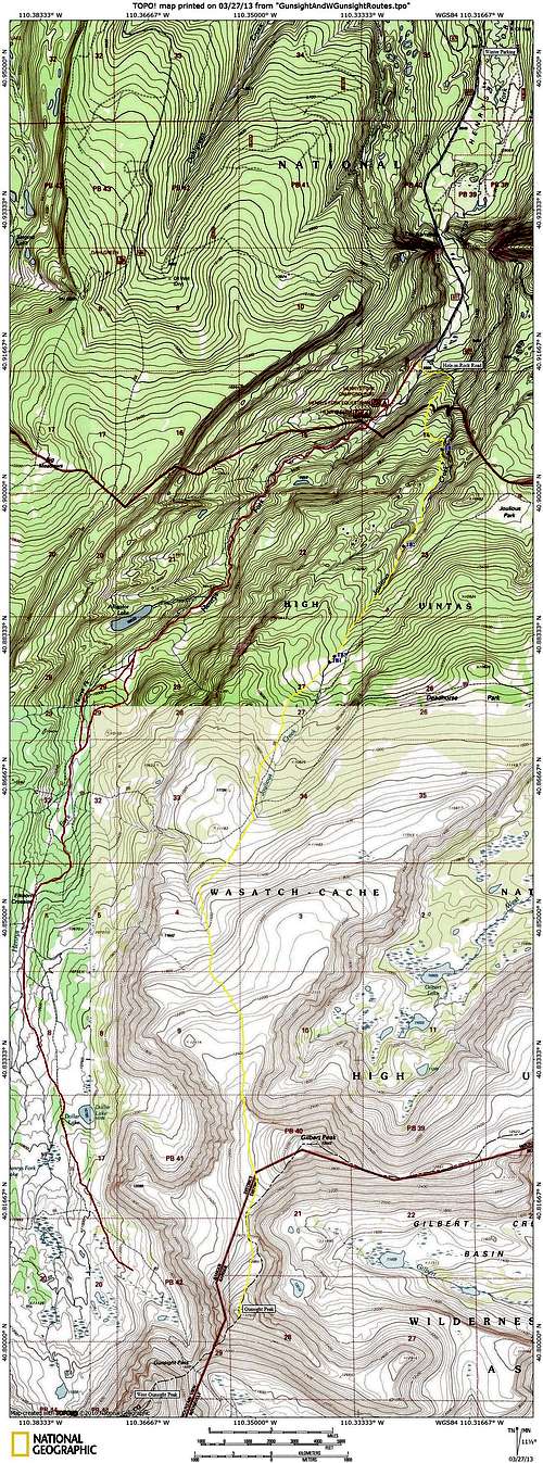
Trip Topos
![Tokewanna Topo]() Topo of Tokewanna trip
Topo of Tokewanna trip
| ![Gunsight/W Gunsight Topo]() Topo of Gunsight Peak trip and failed West Gunsight Peak trip
Topo of Gunsight Peak trip and failed West Gunsight Peak trip
|


Comments
Post a Comment