
Comments
No comments posted yet.
|
|
Trip Report |
|---|---|
|
|
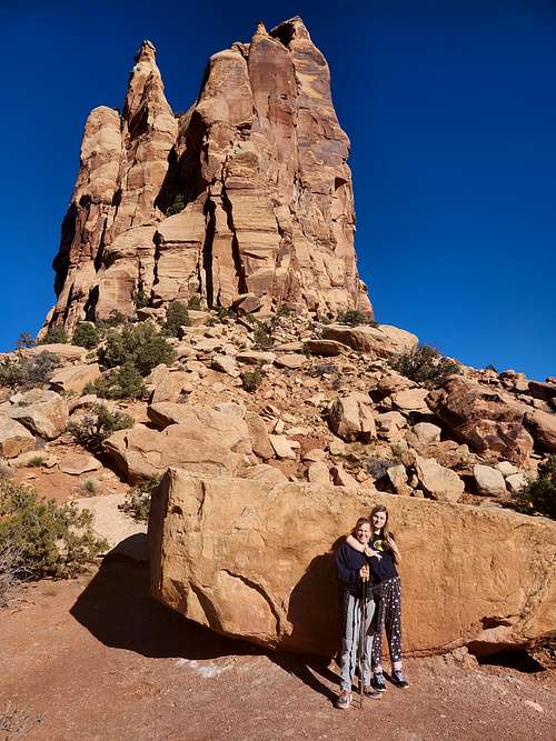
39.02216°N / 108.61754°W |
|
|
Jan 6, 2022 |
This is just a simple log to keep track of our 2022 trips.
See the 2021 Trip Log for 2021
See the 2020 Trip Log for 2020
See the 2019 Trip Log for 2019
See the 2018 Trip Log for 2018
See the 2017 Trip Log for 2017.
See the 2016 Trip Log for 2016.
See the 2015 Trip Log for 2015.
See the 2014 Trip Log for 2014.
See the 2013 Trip Log for 2013.
See the 2012 Trip Log for 2012.
See the 2011 Trip Log for 2011.
See the 2010 Trip Log for 2010.
See the 2009 Trip Log for 2009.
See also the 2008 Trip Log for 2008.
December 30: Dumaluan Beach (Philippines)
Early in the morning, Kim and I hiked the length of Dumaluan Beach.
December 29: Chocolate Hills/Tasier Reserve/Dumaluan Beach (Philippines)
Kim, Shaylee, and I first did the short hike up to the summit of one of the Chocolate Hills, which has some very unusual and impressive scenery.
We then headed for the Tarsier Reserve and did the short hike to see the tarsiers, one of the smallest and unusual primates in the world.
In the evening, Kim and I walked the length of the Dumaluan Beach.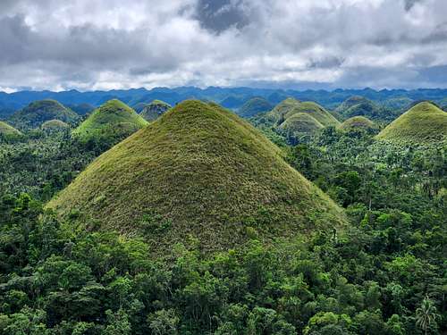
December 28: Dumaluan Beach (Philippines)
In the evening Kim, Shaylee, and I walked the entire length of Dumaluan Beach on Panglao Island. It was a nice beach walk and not very crowded.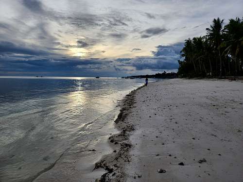
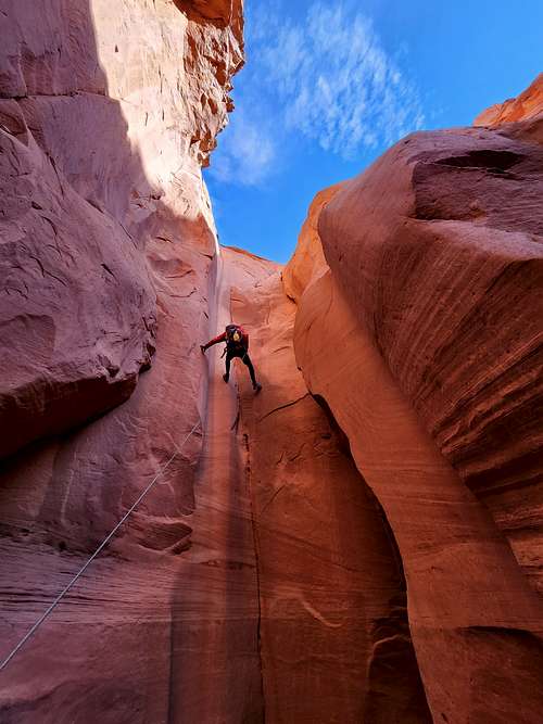
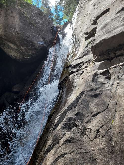
December 27: Kasawan (Philippines)
Kim, Shaylee, and I headed for Kasawan for canyoneering. We started with a zip line to near the start of the canyon, which we then hiked to.
The canyon had a lot of jumps, but no rappels. It was really popular, but was definitely in the top five most scenic canyons I have done. It was somewhat similar to Havasu in Arizona, but with more stalactites and in a green jungle setting. It was a great canyon and very spectacular.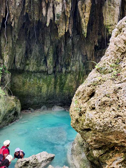
December 26: Tumalog Falls (Philippines)
Shaylee, Kim, and I hiked to Tumalog Falls on Cebu. It was beautiful, but a bit crowded. Most people ride motor bikes down, but we walked.
The pools made for nice swimming and the water was a pretty color.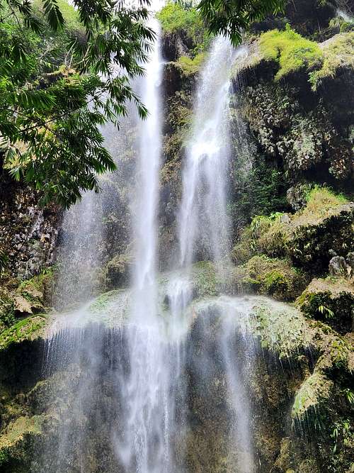
December 25: Moalboal Beach (Philippines)
Kim and I took an evening walk along the beach.
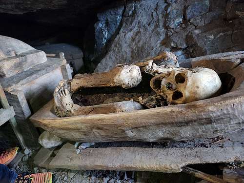
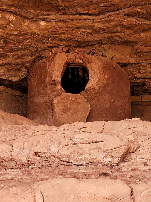
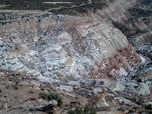
December 22: Pongasan Cave/Tinongchol Burial Rock/Opdas Cave (Philippines)
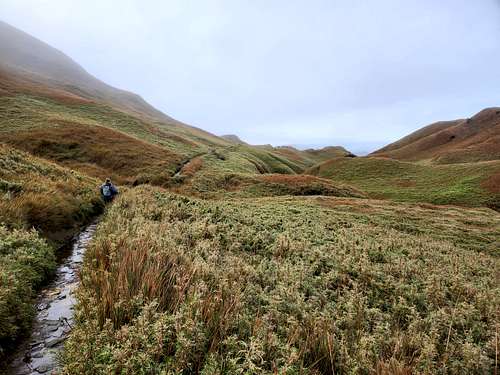
December 21: Mount Pulag (Phillipines)
Kim, Shaylee, and I (and the required guide) woke up at 1:15 AM to climb Mount Pulag. We started up the mountain at 2 AM. Most people started at 1 AM, but we were afraid of reaching the top too early so we left at 2. Even though we left an hour later than everyone else, we passed all of other groups (most people hike slow here!) and reached the top before anyone else today. It was still too early and we had to wait around for the sunrise, but it was too cloudy to see it anyway.
The trail up was not hard, but it was really muddy and wet since it had rained hard several days prior. On the way down the sun came out enough for some pretty good photos. After arriving at the trailhead mid morning we headed for Kabayan.
December 19: Mount Pinatubo (Philippines)
Shaylee, Kimberly, and I (with a required guide) hiked to the crater at Pinatubo after an exciting FJ40 ride. It was a beautiful hike and quite spectacular. There were interesting Aeta villages along the way as well. The crater lake was the highlight scenery wise and was really impressive. It was a great hike!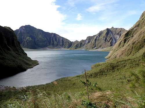
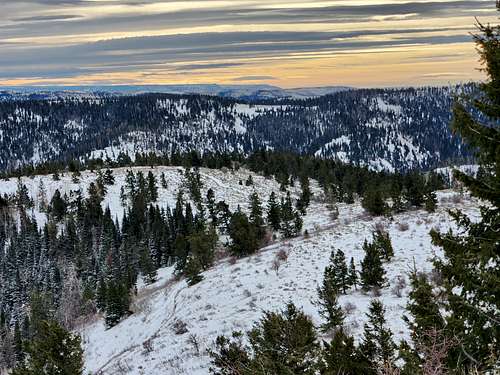
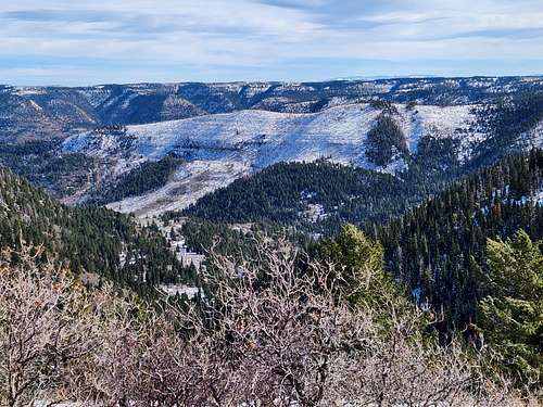
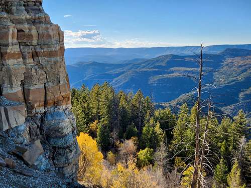
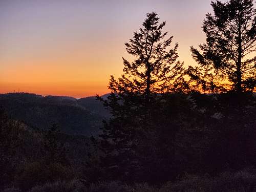
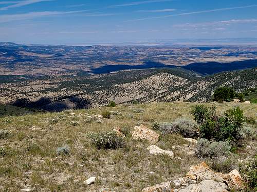
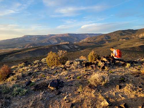
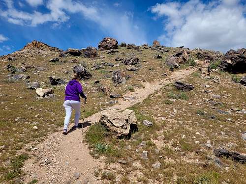
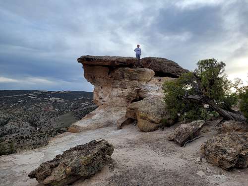
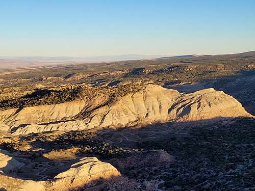
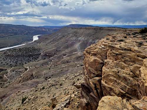
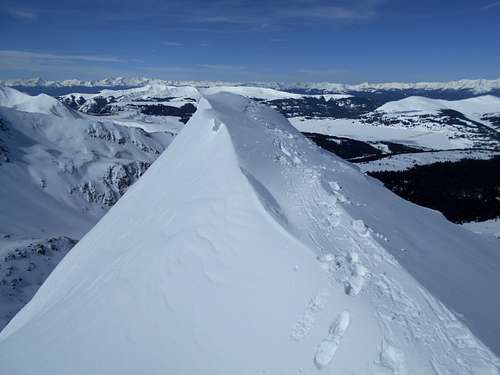
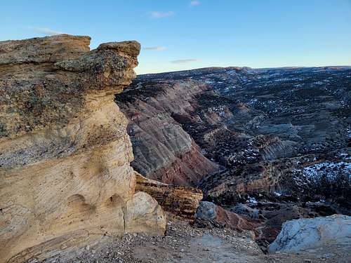
December 12: Peak 5750/Eagles Nest Rock (Colorado)
I climbed Peak 5750 and Eagles Nest Rock during a snowstorm. I really regret not taking the camera since the clouds around the cliffs were impressive.
December 10-11: Peak 5764/Anderson Mesa/Buck Mesa (Colorado)
December 10
December 9: Peak 5750/Eagles Nest Rock (Colorado)
Today I climbed Peak 5750 and Eagles Nest Rock on a nice December day. There wasn't much snow.
December 8: Canal Trail (Colorado)
At night, Kim and I hiked the Canal Trail. The mud was nice and frozen.
December 7: Canal Trail (Colorado)
At night and alone, I hiked the Canal Trail. There was some mud on the trail.
December 6: Peak 5944 (Colorado)
After work, I headed to go climb Pyramid Rock near Debeque, but when I got in the vicinity it was all fenced off and had closed signs. Instead I climbed Point 5944, a former soft ranked peak. It took a bit longer than expected and had nice views.
December 5: Serpents Trail (Colorado)
At night, Kim and I hiked the Serpents Trail top to bottom. It was a pretty mild night for December and there was no wind.
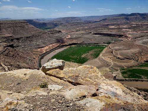
December 4: Rock Canyon (Utah)
On our way home from Salt Lake City, Kim and I stopped at Rock Canyon near Provo and hiked up the trail a ways before heading back. The views of Kyhv (formerly Squaw Peak) were spectacular. 
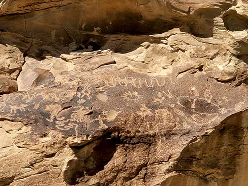
December 3: Double Arch Canyon/Petroglyph Canyon (Utah)
On our way to Salt Lake City, Kim and I stopped in the San Rafael Swell to hike up Double Arch and Petroglyph Canyon. Both are nice hikes and Spirit Arch is impressive. One of the petroglyphs was really well preserved as well. 
December 2: Peak 5750/Eagles Nest Rock (Colorado)
After work, I climbed Peak 5750 and Eagles Nest Rock right after sunset. It was a nice hike on a chilly evening and the moon was bright.
December 1: Douglas BM (Colorado)
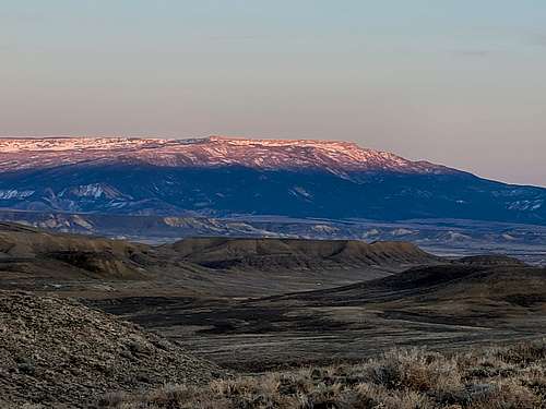
Early morning and before work, I hiked/postholed up Douglas BM from Douglas Pass. I didn't want to try and drive the dirt road which was covered in snow. I walked up the road and climbed a steep and tedious route (with deep snow in places) up the SW side of Douglas BM. I then headed down the east side, but when I got back to the road I noticed some No Tresspassing signs, so apparently you aren't supposed to go here, or at least they want to keep people away from the radio towers. 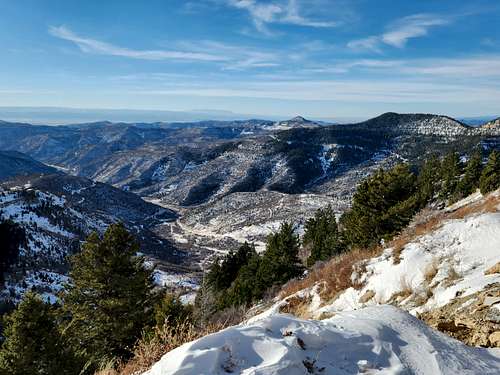
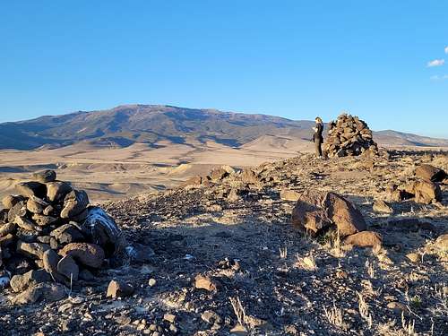
November 30: Opal Hill (Colorado)
After work, Kim and I did a loop hike over Opal Hill on a chilly, but nice day.
November 29: Dinosaur Hill (Colorado)
After work, Kim and I hiked the loop on Dinosaur Hill. 
November 28: Dome BM (Colorado)
I hiked up Dome BM early in the morning and before work. This will definitely be the last time I go up there this year as the roads were really dicey!
November 27: Riggs Hill (Colorado)
In the late afternoon and evening, Kim and I hiked the loop on Riggs Hill. The sunset at the end was spectacular.
November 26: Peak 5750/Eagles Nest Rock (Colorado)
Kim and I did a long loop combining several trails and the summits of Peak 5750 and Eagles Nest Rock on a cloudy, but nice day.
November 25: Highline Lake/Serpents Trail (Colorado)
In the daytime, Kim and I hiked the trail all the way around Highline Lake. We saw two bald eagles, many geese, and swans.
At night, Kim, Shaylee, Kessler, and I hiked the Serpents Trail top to bottom.
November 24: Jabba the Hutt a.k.a. Putterman's Nipple a.k.a. Castle Rocks North/McDonald Canyon (Colorado)
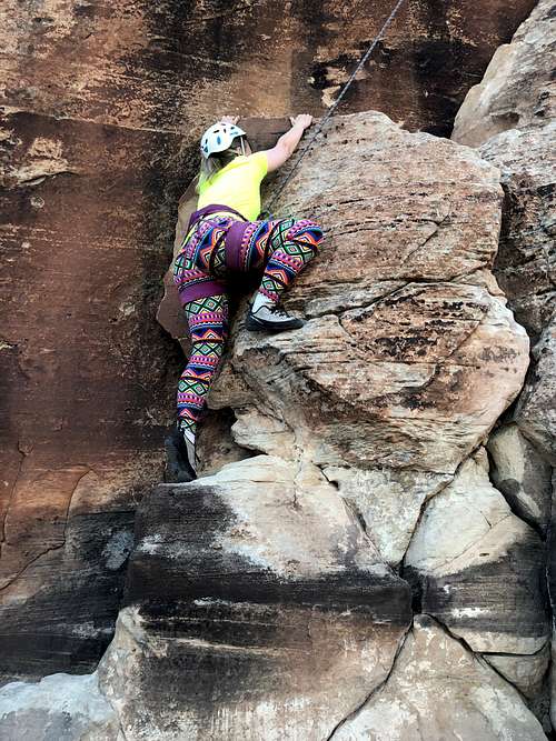
Jeff and I climbed Wind, Sand, and Snow on Jabba the Hutt a.k.a. Putterman's Nipple a.k.a. Castle Rocks North. Jeff led the first two pitches and I did the last one alone since Jeff didn't like the rock quality (I didn't like it either, but I really wanted to reach the summit!). It's a really neat looking formation, but the rock quality is poor and very sandy.
At the bottom of the route, I was getting off rope and a watermelon sized rock fell on my head. Luckily I was wearing a helmet so I didn't get seriously injured.
After doing the climb up the tower or blob Jeff, Kim, and I hiked to the pictographs in McDonald Canyon. 
November 23: Dome BM (Colorado)
I climbed Dome BM again, this time early in the morning.
November 22: Dome BM (Colorado)
In the afternoon I took a hike up Dome BM on a clear day with pleasant temperatures. Since the air was so clear, the long distance views were good.
November 21: Serpents Trail (Colorado)
At night, Kim and I hiked the Serpents Trail.
November 20: Mount Sniktau (Colorado)
Kim and I climbed Mount Sniktau on a breezy and cold, but beautiful day.
November 19: Wedding Canyon/Monument Canyon (Colorado)
Shaylee, Kim, and I hiked up Wedding Canyon and down Monument Canyon on a nice day. It was a great hike.
November 18: Dome BM (Colorado)
After work, I climbed Dome BM. Luckily it was cold enough that the road was still frozen. 
November 17: Devils Canyon (Colorado)
Kim and I hiked up Devils Canyon after work.
November 16: Dome BM (Colorado)
Before work and on a cold morning, I climbed Dome BM. The mud and snow was frozen, which allowed me to drive close enough to the peak to climb it before work. The views were really clear and I could even see Kings Peak in Utah from up there. 
November 15: Opal Hill (Colorado)
After work Kim and I climbed Opal Hill, making the loop hike.
November 14: Dinosaur Hill (Colorado)
After work, Kim and I met at Dinosaur Hill and completed the loop hike. It was a bit chillier than expected.
November 12-13: Coal Creek/Peak 4879 (Utah)
November 12
November 10: Peak 5180 (Colorado)
My project was shut down so I hiked Peak 5180 from the Whitewater Boat Ramp. It was a nice hike and slightly chilly for the area at this time of year.
November 8: Dome BM (Colorado)
After sunset, I hiked up the Dome BM in strong winds. It will likely be my last time up there this year since the road was pretty dicey getting here.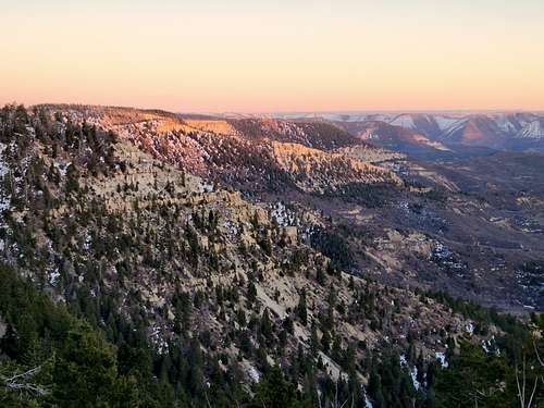
Novmeber 7: Serpents Trail (Colorado)
At night, Kim and I hiked the Serpents Trail under a bright full moon. It was warm for November and a very nice hike.
November 6: Mel Slot (Utah)
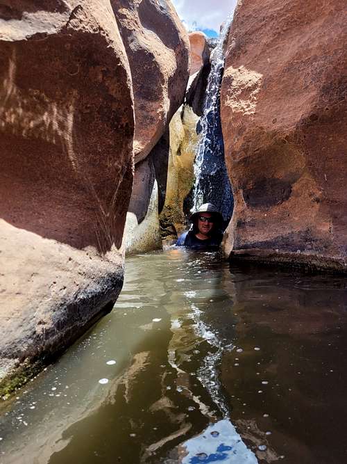
Danny and I canyoneered the Mel Slot south of Moab. It's one of the best canyons in the Moab area and was a really nice trip. There were several areas of water to stem over, but it was crystal clear. We also explored the next canyon to the west which had some really nice alcoves. 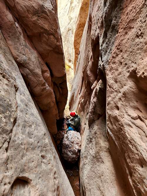
November 5: Canyon Pintado (Colorado)
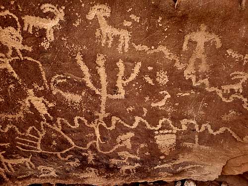
After work I hiked the Cow Canyon and East Fourmile Trails in Canyon Pintado. There are some nice pictographs and petroglyphs there.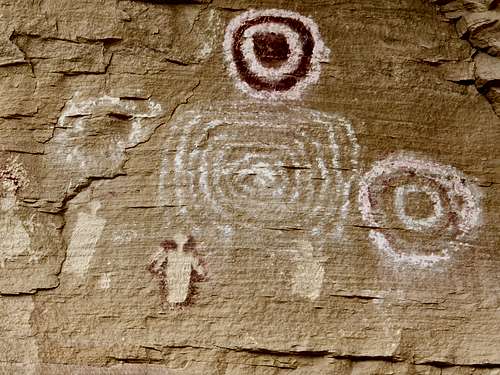
November 4: Canal Trail (Colorado)
Kim and I hiked the Canal Trail. It was pretty muddy and snowy.
November 3: Peak 5750 (Colorado)
At night I climbed Peak 5750. I forgot to bring the headlamp, but made my way in the dark. The way down was challenging since it started snowing hard.
November 2: Pike Ridge (Colorado)
Before work I climbed Pike Ridge just before sunrise. The road was actually pretty good since the snow and mud were frozen. There was some postholing, but it's a short climb. 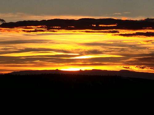
November 1: Dome BM (Colorado)
After work, I climbed Dome BM in the mud and snow.
October 31: Dome BM (Colorado)
Before work I climbed Dome BM, There was a quite a bit of wet snow to walk through. 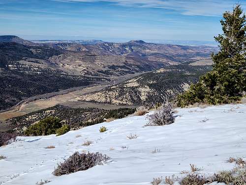
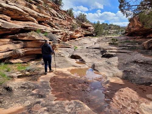
October 30: East Fork Shillelagh Canyon/Trail Through Time (Colorado/Utah)
In the morning, Allison, Nick, Frank, Steve, Kim and I canyoneered the East Fork Shillelagh Canyon, a pretty short, but nice canyon.
After completing East Fork Shillelagh Canyon Kim and I parted ways with the rest of the group and we hiked the Trail Through Time on the way home.
October 29: Butler Canyon (Utah)
In the evening, Kim and I hiked up Butler Canyon, a side canyon of North Wash. The sunset was nice.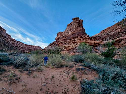
October 28: Canal Trail (Colorado)
At night, Kim and I hiked the Canal Trail.
October 27: Peak 5750 (Colorado)
My project was shut down because of the weather so I climbed Peak 5750 since that trail usually has little to no mud.
October 26: Devils Canyon (Colorado)
My project was shut down because of weather so Kim and I hiked Devils Canyon in the afternoon and evening. It was cloudy, but a nice hike.
October 25: Canal Trail (Colorado)
At night Kim and I hiked the Canal Trail.
October 24: Peak 5750/Eagles Nest Rock (Colorado)
My project got shut down today because of weather so I climbed Peak 5750 and Eagles Nest Rock. It was pretty with the new snow. 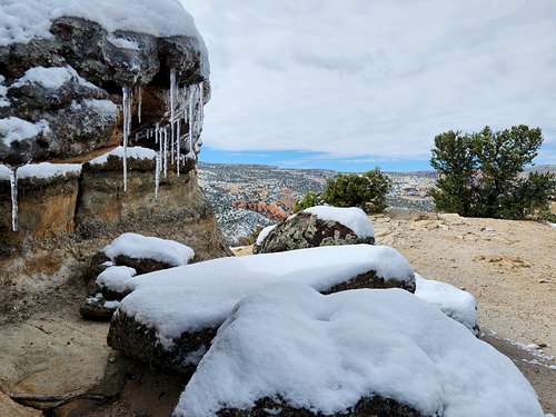
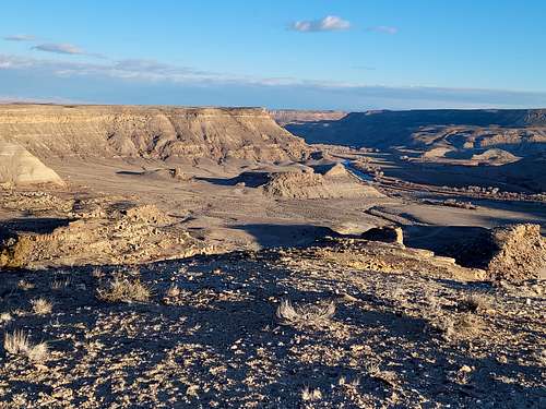
October 23: Grassy Knoll/Price River (Utah)
On our way back from the Salt Lake area, Kim and I stopped at Grassy Knoll/Prive River to hike to the petroglyphs and ruins. The road was washed out so we weren't able to drive as far as we thought we would, but we didn't mind the extra hike. The petroglyphs and ruins were interesting and the weather was good (though windy and cool) even though it was storming all around.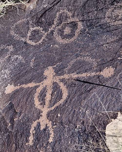
October 22: Avenues Twin Peaks (Utah)
My dad and I climbed the Avenues Twin Peaks from the Terrace View Trailhead, making a loop hike. It was rainy much of the time, but still a good hike.
October 21: Howard Canyon/East Salt Creek (Colorado)
Before work I did some short hikes around Howard Canyon and East Salt Creek.
October 20: Dome BM (Colorado)
Before work I made a quick hike up Dome Benchmark.
October 19: Serpents Trail (Colorado)
On a moonless night Kim and I hiked the Serpents Trail.
October 18: Colorado River Trail (Colorado)
At night, Kim and I hiked the Colorado River Trail.
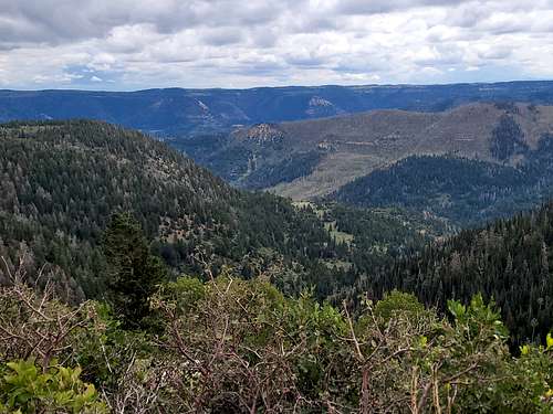
October 16-17: Fish Lake Hightop (Utah)
October 16
I had some time off so I backpacked to the summit of Fish Lake Hightop. In order to make it more of a hike, I hiked up Tasha Creek which is the long way up. The leaves were mostly gone, but there were still a few nice ones around. I had planned to camp half way up Tasha Creek, but it was dry except for the lower end so I hiked all the way up to Tasha Spring and camped at 11,430 feet.
October 17
It was a chilly 14F in the morning, but once the sun came out it was nice. I hiked to the summit boulders and then headed back down, packing up camp along the way.
October 15: Dome BM (Colorado)
After work I climbed Dome Benchmark.
October 14: Mack BM (Colorado)
After work I climbed Mack Benchmark on a nice evening. I reached the summit right at sunset.
October 13: Haystack 3 BM (Colorado)
After work I climbed Haystack 3 Benchmark on a sunny evening.
October 12: Dome BM (Colorado)
After work, I took a quick hike up Dome BM.
October 11: Rabbit Mountain (Colorado)
After work, I climbed Rabbit Mountain. I parked where the road got rough and walked the rest of the way. I did some exploring on top as well looking at various viewpoints. It was a neat little mountain.
The orginal plan was to climb peak 7017, but I found the road there to be gated and didn't have a good enough map to find an alternate route.
October 10: Lookout Mountain (Colorado)
After work I climbed Lookout Mountain near Douglas Pass. The road was too rough to take by my low clearance vechicle so I walked much of the road and climbed the north ridge of Lookout Mountain. As implied by the name, the peak has really nice views, but the peak is sort of a pain in the butt to climb and the north ridge was rather brushy.
October 9: Redlands Mesa (Colorado)
Kim and I hiked a big loop on Redlands Mesa. It was a nice hike on a nice day, but it appears that Mr. Bones was vandalized(?). 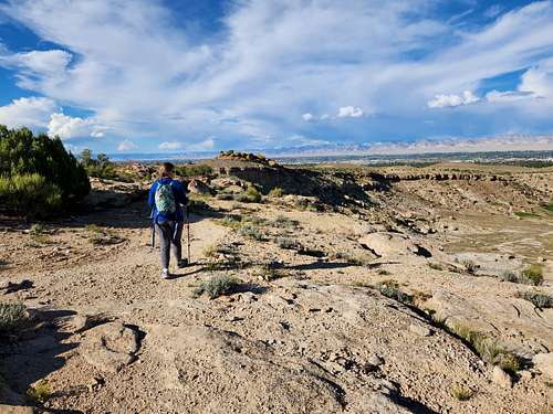
October 8: Peak 6700 (Colorado)
Early morning and before work I made of quick climb of Peak 6700 near Canyon Pintado. 
October 7: Texas Mountain (Colorado)
Before work I made a quick climb of Texas Mountain. 
October 6: Peak 7729/Dome BM (Colorado)
After work I climbed Peak 7729. Later, Kessler also joined me for a hike up Dome BM. Since the light was just right I noticed something rather interesting. Mt. Hillers and Mount Pennell in Utah were clearly visible from the summit of Dome BM. This was a surprise to me since they are so far away.
October 5: Serpents Trail (Colorado)
At night and under a bright moon, Kim and I hiked the Serpents Trail.
October 4: Rope Ridge (Colorado)
After work I hiked Rope Ridge (across from Rope Canyon) in the Douglas Creek area.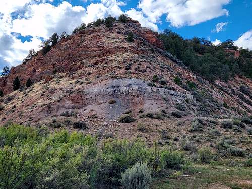
October 3: Canal Trail (Colorado)
After work, Kim and I hiked the Canal Trail.
October 2: Ball Mountain/Camp Hale-Colorado Trail (Colorado)
In the morning I climbed Ball Mountain near Leadville. It was cloudy or foggy much of the time, but when it cleared, the views were beautiful. It was well worth going and hiking through the fresh snow wasn't bad.
In the afternoon I wanted to see the autumn leaves so I hiked the Colorado Trail around Camp Hale. The autumn leaves are right at peak and it was a nice hike.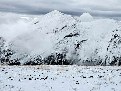
October 1: Peak 5750/Eagles Nest Rock (Colorado)
Kim and I climbed Peak 5750 and Eagles Nest Rock. It was a rainy day and about 2/3 of the hike was in the rain, but the trail doesn't get that muddy and it was still a great hike.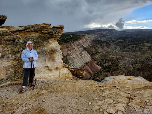
September 29: Texas Mountain/Dome BM (Colorado)
After work I climbed Texas Mountain alone and Dome BM with Kessler. Both were nice hikes and we got lucky and missed the rain.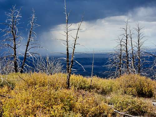
September 28: Canal Trail (Colorado)
Another night hike with Kim.
September 27: Canal Trail (Colorado)
Kim and I hiked the Canal Trail at night.
September 26: Riggs Hill (Colorado)
At sunset I climbed Riggs Hill, making the loop hike.
September 25: Elder Spring Canyon (Utah)
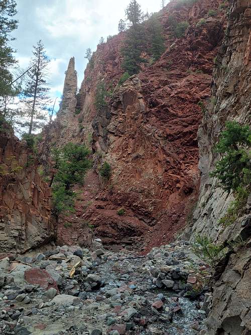
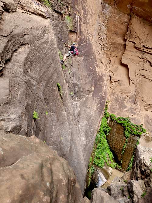
Five of us, including Justin, Mark, Charles, and Don made the first descent of Elder Spring Canyon in Dinosaur National Monument.
The approach was a bit strenuous, but it was a pretty good canyon scenery wise. There were three rappels uo to 200' in length. For the last one, we had to throw rocks down the drop in order to build a deadman anchor, but a piece of a big rock hit my backpack and crushed my cell phone (which is why several of the below entries are missing photos).
Other than that, the trip went well, but there was a bit of annoying bushwhacking at the end.
September 24: Peak 7208 (Colroado)
This peak south of Rangely was a bigger adventure than expected. I climbed it after work. I didn't have a map so I tried to get there with Google maps. I ended up well to the south of the peak and made the climb from there, passing two good roads along the way.
Eventually I reached the summit, but by the time I got back to the car there was no time to try an additional peak.
September 23: Canal Trail (Colorado)
At night, Kim and I hiked the Canal Trail.
September 22: Colorado River Trail (Colorado)
At night, Kim and I hiked the Colorado River Trail.
September 21: Colorado River Trail (Colorado)
At night and alone, I hiked the Colorado River Trail.
September 20: Echo Canyon Trail (Colorado)
At night, Kim and I hiked the Echo Canyon Trail.
September 19: Texas Mountain/Peak 7729 (Colorado)
After work, I hiked up Texas Mountain and then headed over and climbed Peak 7729. Texas Mountain has a road within a few feet of the top, but I parked early and walked in order to climb the mountain. Peak 7729 has no trail. Both were nice mountains with good views.
September 18: Crag Crest (Colorado)
I climbed Crag Crest on a nice day. The views were nice, but the autumn leaves hadn't changed yet.
September 17: Jones Canyon Overlook (Colorado)
Kim and I hiked to near the Jones Canyon Overlook. It was a beautiful hike, but much of the trail was covered in cheat grass.
September 16: Opal Hill (Colorado)
Before work, I climbed Opal Hill, completing the loop hike.
September 15: Dome BM (Colorado)
After work, I hiked up Dome BM. There were some hunters about.
September 14: Canal Trail (Colorado)
At night Kim and I hiked the Canal Trail.
September 13: Peak 5750/Eagles Nest Rock (Colorado)
At night I hiked up Peak 5750 and Eagles Nest Rock. It has just rained and was a pleasant trip.
September 12: Dome BM (Colorado)
After work, I hiked up Dome BM.
September 11: Cress Creek (Idaho)
Kim and I hiked the loop trail at Cress Creek and then hiked the trail along the Snake River afterward. After that we started the long drive home. It was a nice hike.
September 10: North Menan Butte (Idaho)
Kim, Shaylee, and I hiked up North Menan Butte and made the loop along the crater rim. It was smoky with wildfire smoke, but otherwise a nice hike up an interesting volcano.
September 9: Sterling Hollow (Utah)
On our way up to Idaho Kim and I stopped in Spanish Fork Canyon to hike up Sterling Hollow on a nice evening.
September 8: Pike Ridge (Colorado)
After work I took a hike up Pike Ridge.
September 7: Dome BM (Colorado)
Before work, I took a hike up the Dome BM. It was very warm for this altitude.
September 6: Dome BM (Colorado)
Before work, I took a hike up the Dome BM.
September 5: Peak 5750/Eagles Nest Rock (Colorado)
Early in the morning and before it got hot, I climbed Peak 5750 and Eagles Nest Rock.
September 3-4: West Elk Peak/Goat Peak (Peak 12,968) (Colorado)
September 3
Kim and I started from the Mill Castle Trailhead and hiked up to 11,260 feet in Mill Creek before setting up camp. The hike sure was beautiful and was one of the most scenic approaches that I have done in Colorado. The castle like rocks were really impressive.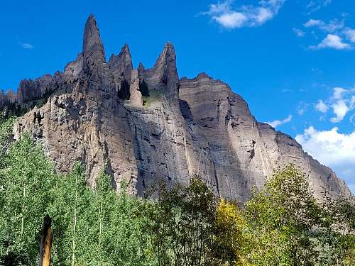
September 4
Kim didn't sleep well, so I set off alone to climb West Elk Peak. It was another really scenic hike. I also climbed Goat Peak (Peak 12,968) along the way. I met two others on the mountain. After enjoying the summit, I headed back to camp and we hiked back to the trailhead. It was a great trip.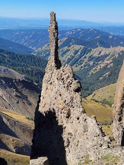
September 2: Liberty Cap Trail/Monument Mesa (Colorado)
Today I hiked the Liberty Cap Trail from the top to the overlook of Ute Canyon. I then backtracked and climbed Monument Mesa. Even at the moderate altitude, it was hot!
September 1: Dome BM (Colorado)
On my way back from work, I climbed Dome BM.
August 31: Canal Trail (Colorado)
At night, Kim and I hiked the Canal Trail.
August 30: Dome BM (Colorado)
After work, I made a quick hike up Dome BM.
August 29: Dome BM (Colorado)
Before work I made a quick hike up Dome BM near Douglas Pass.
August 27-28: Crestones Traverse (Colorado)
August 27
In the evening, Kessler and I hiked up to Lower South Colony Lake and set up camp. It was an easy walk, but it was raining much of the time. 
August 28
August 26: Dinosaur Hill/Sayles Canyon (Colorado)
Early in the morning and on the way to work, I hiked the loop on Dinosaur Hill.
In the afternoon while it was raining, I took a short walk up Sayles Canyon to the private property line since the project was shut down for an hour.
August 25: Peak 8582 (Colorado)
Late in the evening I climbed Peak 8582 near Douglas Pass. It was short, but more challenging than expected and was steep, brushy, and loose.
August 24: Pike Ridge (Colorado)
Before work, I hiked up Pike Ridge near Douglas Pass.
August 23: Dinosaur Hill/Peak 6700 (Colorado)
I left early in order to climb Dinosaur Hill before and on the way to work. I got bit by someone's dog, but it didn't break any skin. When I arrived at work between Douglas Pass and Rangely, I learned that the plant was broken down, so I made a quick climb of Peak 6700. The views were pretty nice, but there's a maze of natural gas roads in the vicinity.
August 22: Opal Hill (Colorado)
On my way to work, I made a quick climb of Opal Hill.
August 20-21: Gray Head Peak/Peak 9463/Road BM (Utah)
August 20
Kim and I were originally going somewhere else, but the highway through Spanish Fork Canyon was closed due to flooding and an accident. We did bring maps of the area so headed instead towards the Gray Head Peak area since I was familiar with it, having visited in 1998. The heavy rain stopped right when we got into the area of the highway pass on the Arglyle Ridge, it stopped raining. We turned on to FR 324, but it was too muddy to drive so we parked there. We hiked north along FR 324 and FR 114 to its end and then headed north along a faded trail to the summit of a hill where there was a good place to camp. The sunset was really spectacular.
August 21
In the morning, Kim and I headed up the ridge to the north over several sub-peaks to the ranked Peak 9463. There were some nice bristlecone pines in the area. Some parts of the route were steep, but it wasn't too bad. After a brief stop at Peak 9463, we headed down to the saddle and climbed Gray Head Peak. The views were really nice and it was an interesting peak. We then headed back to camp, packed up, and hiked back to the highway.
August 19: Dome BM (Colorado)
After work, I hiked to Dome BM next to Douglas Pass.
August 18: Brushy Point/Canal Trail (Colorado)
After work, I climbed Brushy Point. I walked much of the road there because I didn't want to drive it. I tried to climb the north ridge, but that was a mistake due to brush, so I headed back down and circled over to the south side. From there it was an easy ascent. Later that night, Kim and I hiked the Canal Trail.
August 17: Canal Trail (Colorado)
At night, Kim and I hiked the Canal Trail.
August 16: Dome BM (Colorado)
After work, I hiked to Dome BM next to Douglas Pass.
August 15: Dome BM (Colorado)
After work, I hiked to Dome BM next to Douglas Pass.
August 14: Lower Oak Creek (Colorado)
A group of nine of us descended Lower Oak Creek. It was a good canyon, but some of the people weren't so good at canyoneering so it took a while. The longest rope got core-shot at the big rappel as well and two in the party had to retreat.
August 13: Rink Wall (Colorado)
Kessler and I were in Ouray late, so we climbed Left Handed Blunt and Sesame Street at the Rink Wall. They were only 5.4, but it was night so it made it more exciting.
August 12: Dome BM (Colorado)
After work, I hiked to Dome BM next to Douglas Pass.
August 11: Dome BM (Colorado)
After work, I hiked to Dome BM next to Douglas Pass.
August 10: Dome BM (Colorado)
After work, I hiked to Dome BM next to Douglas Pass.
August 9: Serpents Trail (Colorado)
At night, Kim and I hiked the Serpents Trail. It was a nice night.
August 8: Pike Ridge/Barrel Springs Ridge (Colorado)
After work, I climbed Pike Ridge and Barrel Springs Ridge.
August 7: Ridge Trail/Black Pine Trail (Colorado)
Today I hiked a loop at Pinyon Mesa. I started at the eastern terminus of the Ridge Trail and hiked the trail to the Junction of the Black Pine Trail. I then hiked that trail (which doesn't see much use) down to Black Pine Lake and then east to the road. From there I walked the road back to the vehicle.
August 6: Peak 5750/Eagles Nest Rock (Colorado)
Alone and at night, I climbed Peak 5750 and Eagles Nest Rock.
August 5: Canal Trail (Colorado)
Alone and at night, I hiked the Canal Trail.
August 4: Canal Trail (Colorado)
Alone and at night, I hiked the Canal Trail.
August 3: Crag Crest (Colorado)
Kim and I climbed Crag Crest in the afternoon. It was a nice day with nice weather and the views were great.
August 2: Haystack 3 BM (Colorado)
Shaylee and I climbed Haystack 3 BM early in the morning.
August 1: Black Ridge Trail (Colorado)
Kim and I hiked the Black Ridge Trail at sunset. It was a nice evening hike with some refreshing light rain.
July 31: Lost Lake (Colorado)
Shaylee, Kim, and I hiked to Lost Lake on Grand Mesa. We visited the other lakes along the way too.
July 30: Pinyon Mesa (Colorado)
To escape the heat, Kim and I headed up to Pinyon Mesa. It was nice and cool up there and there were actually several piles of hail around (we missed the hailstorm)! It rained a little, but we had a pleasant hike. We went up the Turkey Flats Trail and then made a loop hike going up the Haypress Trail to the Ridge Trail, along the Ridge Trail, and down to Fruita Reservoir #1, and then back to the Turkey Flats Trail. It was a great hike.
July 29: Peak 5750/Eagles Nest Rock (Colorado)
Alone and at night I climbed Peak 5750 and Eagles Nest Rock.
July 28: Peak 9060 (Colorado)
After work I climbed Peak 9060 on the Roan Plateau. I planned to head over to Pike Ridge, but there was a locked gate on the road so I had to backtrack down to Douglas Creek.
July 27: Peak 5750/Eagles Nest Rock (Colorado)
At night, I climbed Peak 5750 and Eagles Nest Rock.
July 26: Dome BM (Colorado)
After work, I stopped to do a hike up Dome BM near Douglas Pass.
July 25: Canal Trail (Colorado)
At night, Shaylee, Kim, and I hiked the Canal Trail.
July 24: Gunny Loop (Colorado)
Starting after sunset, Kessler, Shaylee, Kim, and I hiked a section of the Gunny Loop. The kids were way ahead of us most of the time.
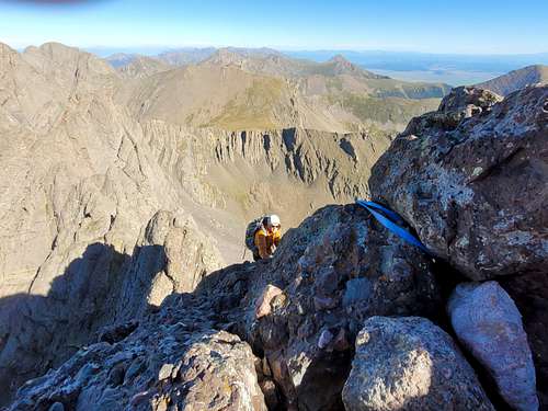
July 22-23: Kit Carson/Challenger Point (Colorado)
July 22
The trip was a fiasco. I had to work in the morning so didn't leave until later than I expected. I then got caught in construction near Gunnison and I was stopped for an hour and a half vs. the 8 minutes on Google maps. With a late start in the evening, I started up the trail only to find that I forgot the sleeping bag. I headed back down the trail. I considered going all the way to Alamosa to get a sleeping bag, but that would postpone me a day. In Crestone, the second hand store had just closed, but they opened it back up so I could buy a small blanket. I knew that this would make for a cold night, but I headed up the mountain anyway. I headed up the trail and found a campsite at 11,260 feet just after the creek crossing. I set up camp there. I didn't get any sleep during the night because I was cold and because there was a bear snorting around camp.
July 23
Since I wasn't asleep anyway, I started at 3:30 AM. I got off route and ended up on the wrong side of Willow Lake, but pushed a route in the dark to above the waterfall. The route wasn't easy and I lost quite a bit of time. I located the corrected trail and headed up Challenger Point. The first 1/3 or so of the route was a pleasant hike up, but the latter 2/3 of the slope consisiting of scree wasn't a very fun climb, but I eventually reached the summit. My knees were hurting because of my spontaneous joint fusion which made me really slow. I then descended to the saddle and headed along the neat little ledge system to the final gully leading to Kit Carson Peak. It was aslo a scree slog. After resting on the summit for a few mninutes, I headed back down. My knees hurt so I had to go slow. It took me 12 hours round trip from camp to the summit of Kit Carson and back! After reaching camp, I packed up and headed back down. I got some pizza in Crestone and drove all the way home that night. Long day!
July 21: Dome BM (Colorado)
After a work meeting north of Douglas Pass, I hiked up Dome BM. I parked a couple of miles before the summit and walked the rest of the way.
July 20: Serpents Trail (Colorado)
I walked up the Serpents Trail at night. Even at night it wasn't that cool (temperature wise), but it was a lot cooler than in the day!
July 19: Dinosaur Hill (Colorado)
Early in the morning I did the loop hike on Dinosaur Hill.
July 18: Peak 5750/Eagles Nest Rock (Colorado)
Early in the morning, I climbed Peak 5750 and Eagles Nest Rock. It was surprisingly warm and humid for early in the morning, but there was some relief since I soaked myself before starting the hike.
July 17: Red Creek (Colorado)
I explored Red Creek in the San Juans today. It was pretty, but not as good as some of the slots near Ouray. The road was really rough for my RAV4 Hybrid, but I made it to just before the forest boundary. Getting back was really sketchy because the road was slippery after rain.
On the drive back, I saw a bear. It was light brown/cinnamon in color.
July 16: Big Dominguez Canyon (Colorado)
Kessler and I canoed the Gunnison River from Escalante Creek to Bridgeport. Near the end we stopped at Big Dominguez Creek to do a short hike to and around the waterfall.
July 15: Black Ridge (Colorado)
I climbed Black Ridge from the south via a fairly steep route. I soaked myself with water before making the climb in order to cool off. I don't think I'll do this one again. Although I went up a trailess route, there are signs on the road saying not to go around the radio towers.
July 14: Peak 5750/Eagles Nest Rock (Colorado)
At night, I climbed Peak 5750 and Eagles Nest Rock. The temperature was pretty pleasant.
July 13: Haystack 3 BM (Colorado)
Early in the morning I climbed Haystack Benchmark from the west.
July 12: Peak 5750/Eagles Nest Rock (Colorado)
At night, Kim and I hiked Peak 5750. I aslo climbed Eagles Nest Rock.
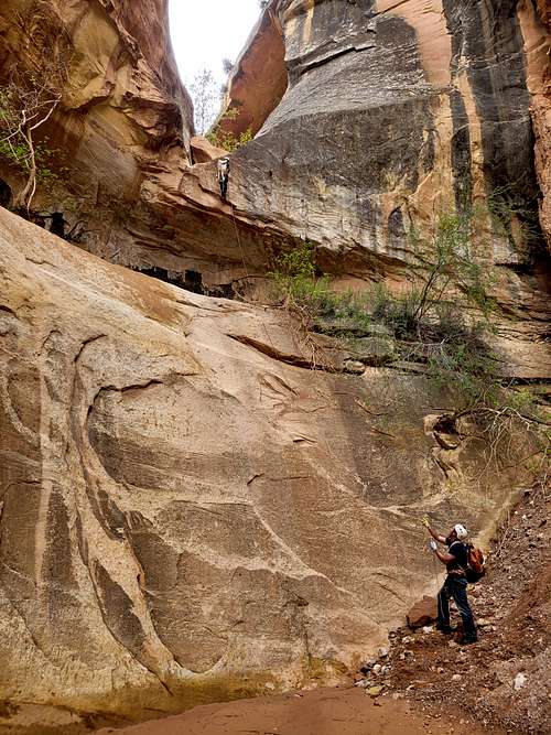
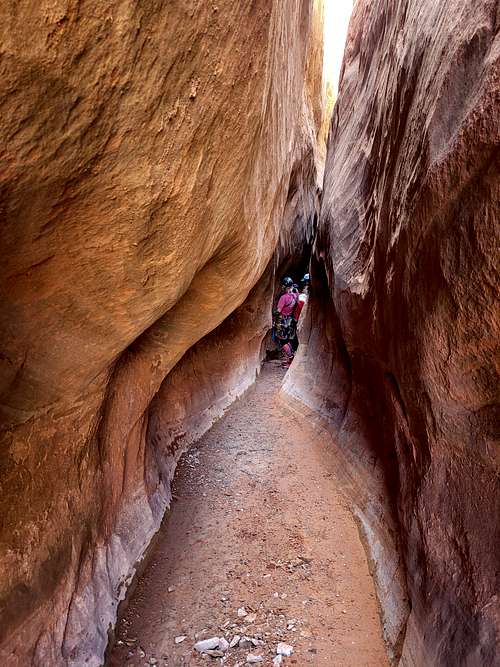
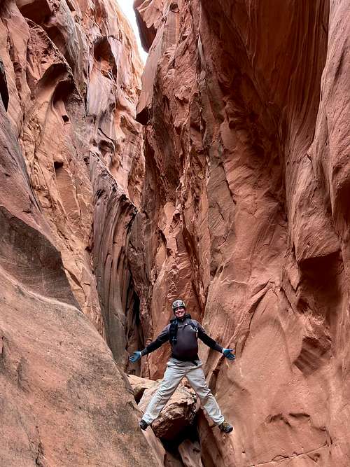
July 11: Water Canyon/Mossy Cave/Willis Creek/Bull Valley Gorge Rim (Utah)
Justin, Kim, and I first headed to Water Canyon and Mossy Cave. We hiked to Mossy Cave and then the waterfall. After that we headed for Willis Creek.
Willis Creek is supposed to be a perennial creek through a slot canyon, which is relatively rare in this region. Unfortunately though, the creek was dry because of the drought! We walked though all the slots, but it was disappointing not to have a flowing creek, especially because it was a hot day. After Willis Creek, we headed for Bull Valley Gorge, but we just rim walked the upper end since there were a lot of clouds and some thunder.
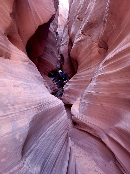
July 10: Mystery Canyon (Utah)
In the morning, Kim decided she didn't want to do Mystery Canyon, so instead of wait for the shuttle, Kim dropped Justin and I off at the trailhead. This was a good think since it would be a hot day. We made good time to the head of Mystery Canyon at Blew By Peak and we found the route down. The Death Gully seemed worse than I had remembered it; at least the top part. We desceded the Death Gully, this time doing several rappels. On my first trip through in 2007, we downclimbed everything in the Death Gully and downclimbed everything in Mystery Canyon except for three rappels in the Rock Narrows and the two end rappels. It was interesting to see how skilled we were at downclimbing 15 years ago; I wouldn't do several of the downclimbs today. We made our way to the Rock Narrows and enjoyed that slot (though it was too short!), passing another group along the way. After the Rock Narrows, the canyon widens and was getting really hot. The "lake" in the canyon was completely dry and it was a bit strenous to climb over the rockfall dam in the heat.
Although a lot of the canyon is average by Zion standards, the canyon does have one of the coolest endings around. We did the big rap at Mystery Springs and finally got a dip in a deep pool. From here on the canyon was wonderful and wet. We downclimbed one waterfall and waded some deep pools before arriving at the top of the final rappel into Zion Narrows. A lot of people were watching us from the Narrows! One person even grabbed the rope from the bottom while I was trying to get on rappel! After doing the rappel, we hiked down the Zion Narrows and called Kim to come pick us up. It was a good canyon and the only bad part was the hot section between teh Rock Narrows and Mystery Springs.
July 9: Orderville Canyon (Utah)
Kim, Justin, and I went through Orderville Canyon. Unfortunately the shuttle we took didn't leave the visitor center until 9:30 AM. I had called the shuttle to see if they drop off at the 4wd drive trailhead and they told me yes, but they actually did not. After the drive and walking the 4wd road, we didn't arrive at the real trailhead until just after noon. This made for a really hot walk through Orderville Canyon and made the hike less enjoyable that usual. Although scenic, because of the heat it was kind of a slog to the beginnig of the water in the canyon. From there on the canyon became much more pleasant and there was a lot of wading, swimming, and some refreshing short jumps. Paradise. We enjoyed this part of the canyon before reaching the Zion Narrows. From there it was a nice walk down to the Temple of Sinawava. It was a pretty long day. I wish the first 2/3 of the hike were cooler as it made for a tiring day in the heat.
July 8: Benson Creek (Utah)
After leaving Grand Junction and arriving in the afternoon, Kim, Justin, and I headed for Benson Creek. The hike up was hot, as expected, but once we reached the canyon, things got better. What a nice canyon and an incredibly pleasant one in hot weather. It was pretty short, but a really fun one and really pretty as well. It was also a basalt slot canyon, which is rather unusual in Utah.
July 7: Canal Trail (Colorado)
Just after sunset, Kim and I hiked the canal trail.
July 6: Peak 5750/Eagles Nest Rock (Colorado)
At night, I hiked Peak 5750 and Eagles Nest Rock. It was pleasantly cool.
July 5: Peak 5750/Eagles Nest Rock (Colorado)
On a nice evening, Kim and I hiked Peak 5750 and Eagles Nest Rock.
July 4: Big Dominguez Canyon (Colorado)
My dad, Shaylee, Kim, and I hiked up Big Dominguez Canyon to the first four petroglyph panels. It wasn't too hot for July since we could soak clothes and hats in the first waterfall.
The petroglyphs were nice.
July 1-3: Mount Eolus/North Eolus/Sunlight (Colorado)
July 1
The trip got off to a rough start. The weather forecast was bad for the weekend and in the morning we found that Shaylee had forgotten her shoes. She only had Crocs.
My dad, Shaylee, and I rode the Durango Silverton Train to Needleton and started hiking from there. We made it to Chicago Basin, but much of the hike was in the rain. The evening was pretty clear though.
July 2
We awoke to clear skies and 36 degrees F. Perfect. My dad, Shaylee, and I headed for Twin Lakes, but Shaylee and I split from my dad part way up. Shaylee made it to 13,000 feet or so in her Crocs, but that was about all she could manage in those shoes, so she headed down. I continued up to the saddle between North Eolus and Eolus. I climbed Eolus first. It was a bit spicier than I expected. I then headed back to the saddle and climbed North Eolus. It was a fun little scramble and pretty easy. I then headed back to camp. The weather held.
At around 7 PM and when we were eating dinner, the rain started.
July 3
It rained most of the night. Shaylee and I also found that our tent leaked and water dripped on our heads all night long. In the morning and in the rain, I set off to climb Sunlight Peak, hoping that it might clear later. I rained hard the whole way up towards Twin Lakes. Short of the lake, I gave up and gave back down. I didn't want Shaylee to have to wait in the rain either.
We packed up camp and then headed down to Needleton, where we caught the train a day early. Missing the summit of Sunlight Peak was a bitter blow to me since I don't think I'll be able to make it back this year and I was hoping to finally finish off the 14ers.
June 30: Peak 5750/Eagles Nest Rock/Dinosaur Hill (Colorado)
Early in the morning, my dad and I climbed Peak 5750 and Eagles Nest Rock. I had to go to work after that. In the afternoon, my dad, Kim, and I hiked Dinosaur Hill before visiting the Dinosaur Musuem.
June 29: Serpents Trail (Colorado)
My dad, Kim, and I hiked the Serpents Trail on a pleasant evening. It even rained a little, which is always nice this time of year. There was a lot of thunder as well. The clouds made for a spectacular sunset.
June 28: Peak 5750/Eagles Nest Rock (Colorado)
In the morning, Kim and I hiked Peak 5750 and I also climbed Eagles Nest Rock.
June 29: Dinosaur Hill (Colorado)
In the evening, Shaylee, Kim, and I hiked Dinosaur Hill.
June 26: Kannah Creek (Colorado)
Shaylee, Kessler, and I hiked the Kannah Creek Trail in the evening. It was surprisingly cool for late June.
June 25: Aztec Creek (Arizona)
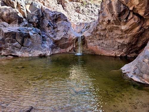
Nathan, Kim, and I hiked down to Aztec Creek from Round Rock. We also poked around some technical slot canyons to scout out some routes for a future trip. We hiked down through the narrow section to some nice small waterfalls and big swim holes. After enjoying a swim, we headed back up to the rim. It clouded up and some rain fell, which was really nice because we expected the hike out to be brutally hot.
June 24: Cha Canyon (Utah)
Nathan, Kim, and I headed for Cha Canyon on the Navajo Reservation. Although I have read a report of someone hiking the canyon, they bypassed the technical part and waterfalls. We wanted to explore the technical part directly. We started at the North Rainbow Trailhead and hiked to Cha Canyon. It was disappointingly dry, but we headed down canyon hoping to get to water, waterfalls, and swimming holes. We passed a few old ancestral pueblo ruins, but still the canyon was dry. I was really hoping that we would reach water soon. We passed a wild horse along the way so we knew that there must be water somewhere. Once we got near the west fork of the canyon, there was a big downclimb down to the first swim. Water at last! We swam through a few pools before deciding to explore the West Fork. We all headed up the beautiful creek to a waterfall and pool. Nathan and I climbed around the pool and went up canyon before dropping into the West Fork again. We headed down canyon and had a few big pools of water to swim before we could slide down the waterfall and make it back to the main fork. The canyon was really wet and beautiful below this. There was some minor bushwhacking in places. We made it to the next waterfall, which we rappelled into a huge pool. It was a beautiful spot. We then explored down canyon a ways before deciding that it was time to turn back.
We then bypassed the rappel and headed back up canyon. We hiked out the East Fork, which turned out to be a pretty easy route. It was a great day.
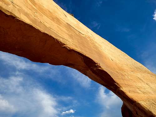
June 23: Wilson Arch (Utah)
On the way to Mexican Hat (where we spent the night), Kim and I did the very short hike up to Wilson Arch. It was right at sunset which made it extra beautiful.
June 22: Peak 5750/Eagles Nest Rock/Echo Canyon (Colorado)
Very early in the morning I hiked up Peak 5750 and Eagles Nest Rock. In the evening Shaylee and I hiked Echo Canyon in Colorado National Monument.
June 21: Good Vibes/Snakeskin/First Flat Loop (Colorado)
At night and by headlamp Kim, Shaylee, and I hiked up the Good Vibes Trail, then down Snakeskin, and then along the First Flat Trail, making a loop (or perhaps triangle) hike.
June 20: Riggs Hill (Colorado)
Shaylee and I hiked the loop on Riggs Hill just after sunset.
June 19: Big Dominguez Creek (Colorado)
Kim and I hiked up Big Dominguez Creek to the third petroglyph panel. The first waterfall was flowing well, but unfortunately Big Dominguez Creek above the confluence is just a trickle.
June 18: Peak 7741 (Colorado)
Kim and I ended up on Peak 7741 by chance. We were actually trying to get to Echo Lake, but found it blocked off by a gate and private land so we drove up the road and ended up near Peak 7741 and decided to climb the peak. We didn't have a map of this area (since this isn't where we planned to go), so we just did a hike up the peak and in the area on a whim, getting rained on near the top. It seems that this is one of the "new" ranked peaks identified by LIDAR, so there probably haven't been that many ascents.
June 16: Little Dolores River (Colorado)
A friend and I did the short technical slot near the Potholes on the Little Dolores River. The water was perfect temperature and a nice way to spend a hot evening.
June 15: Haystack 3 BM (Colorado)
Early in the morning, Shaylee and I climbed Haystack 3 BM, one of the best viewpoints around.
June 14: Peak 5750/Eagles Nest Rock/Ribbon Trail (Colorado)
I climbed Peak 5750 and Eagles Nest Rock ona cool (for June) and very pleasant morning. In the evening, Kim, Shaylee, and I hiked the Ribbon Trail on a nice evening.
June 13: Peak 5750/Eagles Nest Rock (Colorado)
Early in the morning I climbed Peak 5750 and Eagles Nest Rock. It was really windy!
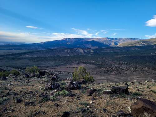
June 11-12: Sheep Mountain/Peak 13,100 (Colorado)
June 11
With temperatures of 102F in Grand Junction, it was time to head for higher elevations! Kessler and I started in the evening at the East Little Cimmeron Trailhead and hiked along the trail to 10,700 feet before setting up camp. The river crossing was pretty challenging and very cold. Other than that the obstacles were mosquitoes and lots of fallen timber. It was still a nice hike.
June 12
It was a pretty noisy night. Apparently several elk walked through our camp and snapped some branches which woke us up.
In the morning we hiked up the trail a ways before heading up the avalance chute due east of the summit of Sheep Mountain. It dead-ended at the cliff, but there was a neat ledge route that went through the cliff. There was one stray rock that fell from above and landed on a snowbank which threw snow on us. There were some neat pinnacles to see as well. We saw many elk as well. It was a neat hike, but there were a lot of mosquitoes before timberline and even a little above! We made our way up to the summit of Sheep Mountain and enjoyed the spectacular views. We ate our lunch on the summit only to find that part of it was rancid! We would have to go a little hungry until we got back to civilization. We then headed down to the saddle to the south and then climbed up to Peak 13,100. It was a really spectacular route with good views of all the neat pinnacles west of the ridge. Overall, I'd consider the route between the peaks as one of the most scenic in Colorado. We enjoyed the views before heading back down the the trail.
We then headed to camp, packed up, and headed down the trail. The river crossing was just as cold as it was on the way up!
June 10: Peak 5750/Eagles Nest Rock/Serpents Trail (Colorado)
Before work, Kim and I climbed Peak 5750 and Eagles Nest Rock. At night and starting at 10:30 PM (to beat the heat), Shaylee, Kim, and I hiked the Serpents Trail under a nearly full moon.
June 9: Peak 5750/Eagles Nest Rock (Colorado)
Before work, I climbed Peak 5750 and Eagles Nest Rock.
June 8: Haystack 3 BM/Gunny Loop (Colorado)
Before work, I climbed Haystack 4 BM. I took the longer, but more gentle routes up and down from Third Flats.
At night, Shaylee, Kim, and I hiked the Gunny Loop.
June 7: Big Dominguez Canyon (Colorado)
In the late evening, Kim and I hiked to the first falls in Big Dominguez Canyon. It was hot, but I got wet before we started the hike and also in waterfall. It was a nice hike.
June 6: Mica Mine/Rough Canyon (Colorado)
In the late evening, Shaylee and I hiked to the Mica Mine in Rough Canyon. Since it stays shaded and is a bit higher than Grand Junction, it was pleasant. It's a very scenic hike as well.
June 5: Battle Creek Falls (Utah)
On our way back from Salt Lake City, Kim and I stopped at Battle Creek to hike up to the waterfall. It was an easy hike, but there was a little more uphill than I remembered. There was less water in the falls than I expected. It was still flowing nicely, but I expected it to be roaring.
June 4: City Creek Meadows (Utah)
My dad and I hiked to City Creek Meadows. I had wanted to do the hike since it is one of the few places I hadn't been in the Wasatch. It turned out to be a lush, green, and beautiful hike as well. We saw a few deer and some huge moose tracks as well.
June 3: Benion Creek Ridge (Utah)
On our way to Salt Lake, Kim and I stopped at Benion Creek in Spanish Fork Canyon. From the mouth of the canyon we followed a steep ATV track up the ridge to the west. After walking the ridge for a ways, we headed back down to finish our drive.
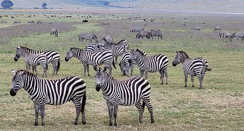
May 31: Ngorongoro (Tanzania)
Kim and I did some of the short walks around the Ngoitokitok Springs and Picnic Area. This is the only place in the Ngorongoro Crater bottom where you are allowed to walk. We saw many birds and there was a lot of hippos in the spring which we watched from a distance. We didn't get close to them for obvious reasons.
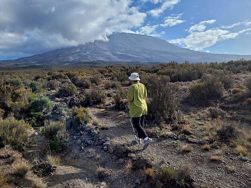
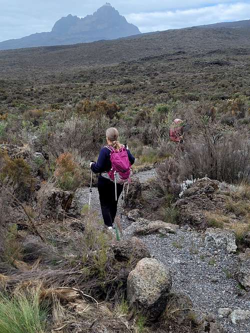
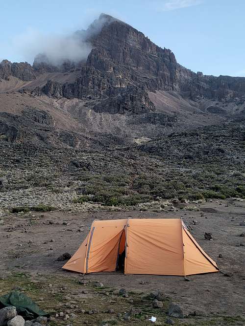
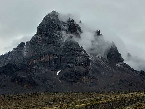
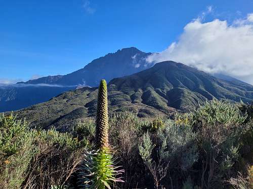
May 22-28: Kilimanjaro (Tanzania)
May 22
Today was our first day on the Rongai Route on Kilimanjaro. Because it was the wet season, the Rongai route was chosen as it was on the dry side of the mountain. We went with Gladys Adventures (a guide service is required to be allowed to climb the mountain).
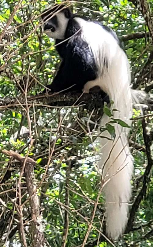
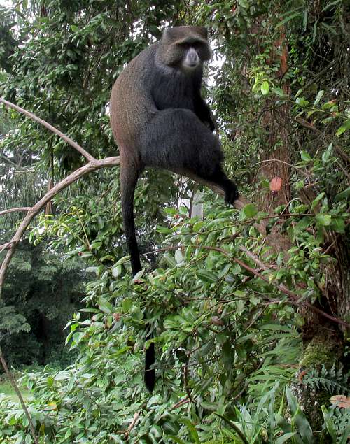
It was a long drive over to the Rongai traihead. Half way along the drive, we discovered that we forgot our sunscreen back in the hotel! Blacks seldom use sunscreen so we had to check several places in the small Chagga towns before we found some. Kim got a 40 cent (literally the price) haircut at one of the towns as well. At the trailhead there were a lot of colobus monkeys. We ate lunch and then started up the trail. It took us just over two hours to get to Simba Camp, which apparently a faster than usual time. Along the way we saw lots of flowers of various colrs and many birds. At dinner time there were a lot of blue monkeys and birds around.
May 23
It was a noisy night last night! There were many blue monkeys, birds, colobus monkeys, and a jackal making a lot of noise! It was cool though.
Just after 7:30 AM we were on our way up the mountain. There were a lot of flowers along the way and the views of Kilimanjaro were very nice. We reached the camp at Second Cave before 11 AM. The ravens were after our food. Around camp we checked out the cave and we could poke our heads out of a hole. In the afternoon we took an acclimatization hike towards the Third Cave since this would be off our planned route for tomorrow. We hiked up to Bread Rock before heading back down.
May 24
Today was our third day on the mountain. We took the alternate route to Kilimanjaro which passes by Kikelelwa Camp. We left at just over 7:30 AM and reached the camp at 10 AM. Along the way were great views of Mawenzi and we saw many flowers. From camp we joined in the porter singing and dancing. We were about half way up the mountain. In the afternoon we took an acclimatization hike. We saw two chameleons and a black lizard. The vegetation has changed to mostly grasses, but with some groundsels. At camp we saw some mice that were large and looked like chipmunks, as well as several birds. Of course the ravens were around too.
May 25
After packing up, we headed for Mawenzi Tarn. The trail was steeper than on previous days, but there were lots of nice views. We reached Mawenzi Tarn late morning and after a rest, we went on an acclimatization hike up to the ridge. Mawenzi Tarn was a really spectacular place in a nice setting.
May 26
Today we hiked from Mawenzi Tarn to Kibo Hut. It was cloudy much of the day and snow, hail, and rain fell. We did get a few views of Mawenzi though. We were worried a bit about the weather since tonight/tomorrow was our big summit day. We tried to sleep, but it was hard with the altitude, plus it was raining and snowing with a lot of wind. There were a lot of other people around too. They hiked up the Marangu Route and it was the first time we saw other hikers in several days.
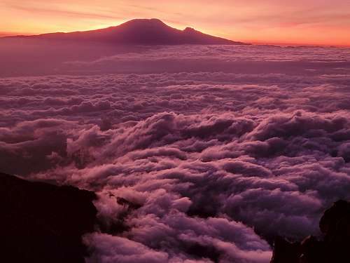
May 27
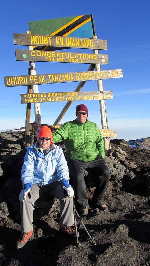
We got up at 11 PM (previous day) and left at midnight for the summit. Luckily the skies had cleared and we had a lot of stars. It was a strenuous and cold, but non technical climb. Kim's hands got a little cold and my toes got a little cold, but other than that we wer pretty warm. The guides sang songs along the way to the summit. We made it to Gilmans Point just as traces of light could be seen on the horizon. We made our way along the crater rim and inside the crater to Stella Point and saw the sunrise between Stella Point and Urhuru Point. We reached the summit at 6:55 AM. It was nice and clear at the summit and the sunrise was spectacular. We were well above the clouds. This was the forth highest I had ever been and Kim's highest. After enjoying the summit, we descended to Kibo Camp. After getting to GiIlmans Point, the rest of the route went faster. We took a rest at Kibo Camp before heading down across The Saddle to Horombo Camp. The cook made us a cake for summitting and we shared it with the guides and porters. It was a long and tiring, but rewarding day. It rained pretty hard much of the afternoon and evening and some water got inside the tent.
May 28
Today we descended from Homboro Camp all the way to Marangu Gate. We woke up at 5:30 AM and headed down the mountain after breakfast. The vegetation was neat through the moorland and the rainforest was thick below this. We saw a tree hyrax and lots of blue monkeys. We also saw a few nice waterfalls.
We reached the gate at 1:00 PM and got some group photos. During lunch some local school girls wanted their photo taken with us.
It was a nice climb. I have climbed a lot of mountains harder than Kilimanjaro, but Kim hasn't climbed as many and said she was glad she did it, but that she wouldn't do it again.
May 17-20: Little Meru/Mount Meru (Tanzania)
May 17
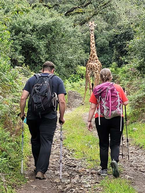
Today Kim and I started our climb of Mount Meru. On the way to the trailhead (Momella Gate), we saw baboons, warthogs, zebras, buffalo, and dik dik. There was a blue monkey at the trailhead as well. Because of the danger from the wildlife, an armed ranger was required to accompany us for the hike up to Saddle Hut. You must book with a guiding service too; we went with Gladys.
We took the forest trail to the hut. Along the way we saw colobus monkeys, warthogs, blue monkeys, lots of birds, red dikas, and a giraffe which was on the trail. We had to wait for the giraffe to move before we could hike farther up the trail. We passed through the famous and spectacular fig tree arch along the way. The only real obstacle were the aggressive ants which bite hard as you pass through their territory. The hike was a pretty one through the rainforest.
We made good progress to the Miriakamba Hut where we spent the night.
May 18
We left the hut at 8 AM and headed for the Saddle Hut. This time we heard lots of colobus monkeys, but didn't see them. We did see a lot of birds though. We started in the rainforest, but the forest got more open as we headed higher and the plant life was really interesting. We started in the clouds, but eventually broke through them to find sunshine above the cloud deck. We also saw our first views of Kilimanjaro and had some good views of the highest summit of Meru as well.
We reached the Saddle Hut at about noon and took a rest before climbing Little Meru. The views were really spectacular as we were above the clouds and had some fantastic views of Kilimanjaro and Meru.
May 19
Toady we woke up at midnight in preparation for our climb of Mount Meru. The skies were mostly clear and the moon was close to full so it was a bright night where we didn't need a headlamp. We headed up the mountain at 1 AM. We made pretty good progress up to Rhino Point (where there are some rhino bones on the summit), where the route became much more difficult. There are three sections of the route where there route had chains to hold on to, if you choose.
The route is pretty slow going and we reached the top at 6:45 AM, which was just after sunrise. The views across the clouds to Kilimanjaro were really spectacular. After enjoying the summit we headed down and we were at Saddle Hut by 11:00 AM.
After lunch we headed down to Miriakamba Hut seeing two types of antelope along as well as redbucks. bushbucks, and sunes along the way. There were many birds as well. We also saw a leopard track. We arrived at the Miriakamba Hut around 4:30 PM. We asked the ranger if he knew the story behind the rhino bones on the summit of Rhino Point. He said yes and it was a very sad story. Rhino Point was actually named for two horn like formations seen on the mountain from the Miriakamba Hut. When the last known rhino in the park was poached, one of the rangers carries some of the bones up to Rhino Point and left them there as a memorial.
May 20
It was a beautiful morning. We were on the trail by 7:45 AM.
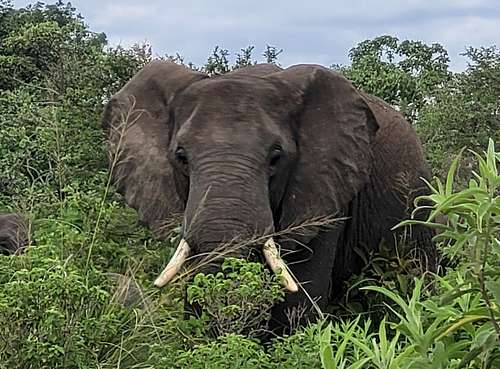
We took the shorter Ikitoni Trail back to the gate. In the forest we saw lots of hornbills, baboons, colobus monkeys, blue monkeys, sune, bushbucks, and many other birds. We took the shorter trail down through the Ikitoni Plain, taking a side trip to the spectacular Tululusia Falls where some of us (including me) took a cold shower. After the waterfalls, we headed to the plain. In this clearing are of of animals such as baboons, many giraffes, zebras, warthogs, cape buffalo, egrets, etc. There were lots of animal skulls along the way as well and we saw a cool looking large caterpillar. We also saw several elephants near the gate. Overall, the climb to Mount Meru was really spectacular even though it is mostly overlooked by trekkers in favor of Kilimanjaro.
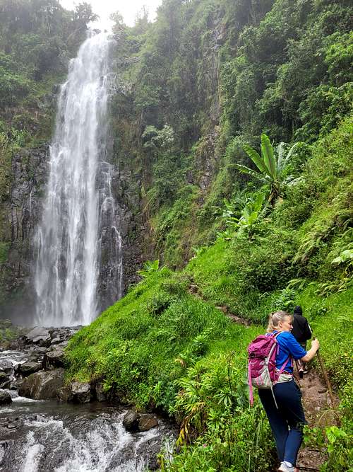
May 16: Materni Falls (Tanzania)
Kim and I hiked up to Materni Falls as part of a guided hike. The falls were really spectacular and we learned how to make coffee too. Even though we don't drink it; it was interesting. Suprisingly we saw a crab along the hike. I didn't know that they lived this far from the ocean. We also saw many birds and a chameleon.
May 11: Canal Trail (Colorado)
At night, Kim and I hiked the Canal Trail.
May 9: Devils Kitchen (Colorado)
At night, Kim, Shaylee, and I hiked to Devils Kitchen. The moon was only about half, but was plenty bright to allow hiking without a headlamp.
May 8: RB-18 BM/Tunnel Point (Colorado)
Kim, Shaylee, and I started out near the saddle between Tunnel Point and RB-18 BM.
We hiked to RB-18 first, stopping at the viewpoints along the way. We then returned to the saddle and hike to Tunnel Point and enjoying those views too.
It was very windy today!
May 7: Wagon Wheel Point/West Serviceberry Draw/Echo Park (Colorado)
Nate, Jess, Mark, Raymond and I met at the Canyons Visitor Center and then headed out to Wagon Wheel Point. We hiked out to the point in order to overlook and scope out the first descent of West Service Berry Draw. After scoping out the canyon and enjoying the views, we headed over to the Bull Canyon Trailhead and started down the drainage near there. There were several downclimbs in the drainage and we ended up bypassing one rappel (next time I'll rappel it-the bypass is dirty) before reaching the first mandatory rappel. Raymond set that one up and we all rapped down into the beautiful chamber. We then headed for the next rappel down canyon and rapped that past a huge (but avoidable) mud hole. I had expeceted a longer rappel after this, but the canyon was actually non technical after the second rappel. It was still a beautiful canyon though, and had a crystal clear stream and high walls. We hiked down to the Yampa River before hiking out the main fork of Bull Canyon, doing a little climb in a mini-slot just for fun along the way.
May 6: Peak 6580 (Colorado)
Kim, Shaylee, and I hiked up Peak 6580 near Kannah Creek. On May 2, Shaylee, Kessler, and I had climbed Peak 6570, but we ran out of time to climb 6580.
It was windy, but the climb was nice since it was a seldom visited summit with good views.
May 5: Colorado River Trail (Colorado)
Starting around sunset, Kim and I hiked the Colorado River Trail on a nice evening.
May 4: Canal Trail (Colorado)
At night, Kim and I hiked the Canal Trail.
May 3: Peak 5750/Eagles Nest Rock (Colorado)
Alone and at night, I climbed Peak 5750 and Eagles Nest Rock. It was raining and a little snow even fell.
May 2: Peak 6570 (Colorado)
Shaylee, Kessler, and I headed for peak 6570 near Kannah Creek. We originally were going to hit peak 6580 as well, but it was already after sunset by the time we reached Peak 6570. Shaylee had to stop early to do some homework assignments, but Kessler and I continued on to the summit. It was an interesting little peak.
May 1: Misery Canyon (Utah)
Today, Justin, Kimberly, and I packed up camp from near the head of West Fork Misery Canyon and hiked around Checkboard Mesa and back to the trailhead. It was a pretty walk and nice and cool in the morning.
April 30: Misery Canyon/Parunaweap Canyon (Utah)
Kim, Justin, and I headed for the Zion area to do Misery Canyon. Since we weren't sure which fork we were doing and so we'd have more time to explore around, we brought camping gear. In the morning, we headed up and over the pass near Checkboard Mesa and across the beautiful country to the park boundary area where we dropped our camping gear. We decided on doing the West Fork. The West Fork is a wonderful canyon and had a lot of neat slots. We made our way through the canyon, staying in the watercourse the entire way instead of bypassing the slots. The last slot before Parunaweap Canyon is really spectacular and a real gem. The warm spring was interesting too. We met some other people in the canyon as well. Hiking the section of Parunaweap to the exit was also sublime. After hiking up the exit and heading cross country back to camp, we had a relaxing evening. At night, some critter was wandering around camp and kept us up; in the morning the tracks appeared to be that of a coyote.
April 29: Lower Ute Canyon (Colorado)
In the afternoon, Justin and I headed for Lower Ute Canyon. As always, it was a neat canyon. The poison ivy was just leafing out and we hoped to avoid it, but alas we both touched it in a few places.
April 28: Kodels Canyon (Colorado)
Shaylee, Justin, and I completed upper Kodels Canyon. The obstacles were a lot of fun and it is one of the only true slots around Grand Junction.
April 27: East Fork Ribbon Canyon/Ribbon Canyon (Colorado)
Shaylee, Justin, and I completed East Fork Ribbon Canyon and Ribbon Canyon.
April 26: Peak 5750/Eagles Nest Rock (Colorado)
Alone, I climbed Peak 5750 and Eagles Nest Rock on a very nice evening. I reached the summit of Peak 5750 right at sunset.
April 25: Otto's Trail/Saddlehorn (Colorado)
After work, Kim, Shaylee, and I hiked Otto's Trail and climbed the Saddlehorn.
April 24: Mount Arkansans/Shrine Pass (Colorado)
Not all trips are successful. Caroline, Kessler, and I tried to climb Mt. Arkansas, a 13,795 foot peak. The weather forecast was bad and so were the road conditions, but that was manageable. So was not getting much sleep and getting up in the dark.
April 23: Riggs Hill (Colorado)
Kim and I hiked up Riggs Hill, making a loop hike on a day that was pretty chilly for April. It was quite breezy as well.
April 21: Peak 5750/Eagles Nest Rock (Colorado)
Alone and after sunset, I climbed Peak 5750 and Eagles Nest Rock on a windy evening.
April 20: Riggs Hill (Colorado)
After sunset Kim and I climbed Riggs Hill, making a loop hike.
April 19: Peak 5750/Eagles Nest Rock (Colorado)
In the evening, Kim and I hiked Peak 5750 and Eagles Nest Rock. It was a nice evening except for the wind.
April 18: East Fourmile Draw (Colorado)
On my way back to Rangely I stopped at East Fourmile Draw to hike the trails to the pictographs and petroglyphs. I saw a huge bull snake as well.
April 17: Five Kivas/Nations Natural Bridge/Recapture Creek (Utah)
First, Kim and I hiked to the Five Kivas at Westwater Creek. The ruins were nice, but it was disappointing to see how vanalized they were. We then hiked to Nations Natural Bridge, also along Westwater Creek. After those two hikes we headed for Recapture Creek, hiking into the canyon at about the half way point. We then followed the creek south to the Big Pueblo. Apparently it was a fairly large pueblo 800 years ago, but the ruins weren't as impressive as cliff dwellings.
April 16: Slickhorn Canyon (Utah)
Kim and I hiked down the First Fork of Slickhorn Canyon and out the Second. It was a rugged and hike and took all days since we did a lot of exploring around looking for ruins and rock art. It was a great hike and two the ruins were really impressive.
April 15: Chasm Canyon/Lower Monument Canyon (Colorado)
Jocelyn, Mark, and I completed Chasm Canyon. There was once nice slot and then a huge 210' mostly overhanging rappel. It was my first rappel this high in a while and I was slightly nervous going down. After that we decided to head all the way down the watercourse in Monument Canyon. There were several downclimbs and one rappel. It was a scenic gorge, but it took a little longer than expected.
April 14: No Thoroughare Canyon (Colorado)
Kim and I hiked Lower No Thoroghare Canyon. We wanted to see the waterfalls while they were still flowing. We hiked past the first pool and waterfall and to the larger waterfall up canyon. Since they were flowing, it was quite spectacular.
April 13: Flume Canyon (Colorado)
After work, Kim and I hiked some of the trails through and around Flume Canyon, making a loop hike. Flume Canyon has a nice mini-slot as well.
April 12: Skinner Cabin/Fruita Paleontological Area (Colorado)
After work Kim and I hiked to Skinner Cabin and then hiked the loop at the Fruita Paleontological Area, seeing the historical sites and dinosaur bones along the way.
April 11: Canal Trail (Colorado)
At night, Shaylee, Kim, and I hiked the Canal Trail.
April 10: The Washout/Mother's Buttress (Colorado)
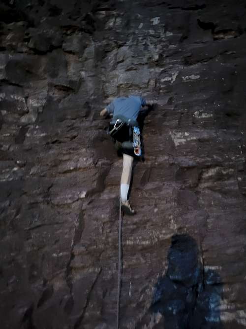
Kessler, Shaylee, Kimberly, and I climbed at The Washout at Mother's Buttress in Unaweep Canyon. We just did some of the easier climbs such as Exultant, Grasshopper, Caveman Tools, and Menta.
April 9: Marble Canyon (Utah)
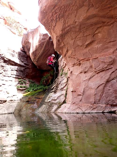
Jocelyn, Norm, and I canyoneered Marble Canyon, a canyon draining into Westwater Canyon. The rest of the group floated from camp at the Little Dolores to Marble Canyon, while us canyoneers hiked up to the bench over to the head of Marble Canyon. I did the first rappel and looked down the second, but couldn't tell if the next rappels had any anchors, so Jocelyn rapped down that one and confirmed that it did. Norm and I then rappelled down and after scouting around we all decided to built a cairn anchor for the next drop. It was a nice rappel and the canyon got really spectacular from here on.
There were several other rappels and well and the canyon was both more challenging and more beautiful than expected. It also took us longer than expected. We completed the beautiful canyon and met the rafts at the mouth of the canyon before rafting the rest of Westwater.
There were no signs that Marble Canyon had ever been descended before.
April 8: Little Hole (Utah)
Jocelyn, Joe, Andrea, Mark, Sarah, Norm, and I hiked up Little Hole from Westwater Canyon and found the petroglyphs. It was a nice little hike and a good break from the river.
April 7: Opal Hill (Colorado)
Kim and I hiked Opal Hill after work, making a loop hike. The weather was perfect.
April 6: Haystack 3 BM (Colorado)
Alone, I climbed the Haystack 3 BM just before sunset.
April 5: Serpents Trail (Colorado)
Starting at sunset, Kim and I hiked the Serpents Trail top to bottom on a very windy evening.
April 4: Lunch Loops (Colorado)
Kim and I hiked some of the Lunch Loops, including Slow and Cranky from the Tabeguache Trailhead. I wasn't feeling well, so we needed something mellow.
April 3: Columbus Canyon (Colorado)
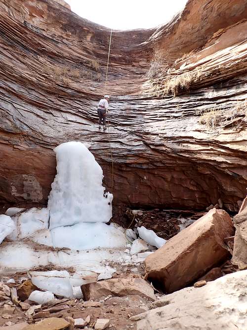
KIm, Kessler, and I canyoneered Columbus Canyon. I replaced the anchor at the 2nd rappel since there was a better place to set an anchor available. There was still a huge chunk of ice on the 2nd rappel. The final downclimb was a lot of fun too and there was running water throughout the canyon.
April 2: Sieber Canyon (Colorado)
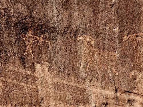
Alone, I hiked down Sieber Canyon to the petroglyph panels. It was a nice hike. The petroglyphs were high off the ground and free from vandals, but someone shot some of them anyway. Sad.
April 1: Canyon Rim Trail/Saddlehorn (Colorado)
After work, Kim and I hiked the Canyon Rim Trail before climbing the Saddlehorn. As usual, the views were spectacular.
March 31: Mack BM (Colorado)
After work Kim and I climbed the Mack BM. It was breezy at times, but a nice evening and the views were great.
March 30: Peak 5684 (Colorado)
After work and around sunset, Shaylee and I hiked up Peak 5684 north of Delta since we hadn't done it before. The route up was steep, but we found an easier way down.
March 29: Peak 5750/Eagles Nest Rock (Colorado)
Around sunset, Kim and I hiked up Eagles Nest Rock and Peak 5750. There was some fresh hail around, but only a little mud.
March 28: Devils Kitchen (Colorado)
Aound sunset, Kim, Shaylee, Kessler, and I hiked Devils Kitchen. We hadn't been for a while and as always, it was a beautiful hike.
March 26-27: Atlantic Peak (Colorado)
March 26
Kessler and I snowshoed up Mayflower Gulch and then up Pacific Creek and found a campsite at 11,560 feet. The trail conditions were great up Mayflower Gulch, but the route up Pacific Creek was much more difficult since the recent warm weather made for deteriorated snow conditions and I kept punching through.
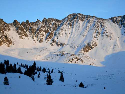
March 27
After a sleepless night, we woke up and headed up Atlantic Peak. I had a lot of joint pain, perhaps from a previous sickness. We slowly made it up the West Ridge to the summit of Atlantic Peak though. It was an interesting climb as well. After enjoying the summit, we packed up and headed back down to the trailhead.
March 25: Serpents Trail (Colorado)
At night, Kim and I hiked the Serpents Trail, top to bottom.
March 24: Third Flats (Colorado)
Kim and I started before sunset and made a loop of the Twist n Shout, Short Shot and Nut'n To It Trails. We then hiked back to the trailhead on the Third Flats Road in the dark.
March 23: Riggs Hill (Colorado)
Just after sunset, Kim and I climbed Riggs Hill, making a loop hike.
March 22: Serpents Trail (Colorado)
At night, Kim and I hiked the Serpents Trail under a starry sky.
March 21: Peak 5551/Peak 5460 (Colorado)
After work I climbed Peaks 5551 and 5460. Peak 5551 has a 4wd drive road to the summit and Peak 5460 has one high on the mountain, but I walked most of the 4wd roads so it would be a real hike. It was really windy and felt rather chilly. I reached Peak 5460 just after sunset. Both were nice hikes, even with the 4wd roads.
March 20: Little Bluejohn/West Fork Bluejohn Canyon (Utah)
Brian, Char, Josh, Alex, Kim, and I canyoneered Little Bluejohn and West Fork Bluejohn. It was a rather cloudy day, but the weather was good. Little Bluejohn was fun as usual and the climb out West Fork was too, but it was harder than I remembered and it gave some people pause. It was still a good loop though.
March 19: High Spur Canyon (Utah)
Erin, Lisa, Brian, Char, Josh, Alex, Jacob, Ashley, Kim, and I canyoneered High Spur Canyon in Robbers Roost. I had never been there before and it had been on my list for a long time. We scrambled down to just above the big rappel, but returned the same way and climbed back up canyon just for fun. It was a great canyon.
March 18: Moore Fun Ridge (Colorado)
After work, Kim and I hiked over the Moore Fun Ridge, making a loop hike on a really nice afternoon and evening.
March 17: Redlands Mesa (Colorado)
Kim and I hiked the Redlands Mesa trails to Mr. Bones and back at night. The moon was full and the skies clear.
March 16: Echo Canyon Trail (Colorado)
At night I hiked the Echo Canyon Trail in Colorado. It had rained so the slickrock section was pretty slippery. The moon was covered in clouds as well.
March 15: Peak 5750/Eagles Nest Rock (Colorado)
Kim and I climbed Peak 5750 and Eagles Nest Rock in the late evening. We left close to sunset and made it into a lopp hike under the moon. The trails had no mud and the what little snow there was could be stepped over.
March 14: Old Spanish Trail/Gunnison Bluffs (Colorado)
Kim, Shaylee, and I did a loop hike in the late evening on the Old Spanish Trail and Gunnison Bluffs. It was a nice evening and it was still light enough that were were able to get some views.
March 11-13 North Canyon/Rider Canyon (Arizona)
March 11
Today, Carol, Ryan, and I met on the highway and headed to North Canyon for a three day technical loop. We did a car shuttle on rough dirt roads and then headed directly down North Canyon. It was colder than normal for the time of year and there was some snow on the ground. The going was actually really fast for the first half or so of the canyon, but things got slower and more strenuous (and more scenic!). The canyon was beautiful, but wetter and colder than expected and we had several pools of up to chest deep water. The one rappel in the canyon was pretty straight foreward, but getting to it had a challenging and slippery downclimb to a big pothole above the final drop.. The anchor is currently under water as well. Carol rapped off me as a meat anchor into and over the pothole then I climbed into the pothole to get everyone's packs (slipping in the process and getting soaked). Ryan was able to get into the pothole without getting soaked.
March 12
Today was a pretty rugged walk, but it wasn't that long of a day so was pleasant. We hiked up the Colorado River from North Canyon to Rider Canyon. Most of the route was boulderhopping, but we made pretty good considering and were able to reach the campsite at House Rock Rapid by mid-afternoon. We took a pretty long break at Boulder Narrows and even met another hiker there. It was the first time I ever met another hiker on an off trail route in the Grand Canyon. The Moon was pretty bright at night.
March 13
Today we hiked up Rider Canyon to the rim, where our vehicle was parked. The hike was scenic and interesting and had lots of pools, but no wading. There was a pretty challenging scramble in the narrows and then the route from the canyon bottom to the rim was a bit challenging, especially since the tendon in my heel was hurting. At the squeeze under the boulders, my helmet came detached and rolled down the slope and into the hole and I had to go back and retrieve it. That part wasn't fun, but the rest of the trip was great.
March 9: Canal Trail (Colorado)
At night, Kim and I hiked the canal trail. It was snowing.
March 8: Elephant Head (Colorado)
Kessler, Shaylee, and I climbed at Elephant Head in Colorado National Monument. Kessler and I did two different variations on the rock. Shaylee climbed a little on the rock.
March 7: Peak 5750 (Colorado)
At night I climbed Peak 5750. It snowed today, but wasn't as snowy as I expected.
March 6: Peak 5140 (Utah)
Kim, Kessler, and I hiked up Peak 5140 near Westwater. This is an easy hike, and really spectacular, but surprisingly almost no one goes there.
March 5: Peak 5239 (Colorado)
Shaylee, Kimberly, and I climbed Peak 5239 east of Rabbit Valley. It is a great little summit and I really like the sidewalk in the sky section of the route.
March 4: Lunch Loops via White Cap (Colorado)
After work, Kim and I hiked down the Clunker Trail to the Miramonte Rim and then hiked that over to the Holy Cross and Holey Bucket Trails, making a loop. The Holy Bucket had some mud, while he other trails were dry.
March 3: Dinosaur Hill (Colorado)
Kim and I hiked the loop on Dinosaur Hill after work. The trail was mostly dry.
March 2: Black Ridge/Liberty Cap (Colorado)
Alone and at night I headed to Colorado National Monument to hike the Black Ridge Trail. I didn't make it very far since it was really muddy and I didn't want to damage the trail. I then headed for the Liberty Cap Trail and hiked a ways to an overlook and headed back. I saw a huge shooting star as well.
March 1: Bullet Hole Cliffband (Colorado)
Kim, Kessler, and I headed for Bullet Hole Cliff Band for some climbing. Kessler climbed Fingers, A Little Dreary (both variations), and Strike a Pose. Kim and I climbed Walk on the Wild Side, A little Dreary (both variations), and Strike a Pose. It was a fun evening.
February 28: Upper Liberty Cap (Colorado)
Late evening, Shaylee, Kimberly, and I hiked the Upper Liberty Cap Trail. The trail was snow covered, but it was packed down.
February 27: Skyway Trails (Colorado)
Kim and I did the snowshoe trails at Skyway up on Grand Mesa. We did a few routes not on the map too. It was a really nice winter day.
February 26: Dominguez Rim (Colorado)
Kim had to work today, so Shaylee, Kessler, and I hiked the Dominguez Rim. We drove a ways up the 4wd road before parking. We then walked the mostly snow covered road to the highest point of the rim. There were many good viewpoints along the way.
February 25: Colorado River Trail (Colorado)
At night, Shaylee, Kim, and I hiked a section of the Colorado River Trail.
February 24: Serpents Trail (Colorado)
Kim and I hiked the Serpents Trail at night. There was less snow than expected, though it was chilly. It was a nice, moonless night.
February 23: Peak 5750/Eagles Nest Rock (Colorado)
Around sunset, I climbed Eagles Nest Rock and Peak 5750 in the fresh snow. There was a fresh set of footprints in the snow, but I never saw anyone. It was a nice hike and quite pretty with all the new snow.
February 21: Serpents Trail (Colorado)
At night I hiked the bottom 1/3 of the Serpents Trail. There was a light dusting of snow and it was snowing lightly at times.
February 20: Shillelagh Canyon/Cedar Point (Utah)
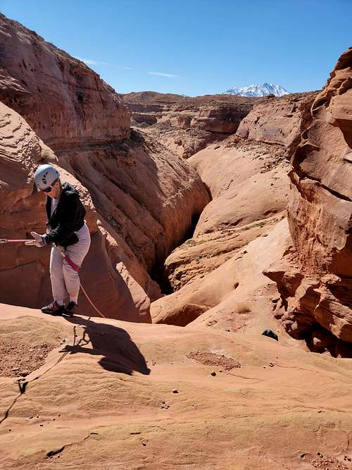
Shaylee, Kessler, Kim, Justin, and I completed the West Fork of Shillelagh Canyon in North Wash. It was one of the few canyons in the North Wash that I hadn't done yet.
It was a pretty canyon and pretty mellow from a technical standpoint, but we did get our rope stuck on the second rap. Kessler and I found a route to the rim not far down canyon so we climbed to the rim (one short 5th class pitch) and circled around and did the two raps again.
It was a nice canyon and the best part was the downclimb which some consider to be the first rappel. Even with having to circle around, the canyon only took three hours.
After finishing the canyon we headed out to Cedar Point so I could show the others some of the overlooks up there. I walked to the Poison BM and we all did the short walk to an overlook after that.
February 19: Sevenmile Canyon (Utah)
Shaylee, Kessler, Kim, Justin, and I completed Sevenmile Canyon on Ticaboo Mesa. This technical Canyon isn't done much (it didnt appear that anyone had been through in a long time), but it's a still nice one. Since it's not tight, it doesn't beat you up as much as some other slot canyons.
There were several interesting downclimbs and rappels, as well as some easy sections and was an enjoyable route. The real difficulty was that we didn't bring a good map so navigation was challenging. We did find a challenging exit, though it wasn't the standard exit.
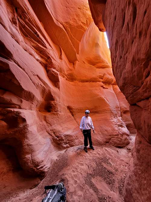
February 15: Peak 5750/Eagles Nest Rock (Colorado)
Kim and I hiked Peak 5750 together and I climbed Eagles Nest Rock. It was a nice hike.
February 14: Dinosaur Hill (Colorado)
After work, Kim and I hiked the loop on Dinosaur Hill. There was still mud on the trail, but we were very careful as to not do any damage to the trail, though it appeared that others were not so careful!
February 13: Egypt 3 Slot Canyon/Devils Garden (Utah)
Kessler and I completed Egypt 3 Slot Canyon today. I hadn't been in the canyon since 30 years ago.
Egypt 3 is a great canyon and has a lot of fun obstacles. The slots are great and impressive.
At the first really tight slot in the bottom of the canyon, Kessler could fit through the bottom, but I had to climb high. I skipped the tightest section of the last slot.
After completing the canyon we hiked back to the trailhead, completing the canyon in a fast 3 hours and then heading home.
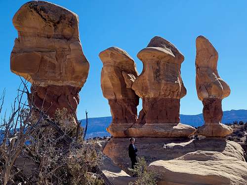
February 12: Egypt 1/Egypt 2 Slot Canyons (Utah)
Kessler and I got a late start down the technical Egypt 2 Slot Canyon. Since we got a late start, we were a little worried about completing the canyon by dark, but we didn't need to worry since we did it much faster than expected. It was a nice slot canyon with a few rappels and lots of downclimbs.
We then headed for Egypt 1 and quickly completed that one too. It was also a nice slot canyon with some rappels and downclimbs and we were out by dark.
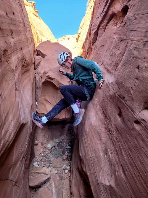
February 10: Serpents Trail (Colorado)
Shaylee and I hiked the Serpents Trail top to bottom. It was icy in spots, but a nice evening.
February 9: Serpents Trail (Colorado)
Kim and I hiked Serpents Trail at night. It was a nice night and the moon was bright. The trail was drier than expected as well.
February 8: Peak 5750/Eagles Nest Rock (Colorado)
At night I climbed Peak 5750 and Eagles Nest Rock alone. The moon was only half full, but bright enough that I didn't use a headlamp after the first few minutes.
February 7: Devils Canyon Overlook Trails (Colorado)
After work, Kim and I hiked a loop at the Devils Canyon Overlook. There was more mud than we thought there would be.
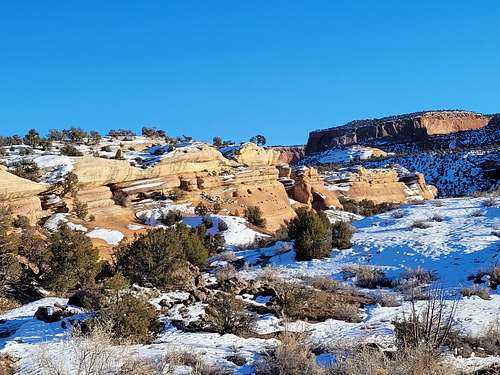
February 5-6: Trachyte Point/U206 BM (Utah)
February 5
Kessler, Kimberly, and I planned to explore the area between Trachyte Point and Hite Benchmark near North Wash Utah. The area is almost never visited even though it is very spectacular. We started in the afternoon and hiked over the summit of Trachyte Point before heading south through the rugged domes and slickrock. We dropped down to the Kayenta (a type of sandstone) bench and headed towards U206 benchmark, which we hoped to camp nearby, but we didn't make it due to the ruggedness of the terrain. The entire route was really scenic. We found a nice campsite on the Kayenta Bench that had great views and a nice sunset and sunrise.
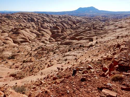
February 6
In the morning Kessler and I headed to U206 BM (peak). It was a rugged route to the base of the peak, but the peak itself was easier than expected. The views from the summit were really spectacular, some of the best anywhere. We hoped to head north and make it to Hite BM, but the route was really slow and rugged and we knew we wouldn't make it with the time we had. We headed back and met Kimberly at camp, where we all packed up and headed back along the rugged route and up and over Trachyte Point.
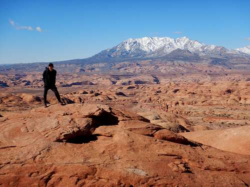
February 4: Peak 5750/Eagles Nest Rock (Colorado)
Alone and at night I climbed Peak 5750 and Eagles Nest Rock under a crescent moon.
February 3: Dinosaur Hill (Colorado)
Kim and I hiked Dinosaur Hill after work. Luckily since it was a cold day, the mud was frozen which made it a good hike. The trail was icy, but it was nice to have the mud frozen.
February 2: Palisade Rim (Colorado)
After work, I hiked the Palisade Rim to the junction. The upper half of the trail was icy! It was pretty chilly and breezy as well.

February 1: Coal Canyon (Colorado)
After work, I hiked Coal Canyon (in the Little Book Cliffs Wildhorse Area) up to the junction with the Hoodoo Trail. It wasn't too muddy, but it was a rather gloomy day due to cloud cover.
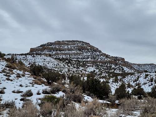
January 31: Peak 5750/Eagles Nest Rock (Colorado)
Alone and after work, I climbed Peak 5750 and Eagles Nest Rock.
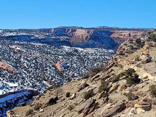
January 30: Rim Shot Canyon/Moonflower Canyon/Birthing Rock/22 Sheep (Utah)
In the morning, Kim and I canyoneered Rim Shot Canyon. It was a pretty route, but wasn't that much of a canyon. After completing Rimshot Canyon we hiked up Moonflower Canyon to the pool. It's a nice and pretty, but short canyon. We then headed for the Birthing Rock Petroglyph and hiked around to some other petroglyphs. Lastly, we hiked up to the 22 Sheep Panel, which is one of the best petroglyph panels around. It was a nice day and we saw a lot.
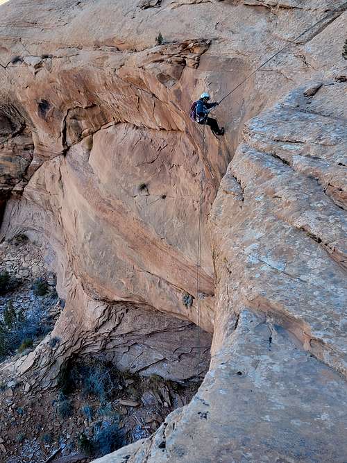
January 29: Peak 4780 (Utah)
KImberly and I climbed Peak 4780 from Dewey Bridge. Even though there is a very rough 4wd track most of the way, it was still a nice hike. The weather was pleasand and sunny and the views were great. We took an alternate way back through Buck Spring Canyon.
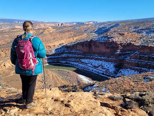
January 28: Peak 5750/Eagles Nest Rock (Colorado)
Alone and late at night I climbed Peak 5750 and Eagles Nest Rock by headlamp. It was a little chilly, but there was no mud and the ice wasn't too bad.
January 26: Serpents Trail (Colorado)
Shaylee, Kimberly, and I hiked the Serpents Trail at night, starting at 9:30 PM. The advantage of doing it then was that all of the mud was frozen. We forgot the headlamps though so had to use a cell phone light.
January 24: Peak 5750/Eagles Nest Rock (Colorado)
Alone, I climbed Peak 5750 and Eagles Nest Rock at night.
January 22-23: Geyser Pass/Burro Ridge (Utah)
January 22
After work, Kessler and I headed for Geyser Pass in the La Sal Mountains to test out my new boots. We arrived at the trailhead and snowshoed up to Geyser Pass and then north and found a nice campsite in the trees. We went up Burro Ridge a short distance to scout out the route.
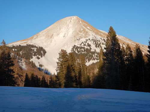
January 23
It was much colder at night than the weather forecast predicted and it was a long cold night! The plan was to climb Burro Ridge, but Kessler wasn't feeling well so we backed up camp and headed back.
January 20: Dinosaur Hill (Colorado)
After work, Kim and I climbed Dinosaur Hill. There was much more mud than expected and I don't think we'll be doing it again anytime soon.
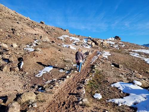
January 18: Peak 5750/Eagles Nest Rock (Colorado)
After work, Shaylee, Kimberly, and I hiked Peak 5750. I also did Eagles Nest Rock. There were some icy and muddy spots, but it wasn't that bad although Kim slipped onto her butt one time. We completed a loop hike with the Tabeguache Trail and got back when it got dark.
January 17: Riggs Hill (Colorado)
After work Kim and I climbed Riggs Hill, completing the loop hike. It was quite muddy. We should have gone before work in the morning so the mud would be frozen!
January 16: The Knoll/Mesa Arch/Grandview Point (Utah)
Kessler didn't feel that well today, so we decided to have a pretty mellow day. We first climbed The Knoll. We then hiked the short loop trail to Mesa Arch. After that I hiked to Grandview Point which has perhaps the best view in Canyonlands National Park.
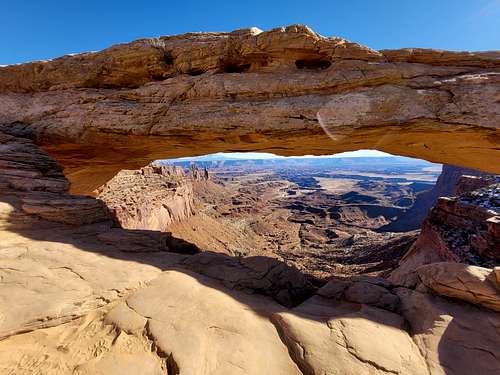
January 15: Peak 5212 (Utah)
Kessler and I had planned to go technical climbing and canyoneering today, but we arrived at the area only to see that we forgot the box which had EVERYTHING in it. We drove back to town (Moab) and bought a small daughter pack and headed for Peak 5212, which was on my list to do sometime.
We hiked up the the Moab Rim Trail and headed south, finding several petroglyph panels. We then found a route up to the peak. It was a little more challenging than expected, but mostly since we got a late start and didn't bother looking for too many bypasses around the harder sections.
The views from the top were fantastic, but since it was late (and windy too), we only spent a short time on top before heading back down.
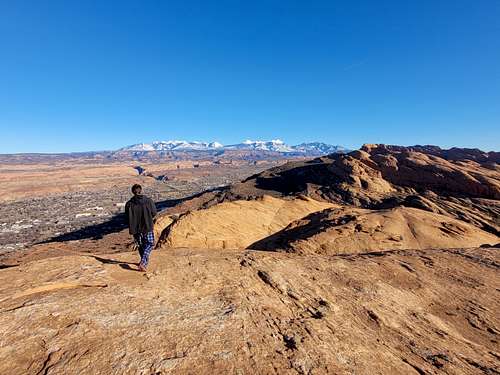
January 14: Peak 5750/Eagles Nest Rock (Colorado)
After work I climbed Peak 5750 and Eagles Nest Rock. It was icy in places, but there was a nice sunset. I came back in the dark.
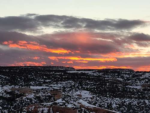
January 13: Serpents Trail (Colorado)
After work Shaylee and I hiked the Serpents Trail. It was rather cloudy and gloomy, but still a nice hike. We could hear the coyotes howling too.
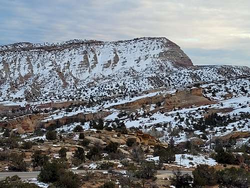
January 12: Peak 5750/Eagles Nest Rock (Colorado)
After work and just after sunset I hiked up Peak 5750 and Eagles Nest Rock, which was icy in places.
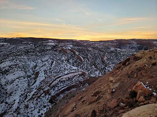
January 11: Main Canyon (Colorado)
After work, I hiked Main Canyon. I parked at the Coal Canyon Trailhead and walked over the saddle to Main Canyon. The creek was too high to cross without getting wet so I headed down canyon staying on the west bank. Although I have been to Main Canyon many times, this is the first time I went down canyon. I saw several wild horses along the way.
January 10: Peak 5750/Eagles Nest Rock (Colorado)
After work, I hiked up Eagles Nest Rock and Peak 5750. Much of the route was fairly icy and the final part of the route up Eagles Nest Rock was a little dicey, but it was still a nice climb.
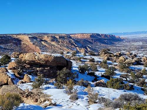
January 9: Delicate Arch Viewpoint/Delicate Arch/Sand Dune Arch/Broken Arch Loop/Skyline Arch (Utah)
Kim and I first hiked to the Delicate Arch Viewpoint before hiking to Delicate Arch. The route was icy in a few places, but we made it to the arch and took a rest before taking the alternate exposed ledge route back. That route has more exposure, but it is spectacular and completely dry. After hiking to Delicate Arch, we hiked to Sand Dune Arch and then did the Broken Arch Loop. It was a nice hike and a nice day. It was windy part of the time to Broken Arch, but otherwise really pleasant.

January 8: The Windows/Balanced Rock (Utah)
Kim and I first hiked the trails at The Windows, including Turret Arch, North and South Windows (Primitive Trail), and Double Arch. After that we did the short hike around Balanced Rock. The lighting was really spectacular.
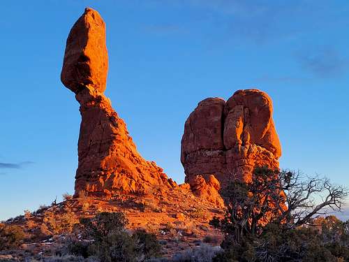
January 6: No Thoroughare Canyon (Colorado)
Due to food poisoning/stomach flu, I got a very late start to hiking and climbing in 2022. In the evening and at sunset, I hiked up No Thoroughare Canyon to the first pool. The light was really nice on some of the cliffs and slopes, but I forgot the camera!
Accumulated Totals for 2022:
Days that I went hiking or climbing: 324
Summits Climbed: 184
Summits Attempted: 189
Rock Towers/Technical Buttes Climbed: 2
Rock Towers/Technical Buttes Attempted: 2
Technical Rock or Ice Routes Climbed: 15
Technical Rock or Ice Routes Attempted: 17
Technical Canyons Completed: 32
Technical Canyons Attempted: 32
Overseas Summits: 5
Goals for 2022:
Days to go hiking or climbing on: 330
Summits: 150
Rock Towers: 10
Technical Rock or Ice Routes: 30
Technical Canyons: 25
Highest Elevation Reached
19,343 feet (5896 meters) at Mount Kilimanjaro (Tanzania); May 27.
Highest Elevation Reached in USA
14,299 feet (4358 meters) at Crestone Peak (Colorado); August 28.
Highest Sleeping Altitude
15,486 feet (4720 meters) at Kibo Camp (Tanzania); May 26-27.
Highest Sleeping Altitude in USA
11,700 feet (3566 meters) at Lower South Colony Lake (Colorado); August 27-28.
Highest Elevation Climbed To By Month
| Month | Feet (USA) | Meters (USA) | Feet (World) | Meters (World) | |
| JAN | 10,600 | 3231 | 10,600 | 3231 | |
| FEB | 10,660 | 3249 | 10,660 | 3249 | |
| MAR | 13,841 | 4219 | 13,841 | 4219 | |
| APR | 11,300 | 3444 | 11,300 | 3444 | |
| MAY | 6580 | 2006 | 19,343 | 5896 | |
| JUN | 13,168 | 4014 | 13,168 | 4014 | |
| JUL | 14,167 | 4318 | 14,167 | 4318 | |
| AUG | 14,299 | 4358 | 14,299 | 4358 | |
| SEP | 13,035 | 3973 | 13,035 | 3973 | |
| OCT | 12,300 | 3749 | 12,300 | 3749 | |
| NOV | 13,234 | 4034 | 13,234 | 4034 | |
| DEC | 8803 | 2683 | 9606 | 2964 |
Highest Outdoors Sleeping Altitude by Month
| Month | Feet (USA) | Meters (USA) | Feet (World) | Meters (World) | |
| JAN | 10,550 | 3216 | 10,550 | 3216 | |
| FEB | 4640 | 1414 | 4640 | 1414 | |
| MAR | 11,560 | 3523 | 11,560 | 3523 | |
| APR | 5640 | 1719 | 5640 | 1719 | |
| MAY | 5640 | 1719 | 15,486 | 4720 | |
| JUN | 10,700 | 3261 | 10,700 | 3271 | |
| JUL | 11,280 | 3438 | 11,280 | 3438 | |
| AUG | 11,700 | 3566 | 11,700 | 3566 | |
| SEP | 11,260 | 3432 | 11,260 | 3432 | |
| OCT | 11,430 | 3484 | 11,430 | 3484 | |
| NOV | 4310 | 1314 | 4310 | 1314 | |
| DEC | 5750 | 1753 | 5750 | 1753 |
December 21
Highest ascent in Philippines; 9606 feet (2964 meters) on Mount Pulag. The previous record for the Philippines was 2686 feet (910 meters) on Pinatubo on December 19 2022.
October 16-17
Highest October sleeping altitude; 11,430 feet (3484 meters) at Tasha Spring (Utah). The previous October record was 11,350 feet (3460 meters) at Second Creek (Colorado) on October 11-12 2013. This was also the highest I have slept in Utah. The previous record was 11,200 feet (3414 meters) at East Fork Blacks Fork on July 2-3 1988. This was also (obviously) the highest I have slept in Utah in October. The previous record was 11,020 feet (3359 meters) at Leidy Peak on October 1 2005.
August 28
Highest August ascent; 14,299 feet (4358 meters) on Crestone Peak (Colorado). The previous record was 14,179 feet (4322 meters) on Mt. Shasta (California) on August 14 2010. Of course, this was also my highest August ascent in Colorado. The previous August record for Colorado was 14,163 feet (4317 meters) on Maroon Peak on August 4 2012.
May 27
Highest May ascent; 19,343 feet (5896 meters) on Kilimanjaro (Tanzania). The previous record was 14,980 feet (4566 meters) on Mount Meru on May 19 2022. Of course this was also my highest ascent in Tanzania and Africa.
May 27-28
Highest May sleeping altitude; 15,486 feet (4720 meters) at Kibo Camp (Tanzania). The previous May record was 11,714 feet at Saddle Hut (Tanzania) on May 18-19. This was also my highest sleeping altitude in Tanzania and Africa.
January 22
Highest January ascent in Utah; 10,600 feet (3231 meters) near Geyser Pass. The previous January record for Utah was 10,315 feet (3144 meters) on Preston Peak on January 29 2000.
January 22-23
Highest January sleeping altitude in Utah; 10,550 feet (3216 meters) near Geyser Pass. Previous January sleeping altitude record for Utah was 10,200 feet (3109 meters) at Preston Peak on January 29-30 2000.