33 Emilius's All Routes & Variants Traced Watershed 1986
33 Emilius's All Routes & Variants Traced
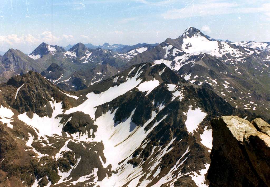
WATERSHEDS from MONTE EMILIUS (3559m)
August 16th, 1986
In great distance from left or North: the Watershed between Aosta's Valley and Piedmont, with Mount Mars in evidence.
In background from left or North: Bec of Viot, Mount Rafrey, Fussì Hill, Mount Delà, Moutsaillon Hill & Tower, Tessonet's Point & Tersiva.
In middle part from left or North: Devil's Crest, Grand Avert Hill & Summit. Terre Blueu Pass, Little Avert to Tessonet's Point.
In midst part from Tessonet's Point or from Southeast to Northwest: Tessonet's Hill, Gianni Vert Point, two Laval's Points & Saint Marcel Hill also called Corona's.
Foreground part from left or North before to South, after to West: Ilario Antonio Garzotto Point, Leppe's Hill & Point, Lussert's Point and Mount of Laures to homonymus Hill.
In bottom to right or South: Tsesère's Point, above the secondary small basin over the Alp with same name, always in High Grauson/Lussert Vallon.
by
Osw


