
|
|
Route |
|---|---|
|
|
37.91310°N / 107.5039°W |
|
|
Hike |
|
|
Half a day |
|
|
Class 2 |
|
|
Approach
American Basin Trailhead
This trailhead is deep inside American Basin. Begin measuring with your odometer from the Henson Creek crossing in Lake City. This area is very well-signed at each intersection. In general, follow signs for American Basin, and stay on the Cinnamon Pass road.
- 2.2 miles: Turn right onto the San Cristobal Lake Road
- 13.1 miles: Pass the Mill Creek Campground and Trailhead
- 21.1 miles: Pass the Grizzly Gulch / Silver Creek Trailheads (see main page "Getting There" section for information on this trailhead.
- 22.0 miles: Turn left onto the American Basin Road. This turn is not signed, but is obvious. It is located right before the Cinnamon Pass Road takes a steep switchback.
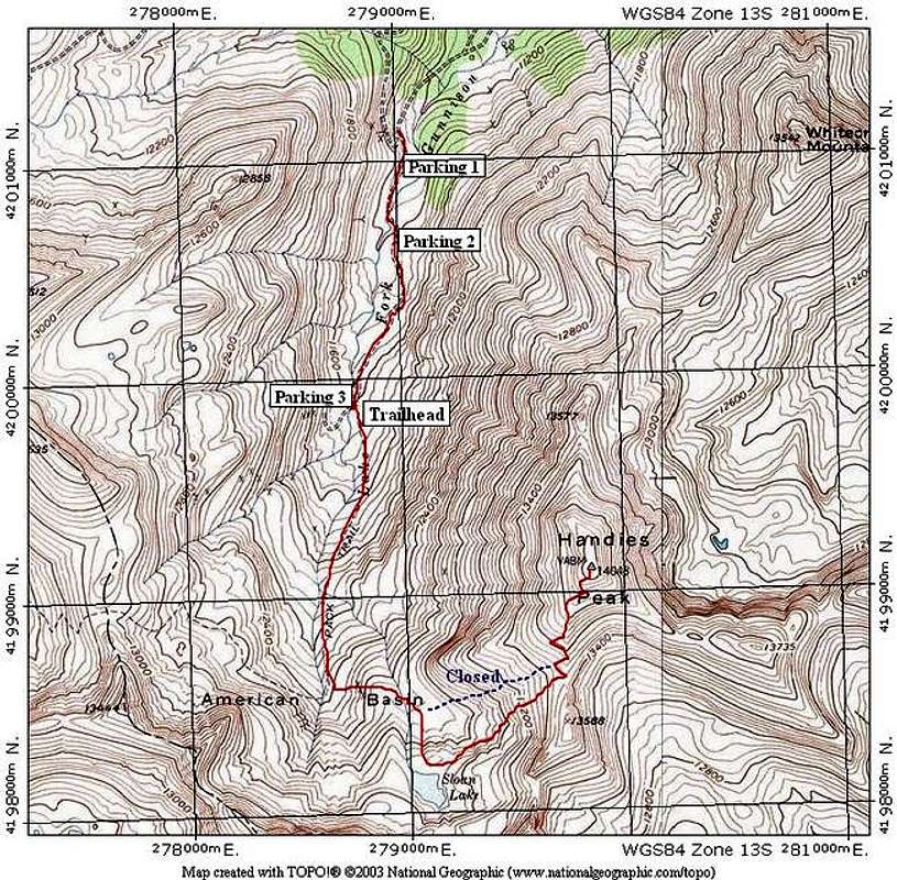
Once you are on the American Basin road, you have several parking options. The American Basin road is 4WD, but isn't very bad at all. It's actually easier than parts of the Cinnamon Pass road that you have already driven. Refer to the TOPO in the Route Section to see where these parking areas are located.
Parking Area 1: This parking area is on your left side as you drive into American Basin. It is large and obvious.
Parking Area 2: This parking area is just beyond a creek crossing that is easy in a 4WD vehicle, but difficult if you are on foot. This parking area is a good bet if you don't want to risk dunking a foot in the creek as you cross. The creek is shallow, but runs fast and is pretty wide. This parking area can fit about 5 cars.
Parking Area 3:This is the last parking area in American Basin before vehicular traffic is prohibited. It is near an old mine site, and it is large and well marked. The final road to this site gets a little rougher.
The Cinnamon Pass Road gets rougher and rougher past the Grizzly Gulch / Silver Creek trailheads. 4WD is recommended past there, although a carefully driven car might make it to American Basin. The 4WD sections are short, and mainly involve negotiating large rocks that jut from steep steps.
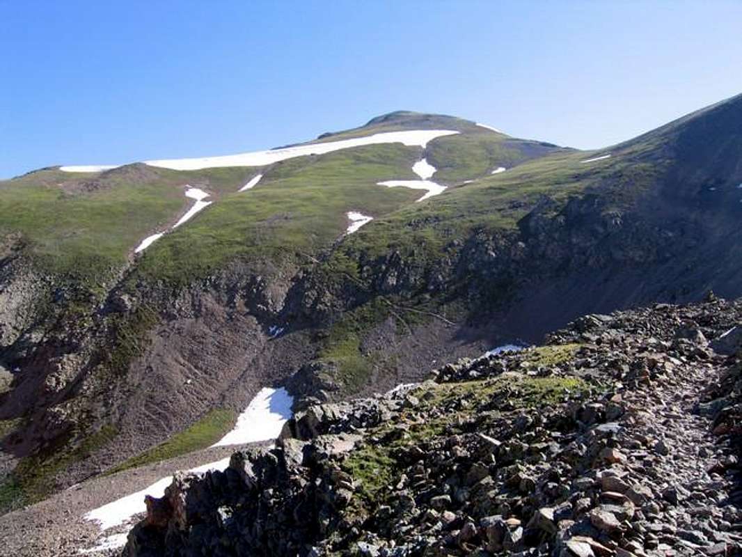
Handies Peak Towers over American Basin
Route Description
Depending on where you parked, follow the remainder of the American Basin road until it ends at Parking Area #3. The trailhead for Handies Peak is located right here, and is well-signed and has a trail register. It's 2.2 miles to the summit from the register.
From the register, continue on the trail as it goes south into the end of American Basin. When the terrain starts to steepen, you will come to a Y in the trail. Take the left fork toward Handies Peak. The right fork goes to the pass between the unnamed points to the southwest.
From the fork, the trail will ascend some steeper terrain into a bowl below Point 13,588. The old trail, marked as a blue dotted line on the TOPO below, cuts this bowl directly. Do not take this trail. The Forest Service has closed it due to erosion. There are signs here warning against this.
From the Erosion Sign, the trail cuts to the South again and goes toward Sloan Lake. Sloan Lake is beautiful and is worth the 2-minute hike off the main trail. From Sloan Lake, the trail cuts across the bowl and you lose a little elevation.
The trail then heads directly to the saddle between Point 13,588 and Handies. From here, the trail switches back across the upper slopes of Handies, and goes directly to the summit. Avoid cutting the switchbacks.
Route Stats:
RT Mileage (from Trailhead / Parking Area 3): 4.4 miles
Elevation Gain: 2,360 feet
RT Mileage (from Parking Area 2): 5.6 miles
Elevation Gain: 2,700 feet
RT Mileage (from Parking Area 1): 6.2 miles
Elevation Gain: 2,900 feet
Essential Gear
In summer, just hiking gear.
Winter will require all the requisite gear. Winter closure on the Cinnamon Pass road varies, but is usually around the Mill Creek TH. Many slopes in American Basin are avalanche prone.
American Basin
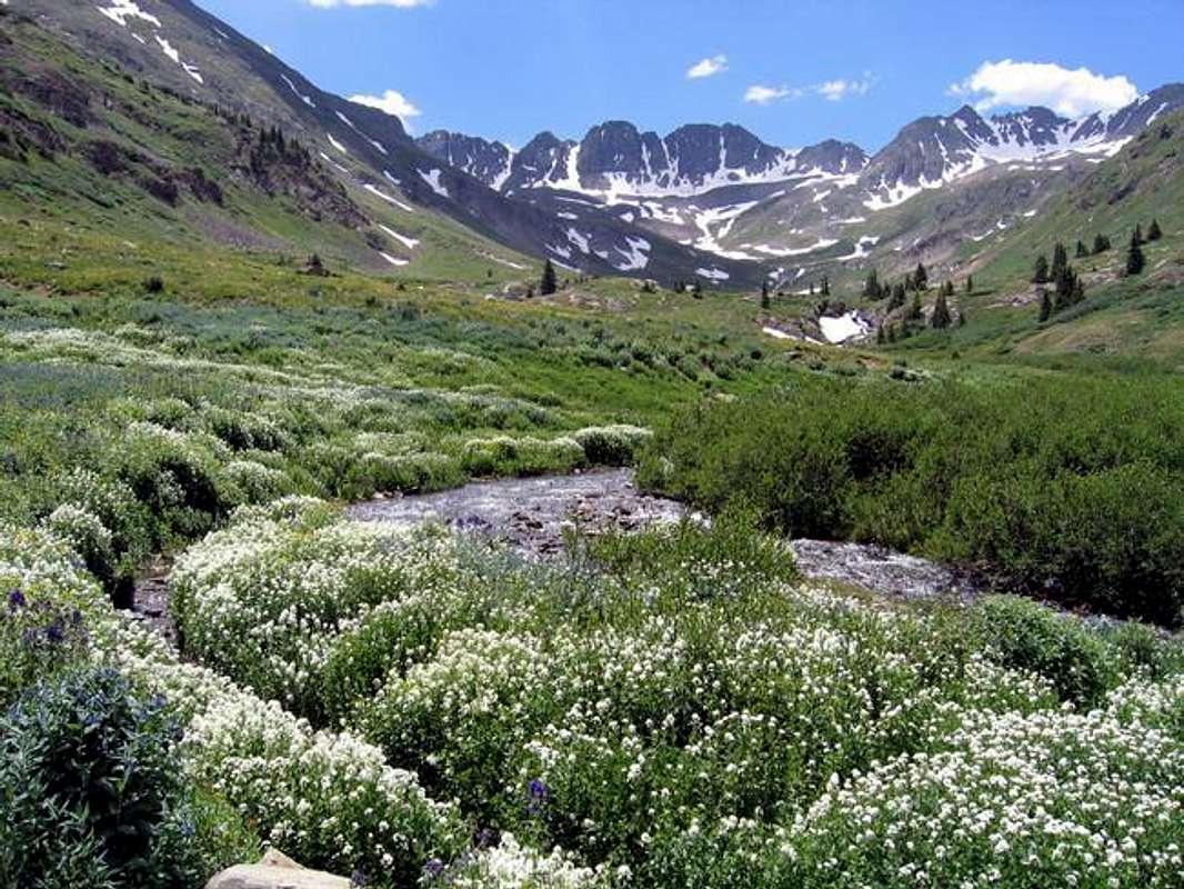
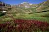
American Basin is an incredibly beautiful area. No matter what route you choose to climb Handies Peak, a side trip to American Basin is well worth your time. The area is notorious for its summer wildflower display. During a recent trip, I spoke with several professional photographers who told me that the best time for wildflowers here was early August. Check out the photos below.
American Basin
 |
 |
 |
 |
 |