
|
|
Route |
|---|---|
|
|
37.90870°N / 107.4804°W |
|
|
Hiking, Mountaineering, Scrambling |
|
|
Spring, Summer, Fall, Winter |
|
|
Most of a day |
|
|
Class II with some optional Class III scrambling |
|
|
Overview
PT 13,795 is a Bi-Centennial ranked 109th highest in Colorado. From the summit of Handies Peak, continue East along the ridge. You have the option to summit the various un-official 13er points along the way.Getting There
In Lake City begin measuring from the bridge crossing Henson Creek, heading south. Go 2.2 miles to the Lake San Cristobal Road and turn right. Go past the beautiful lake and up the Lake Fork of the Gunnison River. Continue to mile 14.3 where the road forks and a take the right fork up Cinnamon Pass Road. At mile 18.3 you will see the large parking lot at the Silver Creek - Grizzly Gulch Trailhead. An alternate way to reach the trailheads is from Silverton. Measuring from Silverton's north end, follow Hwy110 for 12.3 miles to Animas Forks, climb steeply east to reach Cinnamon Pass at 15.3 miles, cross the pass and descend on its east side to reach the Silver Creek- Grizzly Gulch Trailhead after 21.1 miles. A 4 WD is required for this approach.There is ample parking available at the Grizzly Gulch trailhead. The trailhead also has toilet facilities.
(source kilimanjaro1 from his excellent & accurate Handies Peak page.)
Route Description
From the summit of Handies Peak (14,053), descend east along the ridge. Un-official PT 13,735 is the first objective along the ridge that you may either contour around or summit.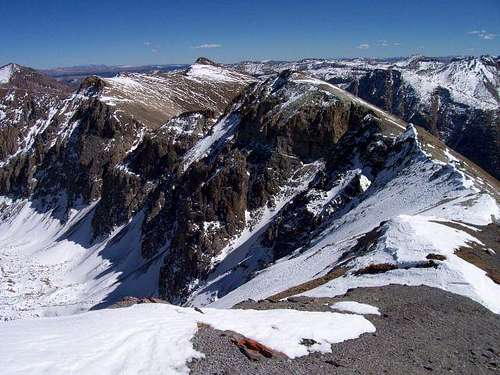
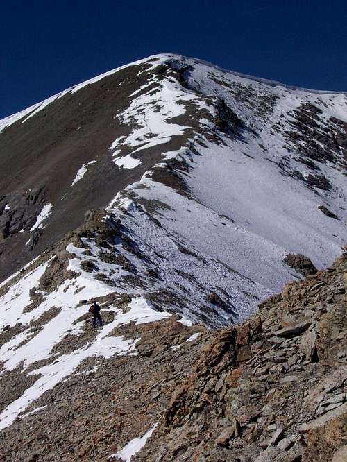
Descend to a 13,300 ft saddle and from there you will see your next objective along this ridge, un-official PT 13,700. From the summit of PT 13,700, you can see what ups and downs await you along this ridge.

The Descent
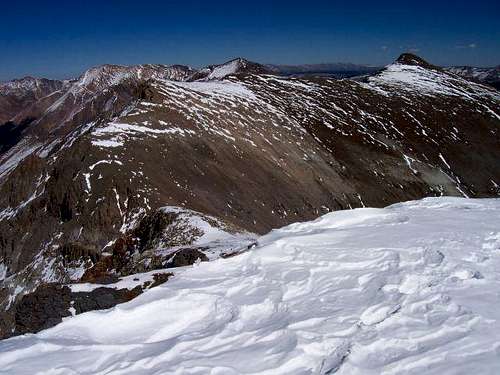
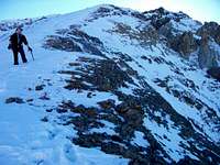
There are two main ways that I saw to descend from PT 13,795 that will take you back to the Grizzly Gulch trailhead. The first would be to descend north from the summit of PT 13,795 and onto the ridge that would take you over points 13,502 & 12,792. However, the north descent looked extremely loose, steep, & snowy. We elected to take a snow covered ridge down to an unnamed lake at 12,323 feet. You can see the ridge on the right in this photograph of the ridge leading to Handies Peak.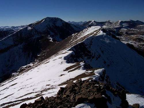

Essential Gear & Conditions
If heading out in the late summer, fall, winter or spring, make sure to have some winter gear. As of September 29, 2006, there were some avalanches that have already slid in this area. Take the necessary precautions and travel safely with this knowledge in mind.