The ascent of Thunder Pyramid
*Thunder Pyramid
*Traverse to Point 13,722 “Lightning Pyramid”
*11.4 miles
*5,050-v-ft.
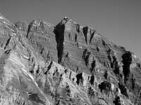
![Ridge traverse]() Thunder Pyramid in the background as from the ridge traverse to "Lightning Pyramid.
Thunder Pyramid in the background as from the ridge traverse to "Lightning Pyramid.
Myself (
Kiefer),
Asphazell (Mark Milburn),
Shanahan96 (Jamie) and
Jamie Nellis set out early Saturday morning (6.23.07) to attempt Thunder Pyramid and the traverse over to Point 13,722 “Lightning Pyramid”. Upon leaving the Maroon Lakes Trailhead that morning at 3:00am, we had absolutely no idea that we were in store for a beautifully weathered epic.
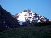
![North Maroon Peak]() Maroon Bells.
Maroon Bells.
Thunder Pyramid has been on my ‘list of interest’ for many years, initially, because of the foreboding name than later because of the challenge. However, when I was first introduced to this enigmatic mountain, my climbing experience was nowhere near what it needed it to be. So, for a few years, it remained just that, an enigma. Then about a month and a half ago, my climbing friend, Jamie Princo, suggested a climb of Thunder and its accompanying ridge over to Point 13,722. I had put this mountain and Lightning Pyramid ironically, on my “to-do” list for 2007 a few months earlier, fact, at spots #1 and #2. So when the invite was offered, I bit Jamie’s hand off.
![Crossing Maroon Creek]() Maroon Creek
Maroon Creek![Early light]() Buckskin Benchmark
Buckskin Benchmark
We arrived at the Maroon Lake trailhead in the dark, roughly 10:00pm. After, our sleeping provisions and assignments were in order, myself, Jamie, Jamie (confusing, I know!), Mark and Steve were off to sleep. Jamie Princo and I had stayed up for far too long talking about Ecuadorian Peaks that night. So when 2:30am rolled around, we rather reluctantly, got up and prepared for a tough day. Steve would not accompany us on these two mountains since he had other plans that afternoon, that is, to ascend
Point 13,039 located just north of the
Sleeping Sexton.
We were on the trail at 3:00am. For only having what could realistically amount to a couple hours of sleep, I was completely excited and awake now. We noticed some headlamps up and down towards the Bell Cord Couloir on the Maroon Bells as we were passing through. We already knew, as all of us e-mail each other frequently via 14ers.com, whom those headlamps belonged to:
Mountain Man Dan,
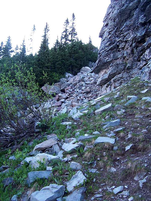
Andy and two others that I forget (sorry, guy's). We kept to the trail until we reached the bent tree. This is where we knew we needed to cross the high and fast moving Maroon Creek to gain the other side. We crossed via a massive snow-bridge and started looking for the “small” cairn that points the general way up to gain the first of by my account, four cliff bands. Searching for this cairn was a pain in the ass.
![North Maroon Peak]() North Maroon Peak from Len Shoemaker Basin.
North Maroon Peak from Len Shoemaker Basin.
A good lesson in general futility and frustration. After three of us took off bushwhacking, Jamie P., who ended up finding it by staying on the trail, called for the rest of to join him, GLADLY. We added to this cairn to mark it better for future climbers. Look for it about 50m past the creek on the left side. It was now in the neighborhood of 5:05am. Climbing up towards the
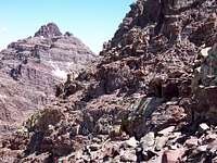
first cliff band was relatively easy. The rock detritus at the bottom, more or less, gives it away. We climbed over the moderately vegetated rock-fall and up into the narrow gully. This presented us with the
second cliff band almost immediately (39º 04.’ 464” N, -106º 59.’ 533” W). Here, we continued straight up towards an apparent gully at the top of a snow run-out. This was nothing more than a (even more so) narrow rock pile. We could see the whole of the Pyramid ridge now and quite honestly, we were all stumped as to the exact location of the White Gully. There were three logical choices. I was pretty sure on one couloir in particular because of its location from Kane’s page on Thunder Pyramid (thanks,
Kane!). However, another, more apparent and greater snow-filled couloir was causing most of our indecision. Turns out, this secondary couloir would end up being our descent route later that afternoon coming off “Lightning Pyramid”. I’d like to extend some recognition to Jamie Nellis and Shanahan96 for having the fortitude to continue on with the climb under the guise of a possible skimpy snow climb and extended rock climbing with Koflach’s. I’m still impressed with this guy’s! The
third cliff band (39º 03’ 765” N, -106 º 58’ 019” W) was all rock and considerably looser than the previous two. We waited at the top off to the left for everyone to ascend before continuing on towards the Len Shoemaker Basin.
The
fourth cliff band (39º 03’ 735” N, -106º 57’ 909” W) was basically nothing more than a rocky slope with varied pitched inclinations.
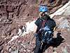
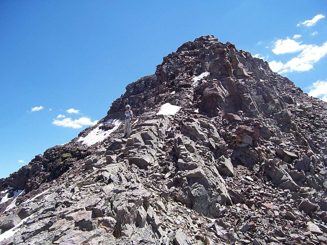
![Point 13,631]() Point 13,631
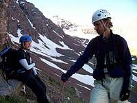
Point 13,631![Jamie Nellis and Skasgaard]() Jamie Nellis and Skasgaard taking an earned rest.
Jamie Nellis and Skasgaard taking an earned rest.
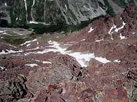
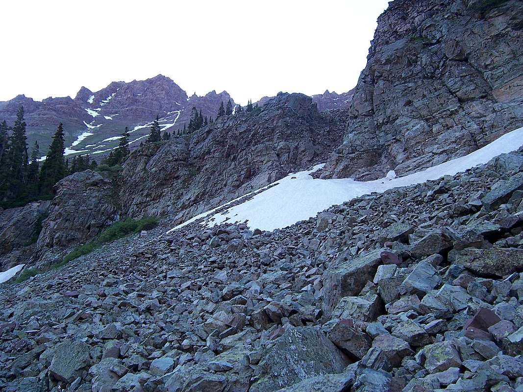
Whew! Now we were in the Len Shoemaker Basin and staring up at what we thought to be the White Gully. From the terminus of this basin, the gully is not visible. So we made a few adjustments and decided on which route we should take to gain the gully’s entrance. I was now becoming quite animated because we had just finished the second segment (in my mind) of three to gain the summit. Only the snow-climb remained. As marked in the
picture, we traversed a series of loose grassy ledges and came out on a good-sized rock overlooking the cliff at the bottom of the gully.
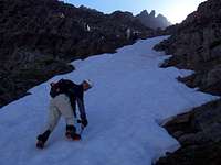
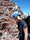
![Starting the first section of the climb]() Starting the climb of the White Gully/West face.
Starting the climb of the White Gully/West face.
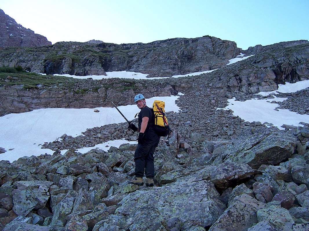
Here, we strapped up (39º 03’ 771” N, -106º 57’ 608” W). The elevation at the base of this couloir is 12,078ft. (3657m). Jamie and Jamie started up first, followed by Mark and myself. The snow was delightfully hard and allowed a very secure purchase. I was ecstatic! We came to a brake in the snow line after about 75 feet. We used this secure our packs better. “Let’s go!” I said, probably too enthusiastically.
![Looking down the West Face]() Staring down the entire West face from the summit
Staring down the entire West face from the summit
I’m a bit surprised because with the exception of the last few hundred feet, the pitch in the couloir stayed fairly consistent. There was some debate among us as to the exact slope but personally; I’d put it at mid-30ºs. A little over half way up, Shanahan96 (Jamie) decided to exit the couloir to the left and try his hand at scrambling. 20-30 minutes later, Mark did the same thing only off to the right. Both were starting to posthole too much. Considering the energy commitment post holing takes, I don’t blame them. So Jamie Nellis and I continued up the couloir alternating sides, trying to find the firmer snow and having great success with it. Jamie suggested we stay climbing the entire way to the head of the couloir as chances were, there was an exit ledge, she was right (Sweet, Jamie!). I reached the exit and climbed about 20 feet up to a secure position on the rock where I un-strapped the crampons. I didn’t dare continue on until Jamie had also reached the exit sliver. The slope was indeed a bowling alley as Kane says in his description, EVERYTHING was loose. I would really hate to climb this thing in the summer without the benefit of snow. The elevation at the top or head of the White Gully is 13,815ft. (39º 03’ 797” N, -106º 57’ 139” W). We had just finished a 1,737ft. snow climb! Holy Shit! Since my GPS and Jamie’s GPS were agreeing on elevations with a departure of about 15ft., I took this as a correct reading. Jamie Nellis and I continued up towards the north ridge of Thunder hoping to catch Jamie P. and so the Jamie’s could reunite again. I lead the way up and across the very top
west face of Thunder until we could gain a small chimmany just on the south side of the summit. Mark was already on top calling down to us! Dam, that guy moved! Another 5 minutes and finally! The summit of Thunder Pyramid! Praise be to Allah, God, the St. Pauli Girl and Guinness beer! Whew! It was absolutely awesome to see four years of drooling finally come to fruition! We were all in very high spirits and ecstatic to be on a summit that might see 20-30 visitors a year. From the summit of Thunder Pyramid, the ridge-traverse over to
Pyramid Peak looked down right crappy and complicated. These mountains when viewed from atop look like nothing more than a pile of loose rocks dumped here by a massive dump truck. Most of the Elk Mountains are standing only under sheer will. I can understand why these mountains are so dangerous.
Short video of attaining the summit!
Second short video on the summitStarting the traverse to Lightning Pyramid
![One of the crux s]() Asphezelle on the traverse
Asphezelle on the traverse
After our summit photo session was over, the ridge traverse over to Lightning Pyramid would hammer this statement home permanently. As to right now, we all knew what to expect and were not surprised by anything in particular. However, we had all underestimated this ridge. Plus, the fact that we were basically doing it backwards (reverse) didn’t help the situation. The recommended direction is from the Thunder/Lightning saddle and then climb north on this class-4 ridge towards Thunder. But these two mountains I believe are actually treated de facto as two separate climbs. I wouldn’t undertake this ridge unless you’re well seasoned as a climber. It is exposed for 85-90% of the time with some sections considerably so, everything on this ridge is loose (similar to stacking dishes or tile) and there are sporadic class-5 moves required. The other thing I noted while traversing, the path of least resistance was actually along the ridge crest itself. DO NOT leave the ridge crest if you do not have to. Mark and myself tried this is one section and were sorry we did because the difficulty, though stayed the same or equivalent, the slope consisted of nothing more than small sloped ledges that wouldn’t fit anything larger than a pika and were littered with loose talus and scree. Many 5-10ft. drops were interspersed in addition to no feasible way of self-arrest in the advent of a fall.
![Taking a rest]() Taking another well-earned breather.
Taking another well-earned breather.
So we carefully made our way back to the ridge crest and stayed here for the duration to the saddle. I lead most of the way over the traverse stopping at safe sections, waiting and occasionally guiding a line down. No one took any definite times but I believe this traverse took us about 4 hours to complete. I believe it is about .5 mile long.
At the saddle, which oddly, is a stand out gray from the predominant red of the mountain and ridge, the route becomes considerably easier,
class-2. Again, if traversing to “Lightning Pyramid”, stay on the ridge crest. You can’t see portions of it from the saddle as it serpentines its way towards Point 13,722 but it becomes a veritable sidewalk. But did we do this option? Hell, no! Why make it easy?
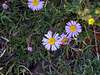
![Elk Mountain flora]() Gratutious flower shot.
Gratutious flower shot.Lightning Pyramid
![The saddle for Lightning Pyramid]() At the ridge for "Lightning Pyramid"
At the ridge for "Lightning Pyramid"
From the saddle, we traversed and angled up onto Lightning’s East face. The ledges on the traverse proper that I mentioned earlier or lack thereof, had now actually become reasonable ledges. They were still sloped and loose but let’s throw a little mud on the picture, shall we? There were some snow lines that were quite adamant about their melting and water content and most of the ledges if they weren’t solid rock, were basically that, mud. My left foot actually sank like three inches on one step and started to slide off. Mark wasn’t far behind me so he had to deal with this shit also. We wound our way over to the south ridge and up a six-foot lift to finally gain the summit of “Lightning Pyramid”! I threw my axe and pack down cussing generously, marveling at our stupidity at not staying on the ridge crest. This maneuver costed us about 30 minutes. Part of my frustration though was due to me being significantly mentally fatigued and utterly exhausted. Mark felt exactly the same. About 15 minutes later, the Jamie’s came strolling up to the top of the very small summit. We were all initially, upon reaching the summit, tired and exhausted. The East Face of “Lightning Pyramid” has some chimmany’s that would in hindsight now, be pretty interesting, probably class-4. We noted that Aaron Ralston had signed the register. He was one of two signatures for 2007.
15 minutes later, we all packed up. We had been thinking about the down-climb off of “Lightning” for a little while and were of the opinion, the only reasonable way down was the couloir off the west side of the saddle. So we started our descent off the saddle. We took turns down-climbing in groups of two to minimize the rockslide with an eye on safety. As soon as one group was down a short distance and protected from rock fall, we yelled,
“Clear!” This way, the other group could descend without additional concern. We were looking for snow at this point. We wanted a continuous line all the way to the bottom. Due to three major bends in this couloir, it was impossible to see the way down clearly. My concern was that we would encounter a serious class-5 drop/overhang. There was no (thankfully) down-climb like this but there was a crux of about 15-20-v-ft. We could either down-climb this OR strap the crampons back on and down-climb the very narrow strip of snow that basically started the beginning of the continuous line we were all hoping for. I opted for the snow. Ok, now it’s my turn to be surprised. Once I was out on it, I found that it wasn’t snow at all. It was actually a ~30ft. piece of mixed rock and ice. I have absolutely no ice climbing experience but I know enough, that while I was kicking my front points in, the entire strip vibrated with my meager purchase. For that short 15 minutes or so, I was more nervous than the entire 4 hours on the traverse! I knew I should have bought that second tool I’ve been eyeing; live and learn. The Jamie’s and Mark down-climbed the slab. The couloir ended up being a steep little SOB. I personally put it somewhere in the neighborhood of the high 30ºs with sections towards the center approaching 40º or so. The couloir alternates between class-3 and class-4. Up towards the top, it's quite wide and extremely loose, much more so than near the center. The pitch is also gentler, probably somewhere in the low to mid 30ºs.
![Downclimbing a strip of ice]() Starting the downclimb proper of the narrow couloir.
Starting the downclimb proper of the narrow couloir.
But, without the benefit of snow, I can see the center not holding as much loose rock or talus. With the snow, it was actually quite easy to down climb. It also narrowed significantly. It averaged about 20-25ft across (width) with one section that couldn't have
been more than 12ft. It had a wide run-out at the bottom. I was going to take some pictures and cord. points while in it to create a route page but I didn't feel like stopping
every 50ft. I just wasn't comfortable doing this on the soft snow.
![Descent Couloir for Lightning]() The descent couloir.
The descent couloir.
At this point in the day, the snow was greasy sugar. Fact, I actually took a ~15ft. slide myself before I was able to self-arrest. Glissading this would have been a death wish. This couloir is basically the next couloir over (south) from the White Couloir. I don’t know if it even has a proper name. It turned out to be very convenient in hindsight. Mark had caught up to me and we both waited at the bottom on the grass drinking straight from the tap, man that was cold water! About half an hour later, the Jamie’s showed up and we skirted down through some more cliffs (Geese! Doesn’t this shit ever end?!) until we reached the valley floor. Here, I took my leave from the rest of the group and jaunted out quickly. I had to work that night and I had a long way to get back home. I sprinted about two miles worth of trail before it got too dark to do this safely. My luck, my headlamp had stopped working! But, thankfully, it was a half-moon, so I had all the light I really needed. I finally reached my truck at 9:40pm, reassured a worried Steve who was still waiting for us with patience that would have humbled Job, that the rest of the climbing party was about an hour or so behind me. So, we packed it up, drove into Aspen, stopped by the City Market and Steve drove us back to Denver while I slept.
A long day that turned into an 18+ hour epic.
![On the summit of Thunder Pyramid]() A successful summit of Thunder Pyramid!
A successful summit of Thunder Pyramid!![Exposure!!]() Just a little bit of exposure!
Just a little bit of exposure!
Other photographs
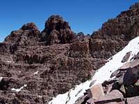
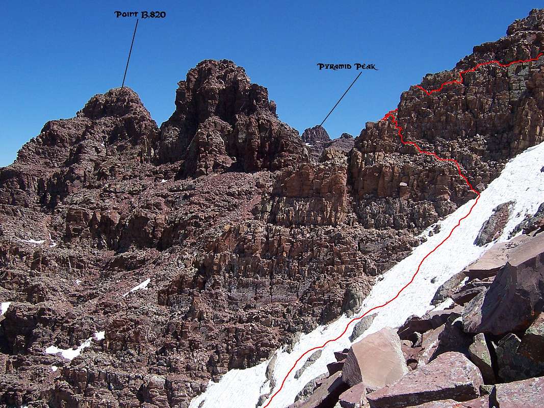
![Point 13,820]() Point 13,820
Point 13,820![Topping out on the White Gully]() Topping out on the White Couloir.
Topping out on the White Couloir.![North Ridge on Thunder Pyramid]() The upper West face of Thunder Pyramid.
The upper West face of Thunder Pyramid.![Pyramid/Thunder traverse]() The traverse to Pyramid Peak
The traverse to Pyramid Peak![Pyramid Peak]() Pyramid Peak
Pyramid Peak![Downclimbing the South Ridge on Thunder]() One of the sporadic crux's on the traverse.
One of the sporadic crux's on the traverse.![The White Gully]() The White Gully/West face
The White Gully/West face![Yet another crux]() Yet another sticky spot.
Yet another sticky spot.


Comments
Post a Comment