Intro/Stats
"Thunder Pyramid" (13932')
10.3 miles RT, 4800' gain
Via West Face/D Baker/Krzanowsky Direct
Participants: Darin Baker, Pete Krzanowsky, & Kevin Baker
"Redemption on Thunder Pyramid"
Thunder & Buckskin BM Pics
Foreboding Thunder Pyramid has been a thorn in my side for the last couple years. Darin and I made a feeble attempt of it two years ago and made a myriad of routefinding mistakes down low as an injury to our climbing partner and weather ultimately doomed us. We were eager to give it another shot vowing not to make the same stupid mistakes.
Pete is working on the centennials and joined us. It's best to keep the group small on this loose scrap heap that rarely gets climbed. The forecast was looking ideal, so after a longer day than expected on Hagerman and Snowmass Peak, we decided to not pack in and just dayhike it from Maroon Lake.
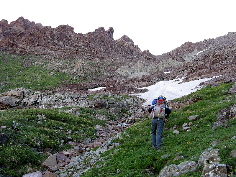
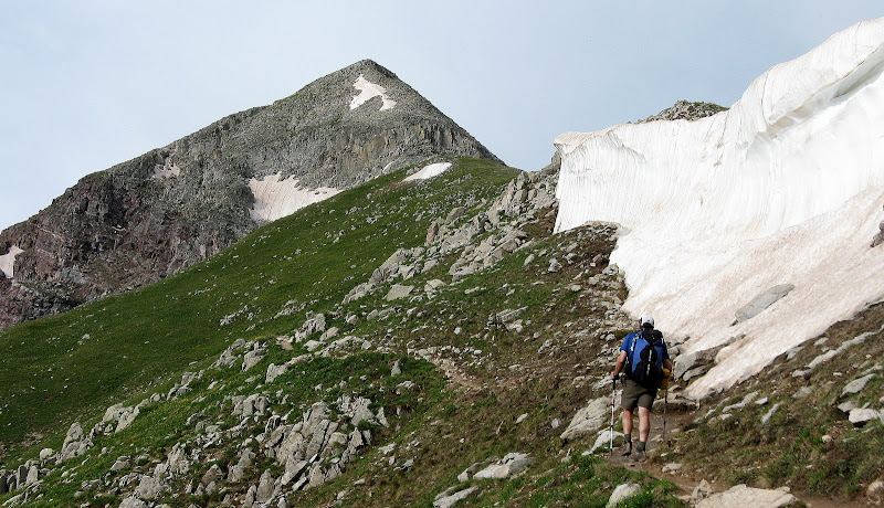
We set out at 4:40am and I was feeling a bit sluggish. It was nice to enjoy a mellow trail as it only climbs about 1000' in 3.5 miles. As Roach would say, the introduction is over just beyond the famous bent tree for the South Maroon, past the stream crossing to a small cairn at 10620'. We missed this the first time and took the wrong bearing. This time, we headed due east at the edge of the trees and crossed a boulder field to the first obvious gully. Not sure how we screwed that up the first time! The view from the trail is daunting to say the least, as it is now a climb of some 3300' in only 1.35 miles!
Up the Steeps We Go
View from trail in afternoon:
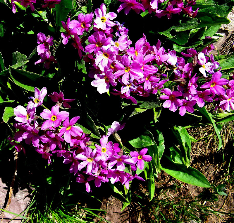
We easily found the 2nd and third gullies without a problem as there are occassional cairns and soon we were at the beautiful Len Shoemaker basin at the base of the west face. Wildflowers were abundant.
We skirted the waterfall/cliffs to climber's right of the waterfall on grassy benches. We then traversed north across the grass to a gully below the white gully.
The white gully did not have continuous snow, so instead of switching out crampons and axes we decided to stay on or near the rib of white rock on the left side of the gully.
Everything was going great and the rock wasn't near as loose as we expected. Maybe climbing peaks in the San Juans jaded us. We began to comment how overrated this peak was and I think mighty Thunder wasn't about to give up the summit! The rock got looser as we approached the saddle, so we fanned out and took different lines. The sun had now crested the ridge and it was in our faces, making it hard to see exactly where you were going.
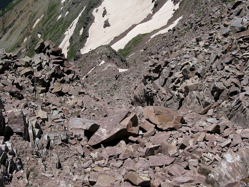
As we crested the saddle, I looked to the south along the ridge and saw something big. The terrain didn't fit what I was expecting.
Wrong saddle!
My heart sunk when I realized we had taken a subsidiary gully too far north off the white gully and were now on the wrong side of the mountain! I looked at my GPS and it confirmed my fears. I announced that we were on the wrong side of the summit and Darin and Pete just looked at me in disbelief.
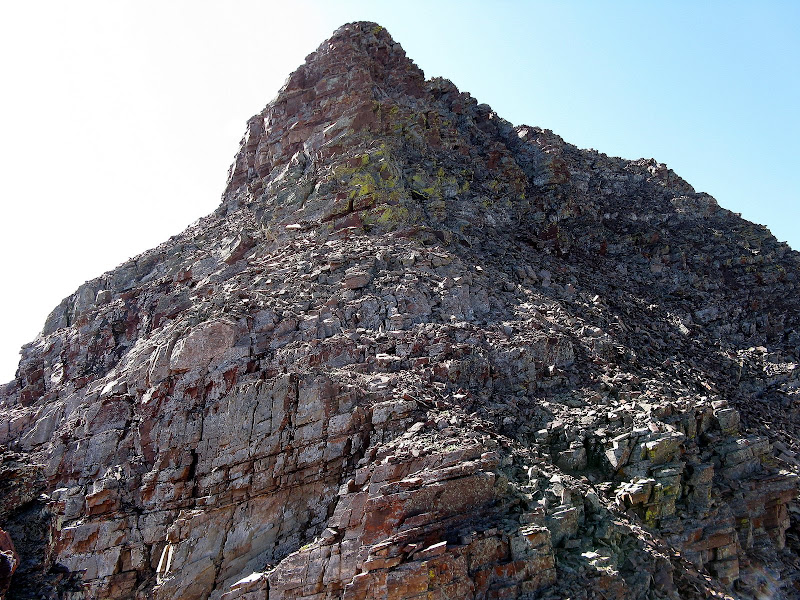
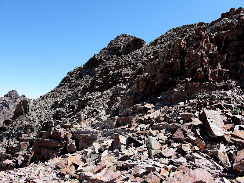
The nasty north ridge of Thunder. Now how do we get around this?
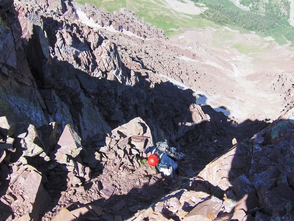
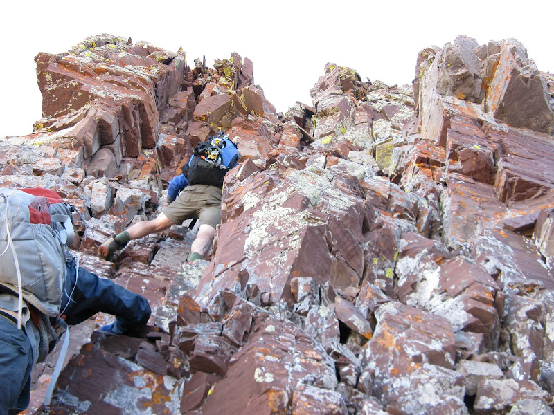
The ridge was not an option for us as it was obviously 5th class, loose, and insanely exposed. We contoured from the saddle out onto the west face on ledges and weaved our way up through the cliff bands, keeping the climbing at 4th class. All holds had to be cleaned and checked as this was your typical suspect, loose sedimentary garbage in the Elks.
Working our way up the summit block below the north ridge:
Luckily, dealing with this junk was brief as we were directly underneath the summit. Darin found a doable 4th class chimney that gave way to class 2 terrain just below the summit. Darin captures the scene well as I am in position for the last climbing move.
It was an exciting finish as we topped out at 10:50am, but we all had wished we had been paying attention more so we didn't have to make it so hard on ourselves on suspect terrain. The weather was perfect, so the traverse to Lightning Pyramid was in the cards. I didn't really have an intention to do the high traverse along the very exposed ridge crest, but the mountain would throw us another curve ball.
The Traverse? No Thanks!
We descended the much easier standard route down the south ridge to the top of the white gully, staying on the west side of the ridge when there were difficulties.
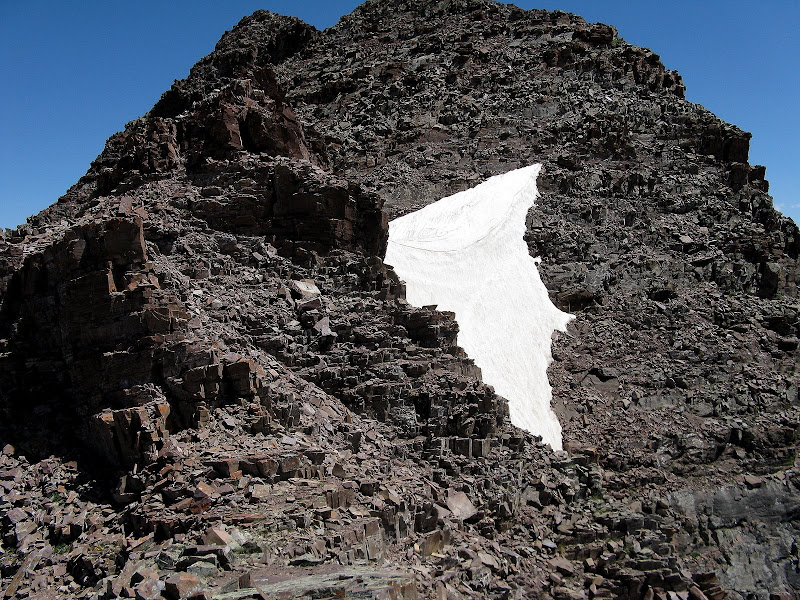
We came to a massive snowbridge above the couloir that is the exit point down the east side to the much easier sidehilling traverse, which you follow down to the elevation of the Thunder/Lightning saddle. The problem was this snowbridge looked way too risky to downclimb even with axe and crampons!
Looking back at the snowbridge after we had passed it on the ridge:
We decided to see what the ridge would give us. It started to get much more exposed as we descended and we came to a narrow, loose ramp that looked very spooky. Pete went across and didn't like what he saw below, a sharp 4-5 foot downclimb followed by another step below. I went across and didn't like it either.
Exposure anyone?
We decided to head up to the snowbridge and see if there were any other alternatives. I spotted a loose gully that would probably go, but we weren't sure what was below it.
Loose gully anyone?
We came to the consensus to call it a day as we all agreed we had already had our fair share of excitement for the day.
We descended the correct gully this time, which was much looser than the line we took! A group of 3 was just making there way closer to the saddle as we descended. It was an older guy with 2 girls who looked to be high school age. I hope they knew what they were getting into!
Darin and Pete decided to see if they could downclimb the snow in the white gully while I stayed on rock for awhile. The snow was too hard for them, so they went back to rock too. I tried a strip of snow farther south on the face and found the same conditions, too hard to plunge step.
On the descent, we got a bit too south of the exit point to traverse the top of the lower cliff band, so I was glad I plotted a waypoint to get us back on track. We made our way down the last 3 gullies without much a problem, and were happy to finally be back on a level trail! Pete, being the nut that he is, decided he didn't get enough exercise on the day and ran down the trail the rest of the way! My feet were killing me from the steep hiking, but the world class views made up for the pain. I made it back down at 5:12, happy to find redemption on mighty Thunder, but 0 for 2 on Lightning!
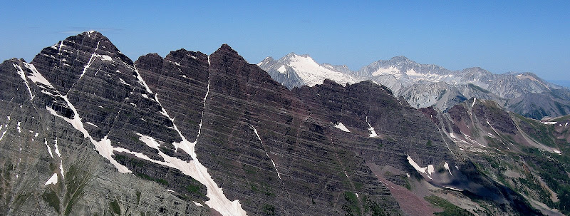
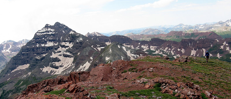
The Bells, Sleeping Sexton, Capitol, and Snowmass from Thunder:
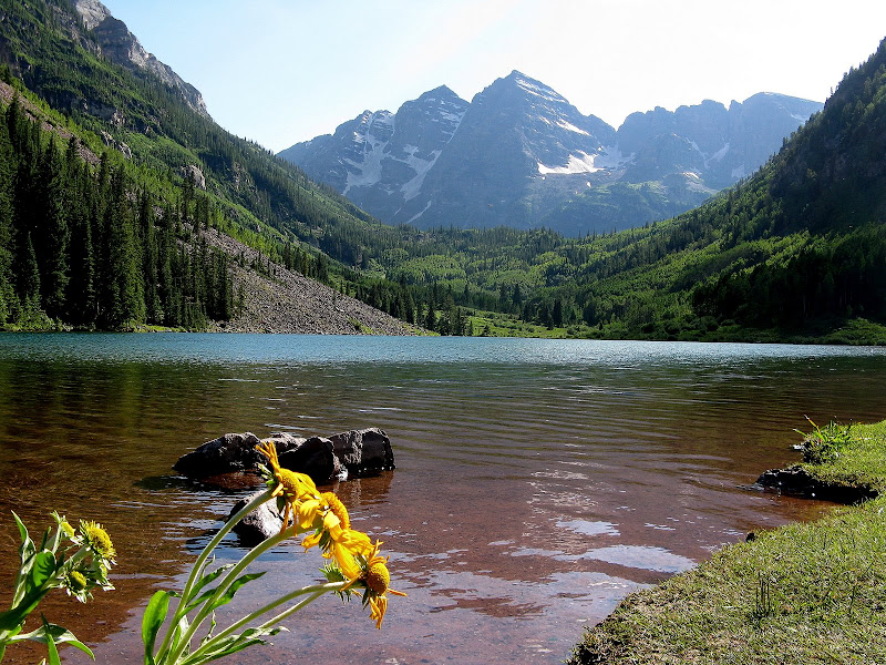
Tourist shot from Maroon Lake of the Bells:
Buckskin Benchmark Group: A Photo Tour
Unnamed 13039
Buckskin Benchmark (13370')
Unnamed 12940
Unnamed 12942
Via West Maroon/Minnehaha/Willow Lake Trails
13 miles RT, 6100' gain
Pete headed home, while Darin and I decided to do a mellower hike the next day in this spectacular area, heading up to Buckskin Pass for some obscure 12ers and 13ers. The crux was the north ridge of 13039. This peak is normally class 3 when dry, but there was still lingering steep snow on the east side that was a no go without an axe. Note to self: Bring an axe in the Elks, even in July!
Here's a photo report since the views were worth a thousand words:
North Maroon's n.e. ridge:
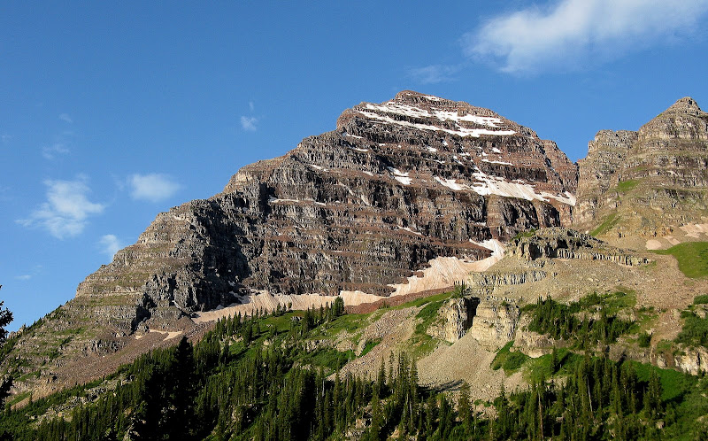
13039 looms above Buckskin Pass:
Darin near 4th class crux on 13039:
Darin nears Buckskin Benchmark summit with Bells in background:
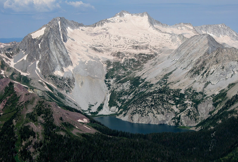
Hagerman & Snowmass from Buckskin Pass:
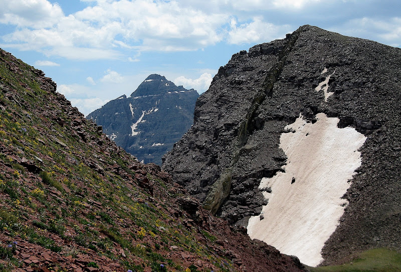
Pyramid sandwiched by the saddle of the 12ers:


Comments
Post a Comment