
|
|
Area/Range |
|---|---|
|
|
44.55033°N / 9.49039°E |
|
|
Hiking, Mountaineering |
|
|
Spring, Summer, Fall, Winter |
|
|
5919 ft / 1804 m |
|
|
Overview
“If we want to build the peace in the world, firstly we build it inside by us".
His Holiness, Tensin Gyatso
XIV Dalai Lama, Nobel Prize for the peace.
 |
Faiallo's Pass 1061 mt. Point of junction of Savona and Genova province. Thank you BigMat
The Ligurian Apennine is the natural continuation of Maritime and Ligurian Alps.
The beginning of the Apennines range was convenctionally fixed at Colle di Cadibona 459m, named also Bocchetta d'Altare, near the village of Altare (province of Savona), but this proposition could be brought into question, since eastwards there is for example the Mount Beigua Group 1287m: the characteristics of this massif are very similar to the Alps, in geological terms (Gruppo di Voltri).
However we conform to the convenction that Alps become Apennines just at Bocchetta d'Altare.
From here Ligurian Apennine extends as far as La Cisa Pass in the upper valley of the Magra river, above La Spezia; at first it follows the arc of the Gulf of Genoa, and then runs east-south-east, always parallel to the coast.
The broad plain of the Po river stretches north and north-east of the Ligurian Apennine; the main tributaries of Po coming from Ligurian Apennine are the rivers: Scrivia, Trebbia and Taro, whereas Tanaro, another important tibutary, rises in the Maritime Alps, though largely fed by streams ("torrenti" in Italian) descending from Ligurian Apennine.
On the other hand, the streams running on the southern and SE side of the range are short and not very important, although they caused disastrous floods repeatedly.
The south side of the range rises steeply from the sea, leaving practically only a narrow coastal strip between the mountains and the sea: its slopes are sheltered from the northern winds and therefore fertile and highly cultivated.
The towns on the coast form the favourite winter resorts of the Italian Riviera.
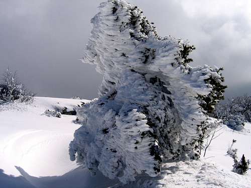
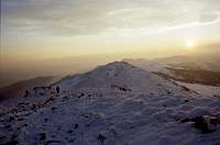
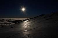
The highest point of Ligurian Apennine, Monte Maggiorasca, reaches 1804 meters and all the zone near the village of Santo Stefano D'Aveto 1017m is a resort ski area.
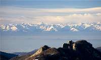
An unique places were is possible to see the snow and the sea, the cities of Savona and Genova are near, with their comforts wet by the Ligurian sea.
The beginning of the Apennines range was convenctionally fixed at Colle di Cadibona 459m, named also Bocchetta d'Altare, near the village of Altare (province of Savona), but this proposition could be brought into question, since eastwards there is for example the Mount Beigua Group 1287m: the characteristics of this massif are very similar to the Alps, in geological terms (Gruppo di Voltri).
However we conform to the convenction that Alps become Apennines just at Bocchetta d'Altare.
From here Ligurian Apennine extends as far as La Cisa Pass in the upper valley of the Magra river, above La Spezia; at first it follows the arc of the Gulf of Genoa, and then runs east-south-east, always parallel to the coast.
The broad plain of the Po river stretches north and north-east of the Ligurian Apennine; the main tributaries of Po coming from Ligurian Apennine are the rivers: Scrivia, Trebbia and Taro, whereas Tanaro, another important tibutary, rises in the Maritime Alps, though largely fed by streams ("torrenti" in Italian) descending from Ligurian Apennine.
On the other hand, the streams running on the southern and SE side of the range are short and not very important, although they caused disastrous floods repeatedly.
The south side of the range rises steeply from the sea, leaving practically only a narrow coastal strip between the mountains and the sea: its slopes are sheltered from the northern winds and therefore fertile and highly cultivated.
The towns on the coast form the favourite winter resorts of the Italian Riviera.
The highest point of Ligurian Apennine, Monte Maggiorasca, reaches 1804 meters and all the zone near the village of Santo Stefano D'Aveto 1017m is a resort ski area.
An unique places were is possible to see the snow and the sea, the cities of Savona and Genova are near, with their comforts wet by the Ligurian sea.
 |
 |
 |
 |
Major Peaks
Ligurian Apennine marks the border between Liguria and many other Italian regions: Piemonte, Lombardia, Emilia and Toscana.
Therefore many summits belong simultaneously to different provinces.
Here is a list of the highest peaks, ordered according to the height, and reporting for each one: its name, its height (in meters) and the Provinces to which it belongs (where: GE = Genova, AL = Alessandria, PV = Pavia, PC = Piacenza, PR = Parma, SP = La Spezia, MS = Massa-Carrara)
|
Summits of Ligurian Apennine |
|||||
|
Name |
height |
Province |
Name |
height |
Province |
| Maggiorasca | 1804m | GE PC PR | Oramara | 1522m | GE |
| Bue | 1777m | GE PC | Montarlone | 1500m | GE |
| Bregaceto | 1771m | GE | Boglelio | 1491m | AL PV |
| Penna | 1735m | GE PR | Zuccone | 1423m | SP PR |
| Ragola | 1710m | PC PR | Zucchello | 1422m | GE PC |
| Chiappo | 1699m | AL PV PC | Rocca Bruna | 1418m | GE |
| Ebro | 1699m | AL | Zatta | 1404m | GE SP |
| Aiona | 1695m | GE | Buio (page) | 1401m | GE AL |
| Cavalmurone | 1670m | AL PC | Ramaceto | 1345m | GE |
| Alféo (page) | 1650m | PC | Collere | 1288m | GE |
| Carmo (page) | 1642m | AL PC | Beigua | 1287m | SV |
| Gottero | 1640m | SP PR | Ermetta | 1267m | SV |
| Tomarlo | 1602m | GE PR | Caucaso | 1245m | GE |
| Antola (page) | 1597m | GE AL | Porcile | 1240m | GE SP |
| Molinatico | 1549m | MS PR | Posasso | 1236m | GE |
| degli Abeti | 1542m | GE | |||
Meteo
VIRGILIO METEO
NORTH RIDGE OF LIGURIAN APENNINE ( Padanian )
ASTI
ALESSANDRIA
PIACENZA
SOUTH RIDGE OF LIGURIAN APENNINE ( Sea )
SAVONA
GENOVA
LA SPEZIA
MASSA CARRARA
 |
 |
Webcams
- HIGH ROUTE LIGURIAN MOUNTAINS - ALTA VIA DEI MONTI LIGURI -