Planning, and the Long Trip to Bariloche
This trip will be divided into two trip reports, since I spent time in both Chile and Argentina. This report will describe my time spent in Argentina; specifically the area around Bariloche and the Nahuel Huapi National Park. For the Chilean part of my trip see this trip report.
To start off, this trip was not supposed to happen...yet again I ran down to South America at the last minute. Since I was gearing up for a potential hiatus from work due to the very low gas prices that started plummeting at the end of 2014, I threw around the idea of heading back to Patagonia. The idea seemed much more appealing this time since it would be the middle of February when I left rather than late March, when I went to Chile last year. As it turns out, the day after the dreadful Superbowl 49 (which will haunt my dreams forever :P) I was done with work and I returned to Bozeman for a couple weeks before my planned departure date of February 15th. A lot happened in that two weeks that is better saved for a different story, but I managed to go ice climbing at Hyalite a few times and made some new friends.
When the 15th came around, I drove to Denver since it was much cheaper to fly in and out of Denver. It took me around 8 hours I think to make the drive and thankfully it was warm and dry the whole way. After crashing the night at a friend's house, I woke up to a blizzard and had to literally sweep 6 inches of snow off my car. I went to a grocery store to pick up some more food and cash (which I didn't get enough of either) and proceeded to park my car at the Nine Mile Park and ride, without realizing the potential disaster that may have ensued (a fee is required to park there!). All I wanted to do was park and get to the airport and out of the worsening blizzard, so I never noticed and signs signalling the required daily fee. I managed to find a place to park and caught the bus to the airport armed with one 50 pound, and two 15 pound packs; one of which promptly disappeared within the next day.
So I caught my flight leaving Denver to Mexico City on Aero Mexico airlines. The flight was delayed so they could de-ice the plane but since this was my first time flying first class, I was comfortable enough and I was treated to a wide array of snacks, drinks, full meals etc. Upon arrival to Mexico city, I was able to enjoy my 5 hour layover in style in the VIP lounge where I ate a copious amount of free sandwiches, beer, soda and cookies. I was a bum among so-called dignitaries in there! My next flight to Santiago was especially nice as it was on one of the brand new Boeing Dreamliner planes with a newly designed first class section where the seats went down to form a flat bed even long enough for me. I was able to sleep most of the way down and cannot remember how many quality meals they gave me.
Upon arrival in Santiago, I switched some of my cash to Chilean Pesos and got a decent exchange rate of 620 Pesos/Dollar. I then was dragged by one of many, many taxi driver con artists wanting to give me a ride somewhere. To amuse the one who actually did know a little English, I agreed to accept his service as I needed to get to the Bus Terminal at Central Station. He wanted to charge me 25,000 Pesos but knowing the insanity of that price, I said 10,000 or I walk, which he amazingly agreed to without much hesitation. Next time I offer even less! I got to the bus station in one piece and immediately was uncomfortable with my enormous amount of gear and surrounded by thousands of people half my height thinking of ways they can rip me off. I bought a bus ticket to Osorno for that night (which I was probably ripped off at 35,000 Pesos but it was in the height of the season so I didn't haggle). My extreme lack of Spanish wasn't helping matters, but I learned about the amazing thing quite literally called "Guard-a-bags" located in nearly every bus terminal in Chile and Argentina. Without hesitation, I dumped my 100 pounds of crap off there and paid 4,000 Pesos for the day for them to keep watch over it. I had 12 hours to kill before the bus left so I walked to the Subway station and went to a place I knew I could buy some maps.
I managed to find the small outdoors shop on the northeast side of the city and bought a handful of maps, a canister of fuel for my stove and a couple other small things. I grabbed a small lunch at a supermarket and returned to what I thought was the bus terminal. Unfortunately, I assumed my bus would leave from the Borja Terminal, where I left from on my last trip. However since I bought the ticket at the Alameda Terminal the bus left from there. I didn't even realize there were two different terminals! I got off the subway at the Central Station stop and realized that my bus wasn't leaving from Central Station. I then spent the next 2 hours trying to find where the Alameda Terminal was (My taxi driver dropped me off there and I didn't pay too much attention where it was since I assumed it was all Central Station). I finally found someone who spoke English to guide me in the right direction. Turns out it was only 4 blocks away. With only an hour before my bus left, I picked up my bags and walked to the correct bus gate. Exhausted from running around for hours, I sat down on my large pack and put my head down to rest a little and before I knew it, one of my packs was missing! Luckily there wasn't too much important stuff in there but I lost two pieces of gear I really liked, including my medium grade mountaineering gloves (the only pair I brought), my sandals, sleeping pad, sunglasses, headlamp, and the pack itself which I will miss the most. To add insult to injury, I also lost my car key but thankfully I would be able to get that replaced before I returned.
 Tall buildings in Santiago
So with maybe $500 of gear now stolen, I thought about what I really would need to replace while in Argentina and the only thing I decided I really needed was a sleeping pad, but if I wanted to actually do any real mountaineering I would need to also buy sunglasses and a headlamp. I decided to wait and only get those if I needed to. I also realized later that my camera battery charger and SD cards were also in that pack so I planned to make it a priority to replace both of those when I got to Bariloche. Feeling very disappointed, I got on the bus with one less pack and fell asleep fairly quickly. Before I knew it I woke up to daylight as I approached Osorno, and when I arrived, it was fairly early and the Via Bariloche window wasn't yet open. I had to wait a bit to buy an international bus ticket to Argentina and it was quite expensive I recall. I think it was 20,000 Chilean Pesos. Anyway, I continued east on the road that connects Osorno and Bariloche and had to stop twice; once when leaving Chile and once when entering Argentina. I didn't know why they couldn't expedite the process and do everything in one stop at the border but they never seemed to do that. Finally, I reached Bariloche and spoke with someone at the tourist office and got a few maps of town. The bus terminal was a few miles from the center of town so I grabbed all my gear and took the bus to the center, where I was able to quickly find a decent looking hostel that I would end up using on and off for the next couple weeks. At 150 Argentine Pesos per night (~$15) I was ok with that. The owner also spoke English so he was able to give me some advice about buses, places to eat and buy things etc. which was very nice.
 Downtown Bariloche
 |  Church on the lake shore
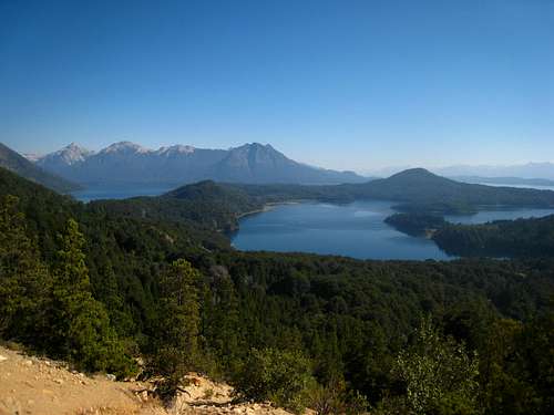
 |  Lago Nahuel Huapi from Bariloche
 |
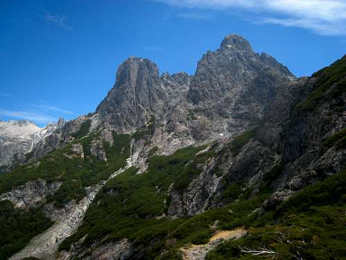
Climbing at the Frey
Aside from wander around town I didn't do anything that first day I arrived in Bariloche. I had been on buses for nearly 18 hours and just wanted to relax. I emailed friends back home, went out to eat and unsuccessfully tried to find an SD card that was compatible with my camera. It was an early bedtime for me that day. The next day I was a little more successful at finding things. I was able to buy a similar sleeping pad to the one I lost, a plug adapter (since Argentina uses yet another type of plug!), and I ended up getting a cheap headlamp. I ate lunch at a nice restobar that served excellent chicken but my waiter used my lack of Spanish knowledge to his advantage and served me the Argentine equivalent of Coors Light for beer. He was nice enough to give it to me for free though when my check came. Man that was an awful beer (Quilmes was the name) but I still managed to drink an entire 1.5 liter bottle of it! I planned out my first little trip and decided to head to the Frey and see what I can find. I originally mapped out the entire Nahuel Huapi Traverse and was going to take roughly 6 days to make the long trek and also ascend as far up Tronador as I could, but those plans quickly changed when I arrived at the Frey.
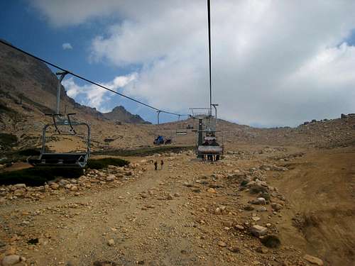
Early the next morning, I caught the Villa Catedral bus and to my disappointment, the town, and the surrounding mountains were completely covered in forest fire smoke. I asked around to see if anyone knew anything about where the fire was and I realized that one of the biggest forest fires in Argentina history was burning roughly 150 miles south of Bariloche. Although the smoke was on and off the entire time I was there, it was especially bad on this first day. An hour or so on the bus later I arrived at Villa Catedral and was shocked to see an enormous village there. I didn't realize it was a massive ski resort and immediately my laziness took over and I paid for a ride up the ski lift to significantly shorten my hike to Refugio Frey. Plus, the smoke really made it hard for me to breathe and I didn't want to exert too much energy. I had hoped it would improve with a change in wind direction later on.
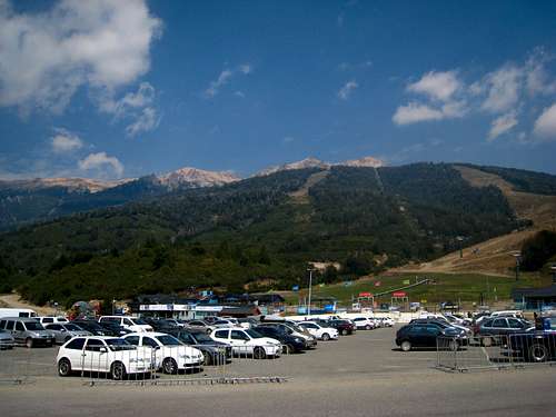
![Cerro Catedral parking area]() Cerro Catedral parking area
Cerro Catedral parking area | ![Riding the Cerro Catedral ski lift]() Riding the Cerro Catedral ski lift
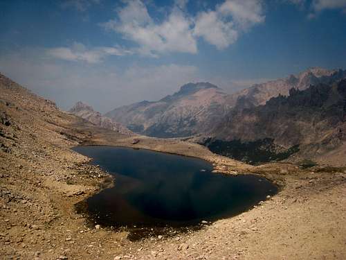
Riding the Cerro Catedral ski lift | ![Laguna Schmoll]() Looking down on Laguna Schmoll
Looking down on Laguna Schmoll |
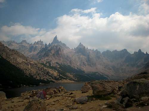
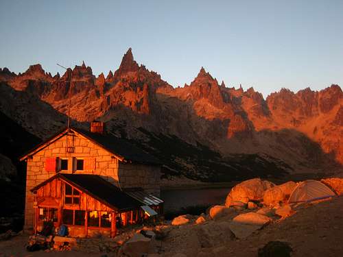
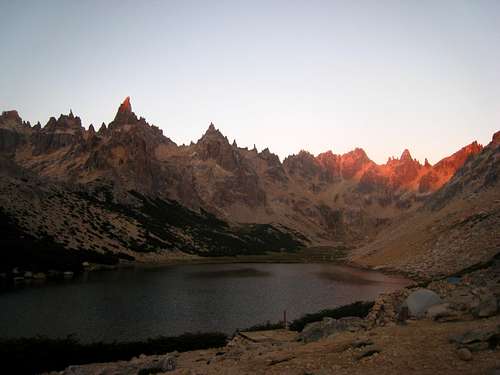
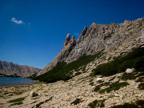
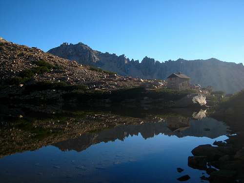
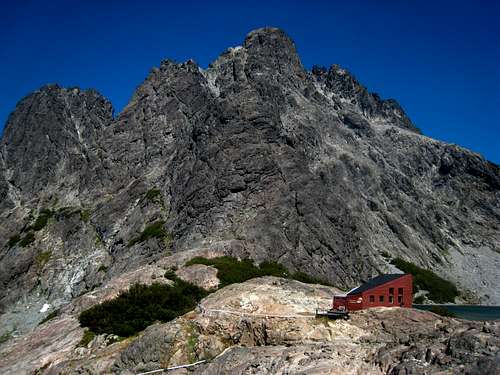
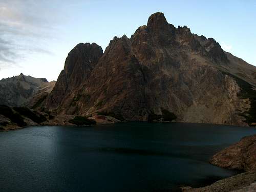
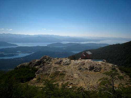
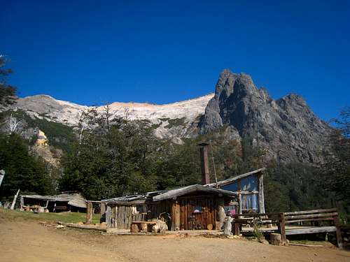
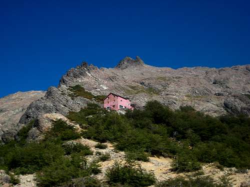
Once at the top of the ski lift, I hiked uphill for maybe 20 minutes to the ridge and followed the boot path marked by red dots painted on the rocks more or less traversing in a southerly direction until I reached the saddle above Laguna Schmoll and what I would call Quebrada Frey (Valley of Frey). It took me around 2 hours to get to this point. I began hiking down the steep slopes, where some scrambling was required. I was carrying a fairly heavy pack since I planned for 6 days of trekking and I brought my rock climbing shoes and harness just in case. I reached the side of Laguna Schmoll which is a small lake above the main valley where Laguna Frey and the refugio are located. I finished the hike down to the refugio and found a nice place to set up my tent just a short distance away. To my surprise, there was pizza, sandwiches, beer, wine and loads of information all available at the refuge. As much as I like remoteness and pristine wilderness, I could not deny the fact I loved having fresh food made for me while roaming around the mountains. Actually, the entire Nahuel Huapi Traverse can be done with nothing more than some water and a sleeping bag since every lake in the area has a refugio you can both stay in and eat at.
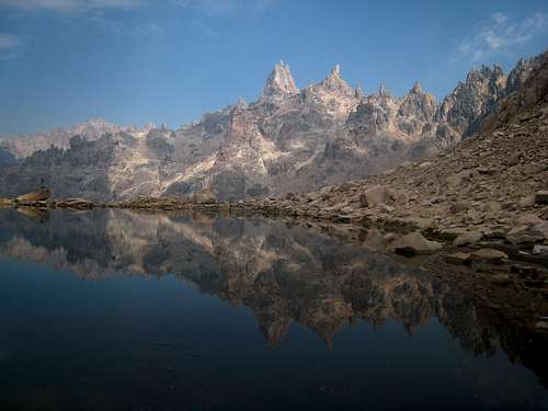
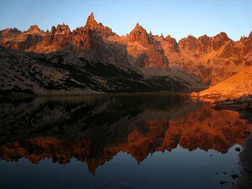
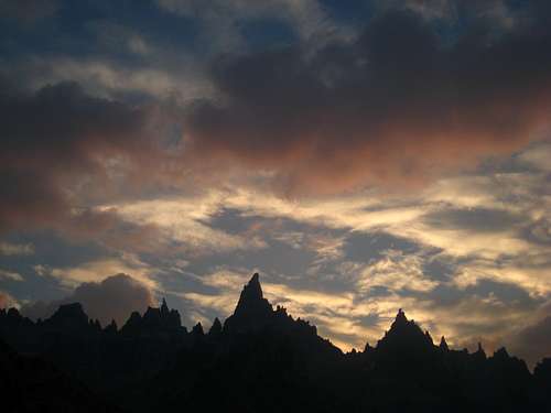
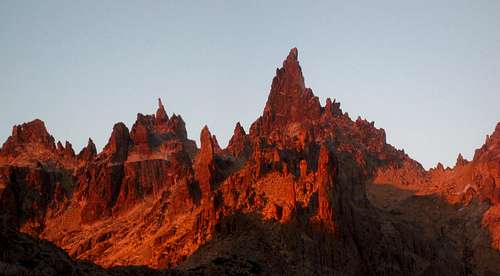
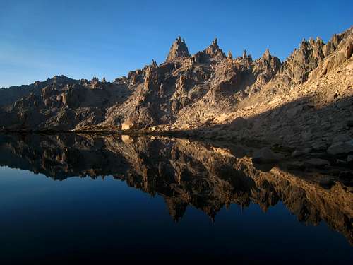
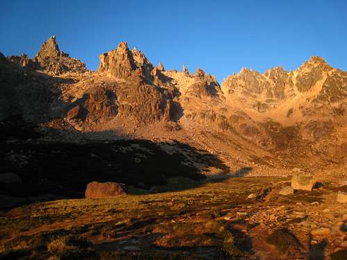
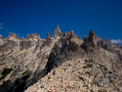
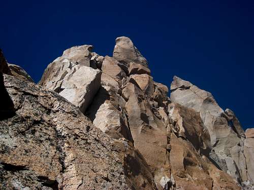
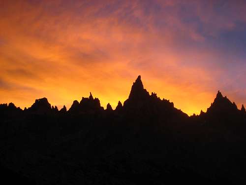
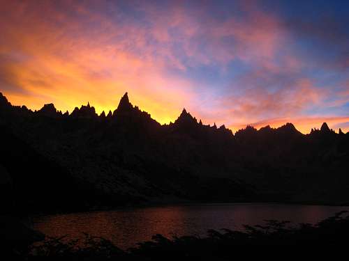
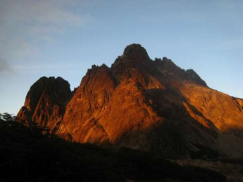
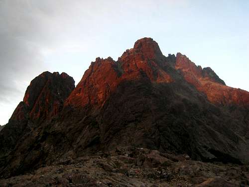
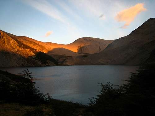
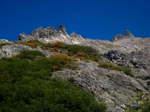
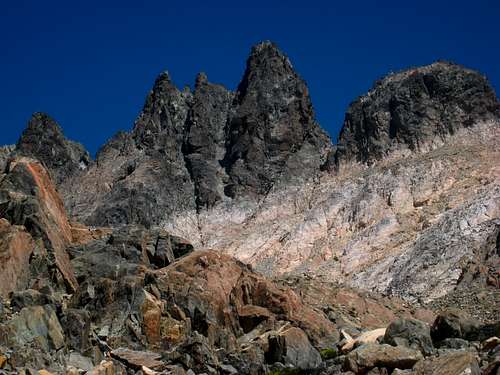
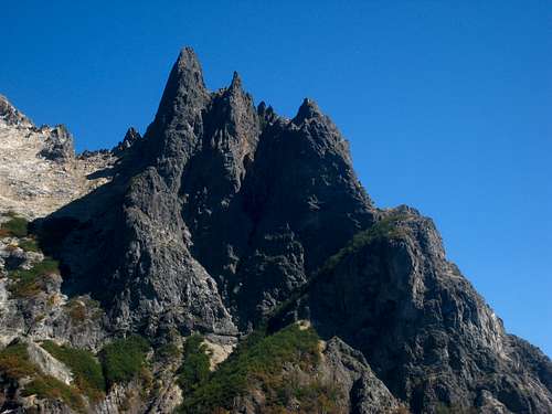
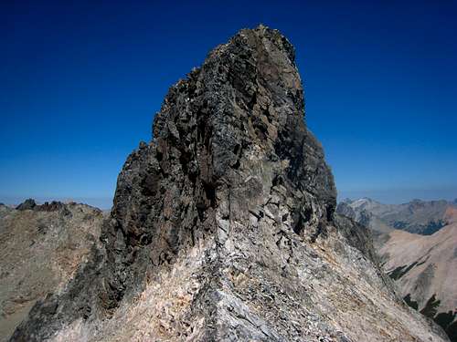
Shortly after I arrived, I took a quick nap and as evening came, I noticed there were many more people around me, all of which had climbing gear. I didn't speak to any of them that night but they kept pouring in to my amazement. I made a point to try and climb with some of them at some point. I did however meet a nice girl from California that evening who wanted to scramble up something. Coincidentally that is exactly what I hoped to do as well as I wanted to actually see the surrounding mountains without all the smoke and I was banking on the next morning being clearer. So we planned to wake up early and hike up a small peak above Laguna Schmoll that I passed by on my hike in. In the meantime though, the sunset that first night was incredible! The lake was calm and the clouds above the towers to the west were glowing bright orange and red. Torre Principal and the rest of the large towers known for their awesome climbing were all perfectly silhouetted below the sunset.
![Torre Principal and Laguna Schmoll]() Torre Principal and Laguna Schmoll
Torre Principal and Laguna Schmoll
![Sunset behind Torre Principal]() Sunset behind Torre Principal
Sunset behind Torre Principal | ![The Frey!]() Arriving at Refugio Frey for the first time
Arriving at Refugio Frey for the first time
![The Frey refugio]() Sunrise over the refugio
Sunrise over the refugio | ![Perfect sunset at the Frey]() Perfect sunset at the Frey
Perfect sunset at the Frey
![Reflection in Laguna Frey]() Sunrise reflection in Laguna Frey
Sunrise reflection in Laguna Frey |
![Sunset over Torre Principal]() Sunset over Torre Principal
Sunset over Torre Principal | ![Sunrise on Laguna Frey]() Sunrise on Laguna Frey
Sunrise on Laguna Frey |
![Sunset on Torre Principal]() Sunset on Torre Principal
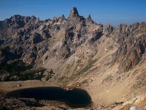
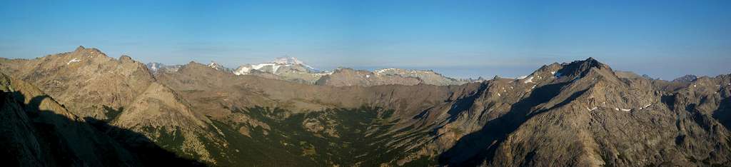
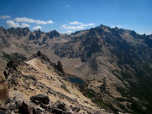
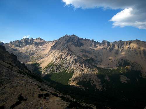
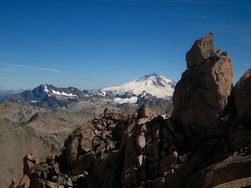
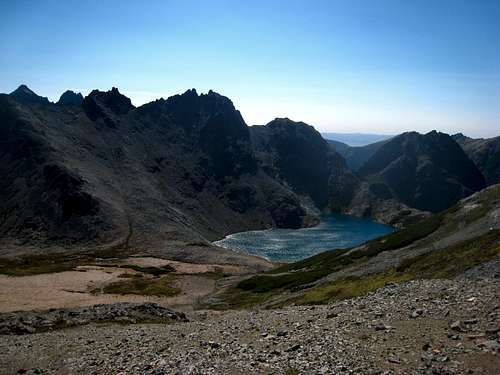
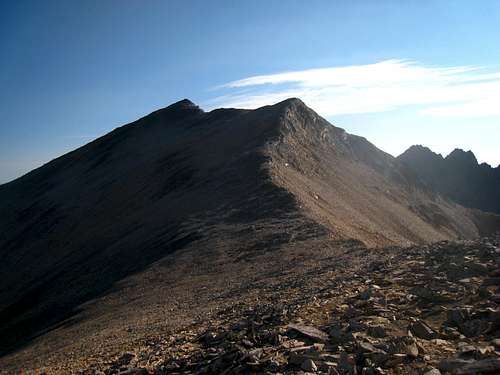
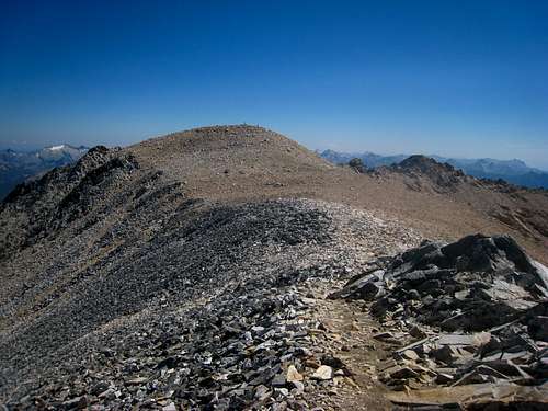
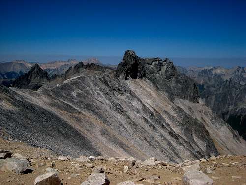
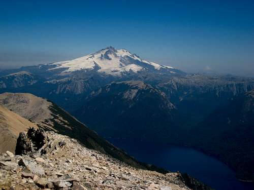
Sunset on Torre PrincipalAt first light the next morning, we started up to Laguna Schmoll. The air was much cleaner as it appeared the winds changed direction at some point in the night. I was quite relieved and excited to get back to where I had a clear view to the west towards Tronador. The reflection on Laguna Schmoll was equally as beautiful as the sunset the previous night as well! A long photo break was needed as Torre Principal was mirrored perfectly on the glassy surface. Within the next hour we were on the ridge crest and I saw Tronador from the Argentine side for my first time. It was equally as dramatic from the east than the Chilean side from the west and I quickly took a boatload of photos. We narrowed in on the exact peak we thought was the highest in the immediate area and began scrambling up the talus, which then turned into some decent third class terrain. The peak I thought was Roca Inclinada ended up being one of the sub-summits roughly 100 feet lower. Looking just to the east of the peak we were standing on we saw the highest peak above Laguna Schmoll and it was clearly technical so we decided to call it good and relax awhile while the day was still young and we had excellent views.
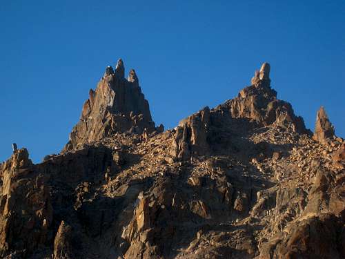
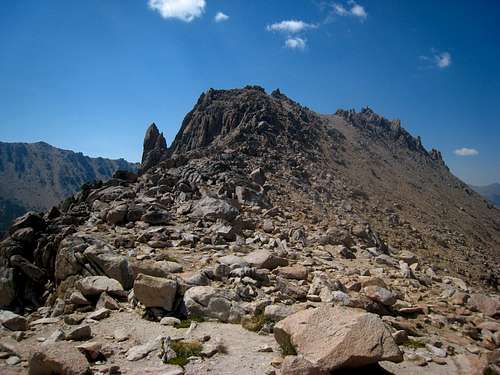
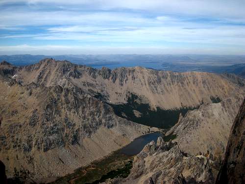
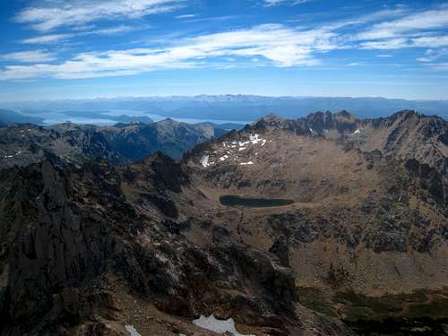
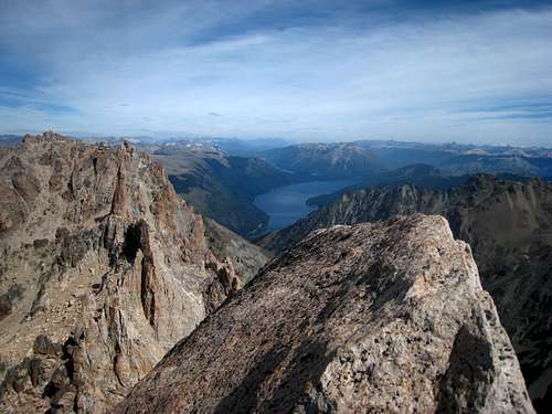
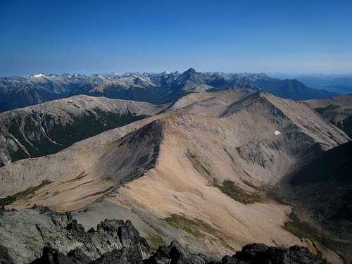
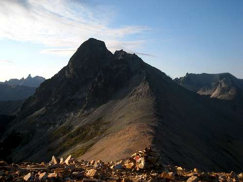
To the north we were able to see the highest ski lift from the resort and to the south all the towers of the Frey dominated the horizon. Tronador stole the show to the west and if we looked closely, we were able to see the edge of Bariloche along the huge Nahuel Huapi Lake. After roughly 45 minutes on top, we began scrambling down and as we passed by Laguna Schmoll on our way back we ran into the same couple we spoke with the previous night. They were headed for Refugio Jakob and we gave them some beta about the scramble. We reached camp by 11 am and went in for a pizza. I was amazed they were able to bake such quality pizza in a mountain refuge. At noon, we parted ways as she (her name escapes me) started hiking back down the trail to head out and I started hiking up Pico Vara which is the small peak sitting about 600 feet above the refuge. The popular Aguja Frey tower which is merely a 5 minute walk from camp sits detached from this peak, and is probably the most often climbed feature in the area.
![Sunrise over the Frey]() Sunrise over the Frey
Sunrise over the Frey
![Torre Principal]() Looking up at Torre Principal
Looking up at Torre Principal | ![Laguna Schmoll Reflection]() Laguna Schmoll Morning Reflection
Laguna Schmoll Morning Reflection
![View north from the ridge above Laguna Schmoll]() View north from the ridge above Laguna Schmoll
View north from the ridge above Laguna Schmoll | ![Frey]() Hiking to Laguna Schmoll
Hiking to Laguna Schmoll
![Torre Principal and Laguna Schmoll]() Torre Principal and Laguna Schmoll
Torre Principal and Laguna Schmoll |
![Tronador from the ridge above Laguna Schmoll]() Tronador from the ridge above Laguna Schmoll
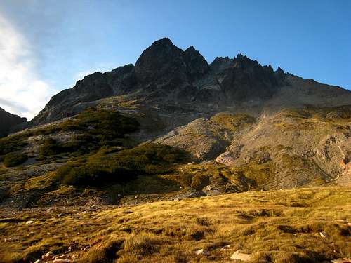
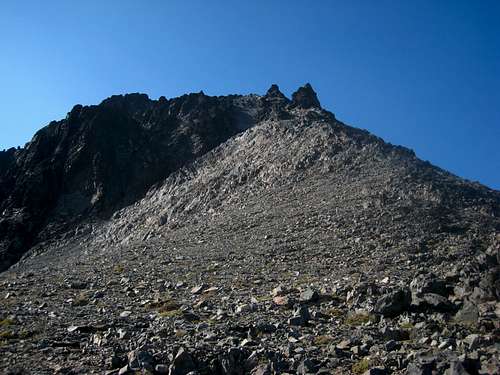
Tronador from the ridge above Laguna SchmollIt only took me an hour and a half to hike up Pico Vara which started by following the trail to the broad saddle between it and Torre Principal. Then I simply followed the ridge to the east ascending gently. I passed by the top of Aguja Frey and continued towards the top which had a small amount of Class 2+ scrambling at the summit. I was able to see the next valley to the south and get a good look at Catedral Sur, which is the second highest peak in the region. I had a good look at the refuge and all the tents below me and enjoyed the solitude being by myself on a nice perch. Roughly an hour later I was back at camp and took another nap to let the hottest part of the day pass. I was thoroughly sun-burnt and was shocked as to how I burned so fast. Even my lower legs (which never burn) were red.
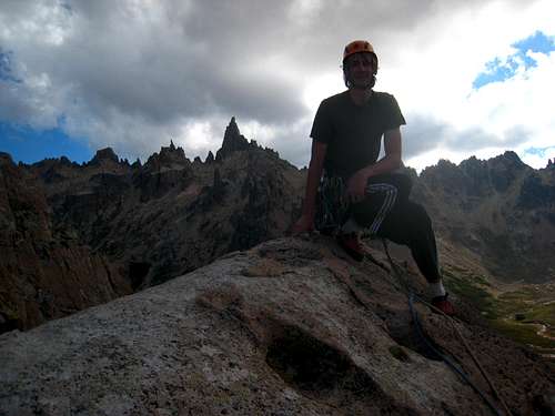
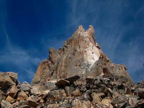
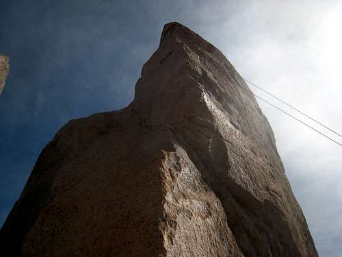
I made a small dinner from the stash of food I brought and went to sleep shortly after nightfall. I managed to talk to a couple guys from Australia who were part of the large group of climbers who came up with plans to spend 15 days at the Frey. Actually they were part of a 6 month climbing trip all over South America! They offered me a spot to climb Aguja Frey with them the next day which I was very happy about. I slept really well that night and did some yoga to stretch out with a few of the others. We then slowly packed up and at the last minute, a Swiss guy asked to join us since his partner was sick so instead of three people climbing the same route, we decided to go in pairs on two separate routes next to one another. I joined the Swiss guy on a 6c route. After the 10 minute hike up to the base, he led up a very difficult, and somewhat blank first pitch for a full 60 meters. I started up and took my time climbing the slab which got quite hard in places. I was impressed as he seemed to simply run right up the thing in half the time it took me to follow it! He led the second pitch as well which circled left around a large overhang, then traversed back right to the top of it. This pitch was scary in a few places due to the swing potential if I fell. I then led the 45 meter third pitch which was about 5.8 in difficulty, which took me right to the top of the tower. The summit was not much larger than a dinner plate and very exposed but the views were gorgeous. We had to stand on top one at a time it was so small. Actually, of everything I have summitted, only the summit of Spire Point along the Ptarmigan Traverse was smaller.
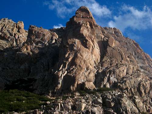
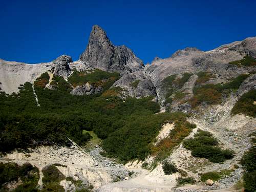
![Aguja Frey]() Aguja Frey
Aguja Frey
![Laguna Frey from Pico Vara]() Laguna Frey from Pico Vara
Laguna Frey from Pico Vara
![Rapelling Aguja Frey]() Rapelling from the summit of Aguja Frey
Rapelling from the summit of Aguja Frey | ![Ridge up Pico Vara]() Ridge up Pico Vara
Ridge up Pico Vara
![Pico D'Agostino]() Pico D'Agostino
Pico D'Agostino
![Myself atop Aguja Frey]() Myself atop Aguja Frey
Myself atop Aguja Frey | ![Torre Principal from Pico Vara]() Torre Principal from Pico Vara
Torre Principal from Pico Vara
![Climbing Aguja Frey]() Climbing Aguja Frey
Climbing Aguja Frey
![Pico Vara from Aguja Frey]() Pico Vara from Aguja Frey
Pico Vara from Aguja Frey |
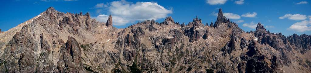
![The Frey Panorama from Pico Vara]() The Frey Panorama from Pico Vara
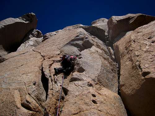
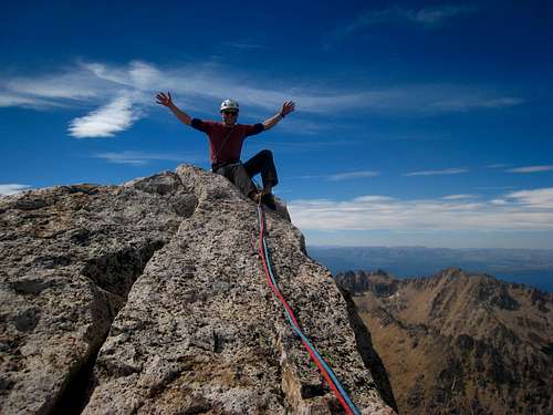
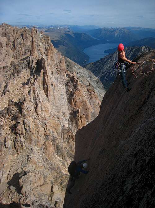
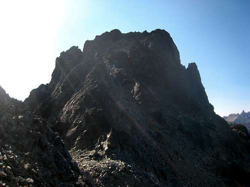
The Frey Panorama from Pico VaraWe had a safe descent of two rappels and were back on the base about 3 hours after we started. Apparently we were quick because the other pair took an additional 2 hours to climb a supposedly easier route. Everyone made it back safely though and I had another sandwich for dinner. The next morning, I found an Englishman who was also part of the large group (about 20 people) who was looking for someone to climb with. I expressed my interest in Torre Principal and he liked it. That had been what I wanted to climb all along so I was excited. After gathering up a couple ropes, a rack and some nuts we started the approach. Thankfully, I had talked to a couple the night before about the approach and had a good idea how to get there. From the broad ridge just above the refugio, there was good markers showing the route to M2 and we continued scrambling further until we reached the large talus gully dropping down from the saddle separating Torre Principal and the shorter tower just to the north. 800 feet up this gully we reached the base of the normal route which was a 3 pitch climb with an "Approach" pitch about 50 meters long of easy climbing. We agreed I would lead the even pitches and he would lead the odd ones. This allowed me to lead the crux, final pitch, which I knew would challenge me but something I could do (rated 6a).
![Aguja Frey from the refugio]() Aguja Frey from the refugio
Aguja Frey from the refugio | ![Refugio Frey]() Sunrise reflection of Refugio Frey
Sunrise reflection of Refugio Frey | ![Surrounding peaks]() View of the surrounding peaks
View of the surrounding peaks |
So he took off up the easy first pitch and I followed. I located the first actual pitch from the photo of the route overlay I took with my phone. It was an awesome handcrack to start, followed by a fun chimney and blocky climbing up to a bolt anchor on the left side of a large ledge. I actually only placed a handful of pieces as the rock was so good and the climbing was secure. I belayed him up and we walked about 50 feet across the ledge and located the second pitch, but not without some confusion. It started up a rightward leaving crack and continued up a wide chimney and through a small overhang. He did a great job leading this pitch and reached the notch at the base of the summit pitch. I climbed up, and upon seeing one of the pitons he clipped almost laughed to the point of losing my mind. Apparently someone long ago thought it was a good idea to hammer a 2 X 4 piece of lumber into the crack, then pound a piton between the wood and the rock! As I unclipped the piton I nearly pulled it out. Anyway, passing through the narrow overhang with both my camera and phone in my pocket was a fun challenge. Luckily I didn't crush them.
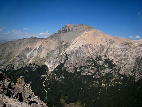
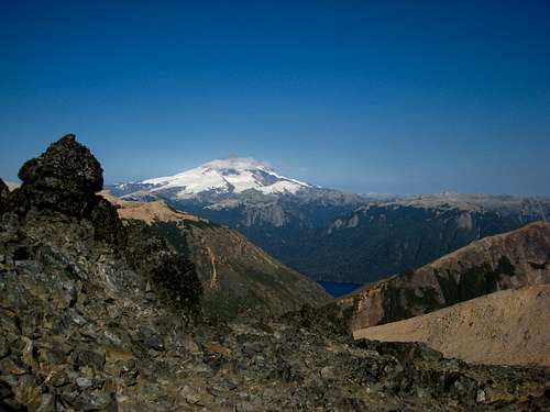
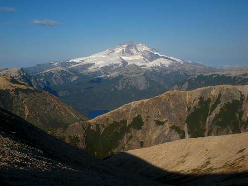
As I got a look at the final pitch, we took a short break to drink water. Realizing it was well protected with many bolts of various ages, I started up. The first 10 feet was one of the crux moves as I had to get onto the first ledge to clip the first bolt. I slowly climbed up the face which had many crimps, and no cracks of any size. I veered slightly left to stay on the lower angled slab and with one more blank crux move, pulled onto the summit and set an anchor. As he climbed up, I was in awe at the views surrounding me. I was on the highest peak in the entire region, only eclipsed by the massive Tronador Volcano on the international border. To the west I was able to see Calbuco and Puntiagudo which are volcanoes in Chile however Osorno Volcano was hidden behind Tronador. The smoke wasn't so bad either so I had clear views for many miles of the Argentine Andes. Just about every peak in the Nahuel Huapi National Park was visible.
![Approaching Torre Principal]() Approaching Torre Principal
Approaching Torre Principal
![Pitch 2 on the normal route of Torre Principal]() Pitch 2 on the normal route of Torre Principal
Pitch 2 on the normal route of Torre Principal
![On the summit of Torre Principal]() On the summit of Torre Principal
On the summit of Torre Principal | ![Beginning the climb up Torre Principal]() Beginning the climb up Torre Principal
Beginning the climb up Torre Principal
![Laguna Frey from Torre Principal]() Laguna Frey from Torre Principal
Laguna Frey from Torre Principal
![Laguna Schmoll from the base of Torre Principal]() Laguna Schmoll from Torre Principal
Laguna Schmoll from Torre Principal | ![Tronador from the base of Torre Principal]() Tronador from the base of Torre Principal
Tronador from the base of Torre Principal
![Summit of Torre Principal]() Summit of Torre Principal
Summit of Torre Principal
![Rapelling the last pitch of Torre Principal]() Rapelling the last pitch of Torre Principal
Rapelling the last pitch of Torre Principal |
![Climbers finishing the last pitch of Torre Principal]() Climbers finishing the last pitch of Torre Principal
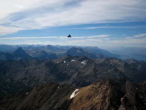
Climbers finishing the last pitch of Torre Principal | ![Condor in Patagonia]() Condor in Patagonia
Condor in Patagonia
![Sunset at the Frey]() Sunset at the Frey
Sunset at the Frey |
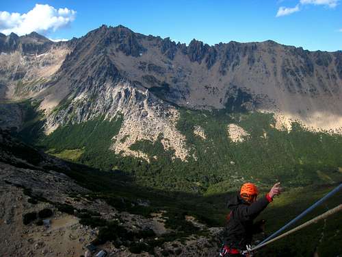
We set up the rappel off the summit since we had another party hot on our tails and made a double rope rappel down to the large ledge at the top of the first pitch. Unfortunately when we pulled the rope, it got stuck, so we had to wait on the ledge for over a half hour for the party behind us to start down. They nicely freed our rope and we made a second rappel down the remainder of the tower. From the base we hiked down as evening set in. I saw a climber standing on top of M2 and was able to get a great photo of him against the sky which was cool. We made it back to camp around 5pm and split a pizza at the refugio, and I was able to catch another fantastic sunset that was even better than the one I had the first night! Unfortunately I didn't get as many photos since I was starving and eagerly awaiting my pizza to cook but I did manage to sneak out for a few minutes and capture a few photos.
Once we finished eating, I went to bed right away and woke up late since I was only planning to hike out that morning. I packed everything up, said my good-byes to the people I climbed with and started down the trail. The hike out was easy and uneventful but my sun burns were getting worse. Luckily I was able to hop on one of the buses right as I arrived at Villa Catedral and quickly got back to Bariloche where I returned to the Backpackers Hostel and got a nice shower and took a nap. Another large dinner was in order for my first night back in town in 5 days.
![Sunset at the Frey]() Sunset at the Frey
Sunset at the Frey | ![Hiking down the main trail below the refugio]() Hiking down the main trail below the refugio
Hiking down the main trail below the refugio | ![Views from the trail back to Cerro Catedral]() Views from the trail back to Cerro Catedral
Views from the trail back to Cerro Catedral |
Laguna Negra and Cerro Negro
After another full day of rest in Bariloche, I bought a bus card and figured out the rest of the bus routes. I figured out that bus route 10 heads to Colina Suiza but the schedule I was given was not correct as they only ever came what seemed like half the time. I decided I would go to the bus stop on the main road and just wait for it. My plan was to hike to Laguna Negra for a 1 night trip and hike up a couple peaks above the lake. Around 9:30am the bus finally came and after an hour I got to Colina Suiza which at the time I thought was just a couple small buildings on a gravel road but apparently there are over 800 people that live in solitude throughout the area. There are a few restaurants, a huge beach on the lake shore, and everyone knew one another.
![Nahuel Huapi Lake from Punta Panoramico]() Nahuel Huapi Lake from Punta Panoramico
Nahuel Huapi Lake from Punta Panoramico | ![Lago Perito Moreno]() Lago Perito Moreno from the bus
Lago Perito Moreno from the bus |
![Lago Perito Moreno]() Lago Perito Moreno
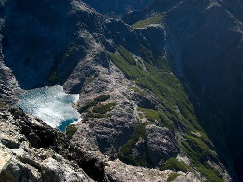
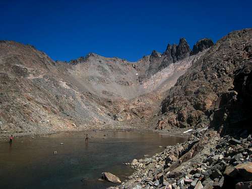
Lago Perito MorenoI located the trailhead for Laguna Negra and started hiking up an old narrow road. After a mile it turned into a trail and stayed quite flat for over 2 hours of hiking. The sign at the start said the lake was 14 kilometers away but it didn't feel that long. I reached a large open area just before the grade steepened severely where people have camped before, then started going uphill. I passed to the left of a large waterfall and emerged into an area filled with small trees and bushes and views of Cerro Negro with its very steep east face. Apparently people have rock climbed on that face but the rock quality looked questionable; certainly not as good as the rock at Frey. I slogged my way up the very steep, dusty switchbacks in the heat of the sun making good time as I reached the lake just after standard lunchtime. I talked with a local from Bariloche who worked as a bartender in town, and spoke great English. We ate sandwiches at the refuge for lunch, jumped in the frigid lake and enjoyed the nice warm sun. The lake was very deep and blue and surrounded closely by rugged peaks with steep walls of rock.
![Cerro Negro]() Cerro Negro from the trail
Cerro Negro from the trail | ![Cerro Negro and the refugio]() Cerro Negro and the refugio
Cerro Negro and the refugio | ![Sunset on Cerro Negro]() Sunset on Cerro Negro
Sunset on Cerro Negro |
I found a nice place to camp and lazily threw my tent up (big mistake) and rested the evening away only getting up to photograph the sunset. Unfortunately for me the winds picked up and never stopped. I woke up around midnight to the tent bending over me and after pushing against it to prevent it from breaking for an hour I gave up and collapsed it and used it as a crappy bivy. I never got a wink of sleep the rest of the night and I crawled out to all my gear, and myself caked in dust. What an awful night, and to make it worse, it was cold! I quickly packed everything up as the sun was rising and started hiking around the lake. I carried my pack around the lake and stashed it on the far side. It was too windy and cold for me to eat anything so I just continued up the boot path to the saddle between Cerro Bailey Willis and Cerro Negro. Once I got there though, the winds really picked up and almost blew me over a couple times. I thought it was incredibly strange for the wind to be coming from the east so I had to drop slightly onto the shaded side of the ridge to escape the wind. Normally in the morning the sunny east side is wind free but not that day!
![Sunset on Cerro Negro]() Sunset on Cerro Negro
Sunset on Cerro Negro
![Laguna Negra]() Laguna Negra
Laguna Negra | ![Laguna Negra and Cerro Negro]() Laguna Negra and Cerro Negro
Laguna Negra and Cerro Negro
![Laguna Negra]() Looking back on Laguna Negra
Looking back on Laguna Negra | ![Cerro Negro]() Cerro Negro
Cerro Negro
![Cerro Bailey Willis]() Cerro Bailey Willis
Cerro Bailey Willis |
I slowly made my way up the gentle ridge, getting very hungry and thirsty but after roughly 1,000 feet from the saddle I reached the top and admired the early morning views of Tronador, and scouted a possible route up Cerro Negro which looked like it wouldn't have a scramble route from any angle I saw it. I decided I would circle around it to the back side and see if there was a way up, as it was at least 100 feet higher than Cerro Bailey Willis and I had plenty of time to tag that peak as well; although the energy was severely lacking. I started back to the saddle and just pushed through the hunger and started up the easy ridge towards Cerro Negro. As soon as I crossed onto the darker colored rock, the footing became much better and required less energy to ascend. I traversed around the west side of the peak and found myself near the top of the false summit. A short 50 foot class 3 down climb brought me to the notch between the two peaks and I found some red dots and an arrow pained on the rocks pointing towards a gully that led right to the summit. Only a couple short spots of actual scrambling was needed and before I knew it, I was at the summit, looking straight down to the lake and the refugio. Such an awesome place that few people, even locals, ever get to see. I retraced my steps back down and upon getting back to my pack, I ate all the food I had! The hike back out was uneventful and I caught the bus around 4pm back to Bariloche and enjoyed another couple nights at the backpackers hostel.
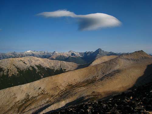
![Nahuel Huapi National Park]() Lenticular Cloud on the way up to Cerro Bailey Willis
Lenticular Cloud on the way up to Cerro Bailey Willis
![Cerro Negro from Cerro Bailey Willis]() Cerro Negro from Cerro Bailey Willis
Cerro Negro from Cerro Bailey Willis
![Tronador]() Tronador from the route up Cerro Negro
Tronador from the route up Cerro Negro
![Summit of Cerro Negro]() Summit of Cerro Negro
Summit of Cerro Negro | ![Nahuel Huapi National Park]() Nahuel Huapi National Park
Nahuel Huapi National Park
![Tronador from Cerro Bailey Willis]() Tronador from Cerro Bailey Willis
Tronador from Cerro Bailey Willis
![Cerro Negro]() Cerro Negro Summit Block
Cerro Negro Summit Block
![Cerro Negro summit view]() Cerro Negro summit view
Cerro Negro summit view | ![Cerro Negro from the route up Cerro Bailey Willis]() Cerro Negro from the route up Cerro Bailey Willis
Cerro Negro from the route up Cerro Bailey Willis
![Hiking up Cerro Negro]() Hiking up Cerro Negro
Hiking up Cerro Negro
![Laguna Negra from Cerro Negro]() Laguna Negra from Cerro Negro
Laguna Negra from Cerro Negro
![Refugio at Laguna Negra]() Refugio at Laguna Negra
Refugio at Laguna Negra |
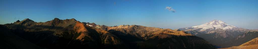
![Tronador Panorama from Cerro Bailey Willis]() Tronador Panorama from Cerro Bailey Willis
Tronador Panorama from Cerro Bailey WillisRefugio Lopez and Pico Turista
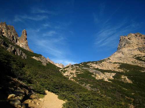
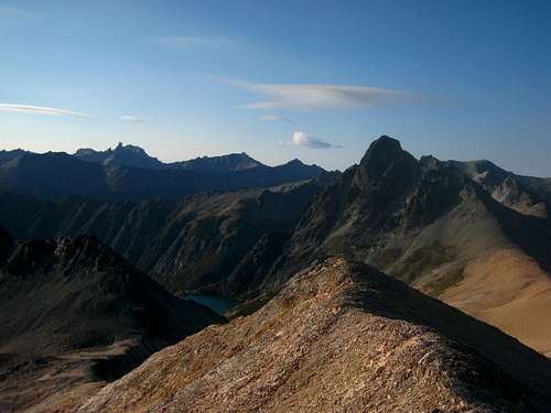
Since I wanted to also check out Refugio Lopez and the peaks above it, I once again took the bus towards Colina Suiza but got off at Arroyo Lopez and started hiking up the popular but steep trail. I only took about 5 pounds of gear as I planned to make a day hike out of it. Luckily, the smoke was still at bay and wasn't posing too much of a view destroyer but it was obvious to notice that the most distant peaks were hard to identify. I made excellent time up the steep trail and in less than an hour reached the closed refugio La Joya, and within 2 hours, reached the large and well placed Refugio Lopez. It was situated on a small flat perch on the slopes of Cerro Lopez overlooking Bariloche, Nahuel Huapi Lake and many surrounding towers and peaks. I ate a sandwich at the hut and continued above heading for Pico Turista. The views of the massive lake behind me only grew larger as I quickly reached a small tarn about 500 feet above the refuge, of which this was clearly the water supply. From here, I deviated from the red dots that mark the standard path and veered left and entered a large basin just below the Principal peak of Cerro Lopez, which is technical and required ropes to ascend. I scrambled directly up the slabs from a flat spot in the basin and reached the ridge roughly halfway between Torre Principal and Pico Turista. From this point, it was an easy walk to the rounded talus strewn summit.
![Lago Perito Moreno from the trail to Refugio Lopez]() Lago Perito Moreno from the trail to Refugio Lopez
Lago Perito Moreno from the trail to Refugio Lopez
![Large rock tower]() Large rock tower
Large rock tower
![Refugio Lopez]() Hiking above Refugio Lopez
Hiking above Refugio Lopez
![Pico Turista]() Pico Turista
Pico Turista | ![Refugio La Joya]() Refugio La Joya
Refugio La Joya
![Looking up towards Pico Turista]() Looking up towards Pico Turista
Looking up towards Pico Turista
![Cerro Lopez Torre Principal]() Cerro Lopez Torre Principal
Cerro Lopez Torre Principal
![Cerro Lopez]() Cerro Lopez
Cerro Lopez | ![Towers on Cerro Lopez]() Towers on Cerro Lopez
Towers on Cerro Lopez
![Refugio Lopez]() Refugio Lopez
Refugio Lopez
![Cerro Lopez Torre Principal]() Cerro Lopez Torre Principal
Cerro Lopez Torre Principal
![Tronador from Pico Turista]() Tronador from Pico Turista
Tronador from Pico Turista |
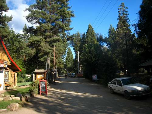
I had some of the best views to the north I had all trip with more lakes visible way down into the mountain valley and stretching west back towards Tronador. I enjoyed 30 minutes or so of solitude before others behind me reached the ridge, at which point I started down. I ended up following the correct route back down and had a very quick descent (I ran) back to the trailhead. I got a hot dog at the small shack and walked the 3 kilometers to Colina Suiza and went down to the lake shore. I swam in the lake for a few minutes but with so many other people there also enjoying the hot afternoon, I didn't stay long. I found a local hostel and talked some basic Spanish with the owner. It was mainly just a small house with a couple rooms upstairs with beds but it was very quaint, situated in the trees in the lovely little village. I walked a few blocks to a restaurant and had an awesome micro-brew and ham sandwich (they seem to like their ham in Argentina). I continued to walk through the village until it got dark then enjoyed a nice night.
![Small tarn on route to Pico Turista]() Small tarn on route to Pico Turista
Small tarn on route to Pico Turista | ![Colina Suiza]() Colina Suiza
Colina Suiza |
The next morning I returned to Bariloche on the bus and bought a bus ticket to El Bolson, however the smoke was so bad there I was forced to leave after only one night, and didn't do any hiking. For the next 5 days or so while I was in Argentina, I went from one town to the next, unable to do much hiking for various reasons, and slowly worked my way back to Osorno, Chile. The Villarrica Volcano erupted the night before I planned to climb Lanin from the Argentine side but for other various reasons, that didn't happen. The international crossing at Lanin was also closed due to the eruption so I was forced to re-enter Chile back to the south and get to Pucon by the longer route. Eventually, I reached Pucon and arrived with roughly 4 days left in my trip. See the next trip report linked below for the story about that section of my trip.
Chilean Chronicles Volume 2 - Pucon, Lanin Volcano and San Sebastian


Comments
Post a Comment