
-
 18431 Hits
-
 85.36% Score
-
 20 Votes
|
|
Mountain/Rock |
|---|---|
|
|
48.10591°N / 121.60243°W |
|
|
Snohomish |
|
|
Hiking, Scrambling |
|
|
Spring, Summer, Fall, Winter |
|
|
4780 ft / 1457 m |
|
|
Overview
The Northeast Ridge
Round Trip Distance: 7.5 miles
Summit Elevation: 4780 feet
Starting Elevation: 1550 feet
Elevation Gain: 3230 feet
At 4623 feet, Bald Mountain is one of the lower mountains accessible from the Mountain Loop Highway. On the plus side, it's proximity to Long Mountain, Liberty Mountain, Big Bear, Three Fingers, Whitehorse, and Devil's Peak make it a very scenic destination. Don't confuse this peak with the other Bald Mountain of the cutthroat lakes trail.
The Standard Route
Summit Views
Follow Deer Creek road to the base of north east ridge of Bald Mountain. Deer Creek road is gated in the winter and spring and reserved for non motorized sports. During the winter it makes a wonderful snowshoe destination with low avalanche danger. Nearby Kelcema Lake is a very popular winter destination. During the summer if the road is gated, it might be preferable to tackle the shallow incline of Deer Creek road with mountain bikes. If it is not gated, you might be able to drive all the way to the NE ridge.
Two thirds of a mile in from the highway, you will come to a T intersection in the road. Turn left here. The right fork would lead up onto Devil's Peak. Follow Deer Creek road for another 2 miles to where it makes a switchback. At this point you will be inside the basin and there are views of Long Mountain, Devil's Peak, and your destination, Bald Mountain.
![Climbing The Slabs]()
Exposed Scrambling On The Upper Northeast Ridge
From the switchback follow the road for another half mile. Ascend the slope to the west by leaving the road. There is no trail from this point. After another third of a mile the slope will narrow into a pleasant ridge top. If it is late summer and there is no snow cover, it might be very brushy. Stay on top of the ridge as it turns to the southwest. Views to the North begin to open up and you might recognize Three Fingers and it's neighbors. From here it is another third of a mile to the summit.
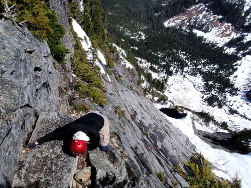
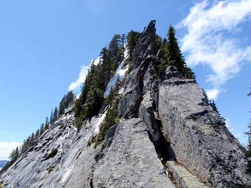
The last hundred feet to the summit follows a narrowing rocky ridge with exposure on either side. When this is covered in snow or wet, it might be advisable to use ropes and protection. The right (north) side drops steeply to Kelcema Lake, the left (south) side drops into an impressive large basin of slabby granite. When the ridge steepens and narrows, traverse left on ledges high above the slabby east face to avoid a few small gendarmes. Expect some steep exposed scrambling (class 2 and 3). Near the summit, scramble back to the crest of the ridge for the finish.
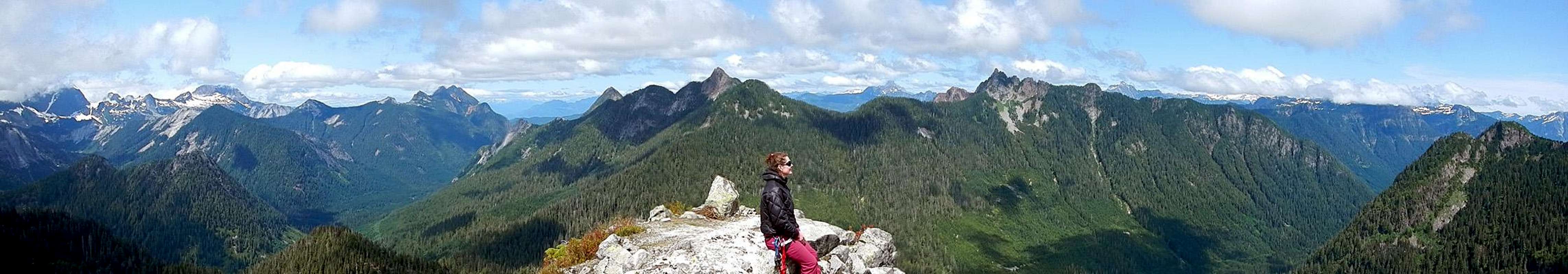
![Big Bear, Three Fingers, Bullen, Whitehorse Panorama]()
Big Bear, Three Fingers, Bullen, and Whitehorse Seen From Bald Mountain![Camp Kelcema]()
Camp Kelcema
In 1922 the Everett Area Council secured a lease on 4 acres of Forest Service land at Kelcema Lake. Over several years a Boy Scouts of America lodge along with swimming and boating facilities were constructed. The camp which was able to accommodate up to 70 scouts at a time was initially known as Camp Kelcema but was later named after a retired scout leader to Camp Matthews.
Big Bear, Three Fingers, Bullen, and Whitehorse Seen From Bald Mountain
History
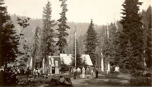
Camp Kelcema
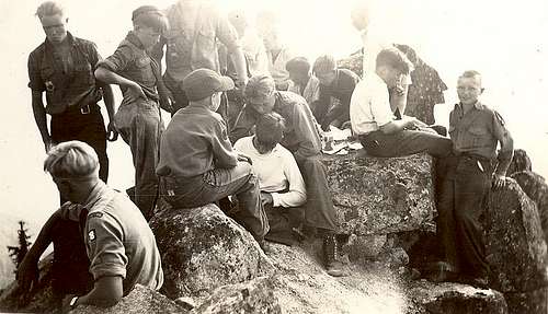
Bald Summit 1938
The scouts made regular ascents of both nearby Helena Peak and Bald Mountain. When the lodge opened, Kelcema Lake and camp was not as accessible as it currently is today. In the early years, the scouts had to hike in from the south fork road in the valley, but in later years the road was completed as far as the town of Silverton. Supplies still had to be brought in on pack mules for the remaining 4 miles.
Getting There
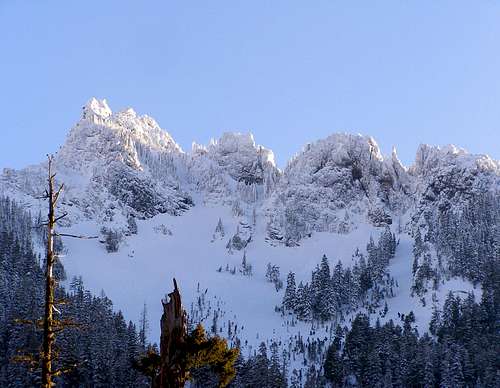
Devil's Peak on the approach to Bald Mountain
From Granite Falls follow the Mountain Loop Highway east 23.5 miles to Deer Creek Park.
Getting there from the south on I-5:
In Everett, exit east onto US-2 via exit #194. Continue on US-2 for 2.2 miles (long elevated highway) until you arrive at WA-204, merge onto 204 going east toward Lake Stevens. Continue on 204 for 2.6 mi. until you arrive at Hwy 9. Turn left (North), onto highway 9, and travel 1.7 miles until you get to Hwy 92, and turn right (east) onto Hwy 92 (a.k.a. Granite Falls Highway). Continue on Hwy 92 for about 8 miles when you will arrive at Granite Falls. From Granite Falls, you will turn left onto Mountain Loop Highway at the major intersection at the other end of town. Drive Mountain Loop Highway for 23.5 miles to Deer Creek Road #4052.
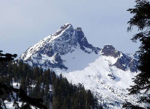
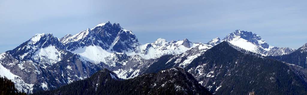
Liberty Mountain seen from Bald Mountain
Getting there from the north on I-5:
Drive I-5 south to WA-531 and exit east on exit #206 toward Lakewood / Smokey PT. Continue for 3.5 mi. to Hwy 9 and turn right (south) on Hwy 9. Drive for 5.5 mi. to Getchell Rd. / 84th St. NE. Turn left (east) here and continue 4.6 mi. to Granite Falls Highway / Hwy 92. Turn left here and the remainder of the trip will be the same as above from Hwy 92.
Road / Weather / Snow Conditions
- Current Weather Information
- Avalanche Forecasts: North West Avalanche Center
- Darrington Ranger District
- Verlot Public Service Center Phone Number: (360) 691-7791
- Current Road Conditions Report
External Links
Josh Lewis's 2009 Trip Report about our experience on BaldMatt's 2009 Trip Report on the South Ridge Variation