
-
 11396 Hits
-
 83.1% Score
-
 16 Votes
|
|
Mountain/Rock |
|---|---|
|
|
48.25581°N / 120.99211°W |
|
|
Chelan, Snohomish |
|
|
Hiking, Mountaineering |
|
|
Summer, Fall |
|
|
7760 ft / 2365 m |
|
|
Overview
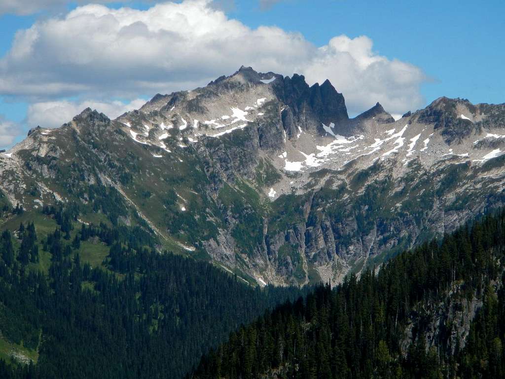
Bannock South Face
Bannock is a variety of round flat bread similar in texture to scones, which was popular among early USGS surveyors. Bannock Mountain is an extremely isolated peak located 13 miles northeast of Glacier Peak inside the Mount Baker Snoqualmie National Forest and the Glacier Peak Wilderness. The first ascent was made by Art Johnson, Dwight Watson and Hermann Ulrichs on July 28, 1936. Currently very few hikers visit Bannock Mountain. The standard route is 32 miles round-trip and requires over 10,000 vertical feet of cumulative elevation gain. Furthermore, attaining the summit involves several miles of off-trail navigation as well as some class 3 scrambling and exposed steep traversing. This peak probably sees an average of one ascent party per year.
Bannock West Face
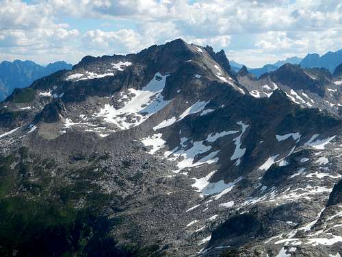
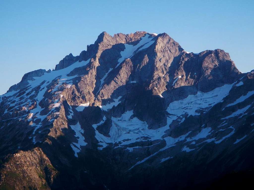
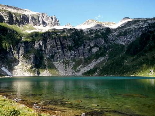
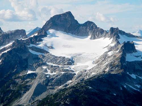
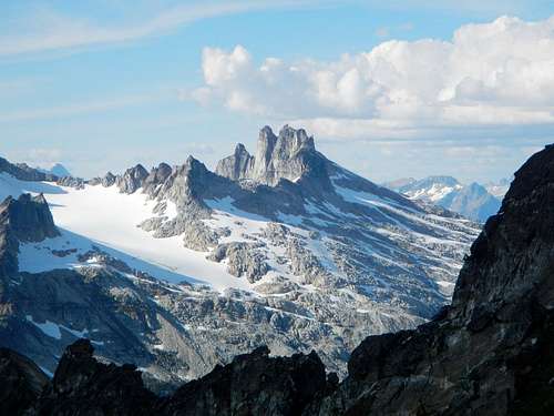
The mountain holds five different lakes and is the source and starting point of three different creeks including Canyon Creek, Sulphur Creek and Spruce Creek. The peak culminates from the intersection of two long ridges which form a T-shape where the summit rises to an apex of just over 7760 feet. Four of the lakes are nestled at the base of the northeast face which has 2000 feet of relief. These are the splendidly remote Bannock Lakes which are guarded between Bannock Mountain and Saddle Bow Mountain to the east. The fifth lake is Canyon Lake which is visible from Miners Ridge, inside a deep alpine cirque on the south side of the peak, at 5600 feet. As the USGS map indicates, the west face was once home to a small glacier; however all that remains today is a permanent snowfield. Overall Bannock features numerous cliff bands on all sides despite the broad shouldered appearance.
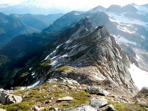
Dome Peak from Totem Pass
Bannock was once the location of a fire lookout structure. It was not located at the summit but was near the Point 7484 survey marker. But now, the nearest remaining fire lookout is several miles to the southwest located on Miners Ridge. The standard route to Bannock passes by two lovely alpine lakes as well as the Miners Ridge fire lookout. Good camping can be had at both Image Lake and Canyon Lake. The southwest ridge of Bannock offers several variations for those who aim to summit.
Bannock above Canyon Lake
Ascent parties might wish to combine Bannock Mountain with one or a number of other peaks in the area, such as but not limited to Gunsight Peak, Hanging Gardens, Sitting Bull Mountain, Stonehenge Ridge, Miners Ridge, Plummer Mountain, Cloudy Peak, or North Star Mountain. For those with a sense of adventure, consider the Bath Lakes High Route which traverses off-trail from Sulphur Mountain. More information about this route can be found in the Routes and Rocks book by Crowder and Tabor. Another alternative is to make a loop and exit via Lyman Lakes, Spider Gap, Spider Meadows, and Phelps Creek.
 The Garden Glacier | 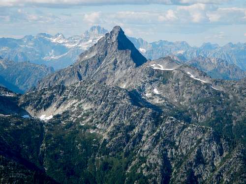 Agnes Mountain |
 Gunsight Peak | 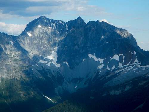 Bonanaza West Face |
So why would anyone wish to visit this remote peak? Solitude is a start. But even more rewarding are the intimate views of some of the most isolated mountains in Washington State. Totem Pass might be the best place to observe the south faces of Dome Peak and Sinister Peak. From the summit of Bannock you will also find some of the best views of Agnes Peak and Gunsight Peak, mountains which are not often seen by anyone. The imposing west face of Bonanza Peak towers to the east. You’ll certainly forget the mileage when you sit on the summit and take in the surroundings.
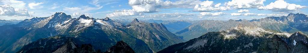
North Panorama
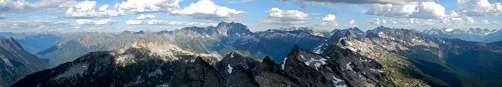
East Panorama
Standard Route
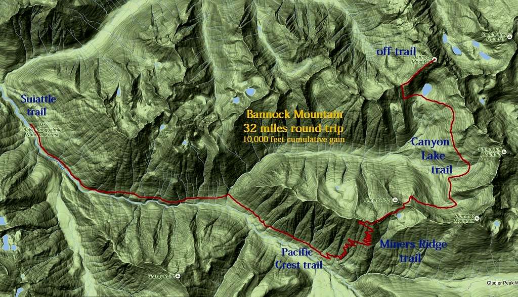
Bannock Standard Route
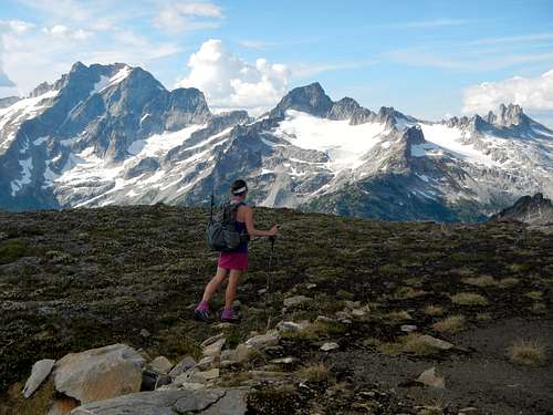
Follow the Suiattle River trail a long way to the junction with the Pacific Crest trail (might appear different on your map since the PCT was rerouted here). Take the Pacific Crest trail a short distance to the Miners Ridge trail. Ascend the Miners Ridge trail to the main crest of the ridge and turn east. Take the left fork which is signed “horse camp” so that you can traverse above Image Lake.
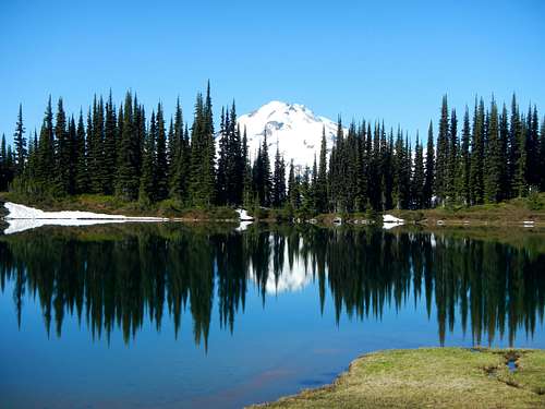
Image Lake
On the slope north of the lake ascend a few hundred feet off-trail to reach the ridge crest above the lake where you will rejoin the trail. Descend the Canyon Lake trail and follow it through two basins, first below Plummer Mountain and then below Sitting Bull Mountain. There is some up and down action which will take you into the forest and back out again. Eventually the trail ends at Canyon Lake which has some small meadows and good camping.
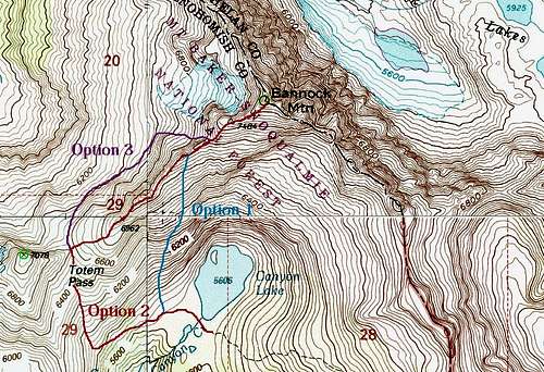
Southwest Ridge Options
Beyond Canyon Lake there are three options to climb Bannock. Option 1 is to ascend the steep vegetated slope just west of the outlet of the lake to reach the upper southwest ridge. This slope is very steep and goes above some cliffs, so it may not be a good choice depending on conditions.
Approaching Crux Gendarmes and Summit
Both Options 2 and 3 depart from Totem Pass. To reach Totem Pass from Canyon Lake, traverse west and ascend slightly looking for an old trail remnant which starts several hundred yards away from the lake. This boot path or game trail will lead to the base of the open gully south of the pass. From the base of the gully it’s an easy 700 vertical feet to Totem Pass.
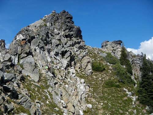
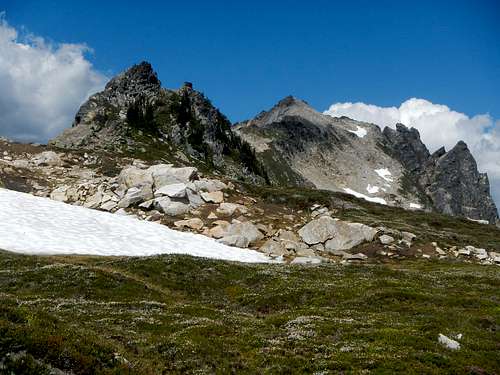
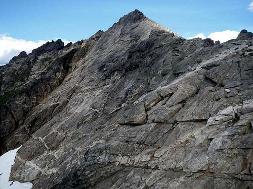
Crux Gendarmes
Once at the pass you will have to decide if you want to brave the tricky gendarme along the southwest ridge, or avoid it by traversing and ascending part of the west face to regain the southwest ridge beyond the gendarme, at 7200 feet. If you choose Option 2 and run the entire ridge, be prepared for a lot of steep traversing and some class 3 scrambling near the gendarme.
Nearing 7200 feet where all routes converge
Scenic Backdrop at Point 7484
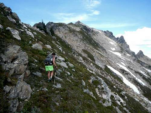
If you choose Option 3 be prepared to lose several hundred vertical feet north of the pass before traversing on a lot of big talus. Getting back up to the ridge crest at 7200 feet can be difficult without snow cover because of steep compacted dirt with loose rocks. All route options converge at 7200 feet on the southwest ridge. The last few feet to the summit is a class 3 scramble with no exposure.
Looking Back Down The Southwest Ridge
The Upper Northwest Face
Note: It’s also possible to access Image Lake and Canyon Lake from Holden Village via Suiattle Pass and Cloudy Pass, but at the time of the creation of this page, access to Holden Village is closed.
Getting There / Driving Directions
Drive either north from Darrington on WA-530 for 8.3 miles, or south from Rockport on WA-530 for 11.1 miles, and turn east onto Suiattle River road which leaves WA-530 near the large bridge. Continue for 9.8 miles to a fork and stay to the left on Forest Road 26 for another 12.5 miles to the end of the road.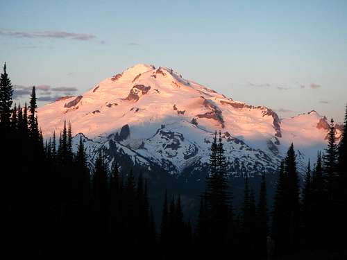
Glacier Peak from Image Lake