
-
 1987 Hits
-
 72.08% Score
-
 2 Votes
|
|
Mountain/Rock |
|---|---|
|
|
35.91247°N / 51.35819°E |
|
|
Sharestanak Karaj |
|
|
Mountaineering |
|
|
Summer |
|
|
12329 ft / 3758 m |
|
|
Overview
Bazarak Peak is part of the Alborz’ Tochal ridge north of Tehran. Its name presumably means ‘little bazar’ in ancient Persian. Maps produced by the Ghitashenasi Geographical & Cartographic Institute such as the Guide Map for Climbing the Peaks of Central Alborz issued in 1999 and the Atlas of the Shemiran Subprovince of 2002 chart Bazarak Peak at 3.758 m.
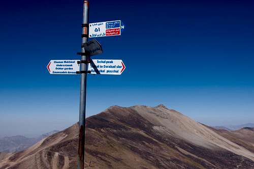
Getting There
At the top of the steep Velenjak Blvd in northern Tehran, there is an asphalted promenade leading to the ‘Tochal Telecabin’ cable car station at 1.900 m. From there you can use the cable car or hike (not recommended in summer) to the cable car terminal situated at 3.746 m. Next you can either follow the western ridge up Shah Neshin and on to Bazarak to the North West or take a 200 m hike or a ski lift downhill to the Tochal Hotel, half Ski resort and half mountain hut, situated at 3.550 m.
Route
From the Telecabin terminal the intermittent trail up Shah Neshin and Bazarak is mostly obvious. You basically follow the ridge.
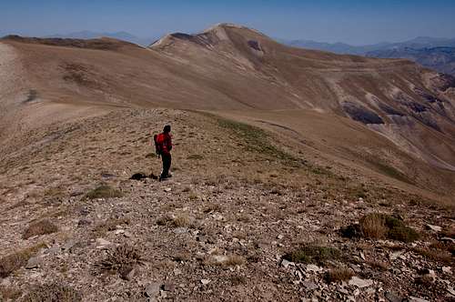
Shah Neshin westward ridge seen from Hoomand Tochal
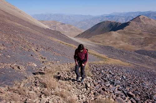
If you start from the Tochal Hotel, take the dirt road going up Shah Neshin’s North face. When the road ends a trail can be discerned among the rocks every once and a while, enough to get yourself safely higher. At one point you'll have to make one short steep climb up the rubble to your left to get on the ridge. Caution required for shifting rocks.
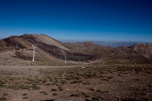
Tochal Plateau with Shah Neshin (left), Bazarak & Sarbaz (right)
Shah Neshin North Face short steep climb
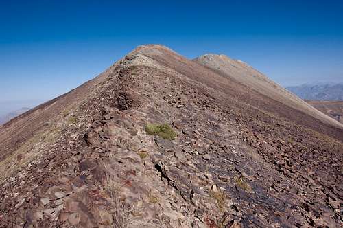
Shah Neshin westward ridge
Follow the ridge to the Shah Neshin summit and then down to the Bazarak Pass to the NW and finally Bazarak summit to the NNW.
Bazarak Pass and Bazarak
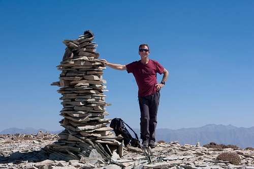
Bazarak Summit
Should you choose for the westward trail behind the Tochal Hotel, take into account that you will lose 200 m and will have to start your ascent at approximately 3.250 m. Avoid the black moraine to your left and go for the vegetation covered slopes leading to the Bazarak Pass ahead instead. They are riddled with goat trails that will help you get to the Bazarak ridge without having to climb Shah Neshin. I do not recommend this last option though. It’s a tad hazardous.
Red Tape
Add Red Tape text here.When to Climb
Add When to Climb text here.Camping
Add Camping text here.External Links
http://gitashenasi.com/index.php?route=common/home
https://www.summitpost.org/detailed-map-of-central-alborz-mountains/189982/c-154322
https://www.summitpost.org/bazarak/651996
http://www.hikr.org/tour/post90167.html