
|
|
Mountain/Rock |
|---|---|
|
|
36.39044°N / 50.95965°E |
|
|
Mountaineering |
|
|
Summer |
|
|
15285 ft / 4659 m |
|
|
Overview
Click for an Introduction to the Central Alborz Mountains.Click for Introduction to Takhte Soleyman Massif.
Click for a map of Central Alborz.
Click for a map of Takhte Soleyman Massif.
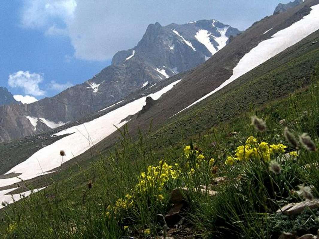
The northeastern slopes of Takhte Soleyman and sub-peak 4500 m to the left (east) of it as seen from Sarchal Shelter.

Takhte Soleyman means Solomon’s Throne (seat). It refers to a peak and a sub-range (massif) in the Central Alborz Mountains of northern Iran.
Takhte Soleyman is a prominent peak that rises to the north of the 4850 m Alam Kooh Peak which is the highest point of the Takhte Soleyman Massif. Due to its prominence and the fact that it dominates the view from the popular Sarchal Shelter (see below), many sources erroneously claim that after Alam Kooh, Takhte Soleyman is the second highest peak in the massif. The fact, however, is that depending on how you define individual peaks, Takhte Soleyman Peak is at best the fifth highest peak in the Takhte Soleyman Massif (along with South Khersan Peak which has the exact same elevation. For a list of the high peaks of the area, use the links above).
To the south, a ridgeline that drops to 4400 m connects Takhte Soleyman Peak to the 4465 m Shaneh Kooh Peak. To the south of Shaneh Kooh, the ridgeline leads to the magnificent north wall of Alam Kooh. To the north, the slopes of Takhte Soleyman merge into a series of crags known as Dandaneh Ejhdeha (Dragon’s Tooth, 4400 m). To the west, you will find the junction of the valleys of Haft Khan and Split Glaciers and to the east the valley of Pa Takht (Takhte Soleyman) Glacier.
Takhte Soleyman is a very rugged peak whose slopes are covered by cliffs/needles many of which can be thought of as sub-peaks. Chief among these are two “towers” (4453 m & 4480 m) as well as a large flat-top area (4500 m) on the south slopes and a “horn” (4500 m) to the east. Despite this, the main route to the summit is non-technical thanks to a boulder/scree covered area to the south.
Climbing Takhte Soleyman usually takes three days. The traditional starting place is the village of Roodbarak (1400 m) to the northeast. From there, you will hike or drive a dirt road 10 km to a place known as Vandar Bon (2300 m) where you can hike a trail up the Barir drainage roughly four hours to the Sarchal Shelter (3750 m) which is a multi-room stony building that is full of bunk beds (metal frames and wooden slats). It can probably house 100 or more people. Running water is piped from a nearby stream into a small pool. You will then hike up the valley of Alam Chal Glacier (no technical equipment needed) to the base of the Shaneh Kooh Peak and up to the 4400 m saddle between Shaneh Kooh and Takhte Soleyman where you will gain access to the mentioned southern slopes ( for more details, see “Route” for Shaneh Kooh Peak). Please be ware that to reach the saddle you will need to hike all the way up to near the summit of Shaneh Kooh and then descend down to the saddle. The saddle can theoretically be accessed via the valley of Pa takht Glacier above Sarchal Shelter but for whatever reason this is generally not done (maybe due to obstacles I am not aware of).
Unlike Alam Kooh which for the main part remains hidden from view, Takhte Soleyman Peak is well-visible from the village of Roodbarak (PIC 1, PIC 2).
 The east face of Takhte Soleyman Peak
 |  |  |  |
Getting There
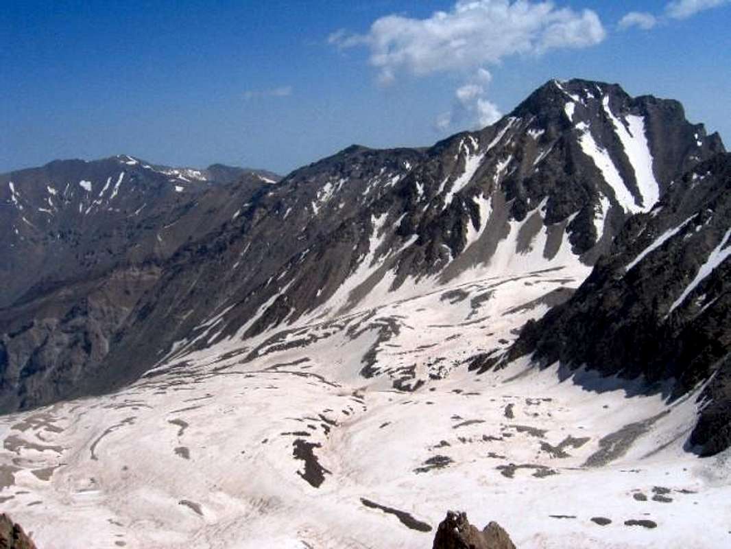
The southern and western slopes of Takhte Soleyman rising above the junction of the valleys of Haft Khan & Split Glaciers.
See Map.
From downtown Tehran drive 40 km west to the town of Karaj and take the Karaj-Chalus Road north (This road crosses the Alborz Mountains taking you through the Kandovan Tunnel to the Caspian Coast). 30 km south of Chalus, you will reach the town of Marzan Abad. Turn left and follow a side road into the Sardab Rood River drainage and to the town of Roodbarak. Distance from Tehran to Roodbarak is roughly 200 km (125 miles)
 |
Red Tape
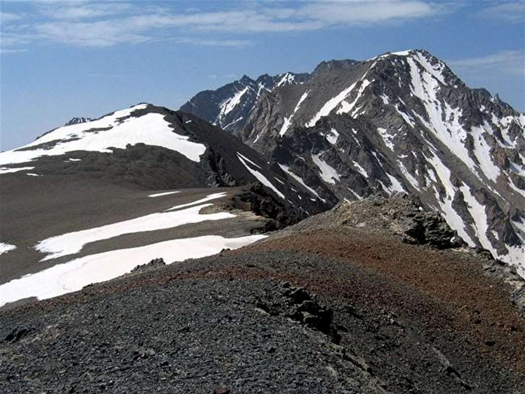
The northern slopes of Takhte Soleyman Peak (right)
No fees/permits needed..
 |  |


