
|
|
Mountain/Rock |
|---|---|
|
|
36.39182°N / 50.99090°E |
|
|
Mountaineering |
|
|
Summer |
|
|
14672 ft / 4472 m |
|
|
Overview
Click for an Introduction to the Central Alborz Mountains.Click for Introduction to Takhte Soleyman Massif.
Click for a map of Central Alborz.
Click for a map of Takhte Soleyman Massif.
Siah Kaman & Alam Chal Glacier
Siah Kamaan means "Black Bow" and probably refers to the graceful arch created by the ridgeline that connects this mountain to Chaloon Peak (see picture below). Except to the south, Siah Kamaan is not connected to any other peaks. From the nearby town of Roodbarak, it appears as a huge cone that seems to rise above the other peaks (even the 4659 m Takhte Soleyman Peak).
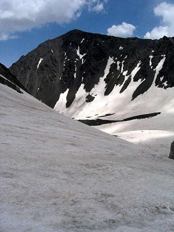
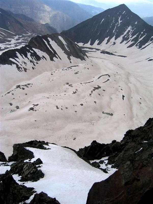
Siah Kamaan is a pyramidal peak that rises in the eastern portion of the Takhte Soleyman Massif in the Central Alborz Mountains of northern Iran. To the north and east, the slopes of Siah Kamaan drop down to the bottom of the valley of Barir drainage and its branches.To the south, a ridgeline that drops to 4350 m separates Siah Kamaan from the 4516 m Chaloon Peak. Beyond Chaloon, the ridgeline gradually turns west and gives rise to the Siah Sang and Shakhaks Peaks before reaching the 4850 m Alam Kooh Peak which is the highest peak of the Takhte Soleyman Massif. To the west, Siah Kamaan guards the entrance into the valley of the Alam Chal Glacier, the most famous of the area glaciers. Alam Chal Glacier originates at the base of the north wall of Alam Kooh (4300 m) and first heads east but then turns north and joins the tail end of the Pa Takht Glacier (3900 m). Siah Kamaan towers directly to the east of this junction.
Climbing Siah Kamaan usually takes two days. The traditional starting place is the village of Roodbarak (1400 m) to the northeast. From there, you will hike or drive a dirt road 10 km to a place known as Vandar Bon (2300 m) where you can hike a trail up the Barir drainage roughly four hours to the Sarchal Shelter (3750 m) which is a multi-room stony building that is full of bunk beds (metal frames and wooden slats). It can probably house 100 or more people. Running water is piped from a nearby stream into a small pool. From Sarchal, you will hike into the beginning of the valley of Alam Chal Glacier and then go up to the 4350 m saddle between Siah Kamaan and Chaloon and then turn north and follow the ridgetop to the summit. Alternatively, you could directly go up the north slopes of Siah Kamaan from Sarchal Shelter. I have not climbed this mountain but both of the options seem to involve steep scree/boulder covered slopes.
 |  |  |
Getting There
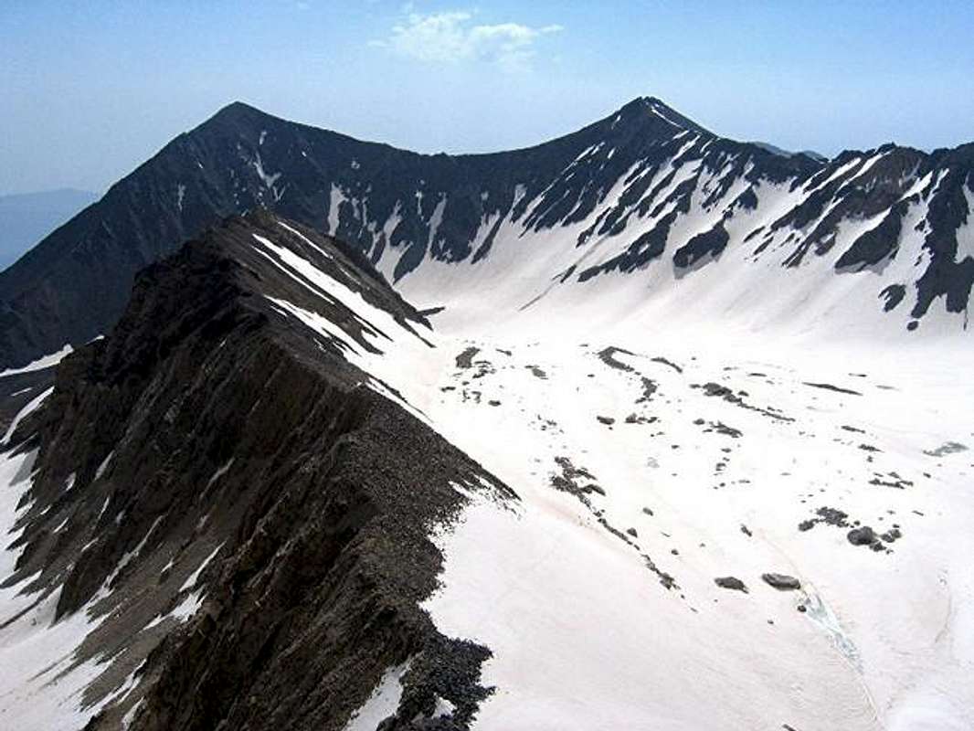
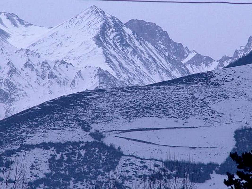
(Left) Siah Kaman & (Right) Chaloon (4516 m). Note the big black arch (Siah Kamaan).
See Map.
From downtown Tehran drive 40 km west to the town of Karaj and take the Karaj-Chalus Road north (This road crosses the Alborz Mountains taking you through the Kandovan Tunnel to the Caspian Coast). 30 km south of Chalus, you will reach the town of Marzan Abad. Turn left and follow a side road into the Sardab Rood River drainage and to the town of Roodbarak. Distance from Tehran to Roodbarak is roughly 200 km (125 miles)
 |
Red Tape
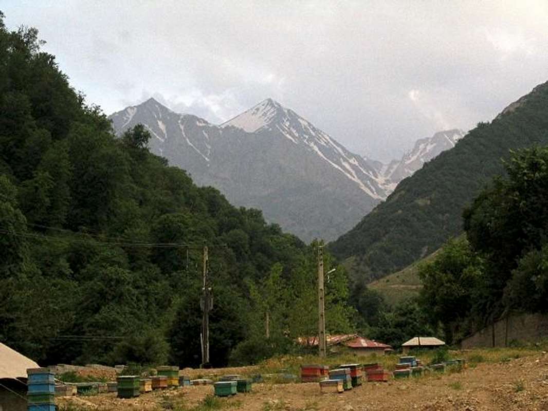
From Roodbarak Village. Siah Kaman is the pyramidal peak in the center of the photos. The photo on the right by Nomad.
No fees/permits needed..