|
|
Mountain/Rock |
|---|---|
|
|
36.06098°N / 51.55260°E |
|
|
Mountaineering |
|
|
Summer |
|
|
14272 ft / 4350 m |
|
|
Overview
Click for Introduction to the Central Alborz Mountains.Click for Introduction to Kholeno Massif.
Click for a detailed map of the Central Alborz Mountains.
Click for a detailed map of the Kholeno Massif.
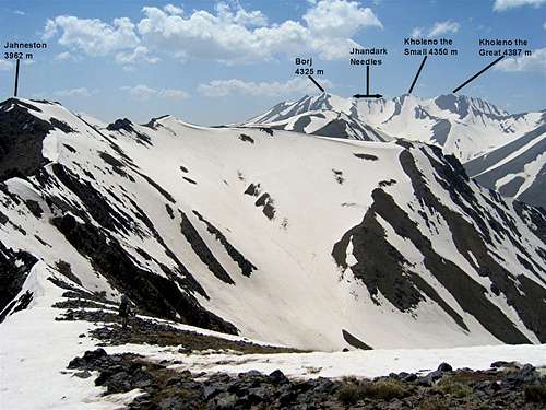
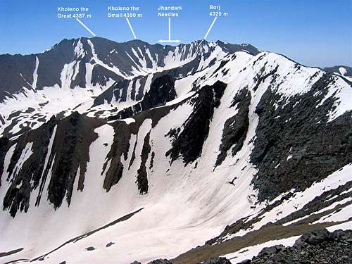
Kholeno the Great (Kholeno Bozorg) 4387 m
Kholeno the Small (Kholeno Koochak) 4350 m
 East Slopes
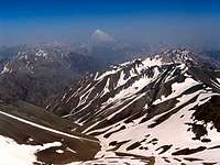
The Kholeno Peaks rise in the geographical heart of the Central Alborz Mountains of northern Iran. The 4387 m Mt. Kholeno the Great is the highest peak of the Kholeno Massif (see footnote at the bottom of the page), a complex series of connected ridgelines that give rise to tens of 4000 m plus peaks. Kholeno the Small sits directly to the south of Kholeno the Great. The eastern slopes of Kholeno the Small drop into the upper portions of the Lar River Valley. To the south, Kholeno the Small is connected to the 4325 m Borj Peak. Three distinct groups of gendarmes known as the “Jhandark” Needles crown the ridgeline between Kholeno the Small and Borj Peaks.
 West Slopes
To the west, the Kholeno Peaks along with their nearby mountains, create a high alpine cirque that houses a small seasonal lake known as the Kholeno Lake. The lake sits at an elevation of 3830 m and is formed in the summer months by the melting of the area snowfields.
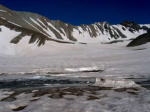 From Kholeno Lake
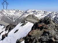 From Kaman Kooh
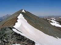
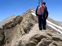
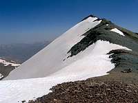 Summit of Small Kholeno
Mt. Kholeno the Great is the highest peak of the Tehran province and is a popular destination for mountain climbers. On the way to Kholeno the Great, Kholeno the Small can be either climbed or bypassed below its summit. The usual starting point for climbing the Kholeno Peaks is the village of Laloon (2400 m) to the southeast. From there, you will hike to the Varzab Pass, climb the Borj Peaks and then tackle the Jhandark Needles (see below) to reach Kholeno the Small and the Great. This route usually takes 1.5 days for roundtrip. A much longer but much more beautiful route is to start at the Varengeh Rood Village (2450 m) to the northwest and hike 21.5 Km along the Varengeh Rood River to set up base camp at the 3830 m Kholeno Lake (this route will give you spectacular views of snow-capped peaks and alpine meadows). From Kholeno Lake, you can climb many of the local peaks. Please be ware that the western slopes of the Kholeno Peaks above the Kholeno Lake are steep scree fields that can be used, after the snow melt off, as quick descend routes. The best ascend route is via the summit of Khers Chal Peak (see Route page).
Jhandark Needles
 Top of N. Jhandark
 N. Jhandark
 N. Jhandark
Jhandark (means “Joan of Arc”) is a strange name for a group of gendarmes in the Central Alborz Mountains near the capital city of Tehran. The origin of this name is not known to me and I often wonder if “Jhandark” is a misnomer for “Gendarme”.
 East of N. Jhandark
On the crest of the ridgeline between the Borj Peak to the south and the Kholeno the Small Peak to the north, you will find three groups of Gendarmes blocking the way to the Kholeno Peaks. The southern and the middle gendarmes do not present much of a technical challenge beyond some Class III hand and foot climbing.
 Borj & Jhandark
 Jhandark
 Jhandark & Small Kholeno
The northern gendarme is made of 2-3 crags that create walls that are 3-4 meters tall. If you want to continue on the crest of the ridgeline, you will have to go up and down these walls. The slopes on the west side of the north gendarme are very steep and are made of very loose rock. These slopes are best avoided. You can bypass the north gendarme to the east of it just below its summit. This will require hand and foot climbing. All difficulties can be avoided by descending 100 m below the summit on the eastern slopes. Be ware that snow remains on these slopes probably until mid summer.
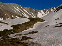
Views from the summit of Kholeno the Small