
|
|
Mountain/Rock |
|---|---|
|
|
48.09845°N / 121.50823°W |
|
|
Snohomish |
|
|
5113 ft / 1558 m |
|
|
Overview
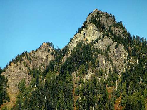
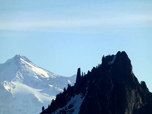
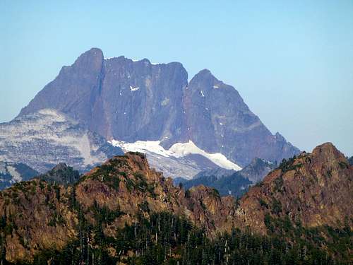
Beaver Peak from Big Four Ice Caves Trail
Looking for a nice scramble on the Mountain Loop Highway, but finding yourself a little short on time? Want an easy scramble on the Mountain Loop Highway with great views, but just can't stand the Pilchuck/Dickerman style crowds? If you answered yes to either question, Beaver Peak may be just right for you. Beaver Peak (unofficial name) is a 5113' peak located three miles northeast of Silverton, Washington. It is a fairly simple, 1.3 mile scramble, and is situated in such a way as to give rewarding views of the neighboring mountains. In fact, this scramble is so quick, and the views so stupendous, that I have decided to bestow upon Beaver Peak 2013's "Under-Rated Peak of the Year Award" (2012 winner was Eagle Rock, in case you are interested). Total elevation gain for this peak is 1700', the scrambling is mostly class 2, and car-to-car times should be around three to four hours.
Getting There
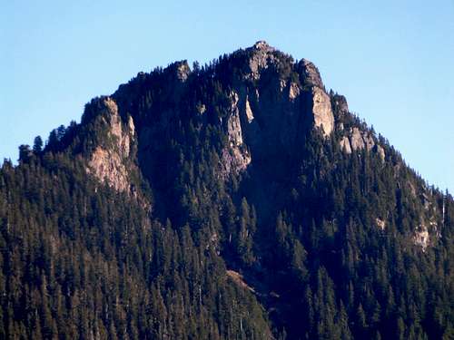
Beaver Peak from Silverton
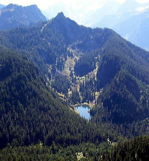
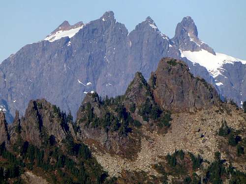
Beaver Peak and Coal Lake from Independence Peak
Route
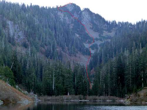
Beaver Peak from Coal Lake. Red line shows my approximate route.
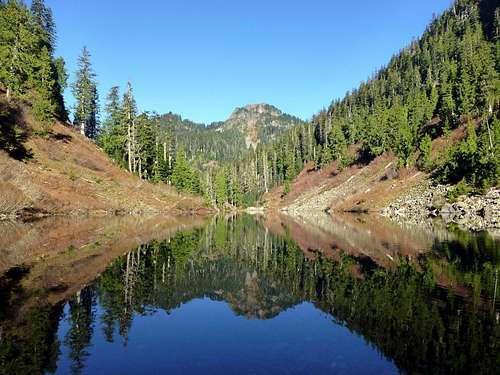
Coal Lake from southeast. Independence Peak in the distance.
From the inlet side of Coal Lake, travel over slightly ascending terrain southeast, directly towards Beaver Peak's summit. The first part of this scramble may present some minor brush difficulties in summer. For my late season trip, I was able to cover much of this section on dried up creek bed. After gaining several hundred feet in elevation, the forest and brush will give way to open talus slopes.
Beaver Peak from the northwest at 4000'
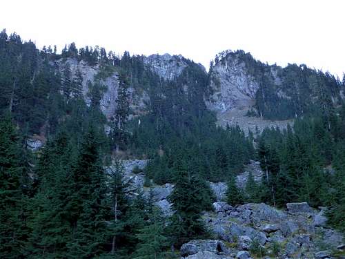
Scramble the talus slopes straight up, until reaching the base of a large cliff at 4600'.
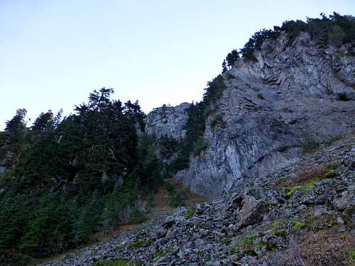
Beaver Peak route at 4600'. From this point, follow the ramp up and to the left.
Looking down the Beaver Peak route at 4600'
From the base of the aforementioned cliff, turn left, and follow a steep ramp (you may start to see game trails at this point). After about 200' of elevation gain, you will again come to the base of a cliff. Ignore the dirt ramp leading up the right, and make a rising left traverse along the cliff base, following game trail where able. I did encounter a little class 3 scrambling on this traverse, but the exposure was not too bad. At about 4900', you will notice a dirty, class 4 gully, where the goats have made their way to the top of the ridge. Unless you are a goat, or just a little masochistic, ignore this gully.
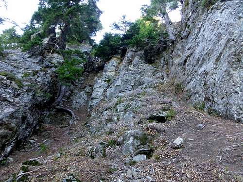
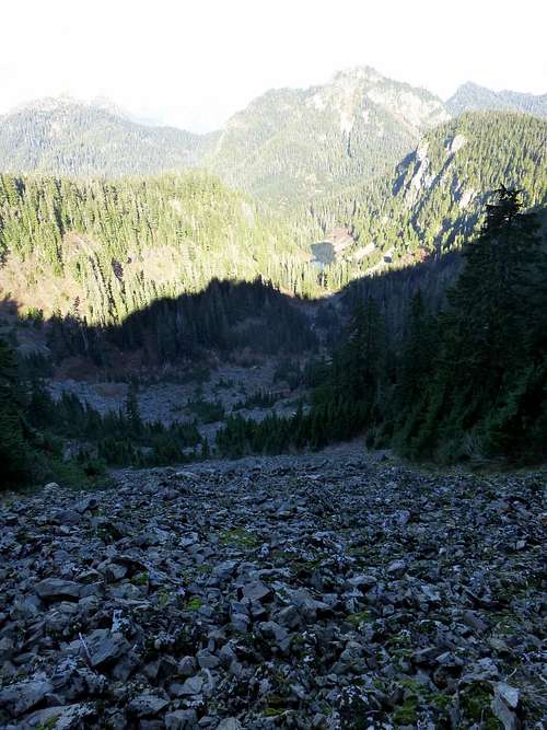
Beaver Peak route at 4900'. Do not be tempted to follow the goats to the top of the ridge this way. Simply traverse a few hundred feet more to north for easy scrambling to the ridge crest.
Continue traversing north for a few hundred feet along the cliff base, where it will suddenly give way to easy class 2 scrambling to the ridge crest. Once atop the ridge, turn right, and follow the ridge crest straight south to Beaver Peak's false north summit (not shown on USGS maps).
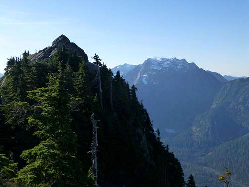
Beaver Peak summit from false north summit
A very convenient series of ramps will lead down to the notch between the false summit and the true summit (From this notch, it may appear as if there is a short cut that can be made on the descent back to Coal Lake, but it will cliff out - ask me how I know!). From the notch, easy class 2 scrambling will lead to the summit. Beaver Peak has a nice summit for hanging out, so pack a lunch and a sit pad, and enjoy the scenery.
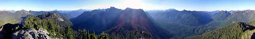
Beaver Peak summit pano
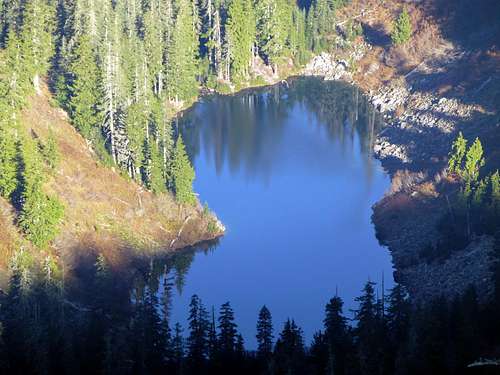
Coal Lake from Beaver Peak
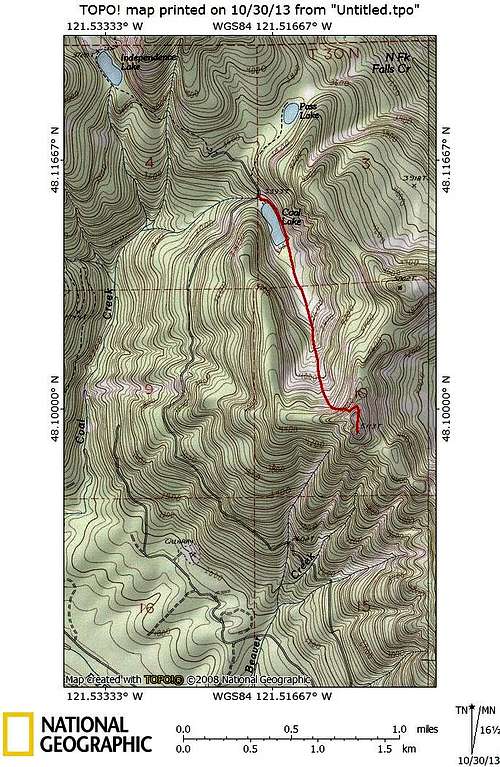
Beaver Peak route map
Attached below is a link (used with permission) I found that describes a June 2012 ascent of Beaver Peak: