In this fifth and final page of the Becca di Nona, the mountain par excellence of the City of Aosta, we want to describe those "Mixed Route" that do not belong completely to one specific slope or ridge. It is therefore a "trait d'union" between two streets that run partially one of these and ends with the next. After the two Routes dedicated to the North Wall and the one directed specifically at great "Ridge" North-northeast, this provides a mix of various slopes and ridges, or simply a classic match between two routes that are usually united in the rising phase and the descent. A classic stà precisely in the Normal Route, traditionally made on one side with subsequent descent through a path neighboring and that connects to the primary.
In questa quinta e conclusiva pagina dedicata alla Becca di Nona, la montagna per antonomasia della Città di Aosta, si vogliono descrivere quelle "Vie Miste" che non appartengono completatante ad un solo specifico versante o cresta. Risulta quindi un "trait-d'union" tra due vie che percorrono parzialmente uno di questi per poi concludersi con il successivo. Dopo le due Routes dedicate alla Parete Nord e quella rivolta specificamente al grande "Crestone" Nord-nordest, questa fornisce un misto tra i vari versanti e le creste, oppure semplicemente un classico abbinamento fra due vie che solitamente vengono accomunate tra la fase di salita e quella di discesa. Un classico stà proprio nella Via Normale, tradizionalmente percorsa da un lato con susseguente discesa tramite un percorso vicino e che al primario si collega costituendo, alla fin fine, un unico itinerario.
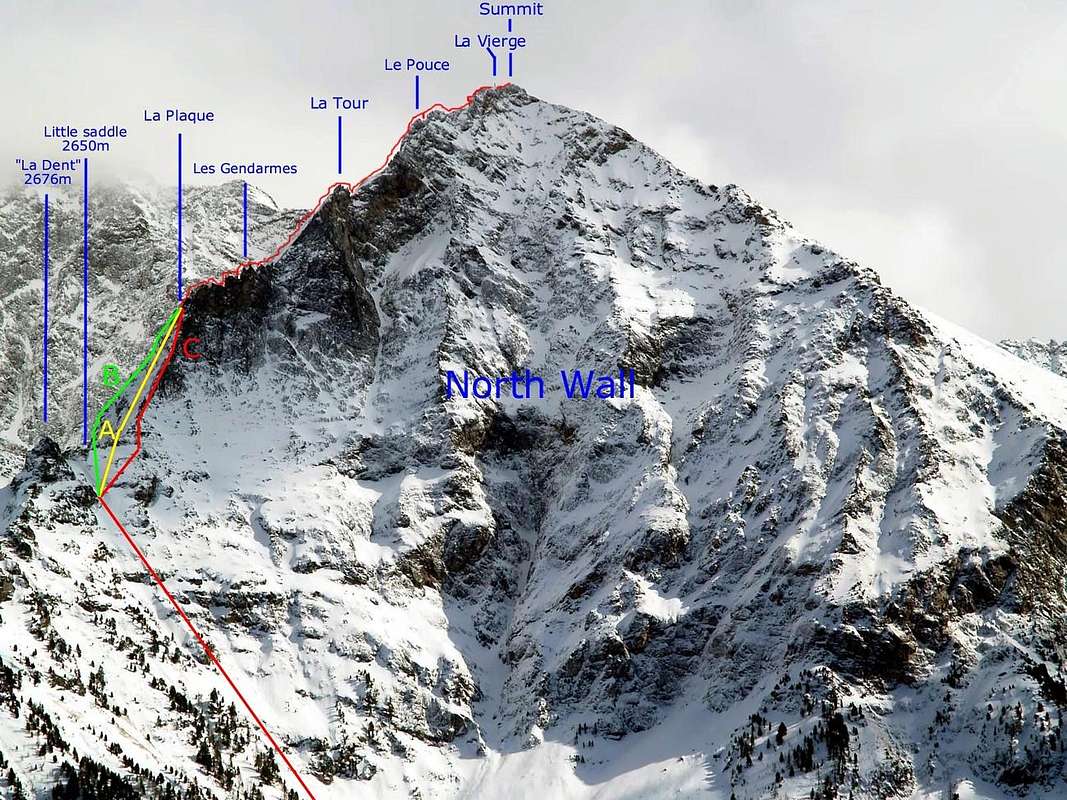
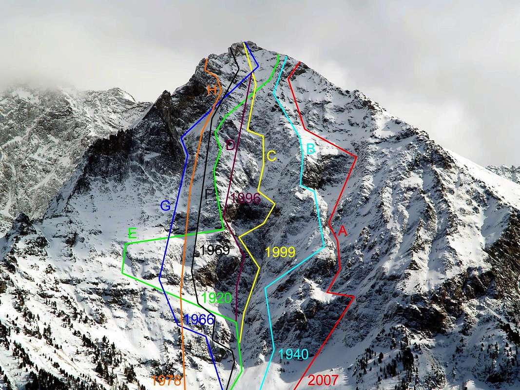
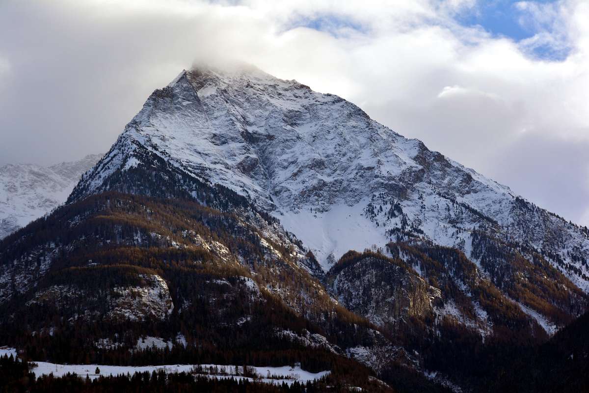
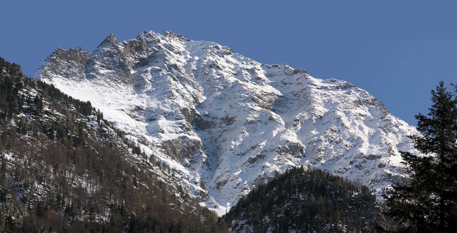
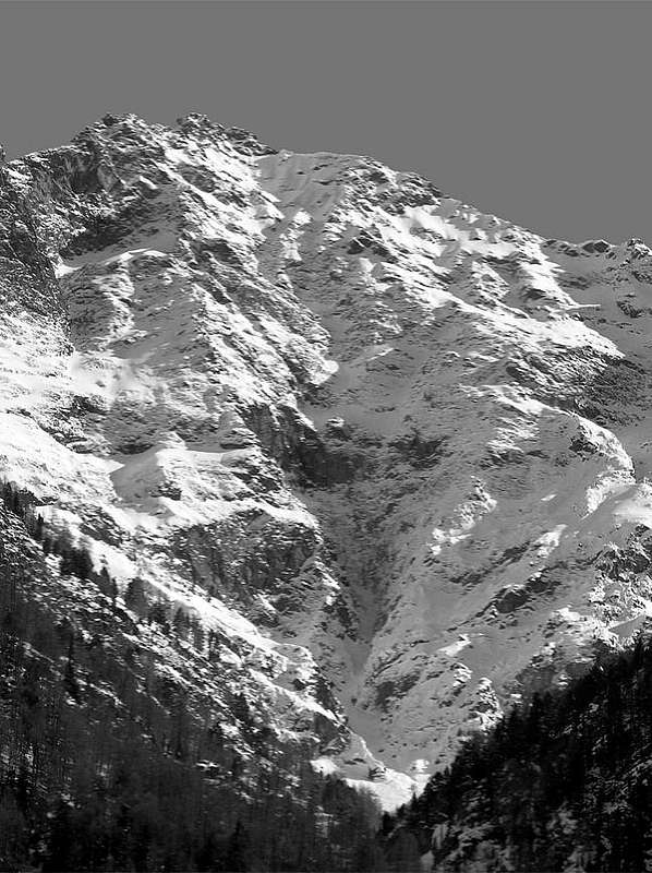
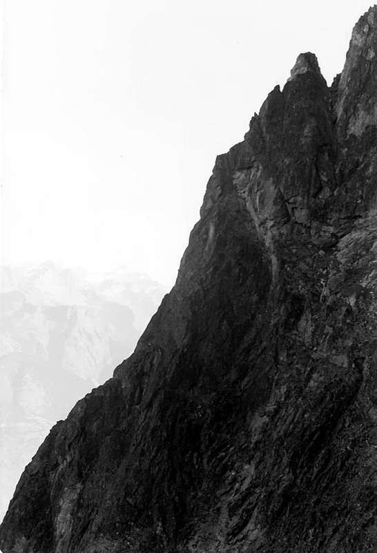
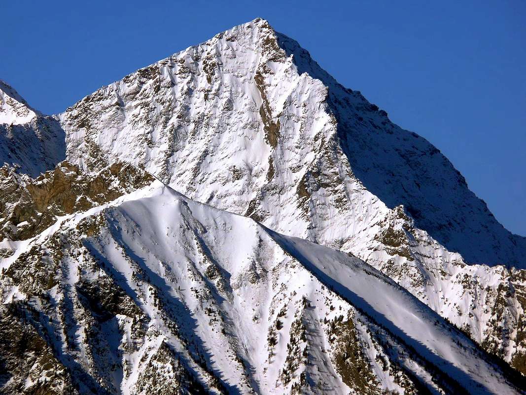
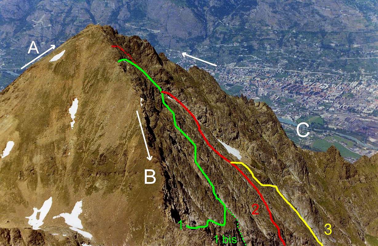
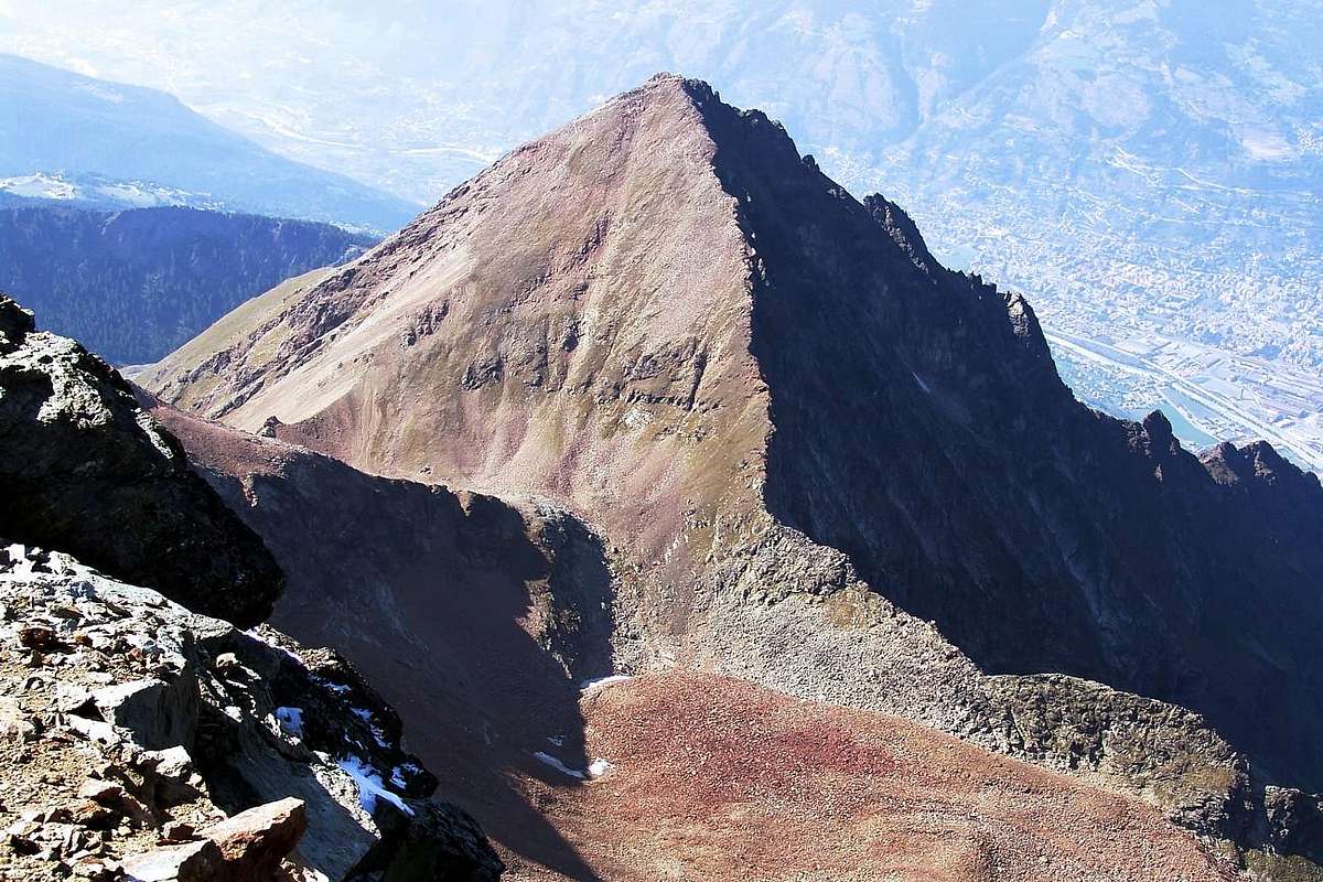
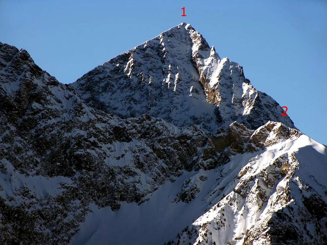
As already we see the two photographs, many routes start on one side and ends with a ridge; a classic is the North wall where, with the exception of the Route of July 1966 and including those of the first climbers in 1920 (but even this exit just right on West Ridge, as in the picture below), of 1996 (on Left Pillar internal side to the West), of 1999 (Central great Couloir), all the others have "vent" on a ridge of the right or left of the same. Logically are indicated for the greater development presented on one or the other, but still remain the "Mixed-way", as it does not belong exclusively to either. Other two-way "mixed" climb towards the two opposing ridges: the first is carried out at the end of December 2007, in overcoming the steep Northwestern Wall of the rocky promontory 2.686 meters, on the Western Side of the North Face, with longer follow-final via the Western Ridge ; the second in June of the same year, up along the Via July 1966 to about half of that to finally decline on a rocky edge towards the Great Tower (2.998m) in the North-Northeast Ridge. From this concept does not escape even the ascent through the "Crestone" North-northeast, because the phase of approach to the same belongs to the Face on Northern Slope of Moriond, while, as performed by the first climbers in June 1926, as well as to that of the Eastern Arpisson in the opposite walloon, below the Monte Emilius. But there is also something mixed even on the Eastern Wall with integral on the same route, but always in June of '27, while the new route at the beginning of 1996 ends on "Crestone" East-northeast at about seventy meters from the Top. or on the desolate Slope West-southwest we find something similar, but with opposite results: a route made in September 1964 mainly along the same to flow on Western Crest not far away from the Vertex, while another of the June 1967 runs in the first part of the same from Plan Valé (a plateau averaging about 2.300/50 meters) by the Face West-southwestern, but then mainly goes up through the very long West Ridge.
Come ben si vede nelle due fotografie, molte vie iniziano su d'una faccia per poi concludersi tramite una cresta; un classico risulta la Parete Nord dove, ad esclusione della Via del Luglio 1966 nonché quelle dei primi salitori nel 1920 (ma anche questa con uscita appena a destra sulla Cresta Occidentale, come in foto soprastante), del 1996 (sul pilastro di sinistra lato interno ad Ovest), del 1999 (Canalone Centrale), tutte le altre hanno "sfogo" su di una cresta di destra o di sinistra rispetto alla medesima. Logicamente vengono indicate per il maggior sviluppo presentato su di una o sull'altra, ma pur sempre rimangono delle "vie Miste", poichè non appartengono esclusivamente a nessuna delle due. Altre due vie "miste" salgono verso le due opposte creste: la prima consiste, effettuata a fine Dicembre 2007, nel superamento della Parete Nordovest del promontorio roccioso 2.686 metri, sul lato Occidentale della Parete Nord, con più lungo proseguimento finale tramite la Cresta Ovest; la seconda del Giugno dello stesso anno, sale lungo la Via 1966 fino a circa metà della medesima per infine declinare sulla Grande Torre (2.998 m) della Cresta Nord-nordest. Da questo concetto non si sottrae neppure la salita tramite il "Crestone" Nord-nordest, perchè la fase di approccio al medesimo appartiene alla Faccia Nord sul Versante Moriond, come effettuato dai primi salitori del Giugno 1926, nonché a quella Orientale su quello dello Arpisson nel vallone opposto sotto l'Emilius. Ma qualcosa di frammisto esiste anche sulla Parete Est con itinerario integrale sulla medesima sempre nel Giugno ma del '27, mentre la nuova via del 1996 si conclude sulla Cresta Est-nordest ad una settantina di metri dal Vertice. Anche sul desolato Versante Ovest-sudovest troviamo qualche cosa di similare, ma con esiti opposti: una via del Settembre 1964 percorre principalmente il medesimo per poi sfociare sulla Cresta Ovest a non molta distanza dalla Sommità, mentre un'altra del Giugno 1967 percorre nella parte iniziale dal Plan Valé il Versante Ovest-sudovest, ma poi principalmente sale tramite la lunga Cresta Ovest.
Getting There
BY CAR:
From TORINO, MILANO, etc: Motorway A5. Exit at IVREA or Quincinetto (PIEDMONT) From VREA Town: in West towards Pollein, Charvensod, Gressan. From Courmayeur Resort: in East towards Gressan, Charvensod, Pollein Municipalities. From Pollein (575m; secondary road) or from Charvensod (746m; main road and connection) to Martsaouchy Damon-Arpisson Vallon, through dirt road, and to Arpisson Lower and Upper (2.010m) Alpages with path. To Federigo Zullo Bivouac (2.907m), through moraines on Western Arpisson Glacier. From Charvensod to Dard-Comboé-Arbolle Vallons towards Ponteilles(1.697m) Alp/Waterfall, through dirt road, Comboé Alp/Saint Ours Shelter (2.114m), through dirt road, and Arbolle Refuge(2.516m), near Lakes (2.497m), by Chair Lift to Chamolé Station (2.309m), Lake (2.325m) and muletrack. From Charvensod (main road from Pont Suaz 567m) or from Gressan (603m; alternative road) to Tivet, Les Fleurs Hamlets (1.292m, 1.414m) Pila Basin and Pila Resort (1.800m); upper parking 1.850m). Arno Shelter (2.660m), always open but unguarded, nearby Couiss Summit on watershed Pila/Cogne Valley.
From FRANCE: through the Mont Blanc Tunnel to Entrèves-crossroads to Vény/Ferret Valleys - Mountain Guides of Courmayeur - La Saxe Rock Gym - Courmayeur. By Little Saint Bernard Pass, closed since November until half May to La Thuile Valley - Pré Saint Didier - Courmayeur.
From FRANCE: through the Mont Blanc Tunnel to Entrèves-crossroads to Vény/Ferret Valleys - Courmayeur. By Little Saint Bernard Pass, closed since November until half May to La Thuile Valley - Pré Saint Didier - Courmayeur. It is not necessary to take Motorway A5: you can drive on SS.26, in the direction of AOSTA - IVREA - TURIN.
BY PLANE:
Aeroporto "Corrado Gex" Saint Christophe (Aosta).
Various Approaches by Pollein Charvensod Gressan Municipalities
1) - From Chamolè station of chairlift (2.311m) by path 19c 19 to Chamolè Lake (2.325m), North Replan Pass (2.366m), Comboè "Lower" (2.601m), path to Morion Alp (1.949m; ruins), West Slope of Becca Jag (2.672m) and little saddle (2.650m), (3h'30/4h'00).
2) - From Pila - Saint Laurent (1.800m) or from parking (1.841m) to Chamolè Alp (2.152m), Plan Fenêtre Pass (2.221m), "Lower" Comboè little Valley (2.001m) joint to preceding route (4h'00).
3) - From main route (regional road) to Pila Tourist Station in quota 1.000m~ to Saint Salò-Gorres (1.382m) little Villages and by path 14d to Ponteills Alp (1.697m) and Waterfall (1.800m~) joint the previous route at entry (2.001m) Comboè Valley (3h'30/4h'00).
4) - From main road to Pila, crossroads to Reverier in quota 1.000m~ toward Reverier to Tzat and Lower (1.042m), Ronghachet Bridge and Alp (1.113m), Barmes Alp (1.255m), Martsaouchy Middle and Higher (1.416m); from Higher by path to Plan Croix Alp 1.744m; ruins), Arpisson Lower (1.951m) and Higher (2.010m) and through Eastern Slope of NE Spur (4h'00/4h'30).
5) From Higher Martsaouchy (1.416m) by path to Plan Croix Alp 1.744m and from quota 1.900m~ direct ascent through wood, grassy slopes and little rocks, crossing in right (W) of "La Dent" (2h'00/2h'30).
1) - Dalla Stazione della Seggiovia di Chamolè (2.311 m) con i sentieri 19c e 19 per il Lago di Chamolè (2.325 m), il Col Replan Nord (2.366 m), Comboè "Basso" (2.601 m), sentiero per Alpe Morion (1.948 m; rovine) e per il versante Ovest de "La Dent" (2.672 m) e la piccola Sella 2.650 metri circa (3h'30/4h'00).
2) - Da Pila - S. Lorenzo (1.800 m) o dal parcheggio (1.841 m) all'Alpe di Chamolè (2.152 m), Colle Plan Fenêtre (2.221 m), Comboè "Basso" (2.001 m) ricongiungendosi alla via precedente (4h'00).
3) - Dalla Strada Regionale per Pila a quota 1.000 m circa verso i piccoli Villaggi di Saint Salò e Gorres (1.382 m) e con il sentiero 14d per l'Alpe (1.697 m) e la Cascata (1.800 m circa) di Ponteilles ricongiugendosi alle vie precedenti, all'ingresso del Vallone di Comboè (3h'30/4h'00).
4) - Dalla Strada Regionale per Pila, bivio per Reverier Dessous a quota 1.000 m circa, a Reverier du Tzat, Reveriers Dessous o Desot (1.042 m circa), Ponte e Alpe di Rongachet (1.113 m), Alpe di Barme (1.255 m), Martsaouchy e Martsaouchy Damon (1.416 m); da Martsaouchy con sentiero per l'Alpe diroccata di Plan Croix (1.744 m), Arpisson di Sotto (1.951 m) e di Sopra (2.010 m) e per il versante orientale del Contrafforte NE (4h'00/4h'30).
5) - Da Martsaouchy Damon (1.416 m) con il sentiero per Plan Croix (1.744 m) e dalla quota 1.900 metri circa direttamente tramite il bosco, pendii erbosi e roccette, passando a destra de "La Dent" (2h'00/2h'30).
Approaches towards Becca di Nona: Marstaouchy (snowy), true front door to Arpisson Vallon, below the North Wall of Emilius (left); in right (West) the Morion rocky promontory, obliged passage for the aprroaches from Dard Vallon or Ponteilles Waterfall and by Pila-Resort through the Plan Fenêtre Pass.
Routes Description
* NOTE: the described routes are listed clockwise departing from the North Face, Towards the Western Ridge.
* NOTA: le vie descritte vengono elencate in senso orario partendo dalla Parete Nord, fino alla Cresta Ovest.
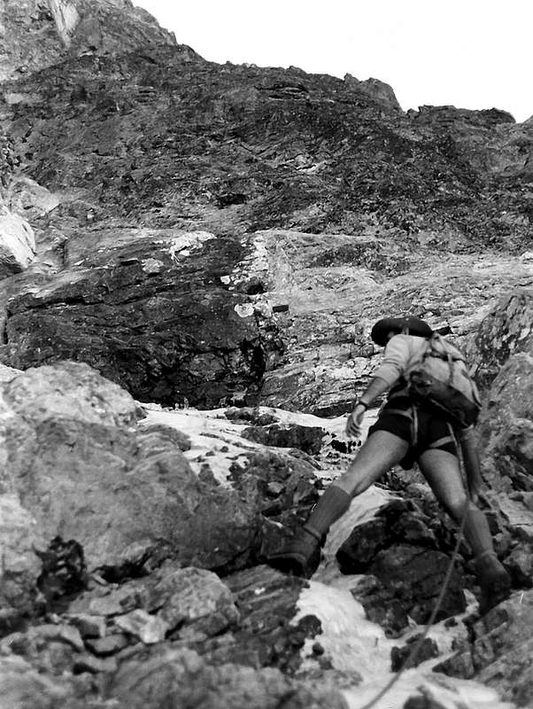
A) - West gully or of Right and Western Ridge in terminal part. First ascension: Osvaldo Cardellina, lone, (October 11th, 2007); in day from Saint Saloo Village and through Ponteilles Alp and Waterfall and Comboé's Tableland to Morion(d) Alp. Not repeated. To begin, starting from the perimeter ruins of Moriond Pastures (1.948m) on the second couloir of unloading at the base and to the lateral right (West) of the big central drainage channel (slightly less steep than the precedent and what a form an angle in the grassy and morenic slope, or stony ground) always at the same basic face to quota 2.330/40 meters around, near a rocky small cascade, with one trickle of water. Attach the wall on the right (West), with oblique and delicate climb and by a terminal little rocky gully, final part of the great Couloir of Right, also West. Climb into the same in ascent through not good and friable rocks, even marches (from the II°+ to the III°+), holding himself on the right of the great stain of damp left by a fall of water during the breakup of the snows and in clear evidence during the rainstorms; later around 80/90 meters around, to reach a great tilted ledge overhanging the basal jump or "clog". * VARIANT of DEPARTURE: instead of going up again through the clog of base the aforesaid channel of drainage of the snows or waters, rather dangerous for the discharges of stones to begin on the rocks immediately to the right, also these of not good quality, but relatively less exposed to the discharges because mostly distant from the axis of fall. (AD+; sees then). * (Especially in the recent period, due to the warm one with landslides through separation even from the part of the top of the West Crest; one first great landslide happened Aug 21 th, 2005, among the hours 16'15s and the 16'30s and the boom of which he was heard thin from the floor valley, with separation to quota 2.680/70 meters around and unloading on the basal slant of right (West) leaving a great whitish trace on the gully and nearby prairie. The second in the same day and month of 2010 with beginning under the West Crest to quota 3.060/50 meters around, longer but of small entity, seen the thin furrow engraved in the couloir. Also the base of the gully rather results precarious with a crack in the ground, overhanging the 2000 great landslide separation, by now long almost 250 meters and wide also over 3; the same one in the slope of July '66 (during note a first approach on the right of the wall, with renouncement for the bad quality of the rock) it was longer than 20/22 meters and wide as a small gutter. Besides he was already known by the shepherds of beginning the twentieth century, that called it to her "Raye (also crevasse earthy) du Morion(d); surely, as from had private informations, it was of small entity and dimension in comparison to the 1966 sighting. The whole zone is to the actual state under continuous monitoring from the Civil Protection."). To mostly support on the right (West) to slightly go up still through a great plate to form of dihedral on scarcely more best rock but anyhow always friable, broken and with very delicate and exposed climb, certainly less and less exposed to falling blocks (III°/III°+, a brief passage of IV°-, delicate). Arrived in about half of this ramp-dihedral, which continues in the upper right toward a secondary edge, abandon to cross left West) in the direction of a wide ledge; going out to the right border of the superior horizontal ledge of rotten rocks; with a crossing relatively more safe, as soon as longer toward left (East), to connect easily him to the precedent itinerary, reaching the inside of West Couloir, here more large, hardly over his half. Therefore, to almost entirely cross it bringing himself toward left (always East), with around 40 metres through broken rocks and even too much steep but easy and enough safe, or through a snowfield until almost the end of the month of June, thus entering the Western Gully real, more specifically, in this second case, reach the "rigola" or drain and climb along side on the right. Achieving such a small rocky strip that easily exceeds coming to a small snowfield shaped little spider, place right at the base of the couloir that from here salt funnel shaped. First with a very narrow stretch vertically and then turning left (East), to go up again it with sinuous course, leaving at first on the left a wall of vertical rock of about forty meters around; for then to, side by side, continue and, underlying to the Spur of Right of the face becoming rather, the narrow couloir and with evident traces of showy and rocky recent landslides, up to reach a second ledge tilted with possibility, in beginning season and up to half summer, to find snowy again it. Go up some more it through a not difficult, but delicate, course in diagonal, from the left toward the right for scarce hundred meters, reaching a second rocky jump of 50 meters around fifty-fifty of the wall; to revolve, doubling it to it on the right (West through a little gully to arc that tilts it toward left (East), overcoming in progression four small constituent rocky "banconate" (bands) the layers of the same rocky jump (II°/II°+; not difficult but delicate climb, raison the remarkable suspended rocky material). Reach a third ledge-plateau tilted and with the same characteristics of the preceding one. To cross it in opposite sense (from West verse East and then in zigzag, with other two changes of direction among the small same bands and a more accented rocky band to West) going beyond two narrow and small again rocky bands; to climb on the first oblique and into the horizontal second, bringing himself so until almost against the E'peron of Right or West, in the proximities of a minuscule promontory. Before joining himself with this last, with brief climb in vertical, to reach a further small wall of more broken and less steep rocks (II°, brief lines of II°+; notable possibility of fall of stones, so much that the landslides verified him in these last years have drawn origin all from this point), that brings, through a narrow passage, toward a fourth grade ledge or tilted snowfield. Edged on the left a second little rocky promontory, the last underlying rocks they are reached the West Crest. Before joining himself with this last, by brief slope in vertical, to reach a further small wall of more broken and less steep rocks (II°, brief lines of II°+; notable possibility of fall of stones, so much that the landslides verified him in these last years have drawn origin all from this point), that brings toward a fourth grade ledge or tilted snowfield. Edged on the left a small rocky promontory, the last underlying rocks they are reached the Crest West in quota 3.070/80m around;, going out nearby and in parallel to the route of the spur on the same one and to around about fifty meters from the Peak. Through this, with passages of I°+ or II°-, if crossed on the thread (possible avoidances to the right or South), in the last 100 meters to reach the Peak (AD+; rock nails also pitons n° 5 utilized; a lot of statement to the fall of stones and very delicate slope; surely climbed by to dissuade every case; 4h'30/5h'00).
The West COULOIR with EXIT OUT (2007): general views of the Right Couloir and details on the exit to Becca Top.
A) - Canalone Ovest o di destra e Cresta Ovest nella parte finale. Prima ascensione: Osvaldo Cardellina, solo, (11 Ottobre, 2007); in giornata dal Villaggio di Saint Saloo passando dall'Alpe di Ponteilles e Cascata, il Basso Comboé ed i resti del'Alpe Morion(d). Itinerario non ripetuto. Iniziare, dopo la risalita, partendo dai miseri ruderi dell'Alpe del Moriond (1.948 m ormai ridotto a misere rovine perimetrali), sul secondo canale di scarico laterale sulla destra (O) del gran Canalone Centrale (leggermente meno ripido del precedente e formante un angolo nella salita) alla base del pendio erboso-morenico della parete stessa a quota 2.330/40 metri circa, con possibilità di trovare ancora i residui di un nevato, di solito inarcuato in basso, oppure pietraia. Attaccare la parete sulla destra (sempre W), con salita obliqua, lungo lo stesso canalino roccioso di scolo, parte terminale del grande Canalone di Destra od Ovest, nella base della medesima. Arrampicarlo salendo tramite rocce sempre non buone ed alquanto friabili, se non addirittura marce nonché da arrampicarsi con prudenza (dal II°+ al III°+; delicato), tenendosi sulla destra della grande macchia di umidità lasciata da una cascata di acqua durante lo scioglimento delle nevi, in buona evidenza durante i temporali; dopo circa 80/90 metri circa raggiungere una grande ed evidente cengia orizzontale, ma inclinata soprastante il salto basale. * VARIANTE di ATTACCO: invece di risalire lo roccolo di base per mezzo del suddetto canalino di scolo delle nevi o acque, alquanto pericoloso per le scariche di sassi, iniziare la salita lungo le rocce immediatamente sulla destra, anche queste di non buona qualità, ma relativamente meno esposte alle scariche perchè maggiormente distanti dall'asse di caduta (AD+; vedi dopo). * (Eventi verificatisi soprattutto nel recente periodo, dovuto al caldo con frane tramite distacco addirittura dalla parte sommitale della Cresta Ovest; una prima grande frana avvenne il 21 Agosto 2005, tra le ore 16'15 e le 16'30 ed il boato della quale venne udito fino dal fondovalle, con distacco a quota 2.680/70 metri circa e scaricamento sul pendio basale di destra (O). Il materiale precipitò, saltando la cascatella nello zoccolo basale, lasciando una grande traccia biancastra nel canalone e nell'attigua prateria. La seconda analoga, nello stesso giorno e mese del 2010, con inizio sotto la Cresta O a quota 3.060/50 metri circa, più lunga ma di minore entità, visto il sottile solco impresso e rimasto nel canale; la medesima striscia risulta osservabile ancor oggi, anche da grande lontananza. Anche la base del canalone é da considerarsi alquanto pericolante con una crepa nel terreno, soprastante il distacco della grande frana del 2000, ormai lunga quasi 250 metri e larga anche oltre 3; la stessa, osservata nella salita del Luglio '66 (durante appunto un primo approccio sulla destra della parete, con rinuncia per la cattiva qualità della roccia, per poi proseguire nel lato opposto) era non più lunga di 20/22 metri e larga come un piccolo tombino. Inoltre era già conosciuta, ma con minor entità, dai pastori in loco di inizio '900, che la chiamavano la "Raye du Morion" ovvero La Crepa o Crepaccia del Morion(d)). Appoggiare più verso destra (Ovest) per risalire per mezzo di una grande placca, a forma di diedro inclinato dalla sinistra alla destra, su roccia leggermente migliore, ma sempre friabile, e sicuramente meno esposta alla caduta di pietre (III°/III°+, un passaggio breve di IV°-; delicato). Arrivati a circa la metà di questa rampa-diedro, che prosegue in alto a destra verso uno spigolo secondario, abbandonarla per attraversare verso sinistra (Est) in direzione di una larga cengia; uscir fuori al margine destro della cengia superiore. Con una traversata orizzontale, appena più lunga ma non difficile e relativamente abbastanza sicura, verso sinistra (sempre Est), ricollegarsi con facilità al precedente itinerario, raggiungendo l'interno del canalone, appena oltre la sua metà. Quindi, attraversarla quasi completamente portandosi verso sinistra, tramite una quarantina di metri circa su rocce rotte e neppure troppo ripide con detriti o tramite un nevaio sin quasi alla fine del mese di Giugno, entrando così nel Canalone Occidentale vero e proprio; più precisamente, in questo secondo caso, raggiungere la rigola o canale di scolo e salire affiancandola sulla destra. Raggiungere così una fascetta rocciosa che si supera agevolmente arrivando ad un nevaietto a forma di piccolo ragno, posto proprio alla base del canale che da qui sale a forma di imbuto. Dapprima con un tratto in verticale molto stretto e poi piegando a sinistra (Est), risalirlo tramite andamento sinuoso, lasciando dapprima sulla sinistra un muro di roccia verticale di una quarantina di metri circa, per poi continuare, parallelamente e sottostante allo Sperone di Destra od Ovest della parete, diventando il canale alquanto ristretto e con evidenti tracce di vistose e biancastre frane recenti, fino a raggiungere una seconda cengia inclinata con possibilità, in inizio stagione e fino a metà estate, di trovarla ancora innevata. Risalirla con andamento in diagonale, dalla sinistra verso la destra per un centinaio di metri scarsi, raggiungendo un secondo salto roccioso di 50 metri circa, nel bel mezzo della parete; aggirarlo doppiandolo sulla destra (O) per mezzo di un canalino arcuato, che si inclina verso sinistra (E). Superare in progressione quattro piccole fasce rocciose costituenti le propaggini estreme e laterali destre del salto roccioso medesimo (II°/II°+; salita delicata, causa il meteriale sospeso), raggiungendo una terza cengia-plateau inclinata e con le stesse caratteristiche della precedente. Attraversarla in senso opposto (da O verso E e poi in zig zag, con altri due cambi di direzione tra le fascette medesime ed una più accentuata banconata rocciosa ad O) oltrepassandone ancora altre due, sempre rocciose; salire la prima obliqua e la seconda quasi orizzontale, portandosi così fino quasi contro lo Sperone di Destra nelle vicinanze di un minuscolo promontorio, non molto evidente salendo. Prima di congiungersi con questo ultimo, con breve salita in verticale, raggiungere un'ulteriore muretto di roccette più rotte e meno ripide (II°, brevi tratti di II°+; notevole possibilità di caduta di pietre, tanto che le frane verificatesi in questi ultimi anni hanno tratto origine quasi tutte da questo punto), che porta, per mezzo di una strettoia, verso una quarta cengia o nevaio inclinato. Contornato sulla sinistra un secondo piccolo promontorio roccioso, si raggiungono le ultime rocce immediatamente sottostanti la Cresta O in quota 3.070/80 metri circa, uscendo quasi vicino ed in parallelo alla via dello Sperone Ovest, nonché sulla medesima ed a circa una cinquantina di metri dalla Vetta. Per mezzo di questa con passaggi di I°+ o II°-, se percorsa sul filo (aggiramenti possibili a destra o S), negli ultimi 100 metri raggiungere la Vetta (AD+; chiodi da roccia utilizzati: n°0; molto esposto alla caduta di pietre e salita alquanto delicata, nonché pericolosa; sicuramente salita da sconsigliare in ogni caso; 4h'30/5h'00).
B) - Right Side of the wall or West Spur and West Ridge in final part. First ascent: Adolfo Giulio "Dulo" Ourlaz, First Lone, (Summer 1940); in day from Pila Alp, Plan Fenetre Pass, Comboé's Lower Tableland and Ancient Morion(d) Pasture. * First Repetition and Second Lone: Renato Quendoz, (Summer 1964); in day from Pila Touristic Village, through the Plan Fenetre Hill to Ancient of Morion(d) Alp (ruins). ** Second Replay also Third Ascent: Marco Gaida and Claudio Curtaz, (Oct 19th, 2008); approach like above and in day *** Third Replay or Fourth Ascent, as well as Third Lone: Marco Gaida, (Aug 05th, 2009). **** First descent, by snowboard, Davide Capozzi and Julien Herry, after the ascent through the same route; (May 31th, 2013). Approach sees over. ** Not having personally crossed it, it leans on us to the relationships of says Adolfo Giulio Ourlaz "Dulo" and Renato Quendoz, Aosta Town mountain guide and climber, in Summer/Autumn 1978 both and you publish in "Guide of the Emilius Mountain", December 1978, by Osvaldo Cardellina and of same Editor: "… it doesn't follow a precise itinerary, being you a lot of liberty of run; the attack is worthwhile to effect it after having been climbed for brief line in the central channel and supporting to the right on steep rocks but not difficult. It is possible to also climb directly the constituent wall the basal clog, with steep rocks and not a lot of good person, but it is unadvisable really because of the rotten rock…"; this remains the only bibliographical, as well as literary available source in existence. Subsequently the same one has been taken back in Guide of the Mountains of Italy of the C.A.I., Edition of March 2005, " Emilius Rosa dei Banchi Parco del M.Avic", itinerary 58d): ... " for the great crest of right (W) of the wall NNW". ... "Over, the wall decreases of inclination and introduces smaller smaller difficulties, with an oblique run slightly to the left." ... , page 132 to work of Giulio Berutto and Lino Fornelli. But, from recent deprived informations, gotten in the years 2010 and 2011 from the mountain climber of Pont Saint Martin Marco Gaida, that he has crossed twice her of which one in solo, it confirms the judgment slightly lowering the level of technical difficulty, as from us published to the beginning of the present job and currently of already retouched. Surely is the more easy and safe via. Begin to right 50 meters (West) of the Central Gully, to quota 2.330 meters around, bringing himself from the central throat toward right on a summer residue of extant double snowfield to form of arc, or on stony ground; through a small gully, with steep rocks, always friable and sometimes marches (III°/III°+), climb up a small thin round promontory (he can also be reached it beginning from right to left on a mini gully), to almost meet a horizontal ledge. From this to exploit an oblique ramp of 150 meters around with diagonal tall toward right (with not forced route). ** VARIATION of BEGINNING: also and again with a different attack but nearby, to mostly hold him on the right (always to West) following a ramp underlying, parallel but briefer; the same route, after having reached the same small rocky promontory (sees above), it goes beyond it and, crossed a channel of unloading "broken" coming from a small yellowish wall overhanging, brings him on a small crest to the oriental borders of the West Couloir, above the first big ledge of this last. Old consecutive two rocky prominences, followed by to series of small ledges, also grassy, overlapped, to go up again it on the thin thread against the border of the aforesaid vertical rocky jump, here more dark color. To double to the left it on his oriental edge facing to small rocky edge of abundant about fifty meters, constituent the weak point of the small wall divided in two separate sides. To overcome it on his small edge reaching a less steep slant constituted by rocks with grass and connect him more aloft with the preceding itinerary (from AD- to AD+; probably with passages from the II° to the III°; same time). Going out of this continue in the same direction with slope, still in diagonal before through a brief stretch, and then vertically and with "ondulated" course on the thread of spur, that begins here to mostly delineate it, along other 200/20 meters around. To often climb on the rock mixed to lines by now grassy (great sights both on the below horrid Central Gully and on that of Right). After a diagonal crossing up a great debris ledge, climb on the spur that here has again rather tightly sinuous course, accompanied to West by the lines of the West Gully; to quota 2.730/40 meters around to gradually go at first himself on the edge of the great crest verse East, through rocks broken with deposits and you shatter, then for 60 meters around rather toward West, with the same characteristics. Re-enter returning toward East and finish, with direct climb in vertical, out going out on a small shoulder hemi level of the West Crest, to quota 3.080/3.085 meters around, meeting some more binding passage in the final part under the same, more for the composition of the rock, mingled with soil, that not for excessive technical difficulties (II°/III°- on the thread). Through this conclude, same remarks, as in preceding itinerary (From AD to AD+; rock nails or pitons n° ? used, nearly surely anybody with the same notes-remarks-considerations of the Route E)- and for the personal knowledge of the bravery and the technical abilities of the mountain climbers in matter; climbed rather delicate, above all for the poor quality of the rock in the "clog" of base of the wall; 4h'30/5h'30; for exemple; in the last lone ascent, by Marco Gaida, start from Pila hours 05h'30 and Summit 12h'00 about). West SPUR into the Right Side (1940): views on Right E'peron, Exit out to Summit of Nona Becca and pano to Aosta Town.
B) - Lato destro della parete o Sperone Ovest e Cresta Ovest nel finale. Prima salita: Adolfo Giulio "Dulo" Ourlaz, solo, (Estate del 1940); in giornata dal'Alpe di Pila, Colle Plan Fenetre, la Bassa di Comboé e l'Antico Alpeggio del Morion(d). * Prima Ripetizione e Seconda Solitaria: Renato Quendoz, (Estate del 1964); in giornata dal Villaggio Turistico di Pila ed identico itinerario. ** Seconda Ripetizione e Terza Salita: Marco Gaida e Claudio Curtaz, (19 Ottobre, 2008); via di Avvicinamento uguale ed in giornata da Pila *** Terzo Replay o Quarta Ascensione, nonché Terza Solitaria: Marco Gaida, (5 Agosto, 2009). **** Prima discesa, tramite snowboard, Davide Capozzi e Julien Herry, dopo la salita lungo la medesima via; (31 Maggio, 2013). Via di Avvicinamento sempre da Pila in giornata** Non avendola percorsa personalmente, ci si appoggia alle relazioni della Guida Alpina di Aosta Adolfo Giulio Ourlaz detto "Dulo" e dell'alpinista aostano Renato Quendoz, entrambe del'Estate/Autunno del 1978 e pubblicate in "Guida del Monte Emilius", Dicembre 1978, di Osvaldo Cardellina, anche Editore della medesima: "… Non segue un itinerario preciso, essendovi molta libertà di percorso; l'attacco conviene effettuarlo dopo essere saliti per breve tratto nel canale centrale e appoggiando a destra su rocce ripide, ma non difficili. E' possibile salire direttamente anche la parete costituente lo zoccolo basale, con rocce ripide e non molto buone, ma è sconsigliabile proprio a causa della roccia marcia …". Questa permane l'unica fonte esistente di informazione bibliografica, nonché letteraria. Successivamente la stessa é stata ripresa in Guida dei Monti d'Italia del C.A.I., Edizione del Marzo 2005, "Emilius Rosa dei Banchi Parco del M.Avic", itinerario 58d): ... "per il crestone di destra (W) della parete NNW." ... "Oltre, la parete diminuisce d'inclinazione e presenta minori difficoltà minori, con un percorso leggermente obliquo a sinistra." ... , pagina 132 ad opera di Giulio Berutto e Lino Fornelli. Ma, da recenti informazioni private, ottenute negli anni 2010 e 2011 dall'alpinista di Pont Saint Martin Marco Gaida che la ha percorsa due volte, delle quali una in solitaria, se ne conferma il giudizio abbassando leggermente il livello di difficoltà tecnica, come da noi pubblicato all'inizio del presente lavoro ed attualmente di già ritoccato. Sicuramente é la via più facile, nonché la più sicura, sulla parete. Attaccare iniziando 50 metri a destra (O) del Canalone Centrale a quota 2.330 metri circa portandosi dalla gola centrale verso destra (O) su di un residuo di duplice nevaio arcuato, esistente sino a metà estate, od altrimenti su terreno morenico e "clapeys". Con un canalino di rocce ripide, rotte, friabili e talvolta marce (III°/III°+) salire sopra un piccolo promontorio tondeggiante (altrimenti lo si puà raggiungere iniziando più a destra per mezzo di una canaletta, che sale da destra a sinistra, ovvero da O in direzione E), fino ad incontrare una cengia pressocché orizzontale. Donde sfruttare una rampa rocciosa ed obliqua di circa 150 metri, interotta da un beve tratto erboso, con diagonale alto verso destra (con percorso sicuramente non obbligato). ** VARIANTE di INIZIO: oppure ed ancora con un attacco diversificato, ma viciniore, tenersi maggiormente sulla destra (sempre verso O) seguendo una rampa sottostante, parallela ma più breve; la stessa via, dopo aver raggiunto il piccolo promontorio roccioso suddetto, lo oltrepassa ed, attraversato un canale di scarico "spezzato" proveniente da una paretina giallognola soprastante, si porta su di una crestina ai margini orientali del Canalone Ovest, sopra la prima grossa cengia di questo ultimo. Superati due risalti rocciosi consecutivi, seguiti da una serie di cengette, anche erbose, sovrapposte, risalirla sul filo fino contro il margine del sovracitato salto roccioso verticale, qui più scuro. Doppiarlo a sinistra sul suo bordo orientale affrontando uno spigoletto roccioso di una cinquantina abbondante di metri, costituente il punto debole della piccola parete suddivisa in due distinti lati. Superarlo sul suo piccolo orlo raggiungendo un pendio meno ripido, costituito da rocce ricoperte anche da erba, ricollegandosi più in alto con il precedente itinerario (da AD- ad AD+; probabilmente con passaggi dal II° al III°; stesso tempo). Uscendo da questa continuare sempre nella medesima direzione (O) con salita, sempre in diagonale per breve tratto prima, e poi verticalmente con andamento "ondulatorio" sul filo dello sperone, che qui incomincia a delinearsi maggiormente, lungo altri 200/20 metri circa. Arrampicare su roccia spesso frammista a tratti ormai erbosi (grande viste sia sull'orrido Canalone Centrale che su quello di destra). Dopo un'attraversata verso sinistra su una grande cengia detritica, salire sullo sperone, che qui ha andamento piuttosto strettamente sinuoso, assecondato ad occidente dalle linee del canalone di destra; a quota 2.730/40 metri circa portarsi sul filo della grande cresta dapprima gradualmente verso E, tramite rocce rotte con detriti e frantumate, poi per 60 metri circa più verso O con le stesse caratteristiche. Rientrare tornando verso E e concludere, con salita diretta in verticale, fuori uscendo su di una piccola spalla semi-pianeggiante della Cresta O, a quota 3.080/3.085 metri circa, incontrando qualche passaggio più impegnativo nella parte finale sotto la stessa, più per la composizione della roccia, frammista a terriccio, che non per eccessive difficoltà tecniche (II°/III°- sul filo). Tramite questa concludere, stesse osservazioni effettuate nell'itinerario precedente (Da AD ad AD+; chiodi utilizzati ?, quasi certamente nessuno, per le stesse note e considerazioni della Via E)-, nonché per la conoscenza personale del valore e delle capacità tecniche degli alpinisti in questione; salita piuttosto delicata soprattutto per la scadente qualità della roccia nello zoccolo di base della parete; 4h'30/5h'30; come esemplificazione: nella solitaria di Marco Gaida partenza da Pila alle 5h'30 e Vetta alle 12h'00 circa).
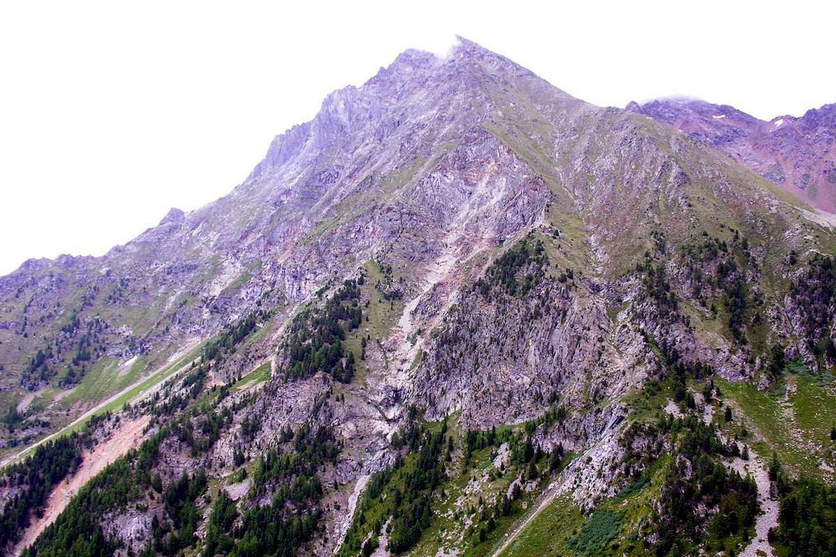
C) - By Mixed and Direct on the East Side, East Spur with exit on the "Crestone" N-NE. First ascent: Osvaldo Cardellina and Bruno Pagliarin,(July 10th, 1969); in day from Pila, Chamolé Alp, Plan Fenetre Hill, Lower Comboé and traverse to ruines of Morion(d) Alp. Not repeated. *** This route in the Guide of the C.A.I./T.C.I. Mar 2005 "Emilius Rosa dei Banchi Parco del M. Avic", pages 134/5, by Giulio Berutto and Lino Fornelli, are inserted what appendix ("58fa) variant." … "In this way the most direct and logical itinerary of the wall realizes him. O. Cardellina, I. Garzotto and Pagliarin, Aug 13 th, 1967." …) to the 1920 first climbers route; in reality, perhaps for a misprint, they are amiss assembled the 1966 Route first repetition effected by Garzotto with Cardellina in Aug 1967, as well as the "mixed" slope, but almost entirely autonomous, effected by this last with Pagliarin in the Jul of 1969. In the same one it makes him cross this itinerary with 58e ("Via" of the Central Couloir), while the same one crosses 58f or Route of the first ascent, to the height of the great horizontal ledge for then to continue in parallel on the left or East and inside of left side into East Spur. Also the final exit out results, for contingent verified reasons during the ascent, "particular" and it is not direct to the Summit, on the contrary at a small carving to the "Crestone" N-NE, through the same to conclude. In essence it is an escape, due to the bad conditions of the wall. To begin to the left 20/25 meters around of the Central Couloir and immediately to the right of a black casting of wet, enough steep and challenging rock (II°+/III°-; enough good rock); overcome the first rocky terrace, he comes on a small grassy ledge tilted to right in direction of channel. Cross it toward left (East) and along a small gully go beyond, doubling a jutting rock, the first stretch, that gives access to the great underlying oblique ramp a vertical wall of it (initial part of Route first ascent 1920). Cut it with slope in vertical on rocks, covered by deposit and grass, contemplating to the oriental edge of the same wall to the extreme (I°/II°-; easy); to edge to the left subsequently it for mean, at first, of to tiny rocky edge (II°+/III°-; amusing) and subsequently with to little crest, that salt parallel to brief gneissic and grey gully immediately to the left, always East (logic and geologic continuation of that coming from the superior snowfield, interrupted by the horizontal ledge; II°-). Still climb on the same directive line meeting in succession a snowy ledge or debris, a short and easy rocky band and a line of broken "roccette" (= small rocks), that bring to the horizontal ledge in the center and fifty-fifty around of the wall (I°+/II°+). From this, gone beyond for a second, as well as last, time the 1920 Street that it brings him to right (West) on the thread of the East Spur, to surmount a first and short rocky jump (from III° to III°+). To vertically go up again still facing the wall overhanging, as well as below the hanging triangular snowfield, through rocks broken with debris and white-greyish very dangerous, due colour to the continuous separations of the same ones (sees under). (*** Variant 1: or and better, as for the itinerary H)-, to support as soon as more to left on the small one and a little delineated spur with more dark-brownish rocks of good qualities, slightly surer and less exposed, as soon as more to East; through this "diversion" he momentarily goes out of the original route getting however a best compensation in safety; II° to III°). Climb about twenty meters holding himself under and to East of the thread of the East Spur (220/30 meters around; II°/II°+; an initial passage of III°-; delicate part, exposed to stonesfall and ice). To go out i know near to small pulpit near the balcony of the itinerary E) - or route of the first mountaineers 1920 and continue with flanking to left of this along the first 10 meters around. When this crosses toward the Central Channel, to abandon, continuing it immediately side by side the thread of the East Spur or as soon as under, and continue to the left toward the triangular snowfield; directly go up the same (II°/II°+; 60/70 meters around), at the moment crossing aloft the Route 1966 Garzotto's and Company to quota 3.040/45 meters around. (*** Variant 2: Otherwise and better and better, to hold to the right him (always West) nearby or on the thread in the tall part of this line of the spur, here constituted by great stacked blocks and precarious (from the II°- to the II°+; difficult but delicate part not); to keep in mind that mostly approaching himself to the same more elevated they are the possibilities to incur in the "verglass", it causes the transformation of the snowfield with the heat of the rock. The whole these two factors convinced the first mountaineers of the wall to abandon the Oriental Side of the same one and, gone beyond the great Central Couloir through an ascending traverse to conclude on the opposite face on a small rib "broken" and parallel to West Spur). To leave in high it on the West and to face a band tilted to the right of reddish rocks, also with gravels and suspended material ( II°+/III°-), that goes up with progressive steep slope. Over this a nearly vertical line of broken rocks and a small very narrow rocky gully, with grips to appraise him with more caution and more and more circumspection (50 meters around; from the II°+ to the III°+; a passage of 5/6 meters around of IV°-; delicate) they bring around rather to a narrow carving on the big "Crestone" N-NE to 40 meters from the Summit and with this to conclude after having overcome a brief rocky prominence, followed from other roughness less important (Variation effected in beginning of season, cause unpracticable route of the Central Couloir for a tall layer of mud owed impending to the breakup of the snowfields, such to make to sink the whole boot; AD+; nails or pitons utilized n°0; 5h'30). MIXED ROUTE into East SIDE and EXIT OUT to N-NE great RIDGE (1969): in lack of 1969 actions photo (too hurry to race to house from the girl), the Wall North and the "Crestone" N-NE from the Plan Fenetre Hill, Military Camps (by Chaberton) to the Comboé and always pleasant return to the same from the North Face. Satisfy you!
C) - Via Mista e Diretta sul Lato Est, Sperone Est con uscita sul Crestone N-NE. Primi salitori: Osvaldo Cardellina e Bruno Pagliarin (10 Luglio, 1969); in giornata da Pila, Alpe di Chamolé, Colle Plan Fenetre, Bassa di Comboé e traversata all'Alpe del Morion(d). Non ripetuta.*** Questa via nella Guida del C.A.I./T.C.I. Marzo 2005 "Emilius Rosa dei Banchi Parco del M. Avic", pagine 134/5, ad opera di Giulio Berutto e Lino Fornelli, viene inserita quale appendice "(58fa) variante." … "In questo modo si realizza l'itinerario più diretto e logico della parete. O. Cardellina, I. Garzotto e Pagliarin, il 13 Agosto 1967." …) alla via dei primi salitori del 1920. In realtà, forse per un refuso, vengono erroneamente assemblate la prima ripetizione della Via del 1966 effettuata da Garzotto con Cardellina nell'Agosto del 1967, nonché la salita "mista", ma quasi completamente autonoma, effettuata da quest'ultimo con Pagliarin nel Luglio del 1969. Nella stessa si fa incrociare questo itinerario con 58e (Via del Canale Centrale), mentre la medesima incrocia 58f, o Via dei primi salitori, all'altezza della grande cengia orizzontale per poi proseguire in parallelo sulla sinistra od E ed all'interno del lato sinistro dello Sperone Est. L'uscita finale risulta, per ragioni contingenti verificatesi durante l'ascensione, "particolare" e non è diretta alla Vetta bensì ad un intaglietto del Crestone N-NE, con il quale concludere. In sostanza trattasi di via di fuga, dovuta alle pessime condizioni della parete. Iniziare un 20/25 metri circa a sinistra del gran Canale Centrale e subito a destra di una colata nera di roccia bagnata sullo zoccolo basale di sinistra (E), ripida ed impegnativa (II°+/III°-; roccia abbastanza buona); superato il primo gradone roccioso, si raggiunge una cengetta erbosa, inclinata a destra. Attraversarla in senso opposto (E) e lungo un canalino, oltrepassando uno spuntone, superare il primo tratto, che dà accesso alla grande rampa obliqua sottostante una parete verticale (collegamento tra il Canalone Centrale ed il prosieguo nella Via dei primi salitori 1920). Tagliarla in verticale, su rocce coperte da detrito ed erba, mirando all'estremo bordo orientale del muro stesso (F/F+; I°/II°-); contornarlo a sinistra dapprima su di un orletto roccioso (II°+/III°-; divertente) e, successivamente, con una crestina, che sale parallela ad un canalino gneissico, (subito a sinistra, od E, e logica continuazione di quello proveniente dal nevaio superiore, interrotto dalla cengia orizzontale; II°-). Salire sulla stessa linea direttiva, incontrando in successione una cengia nevosa o detritica, una breve facile fascia rocciosa ed un tratto di roccette rotte, adducenti alla cengia orizzontale, nel centro ed a metà circa della parete (I°+/II°+). Da questa, attraversata per una seconda, nonché ultima, volta la Via del 1920, che si dirige verso destra (O) sul filo dello Sperone Est, superare un primo corto risalto roccioso (dal III° al III°+); progredire ancora verticalmente affrontando il muro soprastante, nonché sottostante il nevaio triangolare superiore. Arrampicare per mezzo di rocce rotte, bianco-grigiastre, colore dovuto ai continui distacchi delle stesse, nonché molto pericolose (vedi sotto). (*** Variante 1: oppure e meglio, come per l'itinerario H)- del 1978, appoggiare più verso sinistra sul piccolo e poco delineato sperone di rocce brunastre di miglior qualità, leggermente meno pericolose ed esposte, appena più ad E; tramite questa "diversione" si esce momentaneamente dalla via originale, ottenendo però una contropartita migliore in sicurezza; II°/III°). Arrampicare tenendosi una ventina di metri sotto ed ad E del filo dello Sperone Est (230 metri circa; II°/II°+; un passaggio iniziale di III°-; parte delicata, esposta alla caduta di pietre, nella quale bisogna sapersi muovere con cautela e circospezione). Uscire così presso un piccolo pulpito nelle viciniorità del terrazzo all'Itinerario E)-, ritornando per brevissimo tratto vicino alla via dei primi salitori 1920, e continuare fiancheggiando questa lungo i primi 10 metri circa; quando questa attraversa verso il Canale Centrale, abbandonarla proseguendo a lato del filo dello Sperone Est, appena sotto e a sinistra, verso il nevaio triangolare (II°/II°+; 60/70 metri circa) incrociando in alto la Via Garzotto-Ferronato-Cardellina del 1966, a quota 3.040/45 metri circa. (*** Variante 2: altrimenti ed ancor meglio, tenersi più a destra (sempre Ovest) vicino o sul filo nella parte alta di questo tratto dello sperone, qui costituito da grandi blocchi accatastati e pericolanti (dal II°- al II°+; parte non difficile ma delicata); tenere presente che maggiormente avvicinandosi al medesimo più elevate sono le possibilità di incorrere nel "verglass", causa la trasformazione del nevaio con il calore della roccia. L'insieme di questi due fattori convinse i primi salitori della parete ad abbandonare la faccia Orientale della medesima ed, oltrepassato il grande Canalone Centrale con un traversata ascendente, a concludere sull'opposto lato nella parte finale di una piccola costola "spezzata" e parallela allo Sperone O.) Lasciare la Via del 1920 sulla destra in alto (O) ed affrontare una fascia inclinata sempre a destra di rocce rossicce, anche con ghiaie e materiale sospeso, ed impegnative (II°+/III°-), che sale progressivamente in ripidezza; oltre questa un tratto ancor più esposto di roccette spezzate, piccole cenge ed un canalino roccioso molto ripido e con appigli da valutarsi attentamente e con circospezione (50 metri circa; dal II°+ al III°+; un passo di 5/6 metri circa di IV°-; delicato) portano ad un intaglio alquanto ristretto sul gran Crestone N-NE, a 40 metri circa dalla Vetta, e con questo concludere, dopo aver superato un breve risalto roccioso, seguito da altre asperità minori. Variante effettuata in inizio di stagione, per l'impercorribilità della parte finale della Via del Canalone Centrale, causa un alto strato di fanghiglia colata sulle rocce, dovuto allo scioglimento dei nevai soprastanti, tale da far sprofondare l'intero scarpone. (AD+; chiodi: n°0; 5h'30).
D) - Climbed Direct of the Left Sector and gone out on the "Crestone" N-NE. First ascent: Osvaldo Cardellina and Camillo Roberto Ferronato, (September 24th, 1978); in day from Pila, Plan Fenetre Hill, Lower Comboé and crossing to remains of the Old Morion(d)'s Pasture. Not repeated. **** In Guides of the Mountains of Italy of the Italian Club Alpine., Edition of March 2005, "Emilius Rosa dei Banchi Parco del M. Avic", itinerary 58g):... "for wall N and crest NNE."... "To directly attach the wall (200m, II/III, very delicate) finally going out on the great tilted snowfield ..." , page 135 to work of Giulio Berutto and Lino Fornelli. While in "Guide of the Emilius Mountain" 1978, by Osvaldo Cardellina, page 151 and two photos in B&W to the pages 147/150, as generic VARIANT was pointed out, concerned and regarded the tall part from the snowfield in above up to the exit out on the "Crestone" N-NE, as it already happened for the 1969 slope with final climb on the same, but even more aloft and not very distant from the Peak. In essence even it is an escape, due to a mistake. To attach to the left a 90/100 meters around (East) of the big couloir climbing in parallel and, more or less, with the same characteristics of the two preceding routes actually to the great grassy ramp and tilted and to cross it (250m around; I°+/II°- with a passage in chimney of 7/8m of II°+); to go up again from quota 2.580/90 meters around directly a "canalino" (small gully) of good gneiss grayish/whitish, that, with further 120/30 meters around (II°/II°+; climbed amusing, but exposed to the fall of stones), hands to the great horizontal ledge to few less than half wall. From this to directly continue on the vertical one along the underlying wall the great snowfield, or eventually and better because surer, to lean on himself on the left on a evident rocky and sinuous brown rib with more dark rocks, such to constitute the edge western orographic of the small descending gully from the same "nevaio"; to face these 170/80m around (from the II° to the III°; rather delicate) with maximum circumspection and vigilance. To go out on the hanging snowfield, immediately to the left in the balcony with pulpit, through rocks overlapped and more precarious than difficult. To climb the "nevaio" almost tilted in his center with light inclination from the right toward the left, reaching a little constituent wall the terminal part of a small descending rib from the Great Crest N-NE (40°/45°; absolutely necessary the crampons for the frequency often of "verglass"; lately however the snowfield in advance season is destined to disappear entirely also); to overcome it with a jump of 30/5 meters around on rocks enough difficult, unsteady (also III° and III°+) and routs. The slope to continue gradually folding up toward left (East) and, through ledges very you tilt and covered by deposit alternated to steep rocky bands, climbing her in progression and in direction from the left to the right, to aim toward an evident carving at the "Crestone" N-NE, near a double rounded hump (sees always in SP, ). Go out around on the same one to hundred meters of the Peak, through rocks steep and enough difficult (from the II°+ to the III°+; draws delicate in presence of snow). With the same to easily conclude after having overcome in succession an easy tilted line, a sharp tower to form of thumb, a steep small wall and some less binding reliefs (from the I°+ to the II°-, a passage of III°) toward the Summit (D+; nails or pitons used n° 0; crossed very delicate that requires experience; 4h'00 in the first ascension, happened to end September with the practically dry wall; very varying instead according to the snowy conditions). DIRECT ASCENT of East WALL and EXIT OUT on N-NE great RIDGE (1978): climbing in the little gully of grey gneiss, at the base of the small underlying spur the suspended triangular snowfield and above the same and gone out final on the big one N-NE "Crestone" to 90 meters around from the Peak.
D) - Salita Diretta del Settore sinistro ed uscita sul Crestone N-NE. Prima Salita: Osvaldo Cardellina e Camillo Roberto Ferronato, (24 Settembre, 1978); in giornata da Pila, Colle Plan Fenetre, Basso Vallone del Comboé e traversata alle rovine dell'Alpeggio del Morion(d). Via non ancora ripetuta.**** In Guida dei Monti d'Italia del C.A.I., Edizione del Marzo 2005, "Emilius Rosa dei Banchi Parco del M. Avic", itinerario 58g): ... "per parete N e cresta NNE." ... "Attaccare direttamente la parete (200 metri, II/III, molto delicato) uscendo infine sul grande nevaio inclinato ..." ... , pagina 135 ad opera di Giulio Berutto e Lino Fornelli. Mentre in "Guida del Monte Emilius" 1978, di Osvaldo Cardellina, pagina 151 e due foto in bianconero alle pagine 147/150, veniva indicata come generica VARIANTE, concernente e riguardante la sola parte alta dal nevaio triangolare fino all'uscita sul Crestone N-NE, come già avvenne per la salita del 1969 con arrampicata finale sullo stesso, ma ancora più in alto e non molto distante dalla Vetta. Pur questa trattasi di via di ripiego frutto d'un errore di percorso. Attaccare un 90/100 metri circa a sinistra (E) del gran Canale Centrale salendo in parallelo, e più o meno con le stesse caratteristiche delle due precedenti vie, sino alla grande rampa erbosa ed inclinata ed attraversarla (250 metri circa; I°+/II°- con un passaggio in camino di 7/8 metri di II°+); risalire da quota 2.580/90 metri circa direttamente un canalino di ottimo gneiss grigiastro che con ulteriori 120/30 metri circa (II°/II°+; arrampicata divertente, ma esposta alla caduta di pietre) porta alla grande cengia orizzontale a poco meno di metà parete. Da questa proseguire direttamente sulla verticale lungo la muraglia sottostante il grande nevaio, oppure eventualmente e meglio perché più sicuro, appoggiarsi sulla sinistra su di una evidente e bruna costola rocciosa con andamento sinuoso su rocce più scure, tale da costituire il bordo orografico occidentale del piccolo canale discendente dal nevaio stesso; affrontare questi 170/80 metri circa (dal II° al III°; alquanto delicato) con massima circospezione e vigilanza: uscire sul soprastante nevato subito a sinistra del terrazzo con pulpito, per mezzo di rocce accatastate più pericolanti che difficili. Salire il nevaio inclinato pressocché nel suo centro con leggera inclinazione dalla destra verso la sinistra, raggiungendo così una paretina costituente la parte terminale di una piccola costola discendente dal Crestone N-NE (40°/45°; assolutamente necessari i ramponi per la frequenza spesso di "verglass"; ultimamente comunque il nevaio in avanzata stagione è destinato a scomparire anche del tutto); superarla con un salto di 30/5 metri circa su rocce abbastanza difficili, instabili (anche III° e III°+) e rotte. Continuare la salita piegando gradualmente verso sinistra (E) e per mezzo di cenge molto inclinate con detrito alternate a ripide fasce rocciose puntare, salendole in progressione ed in direzione dalla sinistra alla destra, verso un evidente intaglio sul Crestone N-NE, presso una duplice gobba arrotondata (vedere sempre in SP). Fuoruscire sul medesimo ad un centinaio di metri circa dalla Vetta, tramite rocce ripide ed abbastanza difficili (dal II°+ al III°+; tratto delicato in presenza di neve) e concludere agevolmente, dopo aver superato in successione un facile tratto inclinato, un torrione acuminato a forma di pollice, una ripida paretina ed alcuni rilievi meno impegnativi (dal I°+ al II°-, un passaggio di III°) verso la Sommità (D+; chiodi da roccia utilizzati: n° 0; percorso molto delicato che richiede esperienza; 4h'00 nella prima ascensione avvenuta a fine Settembre con la parete praticamente asciutta; molto variabili invece secondo le condizioni di innevamento).
E) - Climbed Direct of the Left Sector and gone out on the "Crestone" N-NE towards the Great Tower (2.998m). First ascent: Osvaldo Cardellina, lone (June 05th, 2008); in day from Pila, Plan Fenetre Hill, Lower Comboé and crossing to remains of the Old Morion(d)'s Pasture. Not repeated. To begin 45/50 meters around and to the left (East) of the big Central Channel with not obliged course, climbing then for rocks grass intermingled, overcoming some balconies to which they follow brief small crests, directly on the vertical one of the great horizontal ledge, that is reached on it left corner, where a small and dangerous gully flows from the superior snowfield. Departing from this, after an initial wall to take the narrow small gully, that goes down on his Oriental extremity from the triangular suspended snowfield, going up again it for 130/140 meters around through all of it length actually to the inferior border of the same snowcapped sheet (III° to the beginning). More in the detail begin on a small rocky wall, with greyish rocks on the fund of which it often flows the water, and go up again around her of 30/5 metres with thin sinuous course against the base of the triangular, vertical and dark wall of the Great Tower (2.988m). Here the small channel feathers him mostly boxing itself, with inclinations of 40°/45° on hard snow with often presence of "verglass" or in advanced season a rivulet of water; the same slightly goes up again with a diagonal to right and with a continuous line actually crossing the whole base of the same wall reach, after about seventy meters, a zone more open with rocks subject landslips and whitish on the right and a great stain of dampness on the opposite side. Doubled to the right (West) a sharp and very steep corner (what it goes down from the Grande Tour and action to separate his Wall Northwest from that of rocks clearer and sulphurous-yellowish revolt mostly toward West), the little gully, always narrow and cramped, it goes up again forming a great S at the base of this last; for then "to flow" in the superior triangular and hanging snowfield. Just rounded the corner, leave the groove and you turn left (East) to attack the steep rocks that form the base of most Western Great Tower. Climb to 40 meters through steep rock plaques less good than budgeted (III°/°III+; one of step IV°-) coming to a very small terrace; from this, moving more toward the left, reach the thread of the edge in as many meters leads to a terrace more evident on the right. From this a rift in the rock of about 15-20 meters leads the Great Tower and the way of the North-northeast ridge ends at the Summit with the last 150 meters is not difficult (AD/D+; pitons used: n°3; path very delicate that requires experience; 4h'00). ***** See "Diary Mountaineering" and "Register Climbs 1964-2015", unpublished, by Osvaldo Cardellina.DIRECT ASCENT of East WALL and EXIT OUT on N-NE great RIDGE (1978): climbing in the little gully of grey gneiss, at the base of the small underlying spur the suspended triangular snowfield and above the same and gone out final on the big one N-NE "Crestone" to 150 meters around from the Peak.
E) - Salita Diretta del Settore sinistro ed uscita sul Crestone N-NE verso la Grande Torre (2.998 m). Prima Salita: Osvaldo Cardellina, solo, (05 Giugno, 2008); in giornata da Pila, Colle Plan Fenetre, Basso Vallone del Comboé e traversata alle rovine dell'Alpeggio del Morion(d). Via non ancora ripetuta. Iniziare 45/50 metri circa a sinistra (E) del Canale Centrale con percorso non strettamente obbligato, salendo poi per rocce frammiste ad erba, superando alcuni balconi ai quali seguono brevi crestine, direttamente sulla verticale della cengione orizzontale, che si raggiunge sul suo bordo sinistro (E), ove sfocia un pericoloso canalino dal nevaio superiore. Dalla grande cengia, dopo un muretto, accedere al canalino, che, dal nevaio triangolare e sospeso, scende sulla sua estremità orientale, risalendolo per 130/140 metri circa attraverso tutta la sua lunghezza sino al margine inferiore dello stesso lenzuolo innevato (III° all'inizio). Più nel dettaglio, incominciare su di una paretina rocciosa con rocce grigiastre sul fondo della quale spesso scorre l'acqua, e risalirla di 30/5 metri circa con andamento sinuoso fino contro la base della triangolare, verticale e scura parete della Grande Tour (2988 m.). Qui il canalino si impenna incassandosi maggiormente, con pendenze di 40°/45° su neve dura, con spesso presenza di "verglass" o in stagione avanzata un rigagnolo di acqua; risale con un diagonale leggermente verso destra e con una linea continua percorrendo tutta la base della parete medesima sino a raggiungere, dopo una settantina di metri, una zona più aperta con rocce franose e biancastre sulla destra ed una grande macchia di umido sul lato opposto. Doppiato a destra (Ovest) un affilato e ripidissimo spigoletto (che scende dalla Grande Torre, atto a separare la sua Parete NO da quella di rocce più chiare e sulfuree-giallastre rivolta maggiormente verso Ovest), il canale, sempre stretto ed angusto, risale formando una grande S alla base di quest'ultima, per poi "sfociare" nel sospeso e triangolare nevaio sovrastante. Appena doppiato lo spigolo, abbandonare il canalino e piegando verso sinistra (E) attaccare le ripide rocce che costituiscono il basamento più Occidentale della Grande Torre. Arrampicare per 40 metri circa tramite ripide placche su roccia meno buona di quanto preventivato (III°/III°+; un passaggio di IV°-) arrivando ad un terrazzino; da questo, spostandosi più a sinistra, raggiungere il filo dello spigolo che in altrettanti conduce ad un terrazzo più evidente sulla destra. Da questo una spaccatura nella roccia di circa 15/20 metri conduce sulla Torre e con la via del la Cresta Nord-nordest si conclude in Vetta con gli ultimi 150 metri non difficili (AD/D+; chiodi da roccia utilizzati: n°3; percorso molto delicato che richiede esperienza; 4h'00 ).***** Vedi "Diario Alpinistico" e "Registro delle Ascensioni 1964-2015", non pubblicato, di Osvaldo Cardellina.
F) - East Wall Left Rib and East-northeasr Ridge in terminal part. First ascension: Osvaldo Cardellina, lone, (July 04th, 1996); in day from Federigo Zullo Bivouac after the ascent on Becca di Nona with subsequent descent by East-northeast Ridge. Not repeated. Start after the ascent, starting from Alpe Arpisson Inferiore or from Superiore (1.951m, 2.010m), or (as in the case of the first ascent) from the saddle on the Ridge East-northeast at an altitude of 2.880/90 meters around, with a short descent diagonally to the right (N), which leads, after a small rocky gully with grass, to a rib rocky parallel but less accentuated the next or Via Crétier 1927. Attach the same just on the right (always N), with short oblique ascent, along a rocky groove secondary which leads on the wire; then climb almost always on the edge of the ridge going up through rocks is not always good and often crumbly but not difficult to goes up with caution (since the II°+/III°/III°+; delicate). Keeping to the left of a secondary channel that divides this rib crest that runs through the middle wall; after about a hundred meters to reach a series of small ledges alternate to rocky walls that are overcome moving progressively to the right towards the secondary couloir. A final section, which is overcome by climbing in vertical line, door to go out on the Ridge East-northeast on a terrace of the same horizontal to about 70 meters from the Vertex, with this last, after passing the exit of the Via 1927, can be reached easily the Summit (AD/AD+/PD-; pitons used: n°0; very exposed and climb rather delicate and dangerous, certainly not recommended in case of rising damp or wet ground because the presence of grass and moss on the rocks; 2h'30/3h'00 from the saddle of entrance; 3h'00/3h'30 Federigo Zullo Bivouac). ****** This route in the Guide of the C.A.I. / T.C.I. March 2005 "Emilius Rosa dei Banchi Parco del M. Avic", pages 136/7, by Giulio Berutto and Lino Fornelli, is inserted as the first route built in full from Arpisson Alp in June 12th, 1927 by Amilcare Crétier with Guido Perolino; later add the two variants to the left and then further to the right with the reunification itself in an attempt, by three mountaineers, to repeat the July 17th, 1978; as well as the alternative pathway of the left accomplished, in solo ascent, in July 04th, 1996 (see also "Guide of Monte Emilius", 1978, pages 152/3).****** VARIANT of ATTACK: instead of getting out of the saddle above you can start from Lower or Upper Alp Arpisson (1.951m, 2.010m) and, moving toward the Southwest, reaching a small vallon secondary at the base of the Eastern Face. This route was followed in the first ascent of '27 and in an attempt of July 16th, 1978 by Osvaldo Cardellina, Camillo Roberto Ferronato and Giuseppe Lamazzi, which led first to exceed 120 meters about on the wall of the initial gray gneiss towards the left (more to the South of Via Crétier and until the beginning of the Via 1996; n°1 nails left after about 50/60 meters) and then, after descent from the same, to open a variant in the bottom right which connects, after about 220 meters of ascent slightly diagonally from right to left, the Via Crétier 1927. Getting to the wall through steep scree and boring debris coming to the base of the large base (on which there are three ways of attack), high 400 meters in his South margin and up to more than 600 on the opposite; the left sector is certainly more challenging than North, from which it is separated from the central channel formed by rocks covered by many grass and moss (D/D+/AD+/PD, with an initial short step of V°). The East WALL between E-NE Ridge (left) & N-NE "Crestone" from Northeast; North WALL shadowed (to the right).
******* VARIANTS on RIGHT SECTOR: the East Wall is also "broken" into two parts (as the first climbers on June 12, 1927 had already pointed out, noting the right sector of the same as less demanding and interesting) by a long sinuous edge designed to delimit the same another triangular face as well as facing more E-NE, which, starting from the base at about 2.350 meters, ends against the steep little castle of the Summit. On this side, even more obscure and forgotten than the previous one, two parallel routes have been traced by Osvaldo Cardellina, lonely, always starting from Reverier Dessous (1.042m), Martsaouchy Damon, Plan Croix and the two Arpisson Alpine Pastures: A: Route of August 23th, 2007 to the Great Tower (Grande Torre 2.998 meters or "Grande Tour") positioned on the N-NE Ridge: with the approach as just below, attack the fairly large wall (which unfolds like an hourglass for a bottleneck about halfway, formed by the E-NE Corner on the left and by a small rocky rib that descends between La Grande Tour and the Gendarmes) at an altitude of 2.335/40 meters. From Arpisson Higher Pasture, having crossed a clearing with the remains of spring avalanches coming from La Dent della Becca di Nona (2.736m), for the subsequent moraine head towards the point of altitude 2.234 meters and then to the start of the basal belt at the altitude of 2.330 meters approximately. After passing the base (not as difficult as the corresponding one in the left sector of the wall, but still challenging and with a delicate climb due to the presence of a lot of grass on the rocks) continue in the center of the wall following a well visible rocky rib (from the II° at III°/III° +) until you reach a steep wall of 20/25 meters that can goes around the same quite easily on the right (North; II°+) and then re-enters above it. Then you pass two small horizontal rocky bands and that are immediately them in succession (II°+/III°-) to go and resume the rocky rib that rises in the center of the wall and follow it up to the Summit. The same rises sinuously, first bending to the right, then to the left and finally a less to the right again to end immediately on the right (North) of the Great Tower, which can be reached shortly. Continue through the "Crestone" N-NE passing the "Thumb" or "Le Pouce" and the terminal rocks of the same Great N-NE Crest (from PD/PD+ to AD-/AD/AD+ with passages from II° to III° and one of III° +; delicate climb that requires experience, also due to the limited possibility of self safety) . B: Via of September 05th, 2007 to the Colletto (Collar) downstream of the Pollice about 3.050 meters or "Le Pouce" always positioned on the N-NE Ridge; for both see in SP: "Becca di Nona (3.142m) N-NE Ridge" with approach as just below, attack the fairly wide wall at an altitude of about 2.360/70 meters, mmediately on the left (South) of the previous Via A. Climb the first stretch of the ridge leaning on the right of the edge for a hundred meters (II°+/ III° -) until you reach a second sector where the edge becomes hunched (II°-), and then resume with two steeper rocky jumps (II°+/III°-) which lead to a more linear and fairly steep climb of about 170 meters. The same reaches a characteristic square terrace clearly visible when viewed in profile (see photo just the third picture below, where the corner is the one inside the clouds). From this point the crest, brown and, when in full sun, almost orange in color if viewed from the opposite side, rises dizzyingly, capable of separating the two sectors of the East Wall, towards the triangular castle below the Summit. Instead, leave the main edge to take a secondary rib that is outlined on the right (West; II°+/III ° -) landing on the N-NE "Crestone" immediately upstream of the Great Tower 2.998 meters, as well as at the base of the wide collar at the base of the Inch; as for the previous route from this point to the Summit via the "Crestone" N-NE (from PD/PD+ to AD/AD+, with short intermediate passages of III° and one of IV°-, however avoidable; same general considerations as for Via A ).
HISTORICAL NOTE: the upper part of the E-NE Edge of the East Wall had already been covered, after crossing from above the "Gendarmes" to the Summit by Osvaldo Cardellina and Massimo Centelleghe il 2 and 3 August 1967 during the repetition of the "Crestone" N-NE with different variations and first ascent of the "La Dent" of Becca di Nona (2.736m); uphill directly from Aosta, Charvensod, and the Alps of Revererier Dessous, Ponteilles, Comboé, Morion.
APPROACHES: starting from Alpe di Arpisson Superiore (2.010m) and, heading towards the Southwest, reach a secondary and small valley at the base of the East Face. Attain the wall via steep scree and boring debris reaching the base of the large base (on which there are therefore three possibilities of attack), about 400 meters high in its Southern edge and up to over 600 meters, here in question, on the opposite; as already mentioned, the left sector is certainly more demanding than the North one, from which it is divided by the central rocky channel formed by rocks covered with a lot of grass and moss and clearly delimited by a well-evident sinuous and rocky edge (from PD to AD+, with short intermediate passages of III ° for both routes). NOTE: the two variants (A and B) described here must be placed in the second photo of this section between Via June 1927 (A. Crétier-G. Perolino, in red) and the July 1978 variant ( O. Cardellina-C.R. Ferronato-G. Lamazzi, in yellow), traced in the Southern or left sector of the East Wall, and the letter C concenating the N-NE "Crestone" as well as above the right or Northern sector of the same, where they go up (see third photo below).
F) - Parete Est Costola di sinistra e Cresta Est-nordest nella parte finale. Prima ascensione: Osvaldo Cardellina, solo, (4 Luglio, 1996); in giornata dal Bivacco Franco Zullo, dopo aver salito la Becca di Nona con discesa per la Cresta Est-nordest. Itinerario non ripetuto. Iniziare, dopo la risalita, partendo dall'Alpe di Arpisson Superiore (2.010 m), oppure (come nel caso della prima ascensione) dalla selletta sulla Cresta Est-nordest a quota 2.880/90 metri circa raggiungibile in poco tempo dal viciniore Bivacco Federigo Zullo al Colle Carrel (2.907 m), con una breve discesa in diagonale a destra (N) che porta, dopo un canalino roccioso con erba, ad una costola rocciosa parallela, ma meno accentuata della successiva o Via Crétier del 12 Giugno 1927. Attaccare la medesima appena sulla destra (sempre N), con breve salita obliqua, lungo un canalino roccioso secondario che conduce sulla stessa; indi arrampicare quasi sempre sul filo di cresta salendo tramite rocce sempre non buone e spesso friabili, non difficili ma da arrampicarsi con somma prudenza (dal II°+ al III°+; delicato). Tenendosi sulla sinistra di un canale secondario, che divide questa costola dalla cresta che percorre centralmente la parete, dopo circa un centinaio di metri raggiungere una serie di cengette alternate a muretti rocciosi superabili spostandosi progressivamente sulla destra verso il canale secondario. Un ultimo tratto, con salita in linea pressocché verticale, porta ad uscire sulla Cresta Est-nordest sopra ad un abbastanza largo terrazzo orizzontale della stessa a circa 70 metri dal Vertice; con quest'ultima, dopo aver poco dopo oltrepassato l'uscita della Via Crétier 1927, facilmente si raggiunge la Vetta (AD/AD+/PD-; chiodi da roccia utilizzati: n°0; molto esposta e salita alquanto delicata, nonché pericolosa; sicuramente da sconsigliare in caso di terreno umido o bagnato causa la presenza di erba e muschio sulle rocce; 2h'30/3h'00 dalla sella d'ingresso; 3h'00/3h'30 dal Bivacco Federigo Zullo). ****** Questa via nella Guida del C.A.I./T.C.I. Marzo 2005 "Emilius Rosa dei Banchi Parco del M. Avic", pagine 136/7, ad opera di Giulio Berutto e Lino Fornelli, viene inserita quale prima via realizzata in modo completo il 12 Giugno 1927 da parte di Amilcare Crétier con Guido Perolino; successivamente vengono inserite le due varianti più a sinistra e poi maggiormente a destra con riunificazione alla stessa nel tentativo di ripetizione del 17 di Luglio del 1978, nonché la via alternativa di sinistra compiuta il 04 Luglio 1996 (inoltre "Guida del Monte Emilius", 1978, pagine 152/3).
****** VARIANTE di ATTACCO: invece di arrivare dalla sella suddetta si può partire dall'Alpe di Arpisson Superiore (2.010 m) e, indirizzandosi verso Sudovest, raggiungere un valloncello secondario alla base della parete. Questo itinerario fu seguito nella prima salita del '27 ed in un tentativo del 16 Luglio del 1978 da parte di Osvaldo Cardellina, Camillo Roberto Ferronato e Giuseppe Lamazzi, che portò dapprima a superare i 120 metri circa sul muro iniziale di grigio gneiss (più a sinistra della Via Crétier e fino all'inizio della Via del 1996; 1 chiodo lasciato dopo circa 50/60 metri) e poi, dopo discesa dal medesimo, ad aprire una variante più in basso a destra che si collega, dopo circa 220 metri di salita in leggera diagonale da destra verso sinistra, alla Via Crétier 1927. Raggiungere la parete tramite ripidi ghiaioni e noioso detrito arrivando allo zoccolo della larga base (sul quale esistono quindi tre possibilità di attacco), alta da 400 metri circa nel suo margine Meridionale e fino ad oltre 600 metri sull'opposto; il settore di sinistra risulta sicuramente più impegnativo del Nord, dal quale viene diviso dal canale centrale formato da rocce ricoperte da molta erba e muschio (D/D+/AD+/PD con un breve passaggio iniziale di V°).
******* VARIANTI sul SETTORE di DESTRA: la Parete Est viene inoltre "spezzata" in due parti (come avavano già fatto osservare i primi salitori del 12 Giugno 1927, annotando come meno impegnativo ed interessante il Settore di destra della medesima) da un lungo spigolo sinuoso atto a delimitare la medesima da un'altra faccia triangolare nonché rivolta più ad E-NE, che, partendo dalla base a 2350 metri circa, termina contro il ripido castelletto della Vetta. In questo lato, ancora più oscuro e dimenticato del precedente, sono state tracciate da Osvaldo Cardellina in solitaria due vie parallele, sempre con partenza da Reverier Dessous (1.042 m), Martsaouchy Damon, Plan Croix ed i due Alpeggi di Arpisson: A: Via del 23 Agosto 2007 alla Grande Torre 2.998 metri o "Grande Tour" posizionata sulla Cresta N-NE: con l'avvicinamento come appena sotto, attaccare l'abbastanza ampia parete (che si dispiega in forma di clessidra per una strettoia a circa metà percorso, formata dalllo Spigolo E-NE a sinistra e da una piccola costola rocciosa che scende tra La Grande Tour ed i Gendarmi o "Gendarmes") a quota 2.335/40 metri circa. Dall'Alpe di Arpisson, attraversata una spianata con i resti delle valanghe primaverili provenienti dalla La Dent della Becca di Nona (2.736 m), per la successiva morena dirigersi verso il punto 2.234 metri e poi all'attacco della fascia basale all'altitudine di 2.330 metri circa. Superato lo zoccolo di base (non difficile come il corrispondente nel settore sinistro della parete, ma pur sempre impegnativo e con salita delicata per la presenza di molta erba sulle rocce) continuare nel centro della parete seguendo una nervatura rocciosa bene in vista (dal II° al III°/III°+) fino a raggiungere un muretto ripido di 20/25 metri che si aggira abbastanza facilmente sulla destra (Nord; II°+) per poi rientrare al di sopra dello stesso. Successivamente si superano due piccole fasce rocciose orizzontali nonché messe subito in successione (II°+/III°-) per andare a riprendere la costola rocciosa che sale nel centro della parete e seguirla fino al sommo. La stessa sale sinuosamente piegando daprima sulla destra, poi a sinistra ed infine ancora a destra per terminare subito a destra (Nord) della Grande Torre, che si raggiunge in breve. Continuare tramite il "Crestone" N-NE superando il "Pollice" oppure "Le Pouce" e le rocce terminali dello stesso (da PD/PD+ ad AD-/AD/AD+ con passaggi dal II° al III° ed uno di III°+; salita delicata che richiede esperienza su questo tipo di terreno, anche per la scarsa possibilità di auto assicurazione). B: Via del 5 Settembre 2007 al Colletto a valle del Pollice 3.050 metri circa o "Le Pouce" posizionato sempre sulla Cresta N-NE; per entrambe vedi in SP: "Becca di Nona (3.142m) N-NE Ridge": con l'avvicinamento come appena sotto, attaccare l'abbastanza ampia parete a quota 2.360/70 metri circa, subito sulla sinistra (Sud) della precedente Via A. Salire il primo tratto di cresta appoggiandosi sulla destra dello spigolo per un centinaio di metri (II°+/III°-) fino a raggiungere un secondo settore dove lo spigolo si ingobbisce (II°-), per poi riprendere con due salti più ripidi (II°+/III°-) che portano ad una salita più lineare ed abbastanza ripida di 170 metri circa. La medesima raggiunge un caratteristico terrazzo squadrato ben in vista se osservato di profilo (vedi foto appena sotto con lo spigolo che risalta nettamente tra le nuvole). Da questo punto la cresta, di colore marrone e, quando é illuminata dal sole, quasi arancio se osservata dal lato opposto, sale vertiginosa, atta a separare i due settori della Paret Est, verso il castelletto triangolare al di sotto della Vetta. Abbandonare invece lo spigolo principale per prendere una costola secondaria che si delinea sulla destra (Ovest; II°+/III°-) approdando sul Crestone N-NE subito a monte della Grande Torre 2.998 metri, nonchè alla base del largo colletto alla base del Pollice; come per la via precedente daquesto punto alla Vetta tramite il Crestone N-NE (da PD/PD+ ad AD/AD+, con brevi passaggi intermedi di III° ed uno di IV°-, peraltro evitabile; stesse considerazioni generiche che per la Via A, soprattutto per la sicurezza).
NOTA STORICA:la parte superiore dello Spigolo E-NE della Parete Est era già stata percorsa, dopo traversata da sopra i "Gendarmes" alla Vetta da Osvaldo Cardellina e Massimo Centelleghe il 2 ed il 3 di Agosto 1967 durante la ripetizione del "Crestone" N-NE con diverse varianti e prima salita della "La Dent" della Becca di Nona (2.736 m); in salita direttamente da Aosta, Charvensod, e gli Alpeggi di Revererier Dessous, Ponteilles, Comboé, Morion.
AVVICINAMENTI: partendo dall'Alpe di Arpisson Superiore (2.010 m) e, indirizzandosi verso Sudovest, raggiungere un valloncello secondario alla base della parete. Arrivare alla medesima tramite ripidi ghiaioni e noioso detrito arrivando allo zoccolo della larga base (sul quale esistono quindi tre possibilità di attacco nel Settore Sud), alta da 400 metri circa nel suo margine Meridionale e fino ad oltre 600 sull'opposto, qui in questione; come già detto, il settore di sinistra risulta sicuramente più impegnativo di quello Nord, dal quale viene diviso dal canale centrale formato da rocce ricoperte da molta erba e muschio e delimitato nettamente da uno spigolo sinuoso-roccioso ben in evidenza (da PD ad AD+, con brevi passaggi intermedi di III° per entrambe le vie). NOTA: le due varianti (A e B) qui descritte devono essere collocate nella seconda foto di questa sezione tra la Via giugno 1927 (A. Crétier-G. Perolino, in rosso) la Variante Luglio 1978 (O. Cardellina-C.R. Ferronato-G. Lamazzi, in giallo), tracciate nel settore Meridionale o di sinistra della Parete Est, e la lettera C concenente il "Crestone" N-NE nonché al di sopra del settore destro o Nord della medesima, dove salgono le stesse (vedi qui sotto terza foto).
G) - Combination between the two Standard Routes or Cresta South-southeast and South-southwest Slope. Cresta S-SE: the combination between the two traditional ways can be considered, including the phase of ascent and the descent, via a mixed because very often resolves with the ascent and descent of one for the other. In this perspective, we insert between the same regardless of the path followed. In fact the old road from Carrel Hill (2.907m; reachable from Comboé with the path that splits at the junction 2.546m after Grand Scez), after the construction of the Bivouac Federigo Zullo same occurred in July 1984, after a long period of neglect, is back in vogue today is easier to meet groups that go up through the first and then down with the second or slope South-southwest, a factor that had long been reversed if only to go down to get water at the Pond Peckoz. From the bivouac climb through a small path trail without encountering any difficulty reaching over a big shoulder a short distance from the Summit the next route (E/F; 0h'45 from the bivouac). ******* Through the Crest South-southeast has been made the first ascent absolute mountain in 1823 by Captain Alberto Casalegno, Chief Surveyor of his Majesty the King of the Two Sardaigne; also the first winter ascent of December 20th, 1889 (the second in March 19th, 1928) was held by this route, then gradually become "fashionable" to the construction of the camp. On the South-southwest Slope is instead been traced the trail to transport the great statue of the Madonna, which took place September 12th, 1892; also this path had made the first winter in December 23th, 1977.******* VARIATION through S-SW Slope: the other way instead, always starting from the Valley of Comboé up to Plan Valé and then to the Grand Scez and above the junction; from this side to the left (NW) the trail that runs along the south side easily-southwest and then meet at the Summit on the previous itinerary from Colle Carrel(; 2h'30/3h'00 from Comboé). By Emilius S-SW Slope and S-SE Crest (both to the left) towards the "Becca" and pano on Aosta Town. In foreground SE Face, E-NE Ridge, E Wall & (outline right) N-NE "Crestone".
G) - Combinazione tra le due Vie Normali o Cresta Sud-sudest e Versante Sud-sudovest. Cresta S-SE: anche la combinazione tra le due vie tradizionali può essere considerata, tra la fase di salita e quella di discesa, una via mista anche perché molto spesso si risolve con l'ascensione di una e successiva discesa per l'altra. In questa ottica la inseriamo tra le medesime a prescindere dal percorso seguito. Infatti la vecchia via dal Colle Carrel, dopo la costruzione del bivacco Federigo Zullo allo stesso avvenuta nel Luglio 1984, dopo un lungo periodo di semi abbandono, é ritornata in auge: oggi é più facile incontrare comitive che salgono tramite la prima per poi scendere con la seconda o Versante Sud-sudovest, fattore che era stato da molto tempo invertito se non altro per scendere a prendere acqua presso il Laghetto Peckoz. Dal bivacco salire tramite una piccola traccia di sentiero senza incontrare nessun tipo di difficoltà fino a raggiungere sopra uno spallone a poca distanza dalla Sommità il successivo itinerario (E/F; 0h'45 dal bivacco). ******* Tramite la Cresta Sud-sudest é stata realizzata la prima scensione assoluta della montagna nel 1823 da parte del Capitano Alberto Casalegno, Topografo Capo di sua Maestà il re delle due Sardegne; anche la prima salita invernale del Dicembre 1889 si é svolta per mezzo di questa via, poi progressivamente diventata "di moda" fino alla costruzione del bivacco. Sul Versante Sud-sudovest é invece stata tracciata la mulattiera per il trasporto della grande statua della Madonna, avvenuto il 12 Settembre 1892; anche questo percorso ha avuto effettuata la prima invernale nel Dicembre 1977.******* VARIANTE tramite il Versante S-SW: l'altra via invece, sempre partendo dal Vallone di Comboé sale al Plan Valé per poi raggiungere il Grand scez ed il bivio suddetto; da questo parte verso sinistra (NW) la mulattiera che facilmente percorre il versante Sud-sudovest per poi riunirsi presso la Sommità al precedente itinerario dal Colle Carrel (F; 2h'30/3h'00 dal Comboé).
H) - Mixed Via through S-SW Slope with exit on the "Crestone" W. First ascent: Ilario Antonio Garzotto, Dario and Osvaldo Cardellina and Arturo Jemma (September 03th, 1964); in day from Pian Felina, Reverier Dessous, Alpe and Ponteilles Waterfall, Comboé, Plan Valé. Not repeated. This route has been traveled by a mistake and flows on West Crest not far away from the Vertex: at the entrance of Pian Valé with traverse to the left (N) going up a steep grassy ridge that marks the transition between the more wide Slope S-SW and a narrower predominated towards W-SW. Grueling climb but panoramic leading to a large saddle, after a modest elevation that is to the left (W), on friable and reddish rocks below the West Ridge, with which ends in the last 100/20 meters to the Top. Ascent totally not recommended and dangerous due to the presence of grass "ollina" on steep slopes; also at the top of the rocks are not difficult, but somewhat broken and require precaution. Here has been reported only as parts of complete information. ******** This route in the Guide of the C.A.I./T.C.I. Mar 2005 "Emilius Rosa dei Banchi Parco del M. Avic", page 132, by Giulio Berutto and Lino Fornelli, are inserted in what brief appendix of the route "(58fc)" as one variant of the Western "Crestone". In reality it is more like an autonomously that converges on the same in the end short part with which concludes on the Summit.MIXED ROUTE between West-southwest and South-southwest SIDES and EXIT OUT to W great RIDGE (1964):
H) - Via sul Versante S-SO con uscita sul Crestone W. Primi salitori: Ilario Antonio Garzotto, Dario e Osvaldo Cardellina ed Arturo Jemma (03 Settembre, 1964); in giornata da Pian Felina, Reverier Dessous, Alpe e Cascata di Ponteilles, Comboé, Plan Valé. Non ripetuta. Questa via é stata percorsa per un errore e sfocia sulla Cresta Occidentale a non molta distanza dalla Vetta: all'ingresso del Pian Valè traversare decisamente verso sinistra (N) risalendo un costolone erboso divenente progressivamente sempre più ripido, che segna nettamente il passaggio tra il vasto Versante S-SO ed uno più ristretto rivolto più ad O-SO. Salita faticosa ma abbastanza panoramica conducente ad una larga sella, subito dopo una modesta elevazione che si lascia a sinistra (O), sulle friabili e rossicce rocce sottostanti la Cresta Ovest con la quale si conclude negli ultimi 100/20 metri alla Cima. Ascensione del tutto sconsigliabile e pericolosa per la presenza di erba "ollina" su ripidi pendii; inoltre nella parte superiore le rocce non sono difficili, bensì alquanto rotte e tali da richiedere continua precauzione (presenza di camosci). Vien qui riportata esclusivamente a scopo d'informazione completa sulle vie con varie possibilità esistenti. ******** Questa via nella Guida del C.A.I./T.C.I. Marzo 2005 "Emilius Rosa dei Banchi Parco del M. Avic", pagina 132, ad opera di Giulio Berutto e Lino Fornelli, viene inserita in concisa appendice come variante alla via del "Crestone" Ovest "(58c)". In realtà risulta, più che tale, come una via autonoma che confluisce sul medesimo nella parte corta terminale con la quale conclude alla Vetta.
I) - Mixed Via through S-SW Slope with crossing above the rocky promontory 2.686 meters on the "Crestone" W. First ascent: Osvaldo Cardellina,lone, (June 13th, 1967); in day from Pila, Comboé, Plan Valé. Not repeated. With the previous route to the entrance to Plan Valé is to an altitude of 2.340/50 meters around, passing just above the point 2.419 meters; from this continue towards the North and, dubbed left the Ridge South-southwest, entering a narrow grassy walloon that descends sinuous, crossed by a torrent now dried, almost from the Vertex. Through the same, you climb about 150 meters up a steep grassy slope that leads to the above rocky promontory 2.686 meters, where a steep fall toward the Northwest in the direction of the entrance to the Vallon of Comboé. After a short pseudo straight, climb the easy rocks on Western Crest reaching a wall of rocks topped by other reddish brownish like a hood; climb on the wire of the same with less difficulty than expected, or around the same right (S), but making sure the grass covering them (very dangerous with fresh snow). A series of rocky elevations subsequent, more or less with the same characteristics and difficulty (I°+/II°-; II°+ on the edge of the ridge), leads to the conjunction of this ridge with the South-Southwestern, whence with the previous route to the Summit (EEA/F+/PD-, according to the path; 3h'00/3h'30 from Comboé). This life is very panoramic (splendid views on Northern Face) for 750 meters from the above promontory up to the Summit. ********* This route in the Guide of the C.A.I./T.C.I. Mar 2005 "Emilius Rosa dei Banchi Parco del M. Avic", pages 131/2, by Giulio Berutto and Lino Fornelli, are inserted as well as first ascent, but incomplete on the Western Ridge; in fact the climb integral, starting from the "Low" Comboé (about 2010/20 metres) will be realized by the same June 26th, 1970. (see even "Guida del Monte Emilius", 1978, pag, 146). In such case this becomes a fully independent route and therefore is only mentioned in passing here, but without entering into the list of the various "mixed" itineraries.MIXED ROUTE into West-southwest SIDE and EXIT OUT to W great RIDGE (1967):
I) - Via sul Versante W-SW con traversatata sul Crestone O sopra il promontorio 2.686 metri. Primi salitori: Osvaldo Cardellina, solo, (13 Giugno, 1967); in giornata da Pila, Comboé, Plan Valé. Non ripetuta. Con il precedente itinerario sino all'ingresso di Plan Valé a quota 2.340/50 metri circa passando appena sopra il punto 2.419 metri; da questo continuare verso Settentrione e, doppiato a sinistra il costolone Sud-sudovest, entrare in uno stretto valloncello erboso che scende sinuoso, solcato da un torrente ormai essiccato, quasi dalla Sommità. Attraversato il medesimo, si sale per oltre 150 metri un ripido pendio erboso-roccioso che conduce al di sopra del promontorio roccioso 2.686 metri, dove una ripida parete cade verso Nordovest in direzione dell'ingresso al Vallone del Comboé. Dopo un breve tratto pseudo rettilineo, salire per facili rocce sulla Cresta Occidentale raggiungendo un muro di rocce brunastre sormontate da altre rossastre a guisa di cappuccio; arrampicare sul filo delle stesse con minori difficoltà di quanto prevedibile, oppure aggirare le stesse subito a destra (S), ma facendo attenzione all'erba che le ricopre (molto pericoloso con neve fresca). Una serie di elevazioni rocciose successive, più o meno con le stesse caratteristiche e difficoltà (I°+/II°-; II°+ sul filo di cresta), porta alla congiunzione di questa cresta con quella Sud-sudovest, donde con il precedente itinerario alla Vetta (EEA/F+/PD-, secondo il percorso; 3h'00/3h'30 da Comboé). Molto panoramica nei 750 metri dal promontorio suddetto alla Cima. ********* Questa via nella Guida del C.A.I./T.C.I. Marzo 2005 "Emilius Rosa dei Banchi Parco del M. Avic", pagine 131/2, ad opera di Giulio Berutto e Lino Fornelli, viene inserita quale prima via realizzata, ma incompleta della Cresta Occidentale. In effetti la salita integrale verrà realizzata dal medesimo, partendo dal "Basso" Comboè, il 26 di Giugno del 1970 (vedi anche "Guida del Monte Emilius", 1978, pag, 146). In siffatto caso diventa completamente una via autonoma e pertanto viene esclusivamente qui citata di sfuggita, ma senza inserimento nella elencazione delle vie "miste".
L) - Mixed Via through NW Face of rocky promontory 2.686 meters and W Ridge. First ascent: Osvaldo Cardellina, lone, (December 31th, 2007); in day from Reverier Dessous, Alpe and Ponteilles Waterfall. Not repeated. Right end (O) of the North Wall of a triangular wall, facing Northwest, falls over a steep canyon at first rocky debris and then also earthy that is directed towards the Alp Ponteilles (1.697m) at the beginning of Dard Gorge, accompanied in parallel, but more to the West, that of the great landslide of 2000. The same is wedged between the great promontory covered by forest immediately to the West of the landslide and another triangular wall facing even more to the West. At his high a steep rock face of over 200 meters and below the triangular promontory 2.686 meters it occludes completely, while a secondary ramp leans more to the right toward the West Ridge. From Ponteilles (see Approaches) continue through route n°4 towards Comboé; exceeded a source at an altitude of 1.899 meters, there are two ways to get to the attack of the same:
1) - continue with the same path until you reach at Comboé "Low" (2.000 meters around) with the detour path n°15A that reaches, after "cut" the channel of the landslide, the ancient ruins of Alp Moriond, at the base of the North Face of "Becca". Before reaching this final, leave the path and climb through a small gully with blocks in the direction of the more pronounced and higher.
2) - Immediately after the source to go directly to the South-southeast, reaching the junction with the trail through the end part of the channel above. This way, once viable and traveled, in practice has been completely abandoned. From the junction with the trail to climb directly the gully, from very narrow at the bottom, gradually widening but presenting a series of "bottlenecks" rock: the first is avoided on the right, while the later, if you do not want to climb, can be dubbed from the opposite side through steep grassy slopes that converge into a debris flow whitish. The wall above it tackles for steep rocks and less solid than expected, with a diagonal to the left, leading to the final part of the most steep and difficult. The same can be overcome with a triple zig zag first from left to right, after right left and finally vice versa then reaching the small rocky triangle terminal that prevents right (S) reaching the Western Ridge just below the rocky promontory 2.686 meters. Reached the same, just under, continue through the previous or via Western Ridge (A/AD+; 3h'45/4h'15 from the junction with the path towards the Morion ancient Alp; 5h'00/5h'30 from Ponteilles Pasture; 6h'15/6h'30 by Reverier Dessous Pasture). ********** See "Diary Mountaineering" and "Register Climbs 1964-2019", unpublished, by Osvaldo Cardellina.MIXED ROUTE into the NW Wall of Quota 2.686 metres and EXIT to W great RIDGE (2007):
L) - Via sulla parete NO del promontorio roccioso 2.686 metri e Cresta O. Primi salitori: Osvaldo Cardellina, solo, (31 Dicembre, 2007); in giornata da Reverier Dessous, Alpe e Cascata di Ponteilles. Non ripetuta. All'estremità destra (O) della Parete Nord una parete triangolare, rivolta a Nordovest, scende sopra ad un ripido canalone dapprima roccioso detritico e poi anche terroso che si indirizza verso la sottostante Alpe di Ponteilles (1.697 m) all'inizio della Gorgia del Dard, accompagnando in parallelo, ma maggiormente ad Ovest, quello della grande frana dell'anno 2000. Lo stesso si incunea tra quel grande promontorio ricoperto dalla foresta subito ad Ovest della frana ed un'altra parete triangolare rivolta ancora più ad Occidente. Al suo sommo una ripida parete rocciosa di oltre 200 metri a forma triangolare e sottostante il promontorio 2.686 metri lo occlude completamente, mentre una rampa secondaria si appoggia più a destra indirizzandosi verso la Cresta Ovest. Da Ponteilles (vedi Approaches) continuare tramite il sentiero n°14 verso il Comboé; superata una sorgente a quota 1.899 metri, esistono due possibilità per arrivare all'attacco del medesimo:
1) - continuare con il medesimo sentiero fino a raggiungere presso il Comboé "Basso" (2.000 metri circa) la deviazione con sentiero n°15A che raggiunge, dopo avere "tagliato" il canalone della frana, l'antica Alpe diroccata del Moriond, alla base della Parete Nord della "Becca". Prima di raggiungere quest'ultima, abbandonare il sentiero e salire tramite un canalino con blocchi in direzione di quello più pronunciato nonché superiore discendente dal promontorio roccioso.
2) - Subito dopo la sorgente salire direttamente verso Sud-sudest raggiungendo la congiunzione con il sentiero tramite la parte terminale del canale suddetto. Questa via, una volta percorribile e percorsa, in pratica é stata ormai da tempo completamente abbandonata. Dallo incrocio con il sentiero salire direttamente il canale che, da molto stretto nella parte bassa, si allarga progressivamente ma presentando una serie di "strozzature" rocciose: la prima si evita a destra, mentre le successive, se non le si vuole scalare, possono essere doppiate dal lato opposto tramite ripidi pendii prativi che confluiscono in una colata detritica biancastra. la parete soprastante si affronta per rocce ripide e meno solide del previsto che, con un diagonale da sinistra, portano alla parte finale più erta e difficile. La stessa si supera con un triplo zig zag dapprima da sinistra a destra, poi da destra a sinistra ed infine viceversa raggiungendo il piccolo triangolo roccioso terminale che si evita sulla destra (S) raggiungendo la Cresta Ovest appena al di sotto del promontorio roccioso 2.686 metri. Raggiunto il medesimo si prosegue tramite la precedente via (A/AD+; 3h'45/4h'15 dal sentiero; 5h'00/5h'30 da Ponteilles; 6h'15/6h'30 dalla poderale per Reverier Dessous).********** Vedie "Diario Alpinistico" e "Registro delle Ascensioni 1964-2019", non pubblicato, di Osvaldo Cardellina.
Essential Gear
Standard mountaineering equipment with ice-axe, crampons (in the beginning of the season) rope, helmet, carabiners and nails.
Da alpinismo con piccozza, ramponi (in inizio di stagione), corda, casco da roccia, moschettoni e chiodi da roccia.
Parents refers to a larger category under which an object falls. For example, theAconcagua mountain page has the 'Aconcagua Group' and the 'Seven Summits' asparents and is a parent itself to many routes, photos, and Trip Reports.

 5421 Hits
 79.78% Score
 11 Votes