
Viewing: 1-4 of 4

LukZem - Nov 3, 2010 4:39 pm - Voted 10/10
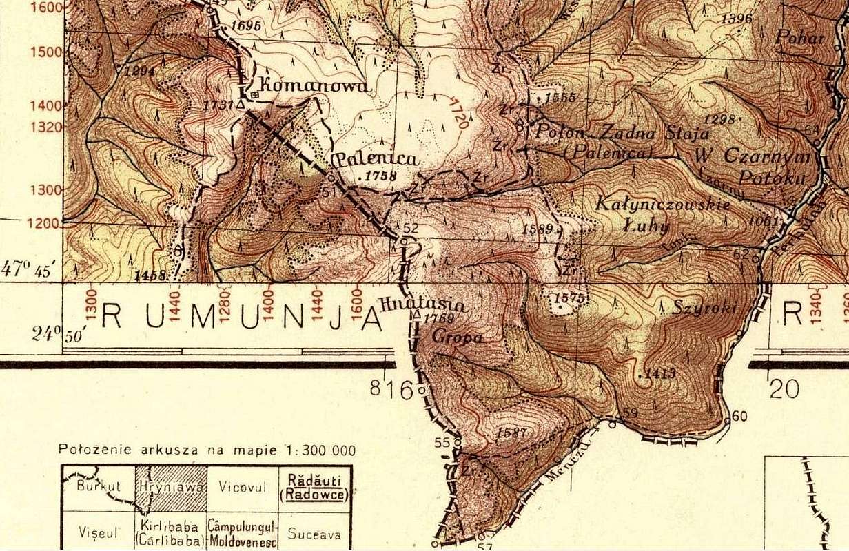
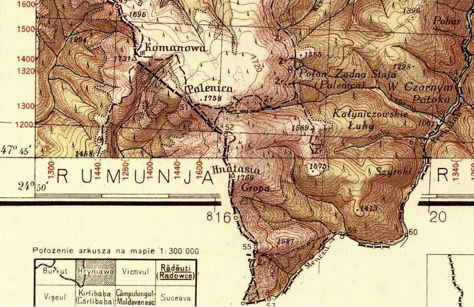
Exact triplex locationMany, many thanks to this extremely precious map. So, it means, the exact T location is about 2 km S of Hnatasia, which corresponds to a real terrain observation (R9) square in Vaser Valley map.

yatsek - Nov 3, 2010 7:25 pm - Hasn't voted
Re: Exact triplex locationHave you clicked the "WIG" above? The collection is absolutely amazing, the same goes for the quality of the images. And I stumbled upon it just last night.

lcarreau - Nov 4, 2010 6:09 pm - Voted 10/10
Valuable map..But.. you don't have to be Polish to see
the proper spelling: "Kraków!"
Everybody knows it's Kraków. Am I right?
Viewing: 1-4 of 4


Comments
Post a Comment