|
|
Route |
|---|---|
|
|
49.18902°N / 20.08670°E |
|
|
Hiking, Scrambling |
|
|
Spring, Summer, Fall |
|
|
Half a day |
|
|
Class 4 |
|
|
Overview
Route ProfileRock difficulty (the crux only): Polish grade I / UIAA grade I-II / YDS class 4 (please see these remarks) Approx. time of ascent: 1h 45min Net elevation gain: approx. 500m (from Morskie Oko Hut 690m; from Polana Palenica 1100m)
Total elevation gain: not much more
Approx. approach time: Łysa Polana/Lysá Poľana to Morskie Oko Hut - 2h (including Łysa Polana/Lysá Poľana to Polana Palenica car park - 15min) Morskie Oko Hut to Starting point marked in the 2nd photo - 1h |
Route Description
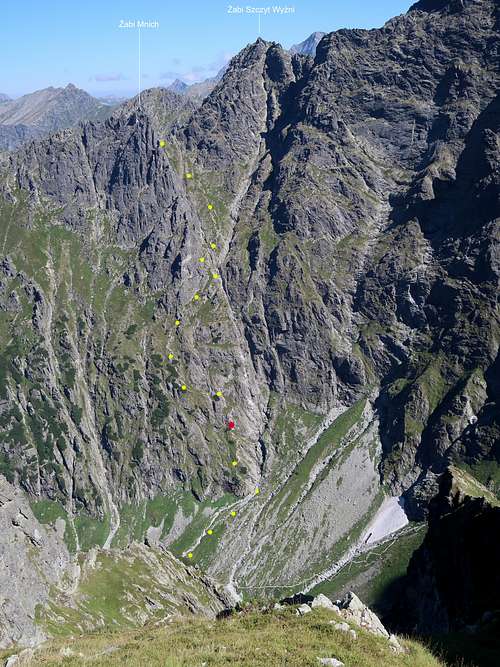
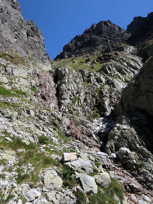
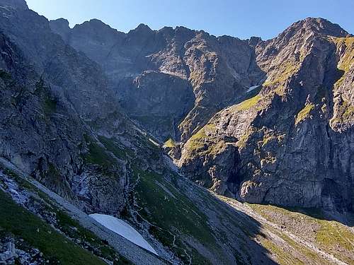
At the southeast corner of Czarny Staw, soon after the waymarked trail leaves the shore of the tarn, there are large debris cones fed by couloirs and chutes falling from the ridge that runs north from Rysy. Look out for the characteristic rock step with a few clumps of dwarf mountain pine on its top which borders them on the left. Leave the waymarked trail at a convenient point (photo above) and head for the rock step. The best approach path, obscured by the grass, you will find just right of the fresh (filled with bare talus) debris flow track/torrential runoff channel which runs from a gully called Wyżni Białczański Żleb, which drops from Białczańska Przełęcz Wyżnia and passes by the rock step. If you miss the spot and follow the waymarked trail some fifty metres more, you can walk up the talus and angle left later on, in the direction of the rock step. Our path crosses the gully right at the base of the rock step (photo below) and climbs it easily. 
Soon the path seems to fork. Turn right there, over an awkward little step, or – this is a more convenient option – continue straight on for a couple of metres and then turn right. (If you don’t turn right you will find yourself in slippery grassy terrain.) You will see an obvious path again, marked with some cairns and fairly well trodden. It will lead you up, along the rim of the abovementioned gully to a clump of dwarf mountain pine at the base of what is the crux of the route.
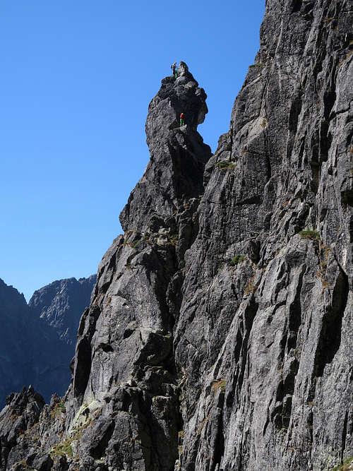
The crux is a two-tier 'bad step' about a dozen metres high, in Polish guidebooks rated I on the Tatra scale, which IMHO means more than UIAA grade I. The lower tier seems to me just a bit more difficult than the upper. At the top of each tier of the crux is a bolt so that you can abseil if need be. 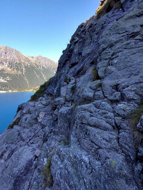
When you are done with the crux, turn left and after a few metres go up a shallow rocky groove. Soon you will see cairns and pieces of a path again. A traverse left will take you several dozen metres away from Wyżni Białczański Żleb. After a shallow chute for you to cross (watch out here while returning so that you will cross the chute instead of walking down!) a clear path winds its way over grassy terrain interspersed with rocky patches and bushes of dwarf pine. 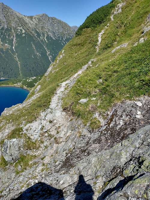
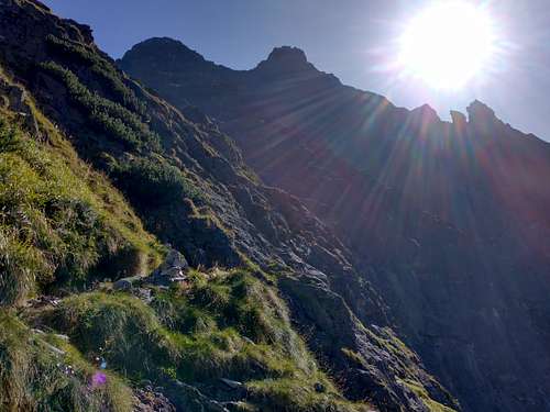
You will be getting closer and closer to the crags of the side ridge that Żabi Mnich sends to the southwest. 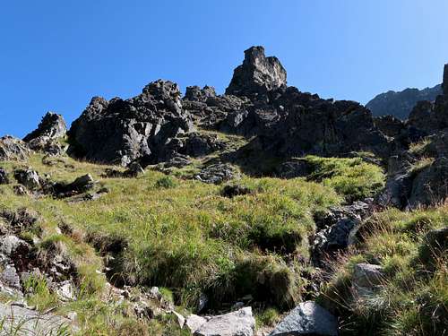
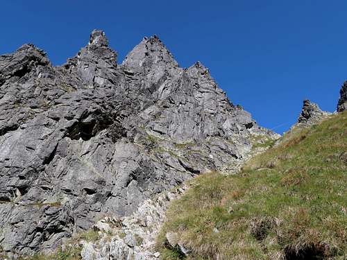
Higher up the path forks. Turn right as the other path leads towards Żabia Lalka, a pinnacle resembling a doll in shape ('lalka' translates as 'doll'), very popular with climbers. You will be traversing back to Wyżni Białczański Żleb, i.e. the gully descending from the saddle you are heading for, along the base of fine crags. Terrain becomes rockier, in places YDS class 3 again (looking out for cairns is a good idea) until you have crossed the gully. 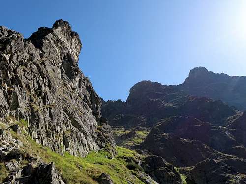
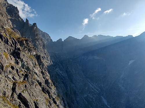
You will have picturesque views to the south. 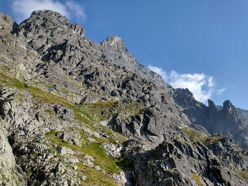
After crossing the gully you will see the saddle ahead, guarded by the characteristic Białowodzka Turniczka, and the path will become obvious. 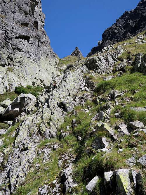
On your left there will be the spectacular crags of the side ridge that Żabi Mnich sends to the southwest (Lalkowe Turniczki, Żabia Lalka, Żabi Kapucyn). 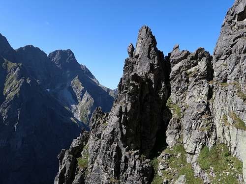
Białczańska Przełęcz Wyżnia/Vyšné Bialčanské sedlo is in fact two cols separated by the ten-metre-tall cone of Białowodzka Turniczka/Bielovodská vežička (about 2095m). The well-defined path leads to the northern col. 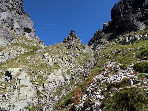
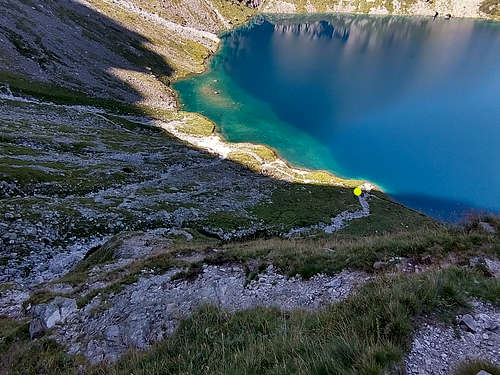
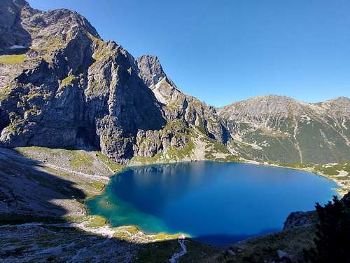
The saddle commands an excellent view of the valley of Żabie Stawy Białczańskie/Žabie plesá Bielovodské. 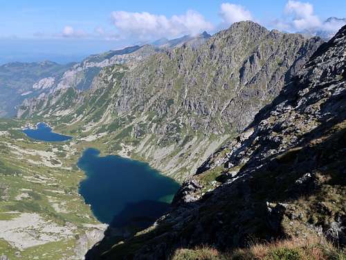
You can also see two interesting peaks which are usually climbed by scramblers who have reached the saddle. Just a 15-minute scramble (more exposure but similar rock difficulty to that of the crux of the route described on this page) away is the bold summit of Żabi Mnich/Žabí Mních (2146m). 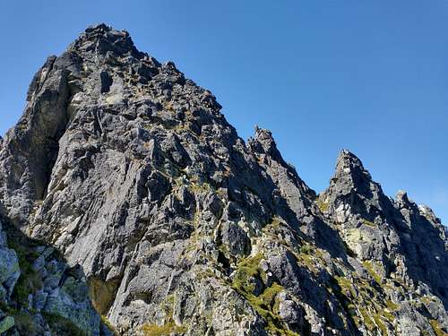
In the opposite direction, a 40-minute hike combined with a bit of scrambling (YDS class 3) will lead you to Żabi Szczyt Wyżni/Veľký Žabí štít at 2259m, which is renowned for fabulous views. 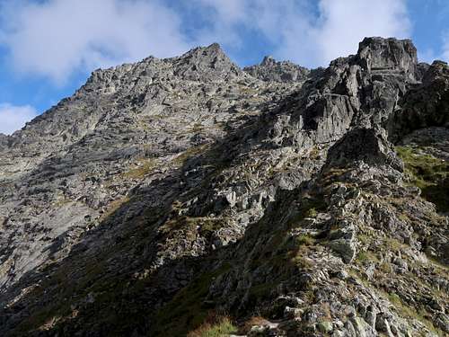
|
Maps
As for the analog maps, there are plenty of options. I would recommend the plastic 1:25,000 map of the Polish and Slovak Tatras by WiT. It is waterproof, durable, cheap, plus the route is marked on the map. |
Getting There (to Nearest Hut)
|
Poland   Polana Palenica, where you will most likely be entering the national park, lies east of Zakopane, 12km away as the crow flies and nearly 25km away by road. Zakopane sits at the foot of the Tatra Mountains about 100km south of Kraków, where there's an international airport. (BTW The city of Kraków certainly boasts one of the most interesting old towns in East Central Europe.) It should take you less than two hours to drive from Kraków to Zakopane, but at the weekend or in high season, it often takes more than 3.5hrs, which is how long a journey by train lasts. As for the buses, check out this website. (The station adjoins the central railway station 'Kraków Główny'.) In Zakopane, minibuses to Polana Palenica (car park and bus/minibus terminus) leave from in front of the entrance to the railway station. Polana Palenica sits in the valley of River Białka, at about 985m. If you go by car, the only possible way to pay for parking is online. From Polana Palenica you walk up the valley along the same tarmac road (later with several shortcuts marked with red stripes) for about 1hr 45min (nearly 9km), making an ascent of 410m, until you get to the hut that sits by Morskie Oko. (About 25min before Morskie Oko is Polana Włosienica, where you can also get by horse-drawn wagon. A few hundred metres past the place is a restaurant with decent toilets next to it.) Slovakia
|


Red Tape
To do the route legally you are supposed to register your climb (online or in the book kept outside the older building of the Morskie Oko Hut) stating you are going to climb Żabi Mnich. If you do, make sure you check out just after you have returned!
Essential Gear
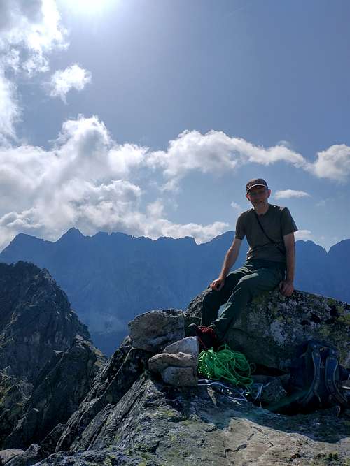
Good hiking boots or rather approach shoes, a good route description. If you do not feel confident with YDS class 4/UIAA grade II terrain or if it is wet, a good idea is to take some rope (20m will suffice) and relevant abseiling gear.
When To Climb, Mountain Conditions & Rescue
|
The best season is summer and often early autumn, the best month seems to be September providing it isn't rainy. In high season and at weekends expect huge crowds on the approach trail. 
|
External Links
This TR by Michał - Projekty Przygodowe is in Polish but has informative images of the crux area which I found helpful.