
-
 49062 Hits
-
 85.69% Score
-
 21 Votes
|
|
Mountain/Rock |
|---|---|
|
|
47.82557°N / 123.12187°W |
|
|
Jefferson |
|
|
6988 ft / 2130 m |
|
|
Overview
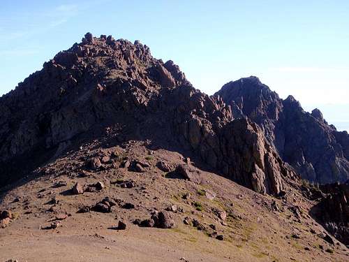
 The West Summit
Buckhorn Mountain is double-summit peak within the Buckhorn Wilderness established. At 6988 feet, the west summit is the 23rd highest point in the Olympic Range. It is named after the appearance of its 2 summits which were once thought to look like deer horns, nearly equal in elevation and separated by a smooth saddle. The east peak, only 1200 feet away, is 32 feet lower. For some reason this area doesn't see the same amount of traffic as the northern half of the park but Buckhorn is one of the more accessible mountains in the general area.
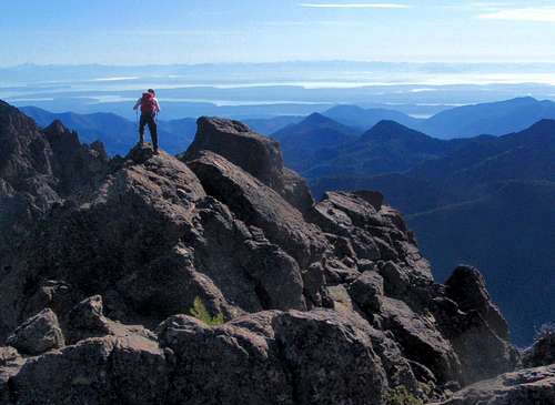 On The West Summit
After a scenic hike from Marmot Pass, the highest point on the west summit can be reached by boot path and a short scramble up onto a large boulder. The first good views come upon reaching Marmot Pass but improve at the summit. Some of the main peaks visible include Constance, Inner Constance, Deception, Martin, The Needles, Graywolf, Baker, Glacier, and Rainier. Many hikers who visit Buckhorn will want to visit both summits. The east summit is slightly more difficult to get to. Please see the route section for details.
 Olympic Goat Near The Summit
Standard Route - Marmot Pass
Hike up along the river, hopping downed trees along the Big Quilcene river and watching for the occasional rhododendron. The trail diverges from the river and begins to rise at Shelter Rock Camp (3600 feet, 2.6 miles). Emerge from the trees near 3.5 miles to traverse scree slopes on the south flanks of Iron Mountain and the southeast slopes of Buckhorn Mountain.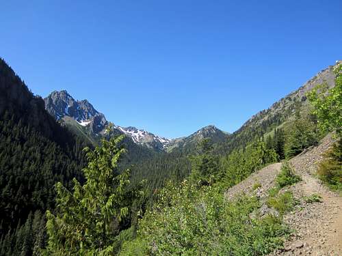 Big Quilcene Trail
Numerous camping locations are passed along the way to Marmot Pass and several of them have running water. The next one, Camp Mystery is located at 4.6 miles (5400 feet) in a stand of firs next to a stream. Beyond Marmot Pass the network of trails continues on. Multi-day backpackers make frequent use of these camps when coming and going from more distant locations.
 Marmot Pass
When the trail begins to make tight switchbacks it is nearing the pass. Refuse the urge to leave the trail among the basalt outcroppings and ascend directly. It will not save any time and will only damage the ground-cover. At 5970 feet, Marmot Pass is a gateway to the eastern Olympics. Turn right onto the Tubal Cain trail and go less than a tenth of a mile, watching carefully for the boot-path which leads up to the summit. It's easy to miss. If you find yourself contouring around the west side of the mountain, you have gone too far. The boot-path begins by ascending the south side of the west shoulder.
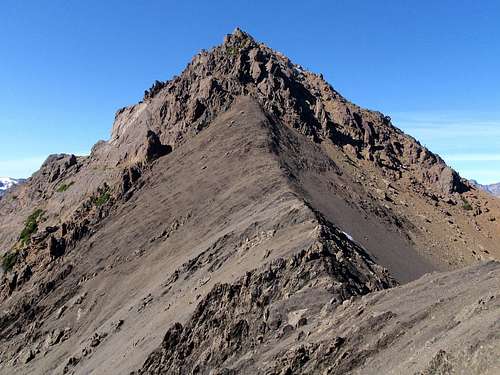
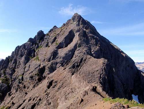
 The West And East Peak Seen From The West Shoulder
The boot-path will lead all the way to the large boulders on the summit. It passes through one steep section covered in scree but it's not quite enough to be considered Class 3 until the summit. Venturing beyond the west summit to the east summit is more challenging. There are a number of ways to do it but the easiest might be to avoid the Class 4 section on the east side of the summit block by dropping down a few hundred feet onto the north face.
 Th East Summit Seen From The Saddle
Traverse over from the north face until access to the saddle is gained at 6600 feet. Continue east along the top of the saddle until you come to a large rock obstacle. Go around this obstacle by scrambling over a rocky rib. Ascend loose scree to the base of a small cliff band and traverse around it to the right (south). Continue to ascend short gullies and rocky outcroppings to the east summit at 6956 feet. The difficulty should never exceed Class 3. If it does, you are off route.
 Ascending Gullies On The East Peak
To continue along the ridge to neighboring Iron Mountain is possible but not recommended. Do not attempt to downclimb the east face of east Buckhorn directly from the summit unless you have a rope.
 The East Summit
Getting There / Driving Directions
From the town of Quilcene, go south on Highway 101 for 1.5 miles, and turn right (west) onto Penny Creek Road passing by a big rock quarry. At 1.4 miles keep left onto Big Quilcene River Road which later becomes Forest Road 27. After 9 miles turn left on Forest Road 2750, and continue 4.5 miles to the trailhead located at 2500 feet. (Upper Big Quilcene trail #833, 2470 feet).Red Tape
Other than a Forest Pass for parking and the trailhead register, there are no permits or fees required. The route is south facing and should be largely snow free in or after June. Mount Constance And Inner Constance Seen From The Summit
When To Climb
Call the Buckhorn Wilderness: 360-765-2200 and ask about snow levels near trail 833 and Marmot Pass.Direct routes (via the saddle) are usually snow-free June-October. Marmot Pass and Camp Mystery often hold snow until mid-July.
One could get creative with couloirs (especially on the SW side of the NE summit) in winter, using snow shoes for the approach...
NWH Trip Reports
- August 2011 report by Fletcher
- August 2010 report by Tigermn
- December 2009 report by Raising3Hikers
- September 2008 report by Crabio
- July 2008 report by SeattleHikerToo
- October 2007 report by Arete