

|
|
Route |
|---|---|
|
|
44.31940°N / 72.8866°W |
|
|
Hiking |
|
|
Spring, Summer, Fall, Winter |
|
|
Half a day |
|
|
Class 1-2 |
|
|
Approach
In Huntington Center look for a sign that says Camel's Hump State Park. The road is called Camel's Hump Road and will be on the east side of town. Follow the signs for the 'Trails' that are posted along the road. You will reach the end of the road in 3.5 miles where the Burrows trailhead is located. Park here.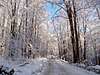 |
Route Description
 3/3/03 - Burrows Trail in Winter
Round Trip Distance : 4.8 miles
Elevation Gain : 2200 feet
The Burrows trail is a nice hike through the Camel's Hump State forest, in the Green Mountains. The trail is well maintained and easy to follow.
From the parking lot at the Burrows trailhead follow the blue blazed trail markers. The first mile of the trail is fairly easy going, the next 1.4 miles increases in steepness but nothing technical. After 2.2 miles from the trailhead the Burrows trail ends at the Long Trail. From here follow the Long Trail south for 0.2 mile to the summit.
 |