
|
|
Canyon |
|---|---|
|
|
42.64810°N / 0.06042°W |
|
|
Hiking, Mountaineering, Trad Climbing, Sport Climbing, Ice Climbing, Big Wall, Mixed, Scrambling, Via Ferrata, Skiing |
|
|
Spring, Summer, Fall, Winter |
|
|
Overview

About Spannish Pyrenee's canyons
Monte Perdido is the oldest National park in Spain, and one of the Pyrenees most gorgeous and original place. This is the biggest and tallest limestone mountain in the whole Europe.
But it is not its only feature. Monte Perdido is dug on all sides by several gorgeous Canyons. On the french side they are 3 and called "Cirques" rather than "Canyons" (the most famous being the Cirque de Gavarnie, together with the Cirque d'Estaubé and the Cirque de Troumousse.
On the Spannish side they are also at least 4, and here they truely deserve the name "Canyon". Ordesa, West is the most famous of them (with Añisclo, Escuaín and Pineta).


About Cañón de Ordesa
Surrounded by three-thousander peaks and vertical cliffs more than 1000m high, Ordesa is one of Europe's largest canyons, sharing this status with Montenegro's Tara, Greece's Samaria, or Iceland's Jökulsárgljúfur . Some may also add to this list Alp's Gorges du Verdon, some deep valleys of the Dolomites, Norway's fjords, and so on, if we consider only the deepness...

But here is where Ordesa makes all the differences, this is probably the only canyon in Europe with a real shape of "canyon", as we imagine them in Colorado, Brasil, or Texas. Perfectly vertical, steep, square-shaped.
The explorator Franz Schrader, in the 19th century, who painted many aquarels of Ordesa, wrote in one of his books : "Ordesa is the only place in Pyrenees which reminds me of the canyons in South America".
In the old times this place was sometimes called "Valley of Arazas" (after its river Rio Arazas), or "Arasas". It was a famous place for Ibex hunting, and was the are were the last Pyrenean ibexes (a characteristic race, different than the alps) were recenced in the 80's, before this race disappeared.

Ordesa is also an area where can be found in abundance the Ramonda pyrenaica, an endemic plant specific to this region, and named after the botanist Louis Ramond de Carbonnières, the first climber of Monte Perdido 1802.

Ordesa is about 7-8 km long, oriented upstream from West to East, and curves towards the North in the final part. It has 2 secondary branches, respectively Circo de Carriata and Circo de Cotatuero on the North side.

On the final part, a serie of little waterfalls, called Gradas de Soaso, are one of the most sceneric parts of the trail going on the bottom.

A trail goes along the South rim ("Faja de Pelay") with breath-taking views overlooking the abyss. It is from here that the views are the most spectacular, since you watch the highest cliffs in the same time than all high 3000m peaks of the area.

On the northern hillside, many trails are located at different levels on flat parts between vertical section of the cliffs. There are 2 of such trails linking Circo de Carriata and Circo de Cotatuero, plus one between the top of the rim and the high peaks of the border. The second is the most vertiginous.

In the Circo de Cotatuero are also located the "clavijas de Cotatuero", a "via ferrata" before the invention of this word, made of metallic bars set on a vertical part, only possible way to go through, and not advised for those who suffer vertigo. They were set here a long time ago to allow british hunter Mr Buxton to access his favorite hunting grounds.
Circo de Carriata also have some "clavijas", but much easier than Cotatuero. (here and here, some pics provided by Luiso)

One of Ordessa most well-known spots is the
Tozal de Mallo, a jagged excentred prominence of the northern cliffs. On the canyon side, it is perfectly vertical; on the wall-side, accessible on foot from the trail of Circo de Cotatuero. This is a very famous rock-climbing spot.
Getting There
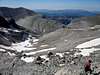
 Panorama from the Roland Breach
The biggest locality near Ordesa is Torla, you must go here first, if
There is a wide car park at Puente de los Navarros 4km after. You need to walk another 4km to the entrance to the Ordesa Canyon.
During summer all private cars are banned beyond Puente de los Navarros; unless you hike in from Torla, you must use the regular shuttle bus (€3.30 one-way or return) from the car park at the village outskirts.
From Spain, to Torla, by public transports
First, you must go to Huesca by bus (Alosa) or by train (RENFE). In arriving there, you have to get the bus to Sabiñánigo, and then another bus to Torla.
Huesca-Sabiñánigo: 5.30 € by bus
Sabiñánigo-Torla: 3.03 € by bus
More information: www.alosa.es, www.renfe.es
From France, by car or... on foot
Ordesa is quite remote to reach from France, since it is located behind the wide Monte Perdido massif, and the nearests cross-border points are not close. Depending on where you start from, you can either cross the Bielsa tunnel from the Aure valley (Saint Lary; in front of Lannemezan), or take the Pourtalet pass in the Ossau valley (in front of Pau).
From Bielsa, you need to drive to Ainsa and drive to Boltaña, Fiscal and Broto. Another more scenerical option, combining the visit of Añisclo canyon, can be to take the pass of Fanlo, on a small road full of bends.
From the Pourtalet pass, drive to Biescas and Broto. Here also, a lot of scenerical places on the way.
If you find Ordesa a bit long to reach by car from France, another very interesting option can be to base yourself in Gavarnie. From here, an asphalted road leads to Col de Tentes where you can park your car. This point is close to the Brèche de Roland, high impressive saddle, gateway to Spain, which overlooks the Ordesa valley. From here, it belongs to you to decide where you go further.
Red Tape
Ordesa is a national park, so you cannot pick up flowers, disturb animals, make fires, leave rubbish, etc.Going offtrails is not forbidden but at your own risk.
The rules concerning camping/bivouacquing are a but unclear. Officially, it is forbidden, but tolerated in few places (see further below).
More information about the precise rules in the excellent page about Tozal de Mallo.
Generally, I would say bivouacquing is possible, but do it in remote places high in altitude, not in the canyon itself.
Camping
Campsites
There are several official camp-sites in Torla:
http://en.campings.com/spain/aragon/huesca/torla/camping-torla.htm
Mountain huts


The mountain-refuge of Goriz is located on the final slopes of Ordesa and the foot of Monte Perdido :
http://www.goriz.es
You may also find useful the the mountain refuge of Les Sarradets on the french side of the Brèche de Roland.
Bivouac
There is a place on the spannish side of the Brèche de Roland where bivouac with tents is usually tolerated, on a wide flat area, near a little depression where a small marsh is lying.
The historic shelter of Ordesa/Monte Perdido

Here is an interesting anecdot about the very first mountain-hut created by the French Alpine Club (CAF), but, paradoxally, not located in France !
This idea was initiated by Count Henry Russell, pioneer and discoverer of many Pyrenean peaks (but not Monte Perdido). He suggested that a shelter should allow mountaineers to stay overnight in order to make the ascent of the remote Monte Perdido more convenient.
This project was realized in 1877, when a shelter was built under a rocky depression in the cliffs of the East slopes of Monte Perdido, facing Ordesa. It was often used by many of the pioneers of the "Pyrénéisme" one century ago.
But later, this place suffered many problems. First, peasants of "Gaulis" (Goriz), who also used to accomodate travellers, heard about this place, and organised several expeditions to destroy it. Fortunately all of these attempts failed since they could not locate it. However, the iron door strangely disappeared one day, unexplainedly.
More annoying, many decades later, Spain revendicated that such "official mountain hut" of the French Alpine Club could not be located on Spannish territory, hence became forbidden. Slowly, the hut felt into oblivion, except in the memory of Pyreneist historians.

This hut is commonly called "Abri du Cylindre" or "Abri Russell", and is still present nowadays, despite abandonned. It is not very often visited because not very known and very difficult to find.
This is a very basic place, not very confortable, but it can provide you a possibility to sleep overnight without the weight of a tent. More than this, with all the historical background, to plunge yourself in the atmosphere of the first Pyreneist pioneers...
If you use it, be respectful: don't destroy anything, don't leave rubbish.
Diego Sahagún - Aug 24, 2009 7:04 pm - Voted 10/10
Aperturas y el polémico taladrohttp://www.desnivel.com/object.php?o=18875