
-
 22125 Hits
-
 84.82% Score
-
 19 Votes
|
|
Mountain/Rock |
|---|---|
|
|
37.57836°N / 118.55029°W |
|
|
Mono |
|
|
Spring, Summer, Fall |
|
|
7912 ft / 2412 m |
|
|
Overview
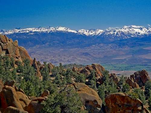
The High Sierra from Casa Diablo Mtn.
This small peak is southeast of the Long Valley Caldera, one of the largest calderas on earth created 760,000 years ago by a large volcanic eruption. There is still notable smoldering potential in the area. Mammoth Mountain to the west, the Glass Mountain Range to the northeast and the Mono Craters to the north are all linked to this dramatic geological activity.
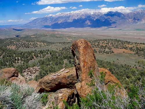
This is a desert peak composed of granite rock much like the Alabama Hills with a short easy approach of scrub brush giving way to a jumble of huge bolders that require some interesting route finding to get to the class 3 summit.
Casa Diablo (La Casa del Diablo, Spanish for House of the Devil), has a colorful mining history and panoramic views of the White Mountains to the east, Owens Valley to the south and the Eastern Sierra to the west.
Getting There
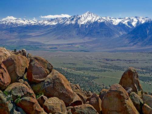
Southwest over Owens Valley to Mt. Tom from Casa Diablo
From the south: From the junction of Hwy. 395 with Hwy. 6 north of Bishop go north approximately 1.5 miles to 5 Bridges Road. Go north on 5 Bridges Road 2.5 more miles passing a gravel mining operation to a junction with Chalk Bluffs Road, left and Fish Slough Road, right. Keep straight (north) on Road 4S04 (Casa Diablo Road), a graded dirt with some washboard and some sandy places 14.5 to a 2 track road that goes a short distance to the east below Casa Diablo Mtn..
Red Tape
Northeast to the White Mtns. from Casa Diablo
Camping

Nevahbe Ridge and Esha Canyon from the McGee Creek area off Hwy. 395
The land surrounding the mountain is Inyo National Forest and Bureau of Land Management so you can also camp independently in the area as long as there are no posted restrictions.
External Links
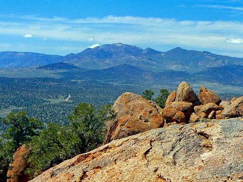
North to the Glass Mtns. from Casa Diablo
Tom's Place
Desert Summits
Casa Diablo
Noondueler - Feb 10, 2009 12:25 am - Hasn't voted
Re: Some more info...Thanks for the extra info Clydascope! I actually took the Benton approach when I did it in '05 but didn't have time to add the route when I posted the page so I derived the Bishop route from Andy Zdons' Desert Summits. I'll get it in there soon and check out the mining history too. Great that you live out there! I usually and get out to the Eastern Sierra several times (awesome territory!) and Death Valley every year from Marin County. Later man! - Windsor.
Juliet_Os - Apr 7, 2016 1:07 pm - Hasn't voted
trail lengthCould you tell me the length of the Casa Diablo trail, please?
Noondueler - Apr 7, 2016 4:52 pm - Hasn't voted
Re: trail lengthThe Casa Diablo Rd. is 1 mile from the summit. There is no trail but a 4wd road leading toward the peak. You have to route find yourself to get to the top boulder. Cheers, Windsor