Introduction:
Layout designed for best viewing on a "1024 x 768" screen.
![Sperry Glacier from Vaught]() Comeau Pass and Sperry Glacier
Comeau Pass and Sperry Glacier
In 2010 Glacier National Park will be celebrating its 100 year anniversary. I believe it is fitting to take a look back and celebrate the work of those who have made Glacier National Park the "Crown of the Continent".
Visit Glacier National Park just once and it will be easy to understand what drew man to this area for many centuries. Glacier National Park emanates wonder, it smells of natural history, it oozes geology and its beauty is like a Siren calling us to come closer and see more.
This place called Glacier has held many of us in its grasp and the allure of her peaks. Her passes and valleys have beckoned and call us back time and time again. It seems that we just can’t get enough of this place that is called “The Crown of The Continent”. I call it a “Glimpse of Heaven on Earth”.
Perhaps Dr.
Lyman B. Sperry said it best. He wrote:
"Finding that a single day in this remarkable place could give but a taste of its delights, some of our party determined to visit again as soon as practicable.”
Dr. Sperry explored the area above Avalanche Lake and “discovered” the glacier above the lake that bears his name, Sperry Glacier.
The first article in this series,
A History of Glacier National Park’s Passes: Part I, covered a portion of the fascinating history of Native American use of the passes in Glacier National Park. Part II focuses on the early exploration and discovery of the passes used in Glacier National Park by the European-Americans.
As word got out about this unique area in northwestern Montana influential men and a few women made long journeys west from the east coast to see and explore. Many of Glacier Mountains bear the names of significant explorers and influential leaders of the late 19th and early 20th century.
Overview:
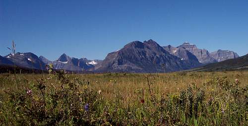
![St. Mary s Valley]() Glacier National Park
Glacier National Park
This article is the second of the series about Glacier National Park’s Passes.
There are at least 28 named passes in present day Glacier National Park. To write this article I have used the sources listed at the end of this article in the Resources section. I certainly will not be able to present all of the information that is available. Instead I have focused on the areas that present the richest history as well as what I have determined would appeal to the broadest area of interest to you as a reader.
The Historical Motivations for Exploration of the American West:
Three main factors motivated Europeans to push west after landing in the New World.
Search For The Northwest Passage
Early exploration of the New World was motivated by the belief that there was a Northwest Passage around or through North America. If the passage could be located trade routes between Europe and the Far East would be shortened therefore reducing the cost to ship goods. The English, French, Spanish and Portuguese were the main players in this search.
Until the “discovery” of the New World this point the only real option was to travel the preferred route around the Cape of South Africa. Traveling to the west through the Strait of Magellan around the tip of South America was problematic as it took Magellan 38 days to navigate through it. To examine all of the explorers and voyages are beyond the scope of this article. For those who are interested an internet search for New World Explorers could yield some fascinating reading. Unfortunately, the Northwest Passage was never discovered but it did open the American West to other opportunities.
Land and Ore
An additional motivation was a thirst for land and they almost immediately began pushing west to raise their crops and harvest the natural resources. In his book, Undaunted Courage, Stephen E. Ambrose writes that raising “tobacco represented an all out assault on the environment for the sake of the crop.” This lead to speculation on large portions of land and resulted in clearing of the forested valleys of the eastern seaboard. A growing nation would need more acreage to support its burgeoning population. Newly established trade agreements with Europe would also need more ground to grow crops that could be sold or traded. Europe also thirsted for ores such as gold, silver and copper and exploration of the Rocky Mountains led to discovery of vast amounts of minerals that were mined and sold for profit.
Fur Trade
In the late 1700s and early 1800s the westward movement was also motivated by Europe’s demand for goods from the New World, especially
beaver. Explorers traveling through North America looking for the Northwest Passage reported back the incredible vastness of the American West and its immense resources spurned interest in using these resources.
Trappers sponsored by companies like The Hudson Bay Company, the Pacific Fur Company, the American Fur Company and the Rocky Mountain Fur Company pushed through the Great Plains into the Rocky Mountains in search of beaver. They established relationships with the Native Americans by taking Native American women for their wives and by fighting alongside of them with their enemies. They also established trading posts where not only white men could trade their
beaver pelts and firs but the Native Americans could trade for goods, but more importantly weapons and ammunition.
Whiteman’s Exploration of Glacier National Park: 1800-1850
![Views from Apgar]() Lake McDonald
Lake McDonald
There is little written history regarding white man’s travels into the American West save a few journals and a lot of oral history that was passed down over the years. Eventually this too was recorded. Fact and fiction perhaps melded into a written history and the men behind the stories such as
John Colter and
Jim Bridger became larger than life heroes that through their exploits opened the American West.
David Thompson
British trapper
David Thompson is regarded as the first European to record impressions of the area in the 1780s.
Although beyond the scope of this article Thompson's exploits are noteworthy. A suggested a book by another SummitPost member is
Jack Nisbet for more information on Thompson.
The men mentioned in this article were heroes as well. Heroes they were but heroes of a different strain recorded with ink and paper. These heroes lead the way in opening one of the most fantastic areas in the world.
Meriwether Lewis and William Clark
![Louisiana Purchase]() Louisiana Purchase, Please Do Not Vote
Louisiana Purchase, Please Do Not Vote![Lewis and Clark]() Lewis and Clark, Please Do Not Vote
Lewis and Clark, Please Do Not Vote
Present day Glacier National Park was contained within the Louisiana Purchase. The Voyage of Discovery traveled along a river that actually came within 30 miles from the eastern boundary of Glacier National Park.
Lewis named that river “Marias River” (or something like that Lewis’ spelling was less than stellar). The Blackfeet called it the Bear River. Lewis was hopeful at first that it led further to the north past the 50th Parallel.
He wrote the following excerpt
in his journal.
"The whole of my party to a man except myself were fully perswaided that this river was the Missouri, but being fully of opinion that it was neither the main stream or that which it would be advisable for us to take, I determined to give it a name and in honour of Miss Maria W____d. [Wood] called it Maria's River".
![Camp Disappointment]() Camp Disappointment, Please Do Not Vote.
Camp Disappointment, Please Do Not Vote.![Two Medicine Fight Location]() Two Medicine River battle Location, Please Do Not Vote.
Two Medicine River battle Location, Please Do Not Vote.
They spent an uncomfortable rain filled July 21-26, 1806 at a place called “Camp Disappointment” when Meriwether Lewis and his three men, George Drouillard and the Field brothers, Joseph and Reubin realized that the Marias River turned to the west towards present day Glacier National Park. Their journals spoke of meeting Blackfeet Indians that were not exactly friendly to their cause. On July 27th Lewis and his three men met a band of unfriendly young Blackfeet braves on the banks of the Two Medicine River.
Stephen F. Ambrose writes in Undaunted Courage that Lewis and his men were outnumbered at least 2 to 1. They agreed to share a camp together on the Two Medicine River and as long as Lewis supplied tobacco things went okay. Lewis learned that this band of Piegan had a trapper that lived with them as well as about the British Fort where the Blackfeet traded for guns, ammunition and other supplies such as alcohol. Lewis made a crucial mistake when he told them that their enemies the Nez Pierce, the Shoshones and others were part of an alliance with the Americans. This alliance would supply their enemies with rifles.
On the morning of the 27th of July the Blackfeet tried unsuccessfully to steal the explorer’s rifles and later tried to take their horses. Reuben Field stabbed one of the braves who died and then the conflict began in earnest when a brave raised his British musket to shoot at Lewis and Lewis fired and killed him. Things got out of control and eventually the braves fled on foot. Lewis ordered his men to pursue them rather than retreat.
Eventually Lewis decided to end the chase and returned to the Marias River and headed back down to meet Clark. In all, the losses that day were two young braves dead, another wounded and ruined relations with the strongest Native American tribe in the Northern Great Plains. Not one of the Corps of Discovery’s best days by far.
![looking south from Mount Siyeh (10,014)]() Lewis Range, distressbark photo
Lewis Range, distressbark photo
Lewis and his three companions traveled over 100 miles that day, found one of the food caches and camped on the shore opposite Blackfeet territory. Ambrose does an excellent job describing these events and the decisions Lewis made on pages 388-394. Perhaps it was this singular event that soured the Blackfeet toward the white man and made it so difficult to peacefully trap and explore in what is now present day Glacier National Park.
Glacier National Park’s
Lewis Range where Mount Cleveland is located as well as the
Lewis Overthrust are named for Meriwether Lewis.
![Lone Walker Mt]() Lone Walker Mountain, Dottie Little Tent photo
Lone Walker Mountain, Dottie Little Tent photo![Sinopah and Painted Tepee]() Sinopah, FlatheadNative photo
Sinopah, FlatheadNative photo
Hugh Monroe was a trapper from the Hudson Bay Company who initially started off on a task for his employer who was the director at Fort Bow in 1814. He was sent to learn the customs and language of the Blackfeet Indians.
He did this quite well and eventually became a member of the tribe when he married, Sinopah who was Chief Lone Walker’s daughter. He traveled with the Piegan band and traveled through Glacier’s passes with them. He also is reported to have traveled to the Flathead Valley. His relationship with the Piegan Blackfeet helped keep the peace between the white man and the Blackfeet Indians.
The Two Medicine Valley hosts two mountains that are named for
Sinopah and Chief Lone Walker.
![St. Marys Lake in Glacier National Park]() St. Mary's Lake, csmcgranahan photo
St. Mary's Lake, csmcgranahan photo
The Catholic Church was influential in introducing Native Americans to religion. Father Desmet was a Catholic missionary to the Salish in the 1840’s as well as had contact with the Blackfeet through Hugh Monroe.
It was Desmet who named St. Mary’s Lake in honor of the Virgin Mary.
Whiteman’s Exploration of Glacier National Park: 1850-early 1900s
![Looking north into the park]() Pumpelly Glacier, whiteroom 17 photo
Pumpelly Glacier, whiteroom 17 photo
Presidential orders to survey the 49th parallel which serves as the boundary between the United States and Canada surged an increase in exploration in Glacier National Park.
Men by the names of Elliot Cones and George Dawson explored, documented and drew maps of the mountains and valleys. U.S. Army troops passed over Cut Bank Pass in 1873 after traveling through the Flathead Valley. One of the men, Raphael Pumpelly, traveling in this group “discovered” a glacier and it was named after him. Pumpelly Glacier is located in the Nyack Valley.
![Grinnell Lake, Gem Glacier]() Grinnell Valley, bbbeans photo
Grinnell Valley, bbbeans photo
Perhaps the white man with the largest influence was Grinnell. His efforts were instrumental in establishing Glacier National Park as the nations. Grinnell made frequent trips to explore and hunt in present day Glacier and his exploration of the Grinnell and Swiftcurrent Valleys lead him to “discover” Grinnell and Swiftcurrent Glaciers. George Bird Grinnell also became a member of the Blackfeet tribe and he was given the name “Fisher Cap” by the Blackfeet.
Areas in Glacier National Park that are associated with Grinnell include
Mount Grinnell, Grinnell Point, Grinnell Creek and Lake and Grinnell Point.
![Sperry Chalet]() Sperry Chalet, FlatheadNative Photo
Sperry Chalet, FlatheadNative Photo
As the founder of the Great Northern Railroad, Hill was influential in Glacier National Park due to a number of factors. His promotion of the park to grow his railroad business brought streams of influential people to the newly established park. He also funded the building of the numerous chalets that today’s visitors enjoy. The lodges at Lake McDonald, Many Glacier and East Glacier were built with funding by Hill. The backcountry chalets, Sperry and Granite Park we also part of his influence. They were used by backcountry trail rides that were prevalent in the early years of the park.
The Mountain Pass:
![Pitamakin Pass sign]() Glacier National Park Trail Sign
Glacier National Park Trail Sign
Often overlooked and generally taken for granted are the mountain passes. We walk over them and rarely think about the men and women that have passed this way before us. Sure we might read a summit log and find that Mike from Pallukaville, USA was there last month, but how many of us truly appreciate the role that these places played in the 18th and 19th century?
A Pass according to Wikipedia is:
“In a range of hills, or especially of mountains, a pass
(also gap, notch, col, saddle, bwlch, brennig or bealach) is a saddle point in between two areas of higher elevation. If following the lowest possible route through a range, a pass is locally the highest point on that route.
Topographically, a pass has the general form of a saddle between two mountains (the elevation as a function of two position coordinates is mathematically a saddle point). They are often found just above the source of a river, constituting a sort of "bridge" over to the headwaters of a different river. Passes may be very short, consisting of steep slopes to the top of the pass, or valleys of many kilometers, whose highest point is only identifiable by surveying.
Since many of the world's mountain ranges have always presented formidable barriers to travel, passes have been important since before recorded history, and have played a key role in trade, war and migration.”
Glacier National Park’s Passes:
Much of this early park history is woven around the use of or search for routes across the mountain range. The old Indian trails were not much as we think of park trails today; but they did follow well-defined routes and were often deeply worn by heavy use. But because of the nature of the terrain and the heavily timbered valleys, trails were almost always a prime necessity if one were to travel from one place to another through these mountain passes.
white man also followed these same routes and also forged routes into more remote areas of the park that were of less significant use to the Native Americans.
Ahern Pass:
![From Iceberg Peak]() Ahern Pass Area, Bob Sihler photo
Ahern Pass Area, Bob Sihler photo![George Patrick Ahren]() George Patrick Ahern, Please Do Not Vote.
George Patrick Ahern, Please Do Not Vote.
“In compliance with letter of instructions from department headquarters, Lieut. George P. Ahern, 25th infantry, with four enlisted men as escort, will proceed tomorrow, the 21st inst., to the headwaters of the North Fork of Sun River to ascertain of there is a practicable pass through the mountain range at or near this point. Upon completion of this duty, Lieutenant Ahern will make a written report to this office, accompanied by a topographical map of the country passed over. The quartermaster department will furnish the necessary transportation, etc.
“By
order of Lieut. Col. Van Horn.
EDWIN F. GLENN, “1st Lieut. 25th Inf., Post Adjutant.”
Ahern and a few black troopers of the 25th Infantry were accompanied by G. E. Culver, a naturalist from the University of Wisconsin, and other civilians — a packer Indian guides and prospectors (with both Louis Meyer and Joe Cosley probably among them).
They explored Cut Bank Creek, Milk River (or Hudson's Bay) Ridge, and Swiftcurrent Creek. With selected companions, Ahern made at least three side-trips to the Continental Divide. From the Canadian line they turned, came up Belly River, had a friendly meeting with some Stoney Indians, and finally crossed the forbidding Ahern Pass — a route fit only for "a crazy man".
An article in Montana: The Magazine of Western History, July 1957 stated that:
Upon reaching this pass, the entire party worked for two days making a trail from the foot of the talus slope to the summit, completing the first of two known successful trips with pack stock over present Ahern Pass. Because the western slope of the pass was heavily timbered, they had difficulty cutting their way through; nor was this helped by the fact that most of the trip was accomplished in pouring rain.
The following article is a vivid description of a vast unexplored wilderness in the Rocky mountains of Montana as found by Maj. George P. Ahern, U. S. A., retired, when he made trips into a territory of some 10,000 square miles to obtain data for military records on assignments of the adjutant general at St. Paul and the post commander at Fort Shaw in 1888, 1889, and 1890. Great Falls Tribune on April 26, 1931.
At this point packs were unloaded and mules turned out for two days, during which time approaches to the main divide were looked over for a possible crossing. A small band of Stony Indians from the far north in Canada were hunting in the region. I made friends with their leader and loaned him my Winchester rifle, which he admired.
In discussing possibility of crossing the main divide, he pointed to a glacier west some 2,000 feet above our camp, and said he had crossed the divide south of the glacier.
Hannon and I accompanied the Indians to the point designated and found the pass practicable if about a dozen steps could be cut on an inclined rocky ledge close to the glacier. We cut the steps and on the third day of our stay at this place crossed the pass. The ledge was too narrow to permit animals to turn back and a drop of almost 2,000 feet on the lower side made the passage one of anxiety, fearing that one of our animals would become frightened, stop in the trail and in the jam endanger the pack train. The trip was made safely. We camped that night, Aug. 22, 1890, by headwaters of a branch of McDonald creek on the Pacific slope.
Ahern Pass has long been known as one of the most dangerous in Glacier Park, but it was used by surveyor Sergeant and packer Frank Valentine, and Joe Cosley made it a favorite escape route into his Belly River refuge. Once Joe's two horses slipped on the ice of the pass and hurtled a thousand feet into the abyss.
The Piegan Blackfeet name for the pass is
Saóix ozitamisohpi(iaw): The warriors where they go up (or West). The name for the glacier is
Sisukkokutui: Spotted Ice.
![Ptarmigan Tunnel to Ahern Pass Goat Trail, #1]() The Goat Trail to Ahern Pass, saintgrizzly photo.
The Goat Trail to Ahern Pass, saintgrizzly photo.
In 1888 when Ahern explored what was soon to become Glacier National Park it was the last large block of unmapped territory in Montana. His maps were studied and the places he saw were given his name.
Ahern was truly a modern day hero and he worked to conserve forest resources for over 40 years.
As a military man he saw duty in the Indian Campaigns after the Civil War, fought in the Spanish-American War, lead his troops in the Boxer Rebellion and helped put-down the Philippine Insurrection. During the World War I he served the Chief of Military Intelligence and also served as the Secretary of the War College as their assistant. He received the Silver Star decoration for bravery during his services in the Spanish-American War.
He was known as a kind man by Chief Sitting Bull who gave him the title of Chief Two Crows.
Lieutenant Colonel George Patrick Ahern
died on May 13, 1940 at the age of 82.
In modern Day Glacier National Park Ahern Peak is found along the west side of the Continental Divide between Iceberg Peak to the south and Ipasha Peak to the north. Ahern Glacier lies on the eastern side of the divide. The incredible Belly River country spreads out to the north at the McDonald Creek drainage is to the west. J. Gordon Edwards describes the route to Ahern Peak on page 118 of A Climber’s Guide To Glacier National Park. Bob Sihler has built a brilliant page on
Ahern Peak as well.
Ahern Pass is also a used to access Stoney Indian Pass from the Highline Trail north of Iceberg Peak as described in Edwards’ book on pages 113-114. It can also be used to access Ipasha Peak as outlined by Edwards on pages 123-124.
Another interesting route, The Ptarmigan Tunnel to Ahern Pass via Pinnacle Wall Goat Trail, is described on pages 163-167 in A Climber’s Guide To Glacier National Park.
Brown Pass:
![Vern on Mt Custer]() Brown Pass Area, jimegan photo
Brown Pass Area, jimegan photo
Brown Pass is located at the top of the Bowman Lake drainage in the north central part of Glacier. The Boulder Pass Trail also extends from Waterton Lake along Olson Creek. Chapman Peak as well as Thunderbird Mountain surround the pass. From this area mountaineers can access the routes for the following peaks featured in SummitPost:
Kintla Peak,
Kinnerly Peak,
Numa Peak and
Thunderbird Mountain
J. Gordon Edwards wrote about Brown Pass on where he describes the Brown Pass to Jefferson Pass route on pages 115-117.
Brown Pass was named for George “Kootenai” Brown. A Canadian who spent a lot of time in present day Waterton National Park as a gold miner, lawman and other nefarious occupations. He emigrated from Ireland after a stint in India fighting for the British government. He also served as a
Pony Express rider on the Great Plains where he was captured by the Sioux War
Chief Sitting Bull.
1877 he found himself in trouble with the law in Montana and retreated across the Canadian border and started a trading post where he traded with the Kootenai, Salish, Blackfeet, Stoney Indians and the Nez Pierce. Eventually Brown served as a conservation officer in the area.
Brown was a man with a colorful past and this beautiful area certainly is a testament to
George “Kootenai” Brown.
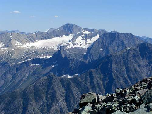
Comeau Pass:
![Comeau Pass]() Comeau Pass, FlatheadNative photo
Comeau Pass, FlatheadNative photo
In A Climber’s Guide To Glacier National Park, Edwards describes a route traveling from Logan Pass to Lake McDonald Lodge on the shores of Lake McDonald on page 278. After hiking to the top of Hidden Lake Pass and then down to Hidden Lake, a glorious trip in and of itself, the route climbs out of the Hidden Lake Basin to Floral Park. While walking below Sperry Glacier both Edwards and Gunsight Mountain loom over Comeau Pass. From Comeau Pass the trail continues to Lake McDonald Lodge.
Peaks featured in SummitPost that can be accessed from Comeau Pass include
Gunsight and
Edwards.
The Comeau Pass area was named for Denis Comeau, a Canadian guide, who acted as a guide for Dr. Walter Bradford Cannon and his wife Cornelia James Cannon after they climbed to the summit of the southwest peak of Mount Cannon on July 19, 1901 while on their honeymoon.
More than likely this pass was not crossed in earlier years due to the incredible headwall to the west of Sperry Glacier. This incredible purple head wall rises over 50 feet straight up from the rocky slopes below. An incredible stair case blasted through the head wall affords access to the glacier basin above. For more details please see
Two Days At Comeau Pass.
Marian Cannon Schlesinger is a painter and author living in Cambridge, Massachusetts is the daughter of Walter and Cornelia Cannon. She wrote about her
parents experiences with Denis Comeau.
“As we were going up the lake,” my father continued, “Cornelia expressed a desire to climb all the mountains in sight.” Apparently Charlie Howe pointed out Goat Mountain, a massive peak standing at the head of the lake, and said it was “the worst” mountain in the region; no one had ever reached the top, and the first person reaching the summit had the right to put his name to it.
Howe’s tale must have fired my mother’s competitive instincts, for she persuaded her amiable bridegroom to consult a guide named Denis Comeau about trying the ascent of Goat Mountain. My father wrote, “Howe has told us that ‘time, water, and vitality’ were the essentials to climbing a mountain, and we thought if water could be provided, we could supply the others.” Although Comeau was slightly skeptical, not promising an ascent, he was willing to try. Neither my father nor my mother had ever climbed a mountain before, being natives of comparatively flat Minnesota.
On July 18, the night before the climb, they camped under the stars at the foot of Goat. They started their ascent at seven the next morning. At half past ten they reached the snow line and sat down to eat their morning snack. My father rather offhandedly remarked in a letter to his father that “the climbing had been hard, but, aside from a stone falling and grazing Cornelia’s face, had not been exciting.”
The excitement was not long in coming. After eating, the three started up again and had reached a height of five thousand feet when they were confronted by a perpendicular wall of rock, nearly a hundred feet high and stretching all around the mountain as far as they could see. Needless to say, they had none of the equipment of modern climbers like ropes, slings, wedges, and so forth, just boots and bare hands. They tried crawling up a narrow crevice; my mother went through, and so did Comeau, who was small and wiry. But my father was “too thick,” as he reported. “I was wedged in that narrow crack, unable to go up or down, and with a slide of smooth mountainside running almost directly below me for hundreds of feet. I finally felt my footing and got down.”
![Comeau Pass]() Comeau Pass, D. Harris photo.
Comeau Pass, D. Harris photo.
Comeau decided that the rock face was too perilous for them, and after scouting, he found what seemed to him to be a better place to climb the wall, a place from which the summit could be seen two thousand feet above. The climb from then on sounds excruciating. They passed along a mountain-goat trail only a foot wide on the side of a slide about a thousand feet long, and at last they reached a ridge, along which they scrambled toward a ledge in the side of a precipitous wall of rock. Walking along the ledge, at one point they had to negotiate a corner where the jutting rock was only six inches wide over a yawning void. At last they topped what they thought was the final ridge, and “suddenly there burst upon us the most wonderful and awful sight we ever hope to see,” my father wrote. “Stretching to the north for more than a hundred miles was the grandest profusion of snow capped peaks and jagged walls of rock, reaching into the sky, that the imagination could possibly picture.” They sat gazing at this glorious vision until Comeau called attention to the fact that what they thought was the top was not within five hundred feet of the summit. The top looked dubious to them, but they went on, picking out a stairway in the rock as they went.
As they neared the summit, my mother went ahead, and when the two men reached the highest point, she was there to welcome them with the cry, “This is Cannon Mountain.” My father had a bottle with him, and he wrote on a piece of paper a certificate of their being there and the name of the mountain, then placed the paper in the bottle, sealed it, and covered it with a pile of rocks.
It is interesting to note the following that was also included in Edwards' excellent work on climbing in Glacier.
In late July of 1985, almost eighty-four years later to the day, two young Montanans, James Best of Kalispell and Ted Steiner of Whitefish, both experienced mountain climbers, scaled Cannon Mountain. At the top they found, partially concealed under a cairn, an old four-to-six-ounce clear glass bottle that had once contained a brand of malted milk bottled in Racine, Wisconsin. Inside, well preserved, was a folded note in pencil that read: “This is to certify that on Friday, July 19, 1901 Dr. and Mrs. W. B. Cannon climbed this mountain. Cornelia James Cannon was first to reach the top and named the mountain Cannon Peak. Denis Comeau was the guide.”
They left their find in place when they descended the mountain, but, having consulted with park officials, they returned the next day, retrieved the artifact, and substituted a plastic bottle with a new and identically worded message “for the benefit of future explorers.” They turned the original over to the Park Service.Dawson Pass:
![Two Medicine Valley]() Dawson Pass, FlatheadNative photo
Dawson Pass, FlatheadNative photo
Dawson Pass is named for Thomas Dawson and according to Holterman, Dawson was the son of a fur trade mogul from Fort Benton, Montana. He was educated in England and Scotland and later served with the Canadian Royal Mounted Police as a scout. He served as a guide for gentlemen by the names of Stimson, Sperry and James Hill, the founder of the Great Northern Railway.
According to Holterman, there was once a Mount Dawson near present day Dawson Pass. The name of this mountain has disappeared from the maps. Perhaps you the reader could present some logical conjecture regarding the new name of this peak. There are a number of them in the Dawson Pass vicinity to choose from, but nevertheless we may never know the exact location of Mount Dawson.
Dawson's Blackfeet name was Little Chief,
Inuxina, and the pass is therefore called
Inuxina ozitamisohpi in the Blackfeet language.
Surprise Pass:
![This is a perfect...]() Surprise Pass Area, saintgrizzly photo
Surprise Pass Area, saintgrizzly photo
It is believed that Dr. Frank Oastler was the first white man to cross this pass that is located in the Coal Creek drainage above the Middle Fork of the Flathead River. The pass is located near Martha’s Basin between Mount Phillips and Mount Pinchot. Surprise Pass is located near the off trail route for climbing
Mount Stimson. The
Southeast Spur Route for Stimson takes off from Beaver Woman Lake in Martha’s Basin.
Dr. Oastler graduated in medicine from the College of Physicians and Surgeons in 1894; elected a Fellow of the Academy October 17, 1912. He was consulting obstetrician and gynecologist to the Lincoln Hospital, consulting gynecologist to St. Luke's, Newburgh, and obstetrician and gynecologist to the Lenox Hill Hospital. He was clinical professor emeritus of gynecology at the College of Physicians and Surgeons and had been on the staff since 1912. Dr. Oastler was a member of the County and State Medical Societies and a Fellow of the American Medical Association and the American College of Surgeons.
He and his wife made many trips into Glacier’s backcountry. Below is an
exerpt describing his wife as written by Dick Schwab who worked at the Many Glacier Hotel from 1948-1951.
"Mrs. Oastler was the last vestige of the wealthy guests who spent a good part of their summer vacations in the Park in the earliest days, before and during World War I and throughout the twenties and thirties. After World War II, when all the old wealthy eastern families had forsaken Glacier for Europe or elsewhere, she still faithfully returned every summer to take up residence in the quiet of the Annex for most of the season.
She was the widow of a distinguished New York City surgeon, Dr. Frank Oastler. The two of them had started exploring the Glacier area in 1912, and they returned to the Hotel regularly until his death in 1936. She continued to come back to Many Glacier until at least 1956. The Oastlers were among those eastern establishment people, like Henry L. Stimson and his wife and others who adventured and explored in the Far West, following the pattern of George Bird Grinnell, who pioneered expeditions to the Glacier area.
Many Glacier Hotel was Mrs. Oastler’s summer duchy, and every year she journeyed in state out from her Park Avenue apartment, stepping onto the entryway to the Lobby from a shining limousine. Her arrival was a Big Event that meant the season had truly begun. She was greeted with great deference by the managerial and clerical staff. By this stage of her life her main activity was to preside as a dignified presence in the Lobby when she was not in her room or at her special table in the dining room. In the golden era, she and Dr. Oastler are said to have explored all over the most spectacular parts of the Park on horseback excursions, as many other privileged easterners had.
At the upper end of Josephine Lake is a rustic shelter she had built in memory of her husband. Sometime after it was completed she made a tour of inspection and found it not to her liking. Thus, although she did not have it torn down, she demanded that her husband’s name no longer be associated with it in any public way."
Edwards mentions Surprise Pass in his narrative on Mount Doody as well as what he calls the great circle route along Nyack Creek to Surprise Pass and then returning to the Middle Fork of the Flathead River. This incredible route is 37 miles in length.
Resources:
Below is a list of the sources that were used in writing this article.
Place Names of Glacier National Park by Jack Holterman
A Climber’s Guide to Glacier National Park by J. Gordon Edwards
Histroy of Glacier National Park
Flathead Lake, From Glacier to Cherries, by R. C. "Churck" Robbins, 1985
Undaunted Courage, by Stephen F. Ambrose


Comments
Post a Comment