
-
 9975 Hits
-
 87.76% Score
-
 25 Votes
|
|
Mountain/Rock |
|---|---|
|
|
36.58090°N / 118.2443°W |
|
|
Inyo |
|
|
Trad Climbing, Sport Climbing |
|
|
Spring, Summer, Fall, Winter |
|
|
8980 ft / 2737 m |
|
|
Overview
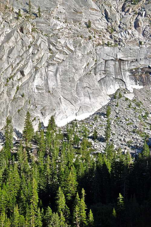
Chicken Ranch is the name of a rock formation on the lower slopes of Mount Whitney in the Sierra Nevada Range, California.
During the summer months when temperatures in the The Alabama Hills soar to over 100 degrees, Chicken Ranch provides a great escape for those looking for a day of clipping bolts. This formation is at an elevation of nearly 9000 feet. That, in addition to being northwest facing, the crag stays in the shade for the good part of the day. The approach is a bit rough and very steep with a faint trail, if you can find it, but it stays in the shade of huge pine trees. Note: I'll do my best to describe the approach in the "How To Get There Section." The approach to Chicken Ranch may be a bit confusing the first time, but when you get there the views become breathtaking. You have the typical Sierra forest below your feet and the granite walls above them. The view of the all time awe-inspiring Whitney Portal Buttress across the valley becomes something to behold.
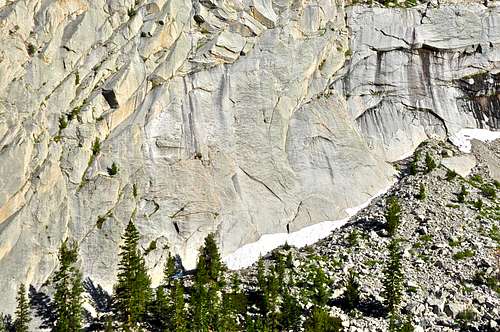
 Whitney Portal Buttress seen from the base of Chicken Ranch
Climbing Aspects
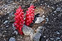 Snow Plant
Note: For full description of Snow Plants by Mountaingazelle click on the link:
Snow Plants
Select Routes
 |
|
How to get there
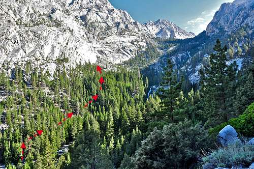
 View from the base
From the log try to pick out a very faint trail going up a steep hillside paralleling the creek. After about fifteen minutes you will come to a steel pipe and a natural spring with a plaque mounted onto a rock. After the spring, head up and left toward the rock walls to your left. After reaching the rock wall, you need to use your imagination as to where Chicken Ranch may be. If you are by some very steep and convoluted walls you are still too low. Hug the rocks and head further up the hill until you see the continuous slabs of rock. Look for the pedestal as seen on the photos on this page.
Camping

If you don't mind driving another fifty miles, there are many campgrounds along Bishop Creek just to the west of Bishop. There are also many places in The Buttermilks area that are close to a creek that are suitable for camping. Please do not camp in The Buttermilks bouldering area. That area is very crowded and is suffering from the impact unregulated camping has caused.
The following links should help finding a good campsite
Horton Creek Campground
Rock Creek Canyon
Inyo National Forest
Bishop Creek and vicinity camping
External Links
Snow PlantsMount Whitney
Sierra Nevada Range
The Alabama Hills