Synopsis
Chicoma Mountain (11561', #55 NM ranked peak, #2 NM prominence) is the monarch of the
Jemez Mountains in NM. For years, I have been looking at this peak and its open south and southeast facing slopes as I drive into work every morning, waiting to ski it. However, in recent years, these slopes have rarely been in condition for a ski descent. When they are (typically after a storm in mid-winter), the approach is long and would typically require an overnight (see Jason Halladay's excellent
TR). Amy and I took advantage of some potent mid-April snowstorms to finally climb and ski this peak, doing it from car-to-car in just under 4 hours. We skinned up Chicoma's forested north slopes to reach the summit, then enjoyed a fantastic ski descent down the southeast face to ~10500', skinned back up to the summit, and then skied back down the north slopes to our car. Our total vertical climbed (and skied) was ~2450', and our roundtrip mileage was ~4 miles.
Times:
5:15am: departed our home in Los Alamos, NM
7:00am: arrived at ~10300' on Forest Service Rd 144 (stopped by deep snow, more on this below)
7:20am: started skinning along FS144 and then up the north slopes
8:40am: reached summit
8:55am: skied off the summit down the SE face
9:30am: started skinning up the SE face from 10500'
10:30am: reached summit again
11:10am: arrived at car
12:10am: arrived home 13 hours after returning to the car (see "The drive out" section below)
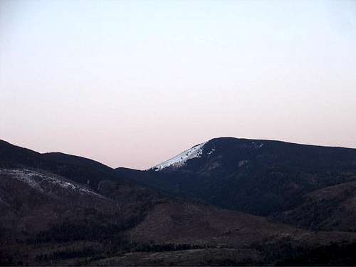
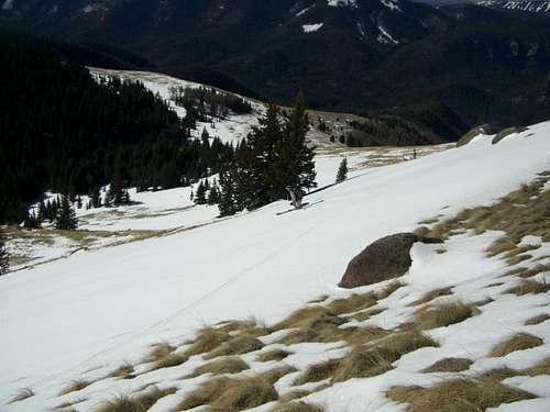
![Chicoma Peak]() Chicoma's S/SE slopes taken from near my home in Los Alamos the morning after we skied it. The skiing was better than this looks!
Chicoma's S/SE slopes taken from near my home in Los Alamos the morning after we skied it. The skiing was better than this looks!Getting there
Please see the main Chicoma Mountain
page for directions to the "trailhead." From US 84/285 in Espanola, it is approximately ~25 miles on FS144 to the northern slopes of Chicoma (depending on how far you wish or can drive). This is a well graded dirt road with occasional rough patches and washboarding that any passenger can handle (when dry). The views from FS144 are very nice, alternating from views toward the south and east (Los Alamos, Espanola valley, and the Sangre de Cristos above Santa Fe) to views toward the north (northern Jemez and the northern Sangres of NM and CO). Of course, views of Chicoma itself are especially tantalizing as it gets closer and closer.
![Chicoma from FS144]() Chicoma from Forest Service Rd 144.
Chicoma from Forest Service Rd 144.Climb and summit
We parked (actually got stuck in a snowdrift) at ~10300' on FS144. We decided to ski first and deal with the car later (maybe a mistake depending on one's priorities). Anyway, more on this below. We put our packs on and started skinning up the road.
I didn't have a specific spot picked out to leave the road but was relying on my topo to find a path with a gentle gradient all the way to the summit. After a short skin (~1/4 mile), we left the road at ~10460' and headed SW into the trees. The trees were surprisingly well spaced in this area, and it was pleasurable skinning with minimal bushwhacking on snow that easily supported our weight (given it was only around 8am). Even though the snow was fairly firm, it was soft enough that we left tracks, which made routefinding a non-issue on the way down.
I remarked to Amy that it was easy skinning on a shallow slope, and she replied that she'd hardly call any slope "shallow" when she had her climbing bars on the highest position. After about an hour skinning up the forest, we could see blue sky ahead and suddenly popped up onto the open summit plateau. It was 8:40am.
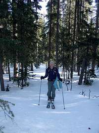
![Scott skinning on FS144]() Scott skinning up Forest Service Rd 144. Scott skinning up Forest Service Rd 144. | ![Amy skinning to Chicoma]() Amy skinning up the forested north slope of Chicoma. Amy skinning up the forested north slope of Chicoma. | ![Amy nearing Chicoma s summit]() Amy nearing the summit. Amy nearing the summit. |
Ski descent
After a short break, we ripped off the skins and headed over to the top of the southeast face.
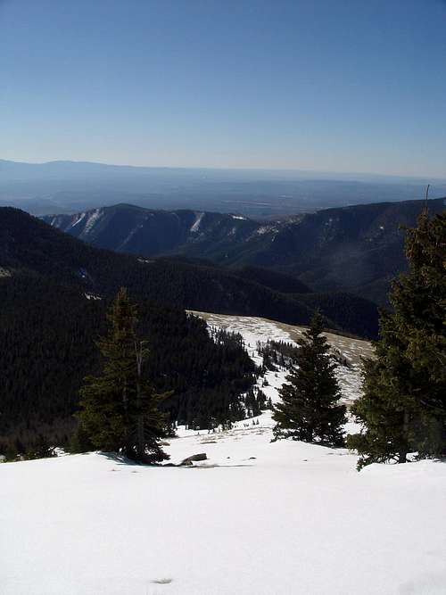
![Looking down Chicoma s SE slope]() Looking down the SE face.
Looking down the SE face.
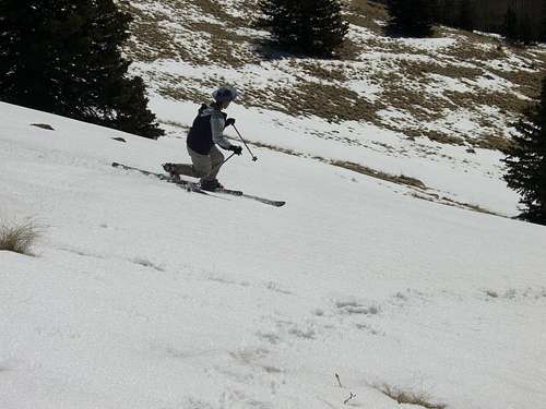
After carefully skiing through some exposed rocks, we had to take the skis off and descend about 50' on foot. From there, it was perfect spring corn.
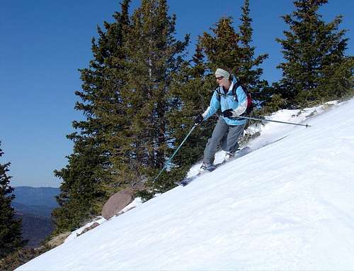
![Amy skiing Chicoma]() Amy enjoying the corn snow. Amy enjoying the corn snow. | ![Scott skiing Chicoma]() Scott doing the same. Scott doing the same. |
After two pitches or so, we traversed west to another snow-filled line and booted up about 100' to reach the top of that line.
![Amy booting up Chicoma]() Amy booting up.
Amy booting up.
From there, it was sweet turns all the way down to 10500' for a total ski descent of ~1100' including the mini-booter.
![Scott skiing Chicoma]() Scott skiing lower down on the SE face. Our bootpack is visible. Scott skiing lower down on the SE face. Our bootpack is visible. | ![Amy finishing her Chicoma ski descent]() Amy finishing up her ski descent. Amy finishing up her ski descent. |
The climb out and return to car
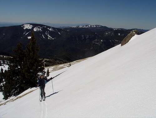
We put the skins back on and skinned all the way back up. I measured the slope angle at 33 degrees about halfway up. It was pretty sustained at that steepness, and it made for some fun turns.
![Amy skinning up Chicoma s SE face]() Amy skinning up. Caballo (10496') and Pajarito (10441') Mountains in the background.
Amy skinning up. Caballo (10496') and Pajarito (10441') Mountains in the background.
We made it back to the summit in about an hour and took some more time to enjoy the views and take some photos.
![Amy & Scott on Chicoma]() Summit shot! Summit shot! | ![Views to the north from Chicoma]() Cerro Pedernal (9862', of Georgia O'Keeffe fame) and Polvadera Peak (11232') to the north. Cerro Pedernal (9862', of Georgia O'Keeffe fame) and Polvadera Peak (11232') to the north. |
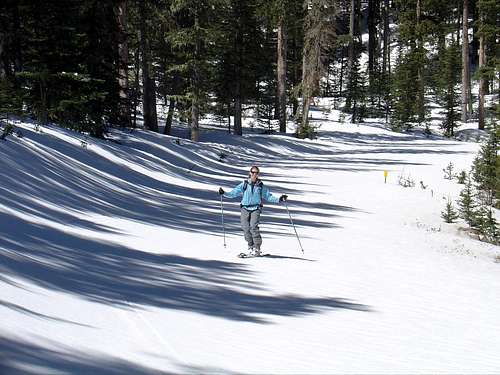
Then we skied down the north slopes, easily following our ascent tracks back to the road and thus avoided any navigation issues.
![Scott snowplowing through the trees]() Scott snowplowing through the trees. Scott snowplowing through the trees. | ![Amy skiing down FS144]() Amy skiing the road. Amy skiing the road. |
The drive out
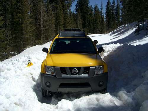
![Car excavation]() Amy about to back out after we spent 2 hours digging.
Amy about to back out after we spent 2 hours digging.We got back to the car around 11:10am, hoping to be able to dig the car out and then just drive out. Well, we had another thing coming to us. First of all, it was easy driving on the hard frozen snow on the way in, and it lulled us into thinking the snow wasn't that deep. It didn't look that deep, until we got stuck and called it quits on the driving. We thought about digging it out right then and there, but there were 2 counts against that. It would delay our ski descent such that the snow on the SE slope would get too slushy, and the snow was too frozen to shovel very easily. Well, even if the snow was still hard enough to drive on around 11am, that didn't help because it took us almost 2 hours to dig the car out to the point where we could back it out of its hole.
By then (~1pm), the snow was so soft that even though it could support a person's weight, the car's tires would instantly sink until the car was high centered (and this on a car with
minimum ground clearance of close to a foot!). We spent the next hour making slow painful progress, with Amy skillfully backing the car up, while I dug around the tires every time it got stuck. We descended a measly ~100 vertical feet on the road (to ~10200') and finally got to a dry spot where we could turn the car around. Then we immediately got stuck as soon as we entered the next patch of snow. By now (~3pm), we were running low on water and energy, and we made the decision to wait until the snow firmed up again. That meant at least several hours after the snow returned to shade. So after a short rest, we dug the car out again and backed up to the dry spot.
After about 6 cold and very uncomfortable hours trying to nap in the back of our car (one of the rare times we left our sleeping pads and bags at home), we finally decided to go for it around 10pm. Well, we made it out OK but not without several nervous moments when we thought we'd get stuck again. The trick was to press on the gas ever so slightly so the tires wouldn't spin. (If they spun, they would instantly dig a hole and we'd have to dig again.) We finally made it home just past midnight, thankful for a great summit and ski of Chicoma, and equally thankful to sleep in our own bed that night.
Lesson: I won't be driving up a snow covered road in springtime again anytime soon, no matter how innocuous it looks while frozen. The snow I thought was <1' deep (which wouldn't have been a problem for our car) turned out to be well over 2' deep in most places.
Notes
Since there are no established trails in this area, it is important to take navigation seriously, especially on your first visit to Chicoma. The northern route is through dense forest, and thus it is easy to lose your sense of direction when you are on your way down. Here is a fine
account by SP user
surgent of how quickly things can go downhill (literally and figuratively). Bring a compass and a good topo map (and GPS if you have it).
External links
1.
Northern New Mexico Avalanche Exchange
2.
Santa Fe National Forest


Comments
Post a Comment