Synopsis
We skinned/climbed up to Jicarita Peak (12835') in the Pecos Wilderness of the Sangre de Cristo Mountains of New Mexico, starting from the barricade near the end of Forest Road 161 (~10383'), and enjoyed a spring ski descent back to the car. The total distance was about 9.5 miles roundtrip with an elevation gain of 2452 ft. Our time from the car to the summit of Jicarita Peak was about 4.5 hours, and our total car-to-car time was about 7.75 hours.
Trailhead and approach
The Alamitos trailhead is located near a vehicle barricade near the end of Forest Road 161 (good gravel road), which is accessible from NM State Route 518 (a few miles west of its junction with NM State Route 121). From the barricade, we hiked a short distance (<0.5 mile) to the end of the gravel road and headed up the hill on Trail #19 toward Serpent Lake. We put our skis/skins on here and did our best to follow the trail, as it was buried under snow.
The approach was through forest and shortly we crossed an irrigation ditch. We lost the trail on a fairly steep NE facing slope but kept skinning and roughly followed the Rito Angostura drainage uphill. We hit treeline a little NE of Serpent Lake and shortly found ourselves at the bottom of a big mostly E-facing snow-filled bowl below PT 12828, which is also known as S. Jicarita Peak and is unranked (rises 288' from its saddle with Jicarita Peak).
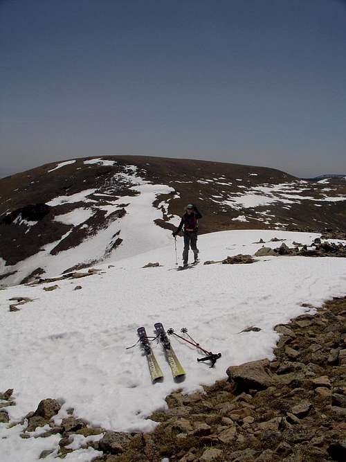
![Bowl beneath S. Jicarita]() Scott at the bottom of the east-facing bowl below S. Jicarita.
Scott at the bottom of the east-facing bowl below S. Jicarita.Climb and summit
From the bottom of the bowl, we skinned and then bootpacked up the slope, bushwhacking at times, and ended up on the edge of the big summit plateau of S. Jicarita. We saw some sheep peering down at us on the way up. Once on the summit plateau, we kept hiking W-NW on dry rock/grass toward the saddle between S. Jicarita and Jicarita. From there, we put the skis back on and skinned up the ridge to the summit of Jicarita.
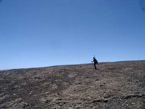
![Amy nearing summit of Jicarita]() Amy (SP user Nice Axe!) nearing the summit of Jicarita.
Amy (SP user Nice Axe!) nearing the summit of Jicarita.![Truchas group from Jicarita]() Truchas group from Jicarita.
Truchas group from Jicarita.
The east-facing bowl beneath Jicarita was pretty melted out, so we decided to head back the way we came and ski the bowl beneath S. Jicarita.
Ski descent
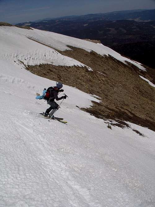
After snacking on the summit and enjoying the views, we skied down the SE ridge toward the saddle between Jicarita and S. Jicarita.
![Scott skiing below Jicarita]() Scott skiing the ridge.
Scott skiing the ridge.
Once we got to the saddle, we took the skis off and had to hike a ways back to the top of the first bowl.
![There s snow around here somewhere]() Amy hiking on the summit plateau of S. Jicarita.
Amy hiking on the summit plateau of S. Jicarita.![Amy dropping in]() Amy dropping in.
Amy dropping in.![Scott dropping in]() Scott dropping in.
Scott dropping in.![East bowl beneath PT 12828]() The line we skied (center of photo).
The line we skied (center of photo).
From here, we skied into the trees and down the Rito Angostura drainage, getting some more fun turns in the trees.
Dude, where's my car?
We paid for those fun turns in the trees, as we ended up a bit low. We skied/traversed across the steep NE facing slope and eventually we hit the irrigation ditch and crossed it. However, my GPS was reading alarmingly low, and luckily I had marked our parking spot with a waypoint that morning. We thrashed through the woods on skis for awhile. It was easier for me on tele; poor Amy was on AT and had to keep releasing and locking down. Finally, we shouldered the skis and hiked/postholed, following the arrow on my GPS. When we finally reached the car, we came from a completely unexpected direction. It's a good thing I set a waypoint; otherwise we'd still be out there.
External Links
Northern New Mexico Avalanche Exchange


Comments
Post a Comment