
-
 122991 Hits
-
 88.85% Score
-
 28 Votes
|
|
Route |
|---|---|
|
|
48.77428°N / 121.82598°W |
|
|
Download GPX » View Route on Map |
|
|
Hiking, Mountaineering, Skiing |
|
|
Spring, Summer, Fall, Winter |
|
|
One to two days |
|
|
Glacier Travel and Hiking |
|
|
Overview

Hiking on the Coleman Glacier
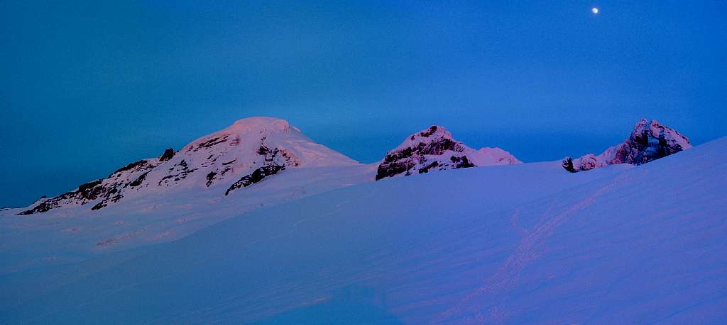
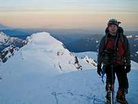
 Climbing Above the Clouds | 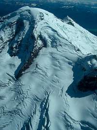 Aerial View of the Route | 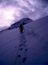 Heading up in the Morning | 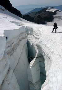 Huge Crevasse near Black Buttes | 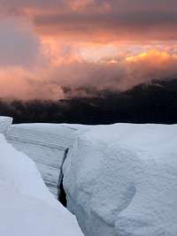 Crevasse at Sunset from the Glacier |
Getting There

Fresh Snow on the Road
From Seattle: Take I-5 for about 60 miles until you get to Mount Vernon, take a right at exit 230 onto Highway 20. After about .2 miles be sure to take a left onto S Burlington Blvd (this goes North). After .4 miles take a right back onto highway 20 (at this part of town it is known as Avon Ave). In 5.1 miles take a left onto Highway 9 heading North. In 22.2 miles take a right at a fork in the road and take a right onto highway 542 (Mount Baker Highway). In 8.3 miles turn right (staying on Highway 542) in the city of Kendall. 11.5 miles further down the road is the city of Glacier where you take a right onto Glacier Creek Road (NF Road 39). Follow this service road for 7.8 miles which the Heliotrope trailhead will be on your left. The road itself keeps on going which you ought not to proceed beyond the trailhead.
The road is usually snow covered in early season making it a longer approach (usually around 3-5 miles). Many decide on bringing ski's to make traveling faster.
Route Description
The trip starts out as a hike along the Heliotrope Ridge trail. After passing Kulshan Creek the trail curves left and wraps around a small ridge. After the second waterfall you arrive at a fork in the trail. The left path goes to Glacier Overlook, the right path is a climbers trail that takes you to the Coleman Glacier. After the fork the route breaks out of the trees where you start to see views of Baker and the Coleman seracs.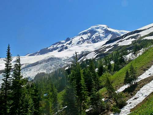
Mount Baker from the Woods
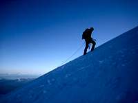
The main trail follows a hogsback moraine pathway and has at least one other variation if you miss this path. Roughly around 6,000 feet you encounter the beginning of the glacier. Through out much of the year it's hard to tell exactly where the glacier starts. Rope up as soon as the snow slope steepens.
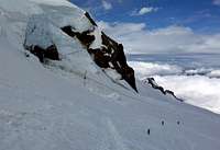
 Looking East |  Coleman Ice Fall |  Baker with Lupines |  Crossing a Creek |
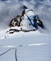
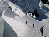
At the edge of the glacier aim slightly east of point 7242 (Heliotrope Ridge). From Heliotrope Ridge head almost directly east for a while and eventually curve southward depending on how crevasses effect the route. Eventually you arrive at the saddle between the summit and Colfax Peak. Head left (east, lightly north) up the ridge that takes you toward the Roman Wall.
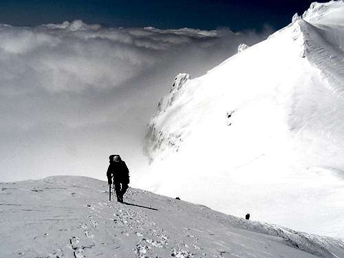
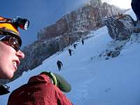
 Baker Clearing Up | 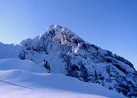 Morning on Lincoln Peak |  Climbers Heading Down | 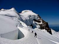 Near Colfax Peak |
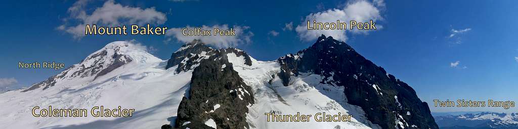
Mount Baker, Colfax, and Lincoln Peak
Shadows over the Coleman Glacier
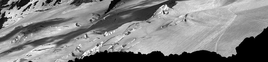
 Crossing a Serac Fall | 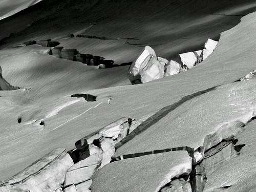 Crevasses on the Coleman Glacier |
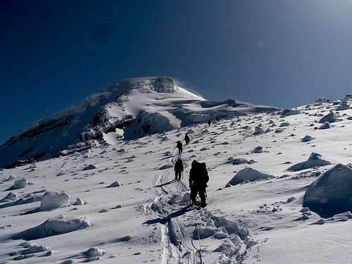
The ridge fades out which the route now goes onto the upper Deming Glacier. After heading up the last part of the glacier you arrive on the summit plateau. There is enough flat space to put up a football stadium. Walk across the plateau to it's northeast edge. The summit itself is a small nub of loose rocks, although can be snow covered depending on the time of year. On the summit you are rewarded with views of the Twin Sisters, Picket Range, Mount Shuksan, Puget Sound, and other various peaks in the area.
 Heading up the Deming Glacier | 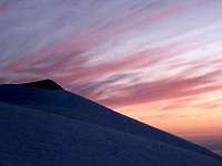 Pink Cirrus Clouds | 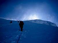 Upper Deming Glacier | 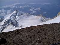 Crater Rim View |
 Hiking Above the Clouds with Colfax Peak | 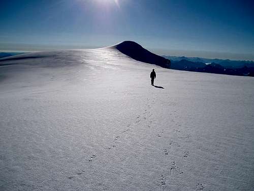 Heading Across the Summit Plateau |
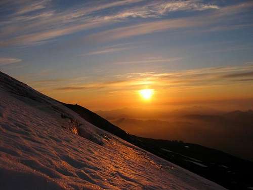 Sunset Over Heliotrope Ridge | 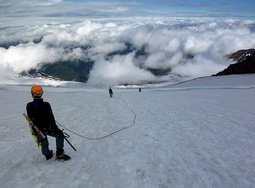 Heading Down the Coleman Glacier |
Red Tape
Water on the Way

Don't Get Lost
The Glacier Public Service Center can be reached at 360-599-2714 and are opened year round. During the winter months they are opened Saturday to Sunday at 9:00 a.m. to 3:00 p.m. They are closed on federal holidays. From mid June to mid October they are open daily from 8:00 a.m. to 4:30 p.m.
Water Sources:
There are a few creeks along the Heliotrope trail. You may get lucky and find some running off the edge of the Coleman Glacier. Finally there is the glacier itself to melt snow.
Hazards
Serac Fall below Colfax
Crevasses to Navigate
2) Avalanche - In early season (before May) be aware of current snow conditions. There is a lot of places that has potential for slab avalanches.
3) Weather - Mount Baker being one of the Cascade volcanoes that reaches above 10,000 feet has unpredictable weather. Be prepared for all conditions. I have personally got caught in a snow white out near the summit during July. Others have too. A buddy of mine had to make a snow cave.
4) Serac Danger - Be aware during earlier season or times of high snow melt that seracs do break off from the Black Buttes onto the Coleman Glacier.
5) Rock Fall - Rocks do fall from the Black Butte from time to time which is something to be mindful of. During late August though October it is possible for the snow to melt off the ridge below the Roman Wall. When this happens the ridge becomes a scramble with loose volcanic rock.
Camping
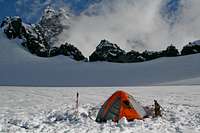
Flat Spot on the Coleman

Coleman Camp during Sunset
When to Climb
This route is often climbed between the month of April through August. The year snow pack plays a role in what month is best for climbing. The best time to climb this route is usually mid July when weather improves and avalanche danger is low. In August more crevasses form making navigation a bit trickier, but better chances of perfect weather. During the early season months the weather is usually bad, but if your lucky you may find a perfect day with low avalanche danger.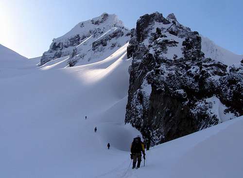
Heading Up in Perfect Conditions
Mountain Conditions

Gloomy Weather Comes
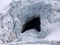
Coleman Glacier Cave
For current weather information on the Coleman Deming Glaciers check in with the Noaa Forecast.
For Avalanche Conditions, check in with the Northwest Avalanche Center. (Limited based on the season)
Check in with the National Forest Website for more information on the current road conditions, scroll down to "Glacier Creek" (#39). For trail conditions scroll down to "Heliotrope Ridge" on the NF Website.
Gear for the Climb
 Helmet, Headlamp, and Glasses
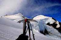
Ice Axe with Colfax
Rope, Camera, Action!
 Be Ready for the Worst
Stay Warm
Mandatory Gear for the Climb:
- Ice Axe
- Crampons
- Helmet
- Rope
- Glacier Rescue Gear (prusiks, carabiners, webbing, ect.)
- 2 Snow Pickets
- Shell Jacket
- Inner Layer Jacket
- 2-3 Liters of Water Per Person
- Stove, Stove Fuel, Pot, and utensils
- Water Filter/Tablets
- First Aid Kit
- Glacier Glasses/Goggles
- Nylon Shell Pants
- Sun Screen
- Map and Compass
- Toilet Paper/Blue Bag
- Full Scale Mountaineering Boots
- Long and Short Sleeve Shirt
- Plenty of Food
Overnight Gear:
- Tent/Bivy
- Sleeping Bag
- Ground Pad
Optional Gear you may Want:
- Camera
- Shorts
- Cover for your Backpack
- Trekking Poles
- GPS
Topographic Maps
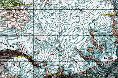
Coleman Deming Topo Map
External Links
- May 7, 2013 on Cascade Climbers - A mini trip report that uses photos to show having a good time. Eye candy included.
- Coleman Deming with Sherman and Colfax Peak - May 19-20, 2011 from Matt on Nwhikers. A full told trip report with lots of photos, stats, and a Baker tour.
- June 13, 2011 from Nwhikers - A typical trip report that starts out cloudy but ends with good weather.