
-
 118995 Hits
-
 89.77% Score
-
 30 Votes
|
|
Route |
|---|---|
|
|
48.77113°N / 121.82396°W |
|
|
Download GPX » View Route on Map |
|
|
Hiking, Mountaineering |
|
|
Spring, Summer |
|
|
One to two days |
|
|
Glacier Walk |
|
|
I |
|
|
Overview
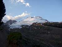
Near The Summit Crater
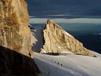
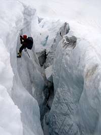
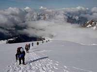
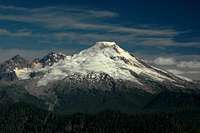
This is one of the two standard routes up Mount Baker (the other one being the Coleman Deming). This route is perhaps the easiest but with slightly more distance. Every route up Baker including this one requires crossing glaciers which everyone climbing this route should know crevasse rescue. For those who plan on climbing Rainier or other major glacier covered peaks, this route makes for a great warm up for glacier newbies. But keep in mind as the summer rolls though, there can be lots of crevasses that create some minor to major navigation issues. This side of Mount Baker offers great views of the Twin Sisters Range, The Black Buttes, and distant peaks of the North Cascades. The distance to the summit is around 8 miles with around 7,600 feet of elevation gain. Most people do this route in 2 days, but if your speedy you can do this in a single push. Also if you want a little bonus for the trip you can climb Sherman Peak as well. (just off the Crater Rim)
 Alpenglow on Baker Alpenglow on Baker |
 Crevasse Fall Crevasse Fall |
 Railroad Grade Railroad Grade |
 Lincoln Peak Alpenglow Lincoln Peak Alpenglow |
 Twin Sisters Clouds Twin Sisters Clouds |
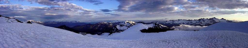 Mount Baker Panorama from the Easton Glacier Camp
Getting There

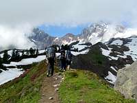
Mount Shuksan on the Way
From Seattle: Take I-5 for about 60 miles until you get to Mount Vernon, take a right at exit 230 onto Highway 20. After about 0.2 miles be sure to take a left onto S Burlington Blvd (this goes North). After 0.4 miles take a right back onto highway 20 (at this part of town it is known as Avon Ave). In about 22 miles you will see a road called "Baker Lake Road" which will be on your left, take this road for about 12.2 miles. From here there is a fork in the road, be sure to go left which goes onto NF Road 12. In 3.5 miles you reach another fork in the road, take a right onto NF Road 13. This road will take you to the trailhead.
The road is usually snow covered in early season making it a longer approach (usually around 3-5 miles). Many decide on bringing ski's to make traveling faster.
Route Description
The trail starts out from the Schreiber's Meadow trailhead using the trail on the left which is known as the Railroad Grade trail. This goes westward for about a mile you come across a large creek crossing, during winter it is often covered up with snow. On a hot day of summer I've seen this creek swell up to perhaps 3 times it's original size from early morning to afternoon which required taking off boots for crossing. On your average day the crossing is fine. The trail then enters into thicker forest and switch backs. At about 4,700 feet the trail forks, take a right which goes up to the Railroad Grade itself. The Railroad grade is a prominent lateral moraine formed by the retreating Easton Glacier which has a ridge like appearance. The trail eventually goes right onto the Railroad Grade which on the map will no longer be labeled but is quite visible in person. The ridge eventually disappears but is trail like still heading in the same direction. At around 6,500 feet you come across the many flat camp spots.
 Hiking Along the RR Grade Hiking Along the RR Grade |
 Easton Glacier Easton Glacier |
 Green Railroad Grade Green Railroad Grade |
 Dusty Trail Dusty Trail |
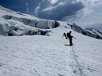
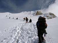
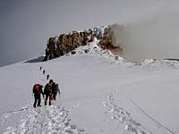
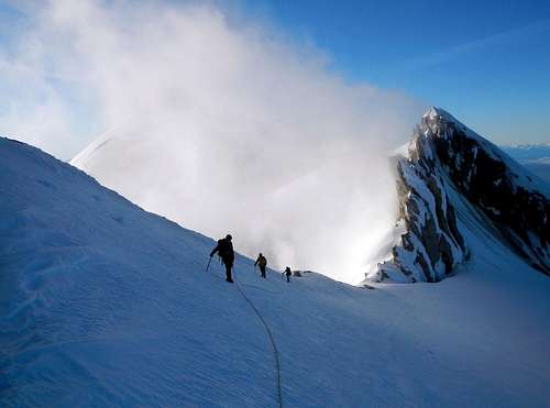
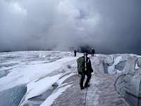
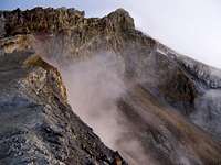
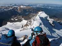
Some where around 6,700 feet you begin to travel onto the Easton Glacier which is where you rope up. During summer time there is a climbers path you can follow. Head northwest toward the crater rim being careful to avoid crevasses. Don't be surprised if you have to go over a few snow bridges or have to navigate around large crevasses. As you approach the crater you will probably notice a sulfur smell in the air which is because your very close to the crater rim where it vents from the volcano. Above the crater (9,800 feet) the grade becomes steeper on the upper Easton Glacier and this is probably the most challenging / fun section of the route. For the upper Easton you head north (slightly east) to obtain the path of lease resistance. Above the upper Easton Glacier you arrive at the flat top which is the size of several football fields. Turn northwest towards Grant's Peak which is the true summit of Mount Baker. The snowy looking summit on the left is the false summit which would only add more work to your climb if you went there. The last 50 or so feet is usually snow free making it a nice dry place to rest and enjoy the views of all around.
 Going up the Easton Going up the Easton |
 The Final 1,200 Feet The Final 1,200 Feet |
 Lincoln Peak during Winter Lincoln Peak during Winter |
 Ascending the upper Easton Ascending the upper Easton |
 Climbing above Twin Sisters Climbing above Twin Sisters |
 The Last Section The Last Section |
 Getting close to the End Getting close to the End |
 The Flat Section The Flat Section |
 View from the Sherman Crater | June of 2012
Red Tape

Water along Railroad Grade

Hiking the Road in Winter
During the winter months the road is almost always closed a few miles from the trailhead and requires a Sno Park Pass for parking in early season. More information on this can be found on Washington State Parks.
There are no permits required for this climb, although you can fill out a trail register at the trailhead or ranger station just in case.
The Sedro Wolley visitor center can be reached at 360-854-7200 and are opened year round. During the winter months they are opened Monday to Friday at 8:00 a.m. to 4:30 p.m. They are closed on federal holidays. From late May to mid October they are open daily from 8:00 a.m. to 4:30 p.m.
Water Sources:
There are many places on the way up the Easton in which one can obtain fresh water. The first one is a few minutes away from the parking lot, the second one is further up the trail where you come across the big creek crossing. Water can also be found on the Railroad Grade in later season. And of course the Easton Glacier itself for melting water.
Hazards
Crevasses
Crater Rim Gases

Gloomy Weather

Volcanic Gases Rising
2) Avalanche - In early season (before May) be aware of current snow conditions. There is a lot of places that can be potential slab avalanche areas.
3) Weather - Mount Baker being one of the Cascade volcanoes that reaches above 10,000 feet has unpredictable weather. Be prepared for all conditions. I have personally got caught in a White Out near the summit, as well as my friends. One of them made a snow cave.
4) Snowmobiles & Volcanic Gas - Due to the start being at a snow park, climbing this route in the early season can be irritating. You have to hike in 2-4 miles on a sometimes snowmobile infested road before you get to the trail head. They usually go up to around 7-8 thousand feet. Once in a while they go up to 9,000 feet and above. So don't be surprised to see them up there. In later season when the snowmobilers are not here, you will most likely be able to smell the rotten eggs of sulfur from the Crater Rim near the summit. Sometimes its better depending on the wind speeds and time of year.
Camping

Crowded Camp on Baker

Metcalfe Moraine Camp
For those who climb this route via the Metcalfe Moraine, there is a great camping spot just after the "Metcalfe" ridge where it flattens out, is more private and has plenty of room.
When to Climb

Good Day during January

Climbing Up in June
Mountain Conditions
Clouds Coming In
Good Weather on the Easton
For current weather information on the Easton Glacier check in with the Noaa Forecast.
For Avalanche Conditions, check in with the Northwest Avalanche Center. (Limited based on the season)
Check in with the National Forest Website for more information on the current road conditions which it will say for the "Schreibers Meadow" (#13). For trail conditions scroll down to "Railroad Grade" on the NF Website.
Gear for the Climb

Rope for the Glaciers

A Mountaineers Kitchen
Wear Your Helmet

Bring a Chef
For this climb you will need standard Glacier gear as well as warm clothing for if the weather turns bad up here.
Mandatory Gear for the Climb:
- Ice Axe
- Crampons
- Helmet
- Rope
- Glacier Rescue Gear (prusiks, carabiners, webbing, ect.)
- 2 Snow Pickets (for standard glacier travel)
- Shell Jacket
- Inner Layer Jacket
- 2-3 Liters of Water Per Person
- Stove, Stove Fuel, Pot, and utensils
- Water Filter/Tablets
- First Aid Kit
- Glacier Glasses/Goggles
- Nylon Shell Pants
- Sun Screen
- Map and Compass
- Toilet Paper/Blue Bag
- Full Scale Mountaineering Boots
- Long and Short Sleeve Shirt
- Plenty of Food
Overnight Gear:
- Tent/Bivy
- Sleeping Bag
- Ground Pad
Optional Gear you may Want:
- Approach Shoes
- Bug Spray (Black Flies get Crazy during August)
- Camera
- Shorts
- Cover for your Backpack
- Trekking Poles
- GPS
Topographic Maps
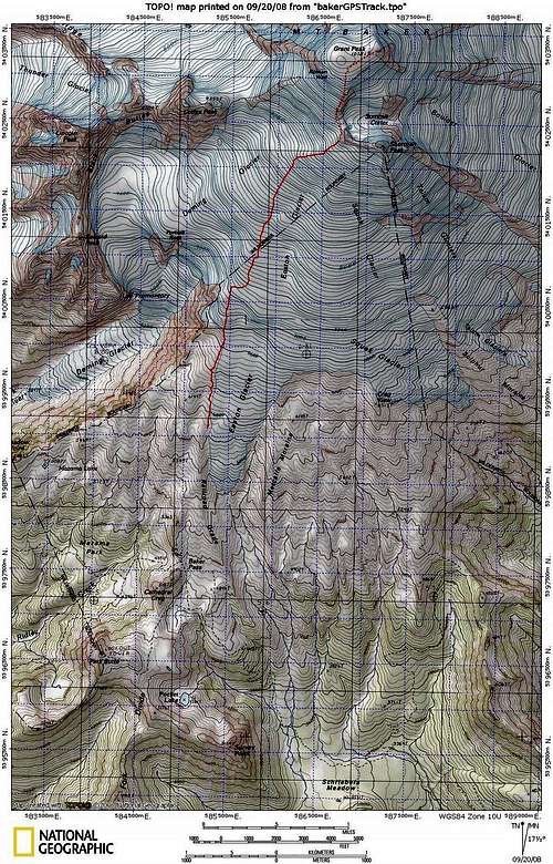 Easton Glacier Topographic Map
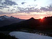
Sunsets and Sunrises
 Alpenglow near the Summit Alpenglow near the Summit |
 Pink Lighting Pink Lighting |
 Sunset Clouds Over Camp Sunset Clouds Over Camp |
 Railroad Grade Sunset Railroad Grade Sunset |
 Sunset over Eldorado Peak Sunset over Eldorado Peak |
 Lots of Crevasses Lots of Crevasses |
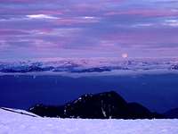 Moonrise during Evening Moonrise during Evening |
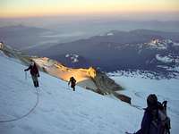 Climbing during Sunrise Climbing during Sunrise |
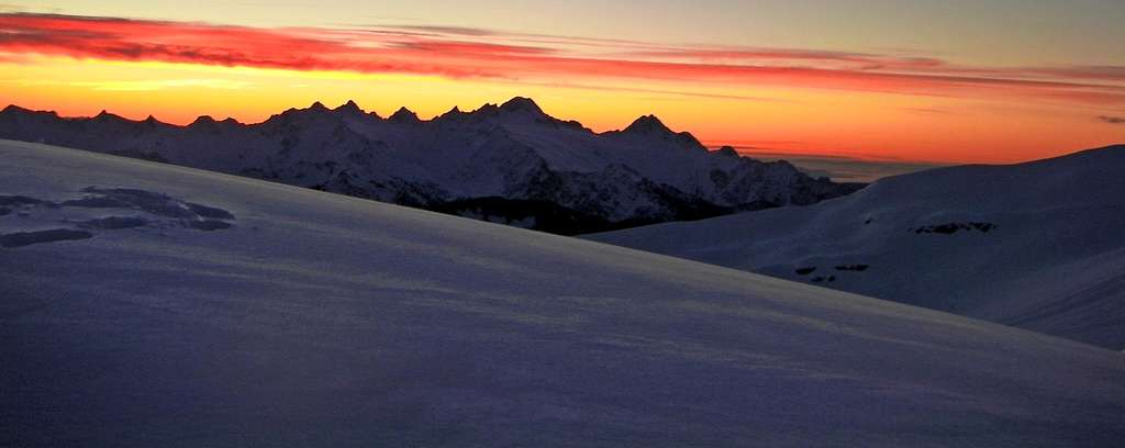 A View of the Twin Sisters during Sunset
External Trip Reports
- Baker in a Day: June 20, 2012: A recent report by Gimpilator which shows a video and some eye candy
- June 25-26, 2011: A Trip that starts out cloudy but then gets better
- May 23-25, 2009: This trip report portrays even kids can do this trip! :-D (Plenty of Eye Candy Included)