|
|
Mountain/Rock |
|---|---|
|
|
52.13175°N / 3.95106°W |
|
|
Carmarthenshire |
|
|
Hiking |
|
|
Spring, Summer, Fall, Winter |
|
|
1568 ft / 478 m |
|
|
Overview
|
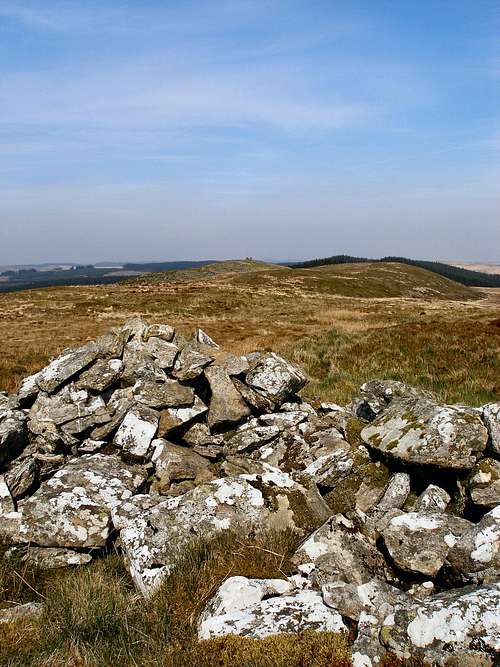
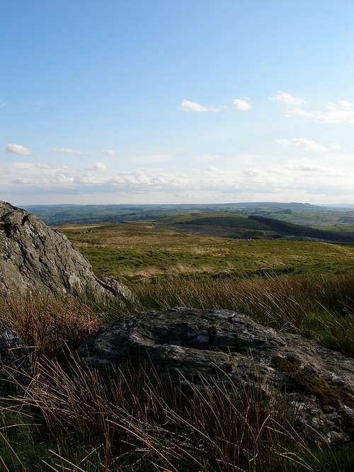
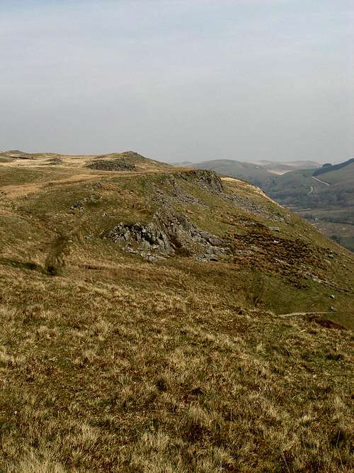
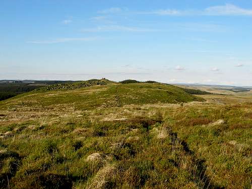
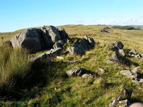
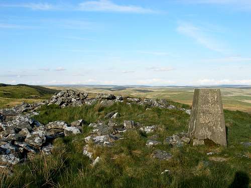
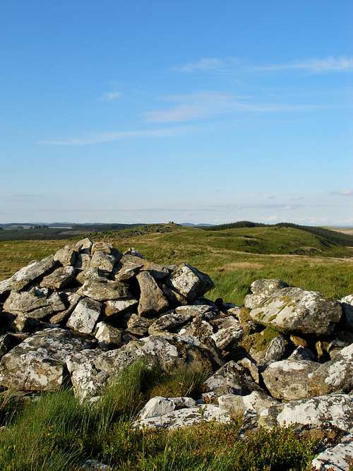
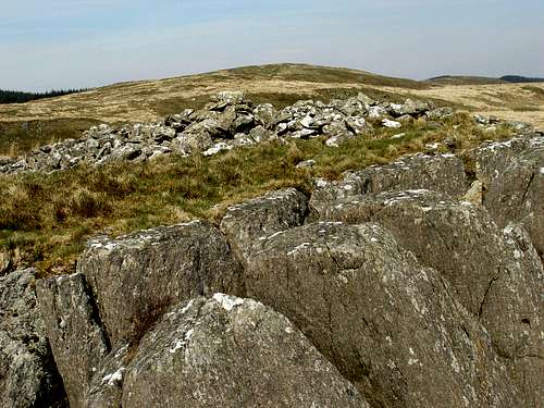
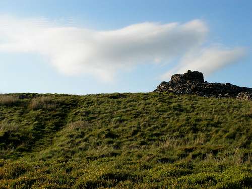
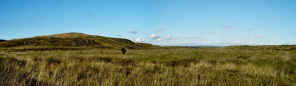
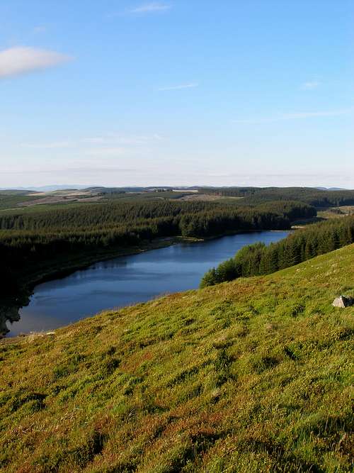
With a modest height of just 478 metres above sea level, Craig Twrch (Boar's Rock in Welsh) is but a minor hill of the southern Cambrian Mountains. However, what it lacks in stature it more than makes up in character. Craig Twrch takes the form of a broad elongated ridge comprising of six minor summits, which from southwest to northeast are Pant-têg (383m), Esgair Ffraith (415m), Banc Tŷ-hen (420m), Bryn Mawr (474m), Llethr Brith (478m) and Garn Wen (460m). This ridge marks the divide between landscapes of great contrast; to the west the hill gives way to the manicured tidiness of the Teifi Valley and beyond it the coastal plateau of Ceredigion; while to its east it falls steeply into the remoter Cwm Twrch and beyond it the wilder, more impoverished and tranquil Mynydd Mallaen and surrounding hills. While today the hill is a rarely visited destination, it's position in the landscape made it a once bustling thoroughfare, and it's this fact that makes Craig Twrch such a worthwhile objective. It's undulating contours are littered with ancient monuments, with its oldest reaching as far back as the Bronze Age. The hill in fact appears to have been a place of some significance to the area's Bronze Age people, with numerous burial cairns occupying its highest points. The finest of these is known as Garn Fawr, which is located on Craig Twrch's summit at Llethr Brith. The cairn occupies a commanding position, overlooking Llyn y Gwaith and the Berwyn Forest, and it should be your objective if visiting the area. |
|
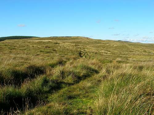
The second important historical feature is far more accessible; in fact it is a feature still in use today. The Sarn Helen Roman road crosses Craig Twrch on its southwestern flank and is in fact the easiest means of accessing the hill. The road was once the main route between southwest and northwest Wales and its course can still be followed, calling on the various Roman archaeological sites along the way. Craig Twrch appears to have been a strategic crossing point and displays the remains of a watchtower and abandoned camp. So while an ascent of Craig Twrch could hardly be described as a challenge, a traverse of its ridge is packed with interest. One will find tranquility and a sense of romance here, as they wonder over its rolling features and explore its archaeological remains. |
Mountain Conditions
This weather forecast is generated by the Met Office Weather Widget |
When to Climb and Essential Gear
| Craig Twrch can be visited at anytime of the year, however in poor conditions it may be best avoided as it's very exposed to the elements throughout its length. April to September offer the most reliable conditions and one will need all the equipment one usually carries for a morning or afternoon in the hills, which in Wales means a decent set of waterproofs and walking boots as a minimum. |
Getting There
|
Craig Twrch (SN 665 499) is located in the southern Cambrian Mountains, between the valleys of the Teifi in the west and the Twrch in the east. It can be accessed by one of the numerous minor roads that come of the main A482, which runs between Lampeter (SN 577 481) in the west and Llanwrda (SN 714 314) in the east. There is limited parking on the side of the Sarn Helen Roman road near Lluest-y-bwlch (SN 646 480), which takes the form of a small lay-bye created by a cattle grid. Few people visit the hill, so it is unlikely that it will be full, just be sure not to block the cattle grid's gate. |
|
| Bryn Mawr (Photo by Nanuls) |
Red Tape and Access
For climbers, hill walkers and mountaineers, the British Mountaineering Council (BMC) runs a Regional Access Database, which holds mountain/crag specific information on matters of conservation and access, including issues such as nesting restrictions, nature designations and preferred parking. If you are in any doubt about any particular access arrangement, or need to report an incident, you should contact your local BMC Access Representative or the BMC Access Officers for Wales: Elfyn Jones. |
Camping and Accommodation
| Camping and accommodation is relatively scarce in the local area, although the local towns and villages such as Lampeter and Llandovery do offer something for everyone. For a comprehensive guide to the area's accommodation, see the Ceredigion and Carmarthenshire County Council tourism websites: |
|
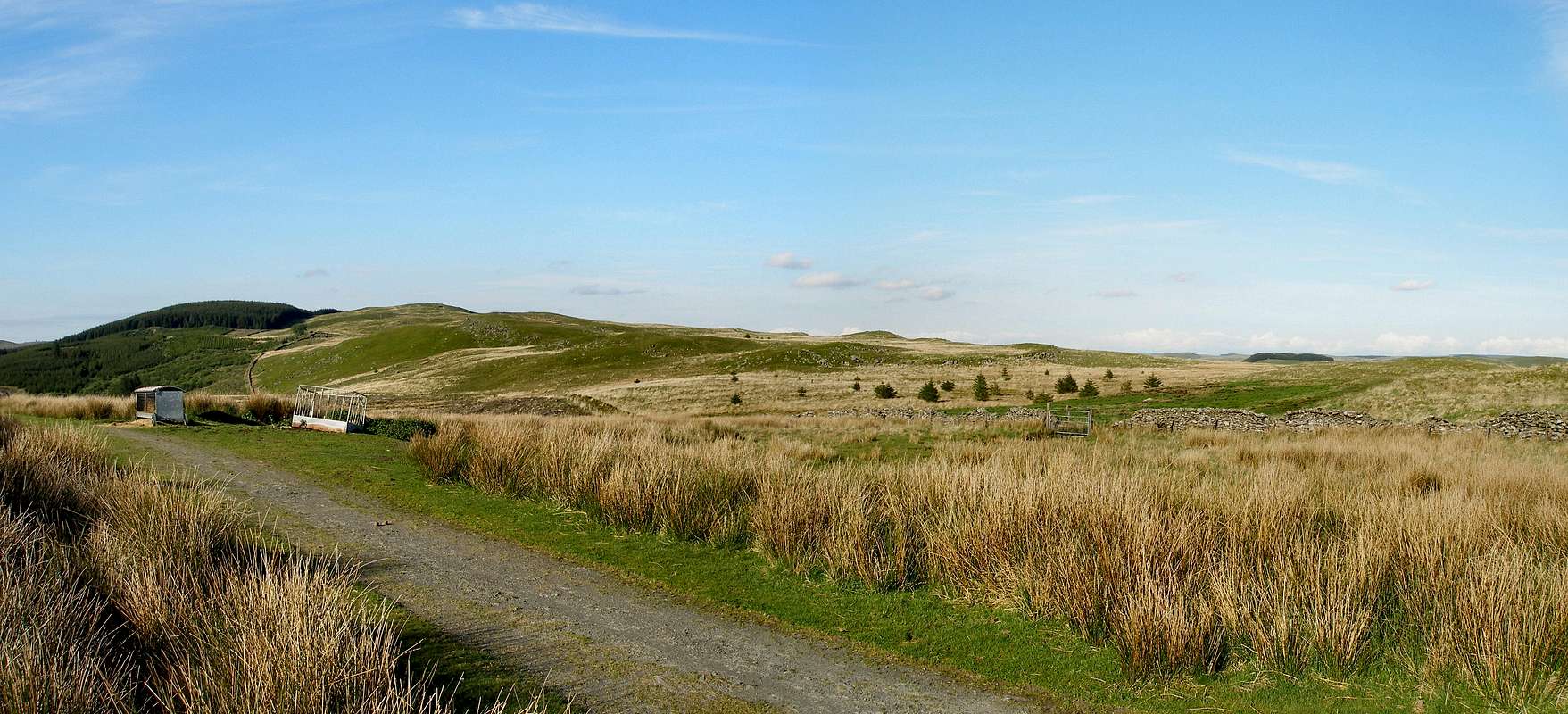
| Craig Twrch (Photo by Nanuls) |
Maps
|
| Navigation Maps Ordnance Survey 1:25k Explorer Series 199 Lampeter Ordnance Survey 1:50k Landranger Series 146 Lampeter & Llandovery Road Maps |
Guidebooks
|

External Links
Carmarthenshire County Council Royal Commission on Ancient & Historical Monuments in Wales Bogs The Wildlife Trusts: Water and Wetlands Mountaineering and Climbing Organizations British Mountaineering Council Tourist Information Weather Travel Welsh Public Transport Information Accommodation Youth Hostel Association in Wales Maps and Guidebooks |