Introduction
The island of Tenerife, located among the Islas Canarias off the west coast of Africa displays all kinds of vegetation zones. Thanks to the low latitude and the high elevations people can be toasting along the beaches at the same time that others shiver on top of mighty Teide. While fog is rolling across the north-western Anaga Peninsula depositing moisture in large quantities, farmers in the south of the island can be praying for rain. And then there is the high plateau, the caldera of the Cañadas del Teide, which receives rain or snow only in exceptional weather conditions, i.e. when the clouds reach high enough to leave a drop of dew or two. Here – with the exception of abundant gorse bushes – rarely a plant grows and apart from the west canary lizards barely a being survives.
In this setting there are two mountains,
Riscos de la Fortaleza and
Montaña Blanca, which are connected by several hiking trails with each other and with the entry point to the Cañadas del Teide at El Portillo. Both mountains are not among the most impressive ones on the island but the triangular loop across the yellow pumice desert makes more than up for it. But be sure to keep on the vanishing trails – orientation in this almost featureless area can become very difficult. During the trip we witnessed a helicopter search for hikers who had got lost the day before, when there was one of those exceptional weather conditions where clouds enveloped Teide, Pico Viejo, Montaña Blanca and the whole eastern part of the Cañadas.
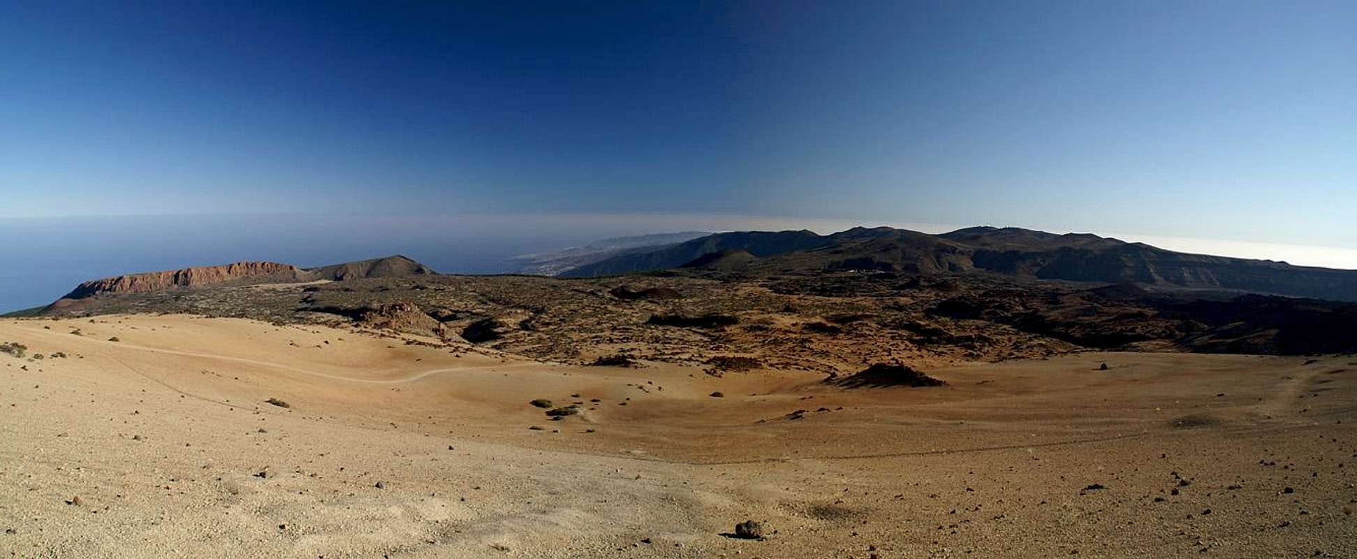
The eastern Cañadas del Teide. In the back, right of center
you can see the houses at El Portillo, where the trip started. La Fortaleza is to the left
and the current viewpoint is at the base of Montaña Blanca |
Rime in Everlasting Spring?
“Let’s do the triangle tomorrow” – this time it was me making the suggestion. We had consulted our guidebook and wanted to go on a hike which we hadn’t done yet. However, the guidebook only described two of the legs of the triangle, the tours from El Portillo to La Fortaleza and to Montaña Blanca while the connecting path between the mountains wasn’t even mentioned. Yet there it was indicated on our map and it would make a longish but perfect tour. Not being mentioned in the guidebook is usually not the best of signs. Many a time we have tried to do such loops – loops that were obvious on maps but wouldn’t materialize in reality. Always turning back had not been an option and thus we had found ourselves on exposed ledges or ridges or had bushwhacked our way through the densest of undergrowths. I have to admit that in most of these cases I had been the one to do the suggestion and consequently Judith was reluctant now. But with no better proposal we agreed – if we didn’t find the path to Montaña Blanca, we could always turn around.
The next morning we were up early – earlier than on the days before anyway. The sun hadn’t reached the tip of Teide yet, when we stepped to our car. Only during the 45 minute drive to El Portillo did he come up but when we arrived, the trailhead was still in the shadows. Moreover, it was more than chilly - after all the hot days on the island it seemed strange. And yet – we were at around 2000m in December – what else did we expect? And sure enough – after only a couple of hundred steps there was rime on the ground. Somehow suddenly it seemed even chillier and we put on our jackets.
![El Teide in the early morning light]() Teide Teide | ![The Fortaleza south face]() Fortaleza South Face Fortaleza South Face | ![La Fortaleza above Cañada de los Guancheros]() La Fortaleza La Fortaleza |
The first stage was the shortest one – a 1h crossing towards La Fortaleza. The path was level with short ups and downs. The shadows still were rather long and Teide was the only object gleaming in the sun. We reached an intersection near the Roques de Peral, 30 – 50m lava towers. Half a day later we would return by the path to the left. Or rather we wouldn’t – as we would have lost our way a few steps further down the trail. Finally the sun started to warm us – we were out of the shadows and the Riscos de la Fortaleza were starting to rise out of the surrounding plain.
Directly beneath La Fortalezza is a sedimentary plain, La Cañada de los Guancheros, and here for the first time we felt like crossing a desert. There was only sand around and in the back the dry red rocks of La Fortaleza loomed. Opting for the direct ascent we scrambled up towards Degollada del Cedro, a saddle to the east of La Fortaleza. We found a little chapel up there, built among beautiful young canarian pines. A perfect place to take a rest.
Scouting the Passage
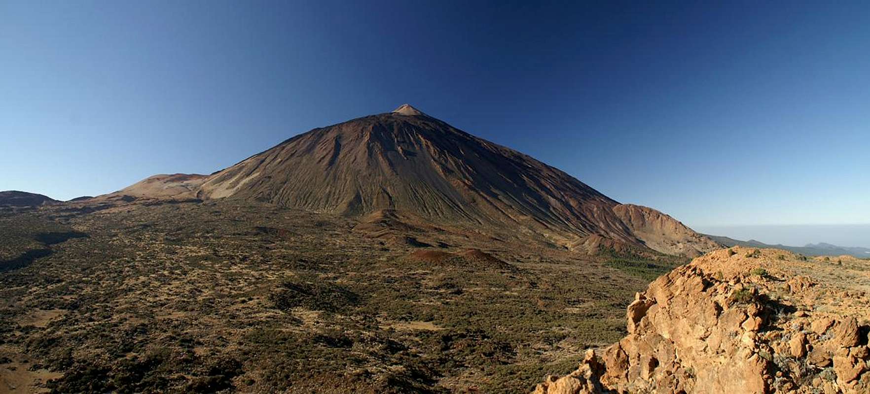
Teide as seen from La Fortaleza. The path to Montaña Blanca can be imagined to the left of the picture |
But the day was bound to be a long one so the rest remained short. We followed a dirt road along the shallow northern Fortaleza slopes and from where it stopped scrambled on towards the summit. We scrambled on out into the vertical south face where we took a longer break in order to scout the passage to Montaña Blanca. But before we could do so the droning of a helicopter reached our ear. Obviously, the day before, when the region had been enveloped in dense clouds, a hiking party had got lost. The chopper searched up and down the Fortaleza south face, then to the north of Teide and finally followed our planned direction towards Montaña Blanca, then vanished.
Annoying as the noise of the helicopter was, it reminded us of our plan to scout the trail. North of Cañada de los Guancheros we saw a path, first clearly visible but soon getting fainter. Should we? The path seemed to wind between thick gorse bushes, negotiating slight steps in the plain and gradually rising towards Montaña Blanca where we already could see the car tracks which lead to its summit. Once out of the gorse the thing would be easy.
Desert Traverse No 1
![Broad backed Teide seen during the traverse to Montaña Blanca]() Teide seen during the traverse to Montaña Blanca
Teide seen during the traverse to Montaña Blanca
Fortunately the sun had not yet started to heat up the plain as we set out to descend from the Fortaleza summit. This time we took the broad train underneath the Fortaleza south face to get to the western end of Cañada de los Guancheros. Bright red rocks loomed above us underneath a (very) deep blue sky. As we reached the Cañada we turned around for a last look, then searched for the entry point to the trail.
It was marked! Not only marked with cairns but also with an occasional sign displaying the trail number. Those signs and cairn were rare but together with the footmarks the sufficed to draw us into the gorse underbrush. To make it short – the traverse was less difficult to find than we anticipated. Though we didn’t see the path clearly at all times, the landmarks of La Fortaleza behind us, Teide beside us and Montaña Blanca in front of us helped us to get to the other side. Teide lost its summit cone as we got nearer – Pan de Azucar hid behind the broad shoulders of the Rambleta. Once the desert plain as behind us and the climb towards started, all questions about the direction were forgotten.
The World in Red and Yellow
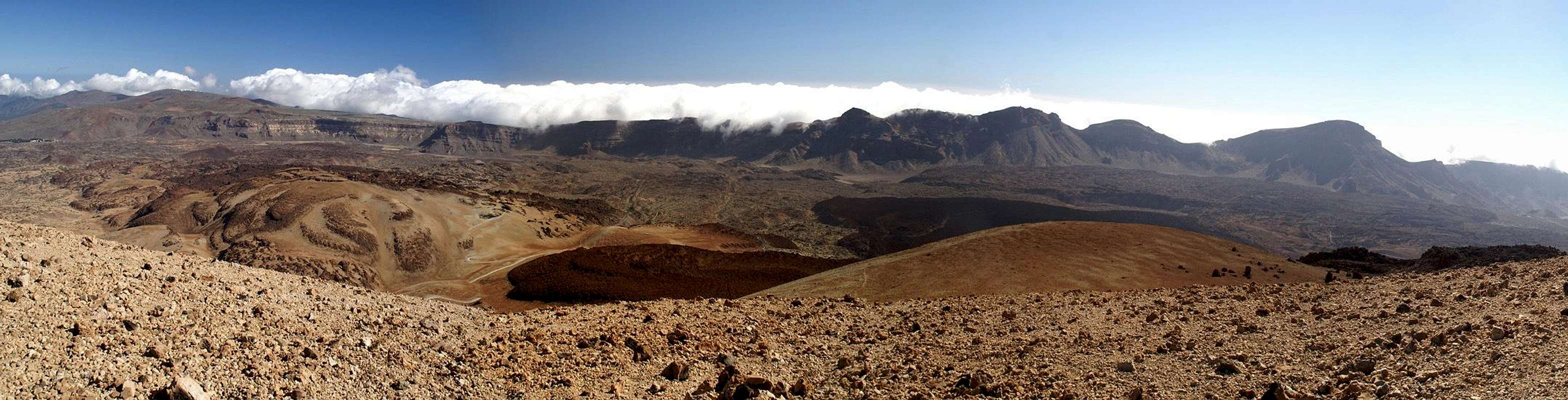
Las Cañadas del Teide as seen from the summit of Montaña Blanca |
I must have said it before - Montaña Blanca itself is not a very impressive summit. A better description would be that it is a shoulder of Teide, a shoulder that is about 1000m lower than the summit cone. However, as you get near to this shoulder – you get stunned by the range of volcanic colours, mainly yellow, orange and red. Montaña Blanca itself is a bright yellow, but Teide and neighbouring Montaña Rajada are a deep red. There are the black Huevos del Teide, Lava “Bombs” which rolled much farther than the flows they originated from and which now are in deep contrast with their surroundings.
![Huevos del Teide]() Huevos del Teide Huevos del Teide | ![Montaña de los Tomillos]() Montaña de los Tomillos Montaña de los Tomillos | ![Montaña Mostaza (2248m)]() Montaña Mostaza Montaña Mostaza |
The downside is that there are a lot of visitors to the mountain, those who want to climb Teide and those who just want to take the 1h stroll to its top to take in the views. Unfortunately we met quite a number of them and one couple really had us looking for (acoustical) shelter. They had sent their two sons up towards the Teide summit and were now commenting on every progress the young ones made. The man (!!) was yack yacking endlessly and unfortunately they were Germans and we understood each word they said. Arghhh! How is one supposed to have a refreshing lunch will all that silliness as a backdrop? Luckily for us they went to a side summit several 100m away and while we still heard them we couldn’t understand a word. Finally we could enjoy the views across the Cañadas.
Desert Traverse No 2
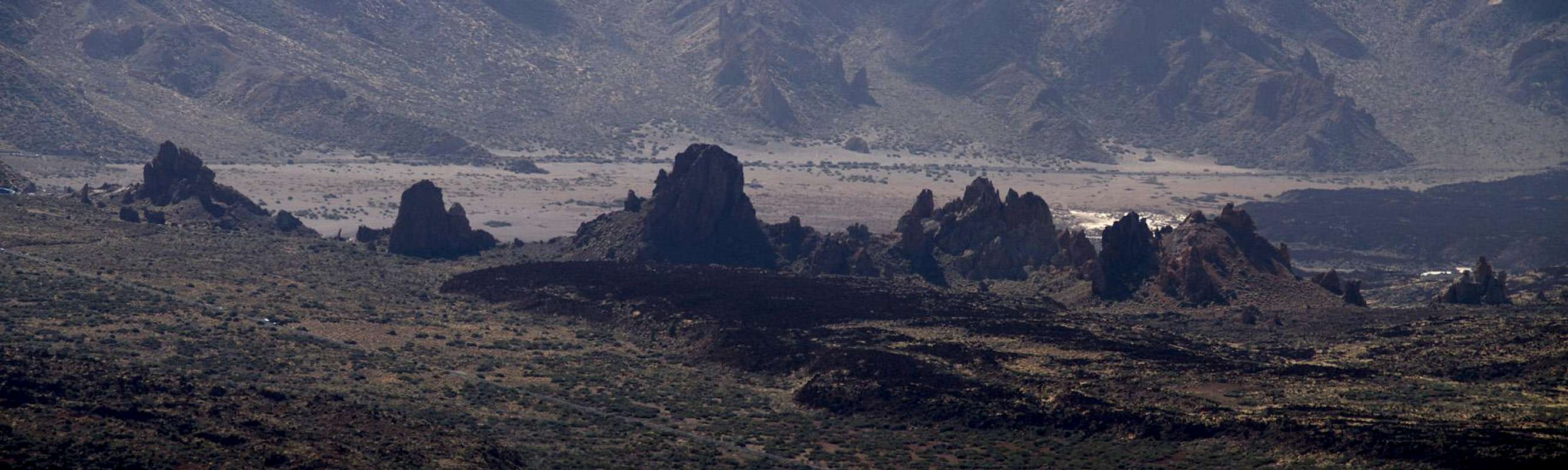
Los Roques de Garcia in the flimmering heat of the Cañadas del Teide |
And now the long traverse back to El Portillo started. There was certainly no question about orientation. We were at 2750m and our destination was clearly visible right in front of us. Some 10km still had to be hiked but they would be easy, right? Yes right! It is a very popular hike, people re taken to the Teide trailhead with busses and hike to El Portillo to be taken up there. Most of the groups take the whole day to complete the 10km. We encountered quite a lot of people – quite a contrast to the first two legs of our triangle.
The first part of the hike followed our ascent route but soon we left for a new path. It descended quickly into the desert plain with Montaña Rajada accompanying us for quite a long part of the way. We headed for Montaña de los Tomillos, a shallow volcanic cone, we had seen from above. The shadows started getting longer again and a rising moon indicated that we didn’t have too much time left to get back to the car. But as the trail was easy we didn’t expect any trouble…
![Montaña Rajada (2509m)]() Montaña Rajada Montaña Rajada | ![Montaña de los Tomillos (2222m)]() Montaña de los Tomillos Montaña de los Tomillos | ![La Fortaleza behind the Roques del Peral]() La Fortaleza, Roques de Peral La Fortaleza, Roques de Peral |
Lost as Usual
… and were lost again. I still don’t quite know what happened near the Roques de Peral. We met several hiking parties, all taking a break, eating and drinking. We hulloed and went by – on a distinctive path – which led in the wrong direction. We slowly drifted southwards and – you never turn back – were forced to fight our way to the trailhead cross country. Luckily I had my GPS system with me otherwise we would have made a large detour. Now we scrambled through bushes and across rocks in the vanishing light of the day. In the end we found out that we hadn't strayed by far but somehow this conclusion somehow spoiled the otherwise perfect day.
![Moonrise above the Cañadas del Teide]() Moonrise in the end
Moonrise in the end


Comments
Post a Comment