
|
|
Canyon |
|---|---|
|
|
33.52415°N / 117.21528°W |
|
|
Canyoneering |
|
|
Spring, Summer, Fall, Winter |
|
|
Overview

 Inside the canyon.
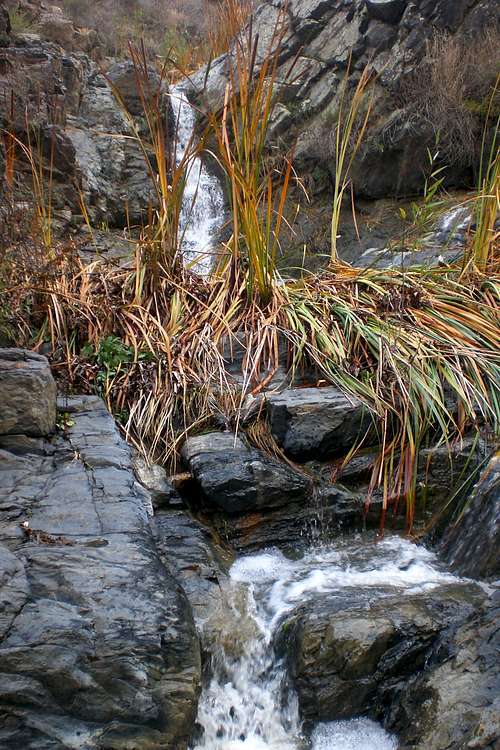
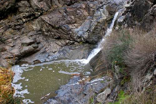
Waterfall (s)? Of course! This canyon has a two tiered waterfall. The first, which is at the top of the canyon, drops around 20ft and the other one drops around 50ft. However, the "lower fall" isn't a straight vertical drop like the "upper fall". However, both are still very impressive. The top waterfall is easy accessed but the lower one takes a little more work to get to. Also, outside of the main canyon, there is another fall that is strictly seasonal and it has around a 30ft drop. This fall is above the canyon and just past the main set of waterfalls.
The best times to visit are in the winter and spring as there will be more water flowing through. In summer, its just to hot plus there are rattlesnakes out and about.
The name of this canyon is not "official", however, since it runs by De Luz Road and because its in the area of De Luz, I gave it that name.
Route Info
If your looking for a technical canyon, this is not your canyon. This canyon can be traversed without ropes or special gear. However, if you wanted to, you could rappel off the top fall and then do the same on the lower one. However, when there is lots of water in the canyon, it is quite a different undertaking. The rocks become very very slick.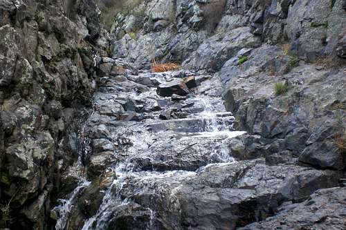

To get to the canyon itself only requires a little walk down from the road. Watch for glass on the way down. If you do not want to down climb the "upper fall", then there is a little trail the skirts it to the west side and ends up back on the bottom. The botton this little trail is really slippery becuase of a little spring the seaps out of the rocks.

Then, keep walking down, and you reach the "lower falls". If there is a lot of water, these falls are very hard to down climb. With or without, you can chimney your way down to the bottom. The granite is extremely slick, especially when wet. A fall in this section might hurt, so you might want to use some sort of protection. After this portion, the canyon becomes gentler. There are a few other brief falls, but these are minimal compared to the other falls.The only real obstacle is the overgrowth trees and bushes.
Getting There
From Murrieta- If your heading North on the 15 freeway, take a left on Murrieta Hot Springs Road and if your heading South on the 15 freeway, take a right. Follow this all the way to Jefferson Road and then take a right. Follow this until you reach Ivy Street (this is wear Los Alamos Road ends and Ivy Street begins) and then take a left. Follow this all the way down until you reach Washington Street, take a left here. Follow this road until you reach Guava Street and then take a right. This turns into a De Luz Road. Once you reach the dirt road and when you reach the chaparral landscape heading up into the hills, the place to park is about .60miles on the right hand side (there will be a big oak tree growing out of a little gorge on the right side). The Oak Tree as mentioned in the directions.
From Temecula- If your heading North on the 15 freeway, take a left onto Rancho California Road and if your heading South, take a right onto Rancho California Road. Follow this road up into the hills (De Luz). Keep follow Ranch California until your reach De Luz Road. Take a left and turn onto the dirt road. Once you pass the houses, a canyon will start to form on your left side. There will be a big oak tree growing out from the top of the gorge; this is an area where you can park at.
Red Tape
There is no red tape to this area. Just do not throw any more trash in the canyon!!! Use your wilderness ethics! The canyon is at the southern boundary of the Santa Rosa Plateau Ecolgogical ReserveExternal Links
Cleveland National ForestMisc
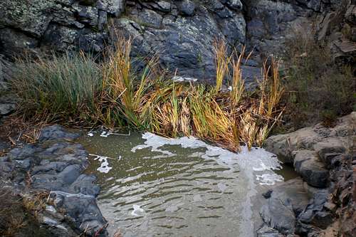
If you have any additional information about this canyon, please post or notify about them. Thanks!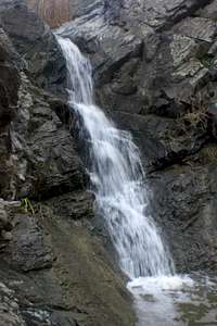 Creek after a rain
 Creek right after the summer