
-
 8088 Hits
-
 72.13% Score
-
 3 Votes
|
|
Route |
|---|---|
|
|
40.45970°N / 112.6263°W |
|
|
Hike |
|
|
Less than two hours |
|
|
Walk-Down |
|
|
Approach
This route starts from the summit of Deseret Peak.
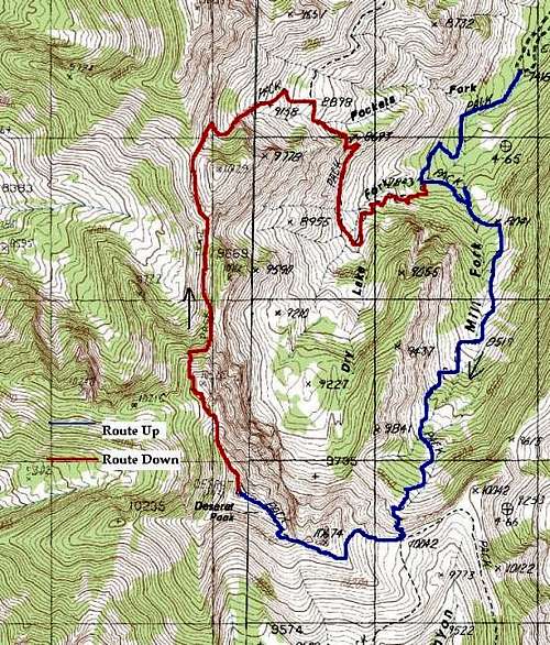
The Blue Route is the South...
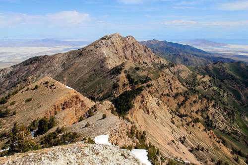
Looking north from the summit of Deseret Peak.
Route Description
This route is an alternate way of descending Deseret Peak that gives you some amazing views into some glacial basins on the west slopes of the Stansbury Range (which is the correct range that this peak is in, not the Wasatch Range). I prefer to use this route to descend Deseret Peak as there are less people and it is a more scenic descent than the South Willow Route and adds some variety to the hike.
From Deseret Peak's summit the trail heads west and descends the NW ridge of the peak. It is pretty easy going for 1/2 mile or so and then begins a very steep descent down an old glacial headwall. The route then continues North along the ridge for 2 miles. You will pass two saddles that give you excellent views into Dry Lake Basin and the North Face of Deseret Peak; I know it is tempting to use these saddles to descend into the basin but DO NOT USE THEM!! This is a wilderness area and as a hiker you should strive to lessen the impact on the area by staying on the trail.
Keep following the trail until you get to the third saddle along the ridge and then the trail heads East, crosses through a pass, and down for 1/2 mile when you will reach another trail. Turn right on this trail and it will take you back to your car in about 2.5 - 3 miles.
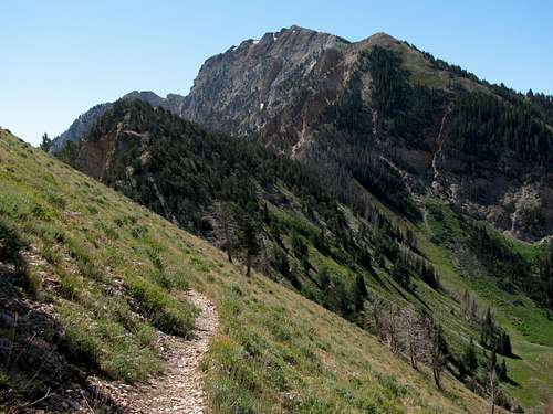
Deseret Peak from north ridge trail
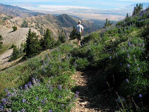
Trail north of Deseret Peak summit
Essential Gear
Good hiking boots and lots of water. There is not much shade on this route.
I wouldn't recommend doing this route in snow or ice as the glacial headwall you would descend on this route is much too steep.
Miscellaneous Info
If you have information about this route that doesn't pertain to any of the other sections, please add it here.