-
 20156 Hits
-
 86.85% Score
-
 23 Votes
|
|
Mountain/Rock |
|---|---|
|
|
43.16400°N / 109.673°W |
|
|
Hiking, Mountaineering, Scrambling, Skiing |
|
|
Spring, Summer, Fall |
|
|
13155 ft / 4010 m |
|
|
Overview
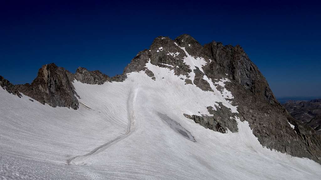
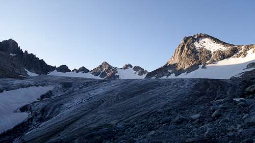
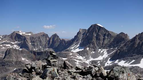
Split Mountain is one of the Wyoming thirteeners in the Wind River Range of Wyoming (See the list here). It is located deep in the glacial, northern end of the range on the SW edge of Mammoth Glacier and is likely the most popular 13er objective for mountaineers visiting the Peak Lake cirque. Its distinguishing feature is a fracture running directly and deeply through the mountain creating a lower, SE summit. The Mammoth Glacier is one of the largest in the American Rockies and the G-4 saddle on the west side of the peak has long provided the easiest access for glaciologists and explorers. This likely contributed to the early naming of the peak.
Approaches
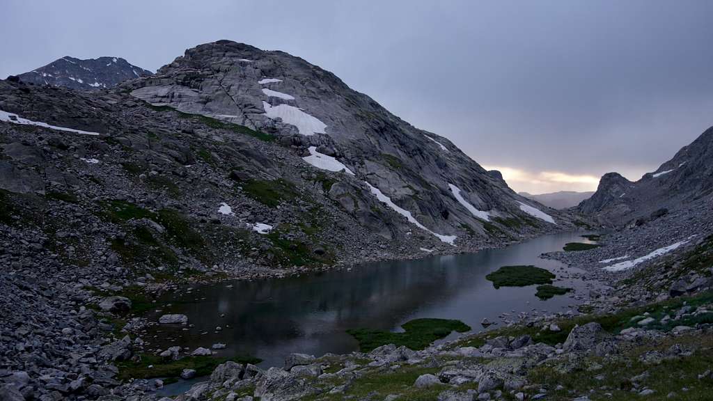
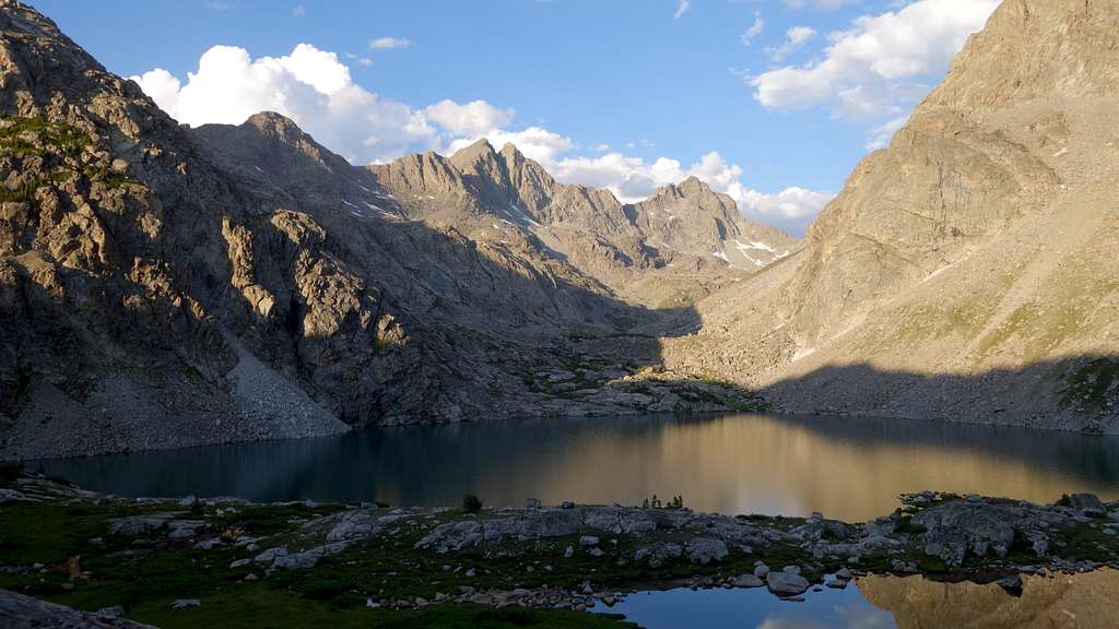
The shortest and most common approach will be to hike to Peak Lake, which is usually reached from the trailhead at Green River Lakes. From Pinedale, follow highway 191 NW for 6 miles to the Cora road and turn north. Follow this road for 45 miles to its end at the lakes. The Highline trail is followed for 15 miles to the Glacier Trail which is followed for 3 miles (through a Class 2 section) to Peak Lake. Peak Lake can also be reached from trailheads to the SW, hiking in from Elkhart Park and over Shannon Pass. Approaches normally take backpackers 2-3 days, but seasoned peakbaggers and climbers should have no problem getting to Peak lake in one day.
A secondary, non-traditional approach is to approach from the northwest to the toe of the Mammoth Glacier via Wells Creek. Using the Green River Lakes trailhead, 10 miles up the trail at Three Forks Park leave the trail, ford the Green River (can be waist deep but very calm water) and steeply boulder hop on at times house sized boulders up Wells Creek to Scott Lake, then follow the milky inlet stream southeast to the toe of the Mammoth Glacier. There are also many other ways in which you could find yourself in this remote part of the Winds with no trails, usually part of a multi-day (or even a multi-week) cross country climbing trip.
Whether approaching from Peak Lake or Mammoth Glacier, the objective is to get to the G4 saddle, just west of Split Mountain. This broad saddle is not quite the low point between Split, and nearby 13er Mount Whitecap. That designation goes to the next sadde to the west on the other side of the more rugged Baby Glacier Peak. Due to a steep cliff on the west side of Baby Glacier Peak, traversing directly between Split and Whitecap is not a scramble and would require rappels. From the Mammoth Glacier side, reaching the G4 saddle is a 25-30 degree snow walk. From the Peak Lake (south) side it's a loose talus romp.
Normal Route - West Ridge Class 2
Whether you access the G4 saddle from Mammoth or Peak Lake, once at the saddle follow boulders up the west ridge to the summit. There are no false summits on this side of the mountain. The boulders get fairly steep, but the difficulty shouldn't exceed class 2
There are other routes that have been done on Split Mountain, including the steep south face dropping steeply down right from the summit.
Seasonal Conditions
Summer season in the Wind Rivers is generally July-September with snow lingering on the higher trails into July. A snow storm is traditional between the last week of August and the second week of September. This is often followed by a dry period with crisp temperatures for 1-4 weeks. On glacier routes crevasses are hidden in June and begin opening sometime in July. Roads are usually opened in early June. An area webcam points at nearby peaks. The approach is heavy with mosquitos and gnats June thru August.
Map
The map above shows the the west ridge route up Split Mountain via the pink line from the lower Mammoth Glacier. The line also shows a combination with West Twin Peak. The same saddle at the base of the west ridge can also be accessed from the Peak Lake drainage on its south side.
Facts and Trivia
- Split was originally called G-5 by surveyors.
- The Koven brothers (Theodore and Gustav), along with NOLS founder Paul Petzoldt, were the first ascenders during their explorations of the area in 1931.
- Split is tied with Desolation Peak as the 23rd highest in the range.
- Located two basins west of the crest, the Peak Lake cirque is separated from the Continental Divide and composed of slightly different material. The gneiss is slightly looser (by solid Wind River standards) than that a mile to the east. Three of the peaks (Twin, Winifred, Buchtel) also form the western wall of Titcomb Basin. There is room for route exploration.
- The trail around the north shore of Peak Lake, shown on the USGS topo, is actually under a rockslide.
- Just past lake 10740, on the trail above Peak Lake, an old weather-beaten sign proclaims:
End of Horse Trail
Wells Creek Glacier 1-1/2
Gannett Peak 2
The Wells Creek Glacier was ultimately renamed "Mammoth" Glacier. There is no trail to Gannett but apparently the sign refers to the view from the saddle or possibly climber's access to the lesser-visited west face of that peak. The sign at the base of the peak is a relic from expeditions to the glacier. - Peak Lake is the largest source lake for the Green River, itself the largest branch of the Colorado River.
- Green River Lakes is said to be one of the most photographed spots in the Rockies.
- Split Mountain is a common name for peaks; notably, a California 14er previously known as South Palisade.